
Another messy day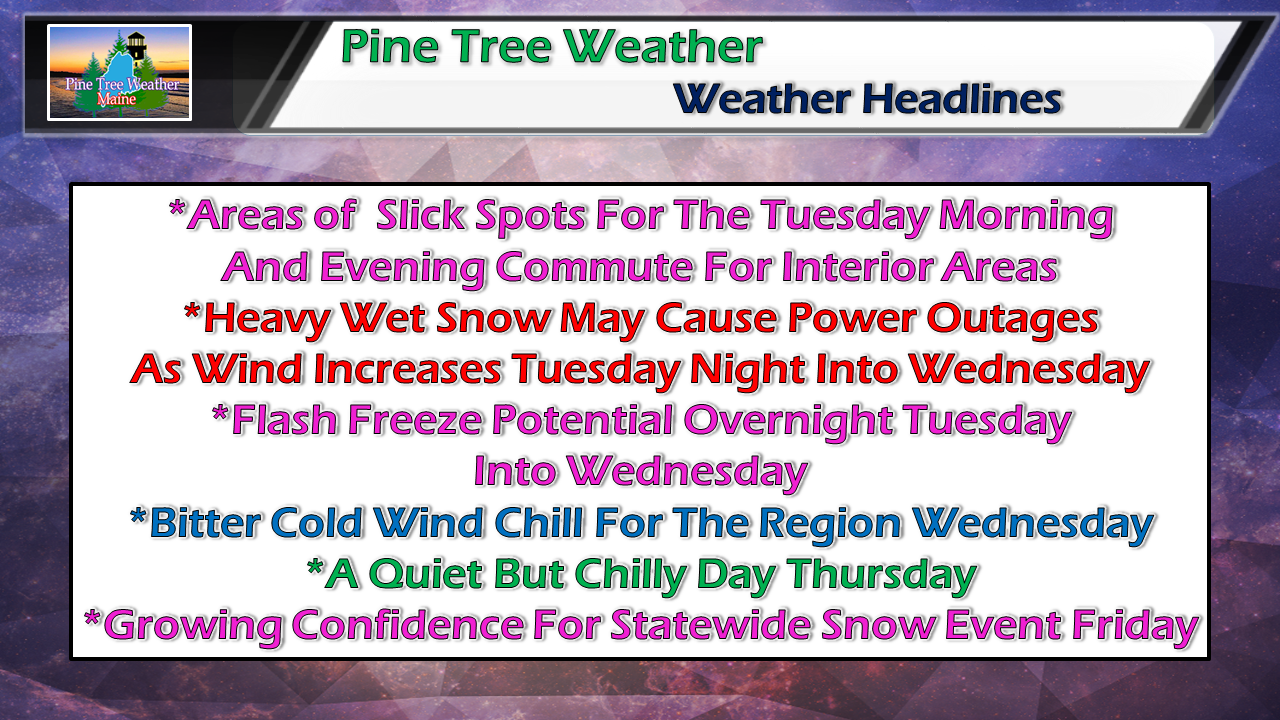 Not a whole lot of changes the forecast as I posted here last evening. Storm is on track to be a messy one and will have impacts for those traveling away from the coast. 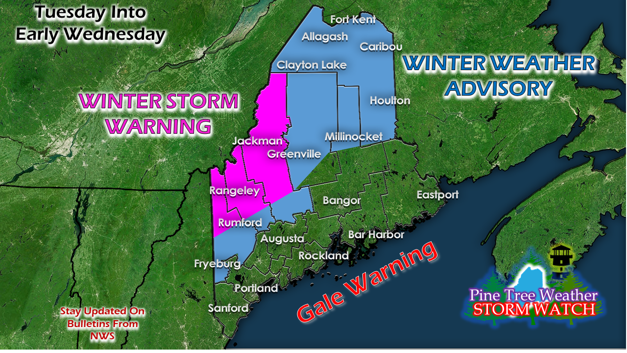 The bulletins from the Gray and Caribou weather offices have been adjusted a bit. A Winter Storm Warning in the western mountains and a Winter Weather Advisory for the foothills and the roof top. Stay tuned with your regional office in case there are adjustments made, which could happen. Messy morning and evening commutes The main concern for sloppy travel for western and southern areas will be through the morning commute and improvements should come by the evening drive. Northern and eastern areas are likely to see conditions get worse as the day progresses, and will have to deal with it in the evening. 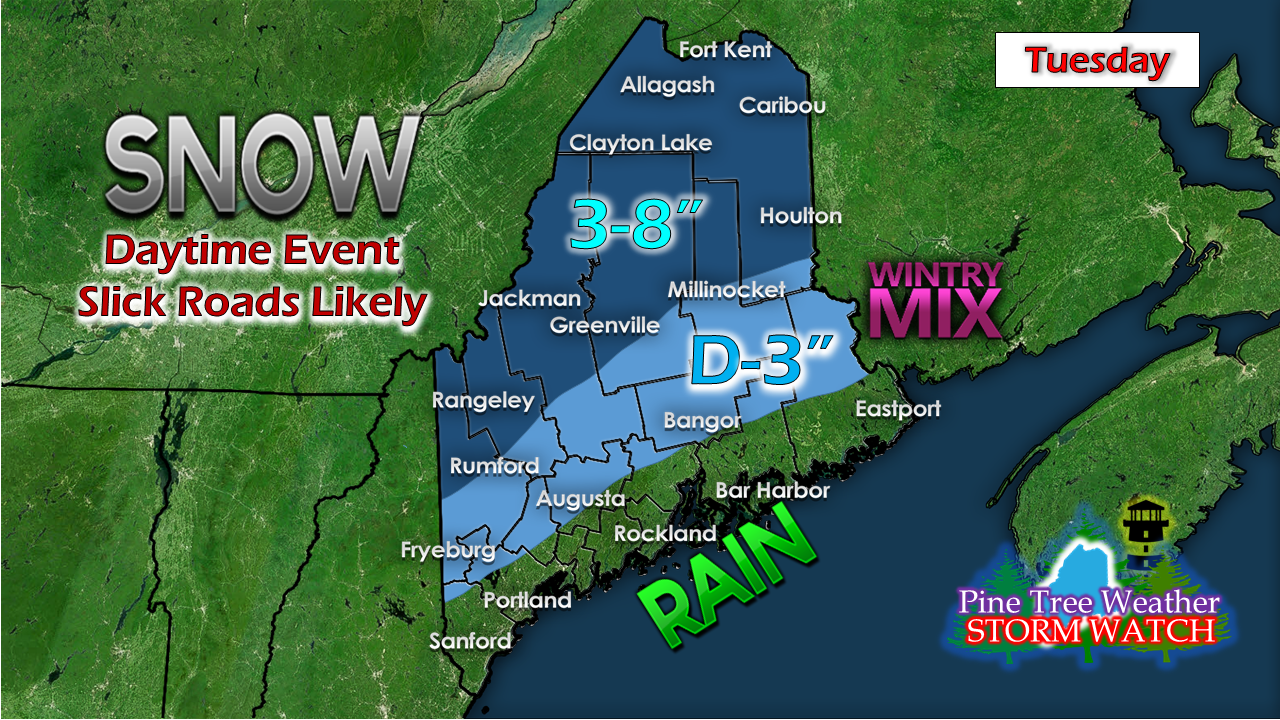 My thoughts on snow amounts haven't changed. Higher elevations get the higher amounts. It will be a sloppy wet mess that is going to freeze up tight by Wednesday morning. Flash freeze concerns overnight into Wednesday Near surface temperature GIF loop from the NAM model focused on 9 PM Tuesday to 7 AM Wednesday shows the temperatures plummet like a rock overnight. This will likely cause black ice on roads statewide as we head into the Wednesday morning commute. Use caution as you head out, no matter where you are, especially you early birds that hit the road before the main rush. Expect sidewalks and parking lots to be skating rinks until treated. Flying Frozen Trash Can Alert For Wednesday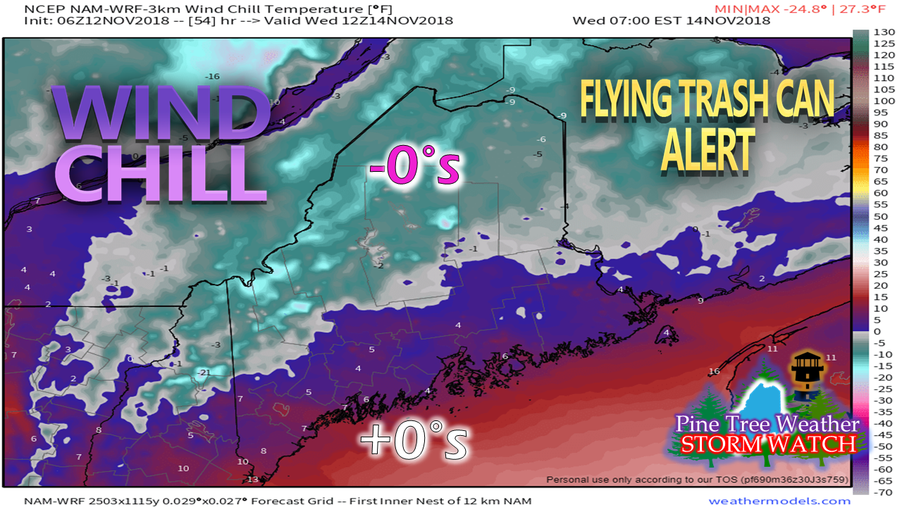 The wind forecast is teetering on what the National Weather Service uses for Wind Advisory, so I will get out ahead of this and call for a Flying Trash Can Alert and it is going to be a frozen one. The wind chill will feel like January. Bundle up. Friday looking snowy for the state With the arctic blast entering the region on Wednesday, the cold will be in place for a statewide snow event for Friday. Whether that stays all snow is a subject for debate along the coast as the track hasn't been ironed out yet. One thing that was noticeable to me today was the southeasterly shift in ensemble ideas, which fits dynamics. Interior areas could get a decent snowfall out of this. I am still going with a mix for the coast for now, but the idea of this being all snow for the region won't take much more convincing if the track moves 75 miles south. Yeah, it's that close. Regional Outlook through Saturday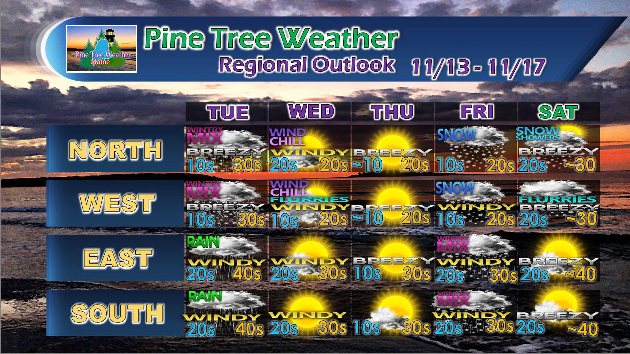 Below normal cold will be with us for the foreseeable future through at least the first half of the Thanksgiving holiday. A weak clipper system may bring a mixed bag Saturday night into Sunday. Stay tuned for forecast revisions through the week. Financial support is still needed Please consider making a donation to keep Pine Tree Weather going through the year ahead. My data cost expense is increasing. The operation is 70% funded and needs your help to get through the winter. You can set up a monthly pledge on my Patreon page or send me a message from the Facebook page or direct message on Twitter to get my address to mail a check or set up bill pay.
For the latest official forecasts, bulletins and advisories, please check in with the National Weather Service in Gray for western and southern areas, or Caribou for northern and eastern parts of Maine. For more information from me, please follow the Pine Tree Weather Facebook page and my Twitter feed. Always stay weather aware, and thank you for your support! - Mike |

Mike Haggett
|


