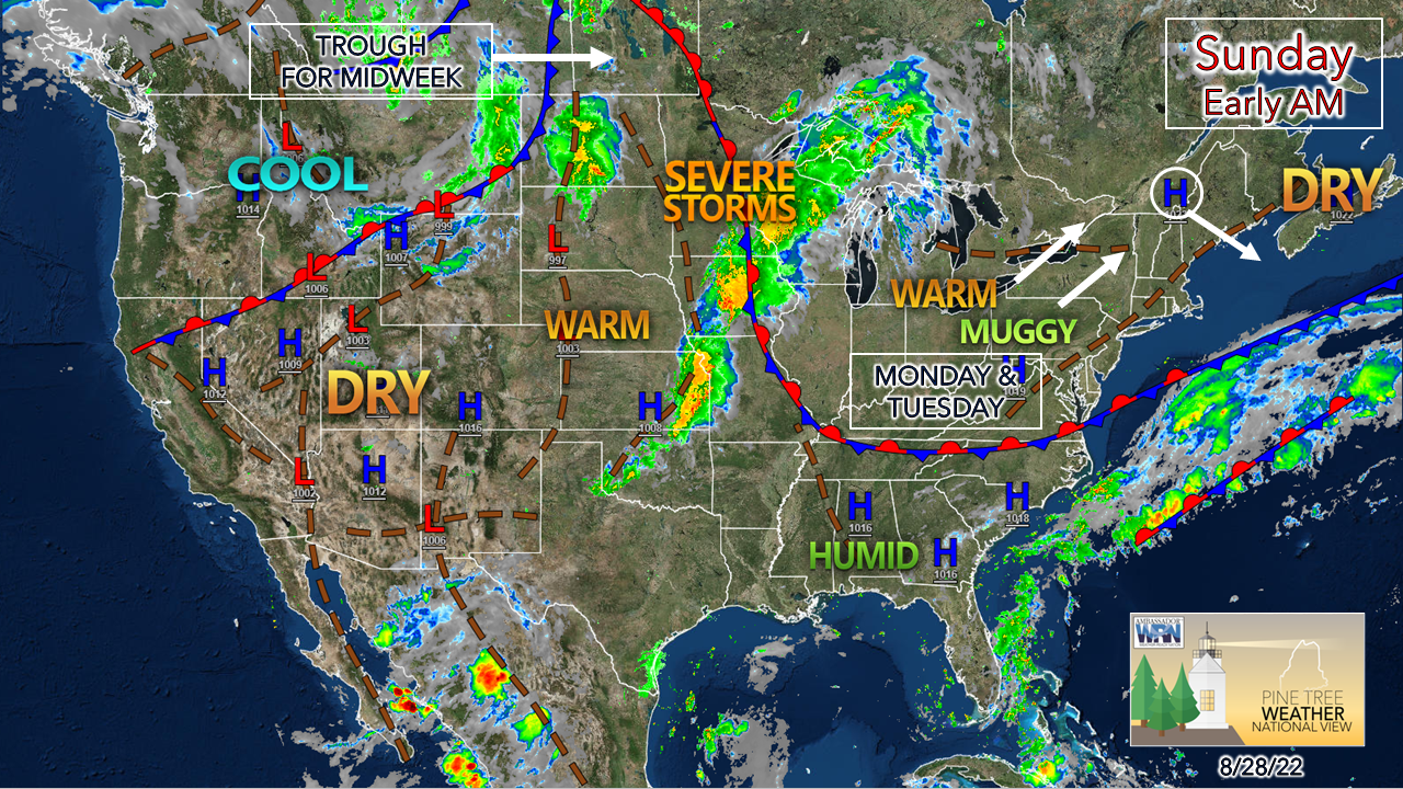
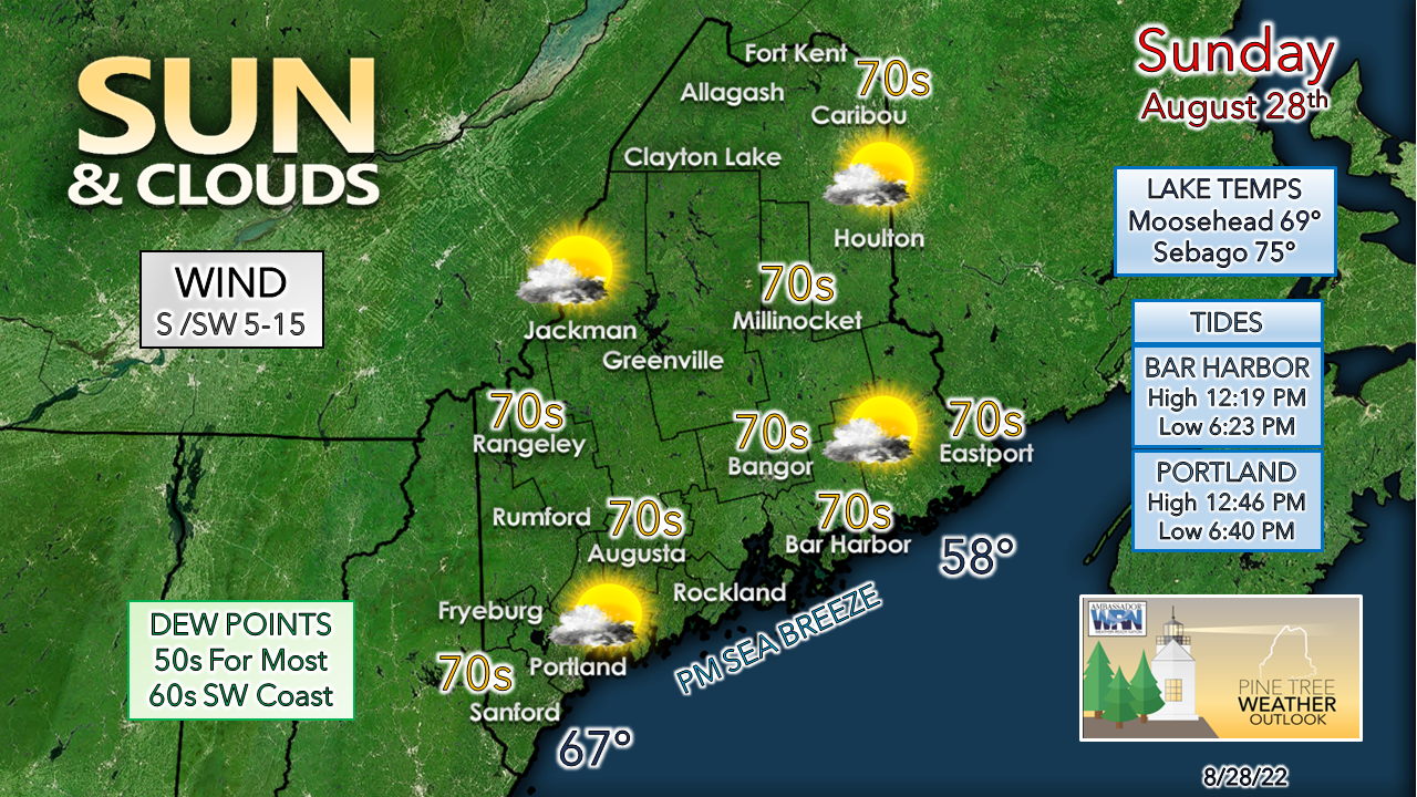
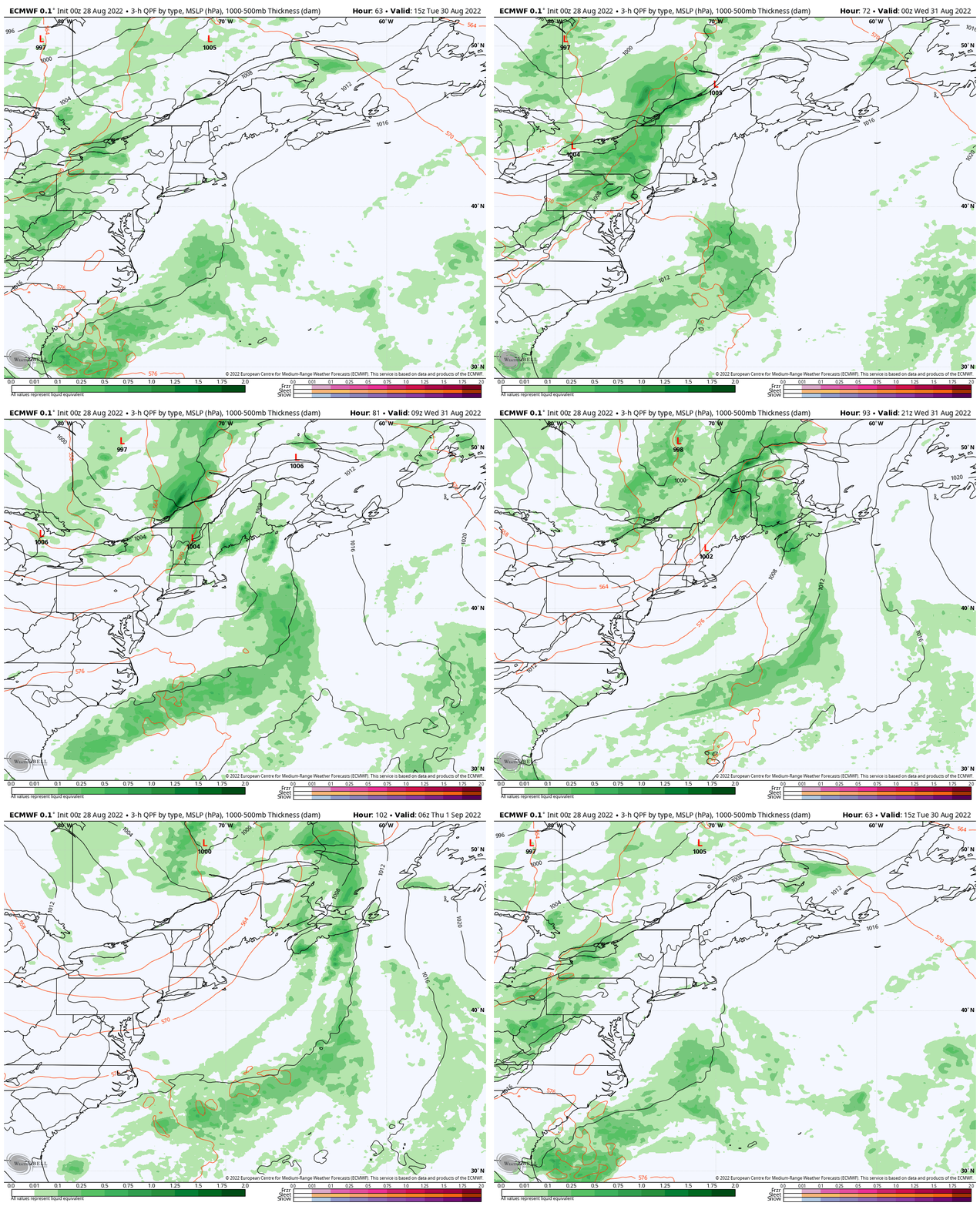
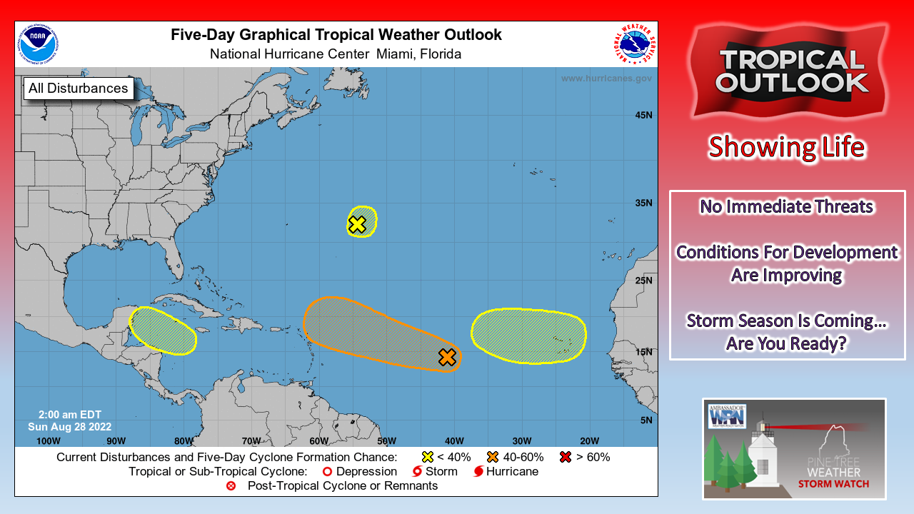
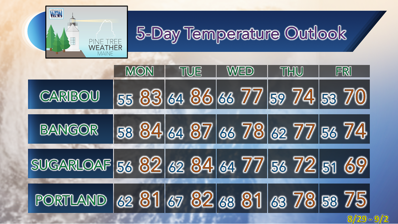
One more day of comfortable conditionsHigh pressure that is giving the region a break from the humidity slides to the southeast during the day. This will set up a southwest flow that raises the dew points once again as we start off the week. An area of low pressure in the Canadian Prairies moves eastward and brings the next chance for showers and storms Tuesday afternoon for the mountains and north and everywhere on Wednesday. Cooler and comfortable conditions return late in the week. A nice Maine summer day to wrap up the weekend. Dew points continue to be slightly elevated over the southwest but are comfortable for the region overall. The midday high tide cramps the beach space, so if you are headed for the sands, go early to get a good spot. A light sea breeze may cool temperatures a bit once that gets going late morning. Potential for rain and storms midweekTuesday 10 AM to Thursday 8 AM - Our best chance for showers and storms over the next several days comes midweek. The mountains and north could see some strong to severe storms pending on the arrival of a cold front from the northwest Tuesday afternoon. Low pressure tracking across the heart of Canada will bring a frontal boundary through the area on Wednesday. The trough associated with the cold front may become negatively tilted, and if that is the case, there could be some enhancement to rain and wind associated with the boundary if low pressure has time to generate as it passes through the area. After the front clears and rain ends, dry air and comfortable temperatures return to end the week Time to watch the tropicsThe 2 AM Sunday 5-day outlook from the National Hurricane Center shows four areas that are being monitored for potential tropical development. The stubborn Saharan air layer and wind shear that has stunted any storm potential is relaxing and allowing waves to enter the international tropical convergence zone offshore of Western Africa. This is the first time since 1997 where there has not been a named storm in August, and the first time since 1982 where there has not been a named storm in the July 3rd to August 31st period. There are indications that the drought of activity is likely to end as we head into peak season in September. Stay tuned! Temperature outlook through FridayThe normal high and low temperature for Caribou for August 28th is 74° and 52°. For Portland, 77° and 58°. Temperatures are expected to be above normal to start the week, and cool to near average late week. Thank you for supporting this community-based weather information source which operates by financial contributions from people like you. NEXT UPDATE: TUESDAY Stay updated, stay on alert, and stay safe! - Mike NOTE: The forecast information depicted on this platform is for general information purposes only for the public and is not designed or intended for commercial use. For those seeking pinpoint weather information for business operations, you should use a private sector source. For information about where to find commercial forecasters to assist your business, please message me and I will be happy to help you. |
Mike Haggett
|

