
First, a quiet Sunday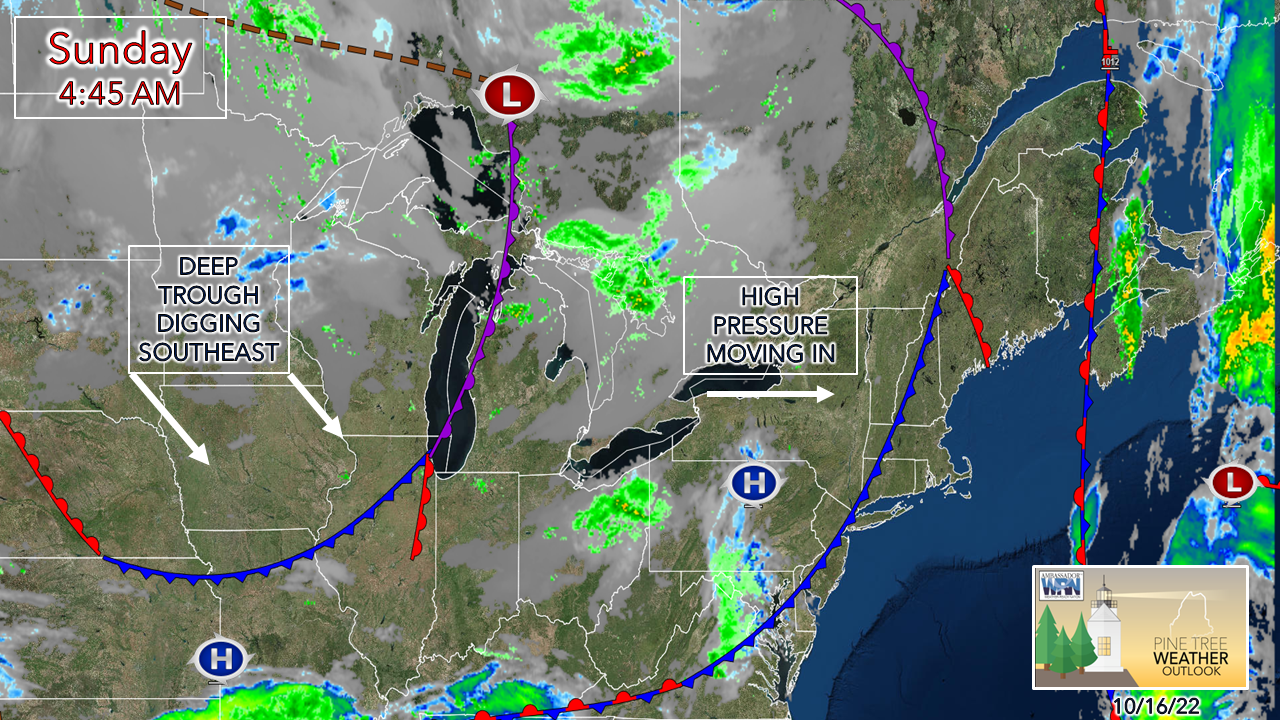 A weak frontal boundary passes to the east early Sunday morning. There is a bit of an atmospheric traffic jam to the east as a massive ridge extends poleward to the north of Greenland which will allow for the passing front to stall over eastern areas in the afternoon. A deep trough developing over the Midwest amplifies and digs to the southeast. High pressure squeezes into the area and gives the region a dry and calm day. 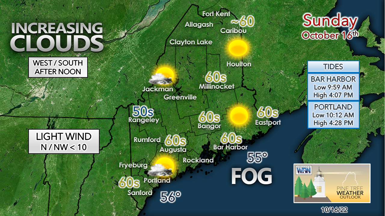 Dense fog advisories are posted over much of the state ahead of the weak frontal boundary to start off. The ground stratus should dissipate by mid to late morning. I do have concerns that DownEast areas may be dealing with it longer with the weak surface low forming along the front, and the slow progression of the boundary. For western and southern areas, the day starts off with some patchy fog and becomes mostly sunny. Clouds are expected to increase in the afternoon as a weak ridge moves in associated with the surface high. Another soaker on the way to start the week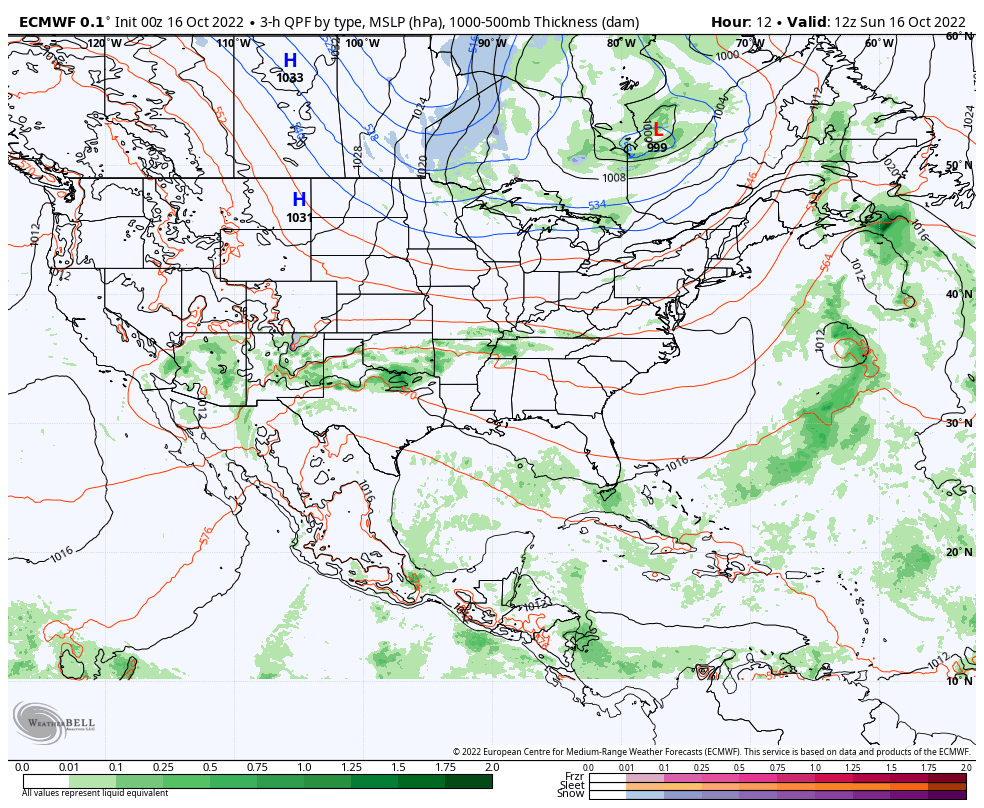 Sunday 8 AM to Wednesday 8 PM - The aforementioned atmospheric traffic jam is where my concern lies as far as Monday to Wednesday play out across the region. Where there are strong ridges come deep troughs, and Maine is caught in the middle of the two. A surface low fires with the trough, picks up moisture from the Gulf of Mexico and pumps it northeastward. Does this sound familiar? 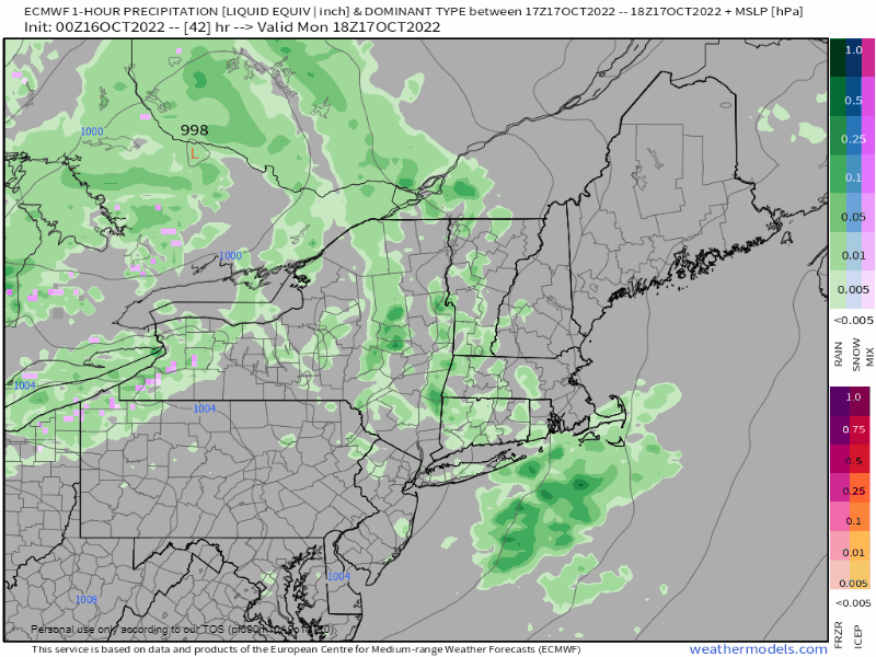 Monday 2 PM to Wednesday 2 PM - The western mountains may pick up a late day shower Monday afternoon, but the day appears dry for most. Shower chances increase over the state Monday night into Tuesday. This is where the forecast becomes a bit tricky, factoring in the blocking ridge to the northeast. Western and southern areas appear to see rain end by Tuesday afternoon for now, but the forecast trend is slowing down the progression of the front. The end time for the north and east is in question for Wednesday morning. 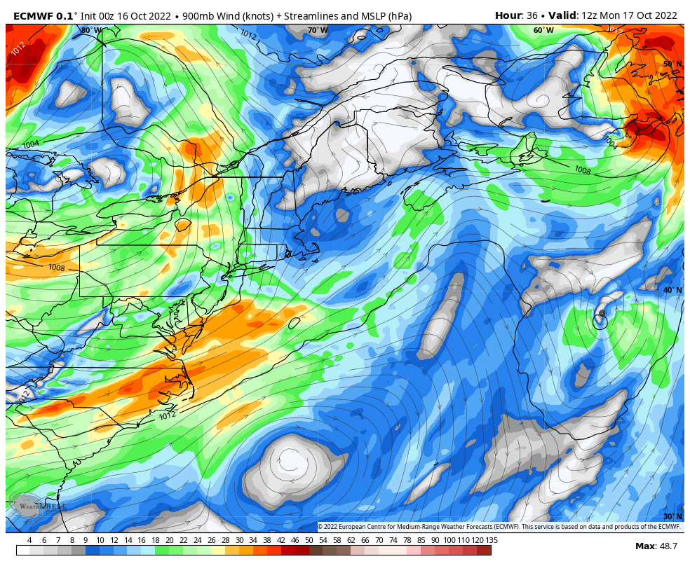 Monday 8 AM to Wednesday 2 PM - This is a look at the low-level jet stream which brings the concern for wind into play. If the jet cranks at 50-60+ knots from the south / southeast, there comes concern for gusts at the surface 30-40+ mph, which would be concerning for potential power outages. This is similar to the previous storm, and we all know how that ended up. 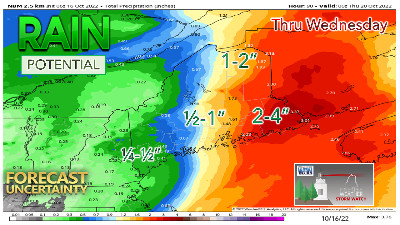 For now, eastern areas of the state are expected to get another soaker, but again the trend is shifting higher amounts westward as the blocking ridge to the northeast is not cooperating with model ideas. With the recent rain, the rivers are up, and the ground is saturated. With potential rainfall rates in the 1-3" / hour range, it won't take much to cause localized flash flooding anywhere in the state. With more leaf drop due to wind, the risk for urban street flooding from clogged drains is a concern. Reduced visibility from heavy rain and fog, standing water on roadways, slick spots from leaves and pine needles on the roads and flying debris all will make for slow and hazardous driving conditions. Stay tuned! Temperature outlook through FridayThe average high and low temperatures for October 16th Caribou are 53° and 35°. For Portland, 59° and 41°. The mercury appears to run a bit warm through midweek, before cooling down later in the week. 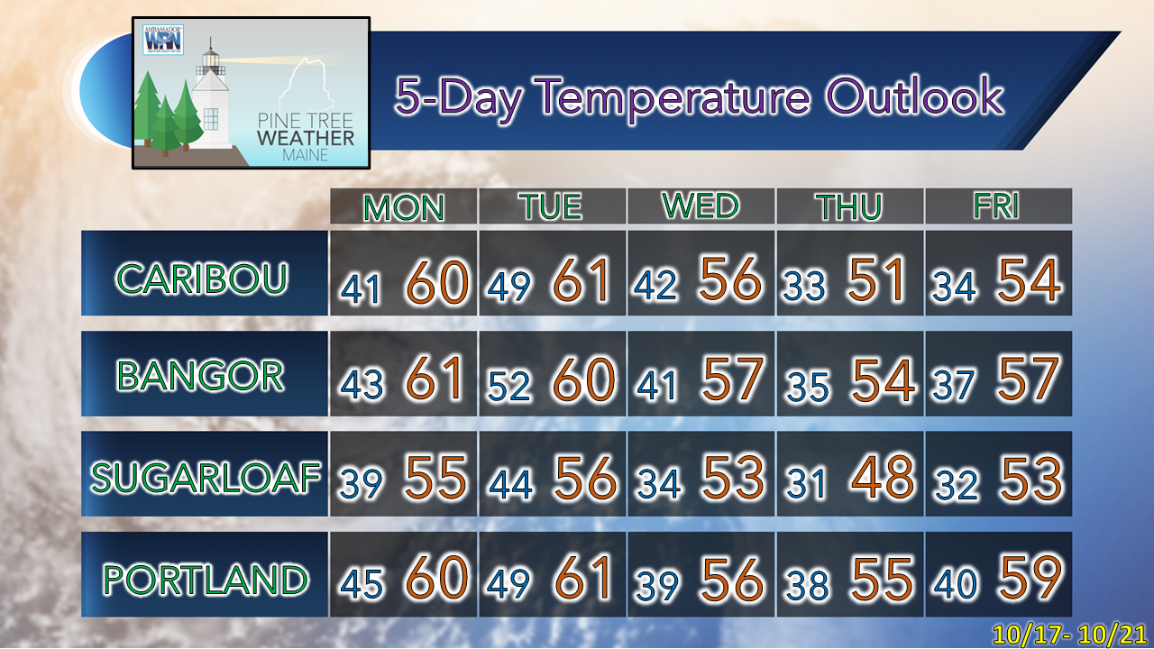 Thank you for supporting this community-based weather information source which operates by financial contributions from people like you. Stay updated, stay on alert, and stay safe! - Mike NOTE: The forecast information depicted on this platform is for general information purposes only for the public and is not designed or intended for commercial use. For those seeking pinpoint weather information for business operations, you should use a private sector source. For information about where to find commercial forecasters to assist your business, please message me and I will be happy to help you. |

Mike Haggett
|


