
Power Restoration ContinuesMore folks are coming back online, which is encouraging to see. Central Maine Power reports 35,637 entering day six, Emera Maine indicates 6,895 are offline as of 8:20 AM Saturday. The day will be a good day reconnect more people. After Sunday into Monday, the forecast is favorable for the rest of the week. Cold air settles in Saturday night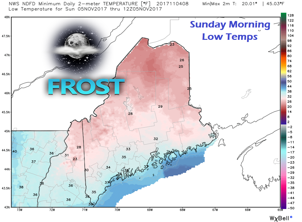 After a seasonable day with temperatures generally in the 40s and 50s statewide, high pressure settles in overnight. Overnight lows fall into the 20s for mountains and north to the low to mid-30s for the south and eastern shorelines. This cold air sets the table for a light snow / wintry mix situation to start Sunday. Cold Air Damming Returns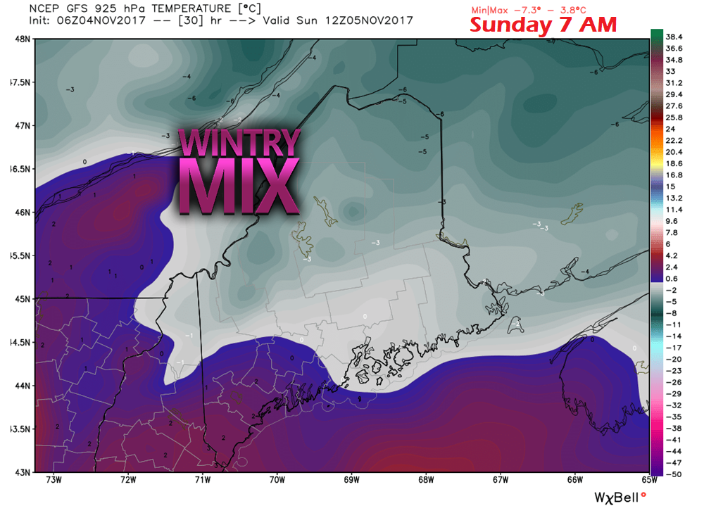 Cold air damming is a weather phenomena areas of the state have to deal with in the cooler times of the year. The western mountains and foothills on up through the Great North Woods are areas that are impacted. Cold air sets up shop at the surface, warm air takes over the mid-level of the atmosphere. As parcels of precipitation fall, rain can change to sleet or stay wet until the surface pending on how low the above freezing temperatures are in the atmosphere. In that scenario, precipitation would end up as freezing rain or drizzle. This is also dependent on wind direction. A light southeast wind flow near the surface is notorious for holding cold air in. In this particular situation, high pressure dries the air column out. It is going to take time to raise the humidity levels to get any moisture out of the atmosphere. You may open the radar and see where it may be a snow/mix falling in your area, but due to the dry air, it may not reach the ground. This is known as virga. I expect a fair amount of virga to be showing up on radar returns from around 7 AM until early afternoon. The higher elevations of the mountains may pick up a coating to an inch of snow, pending on how long the cold air hangs around. How much of that reaches the valleys depends on how quickly the low levels of air saturate with moisture. I do not expect any widespread issues Sunday morning at this point. I do think snow and sleet will find its way to the surface in the high peaks region. Accumulation, if any, appears minimal. 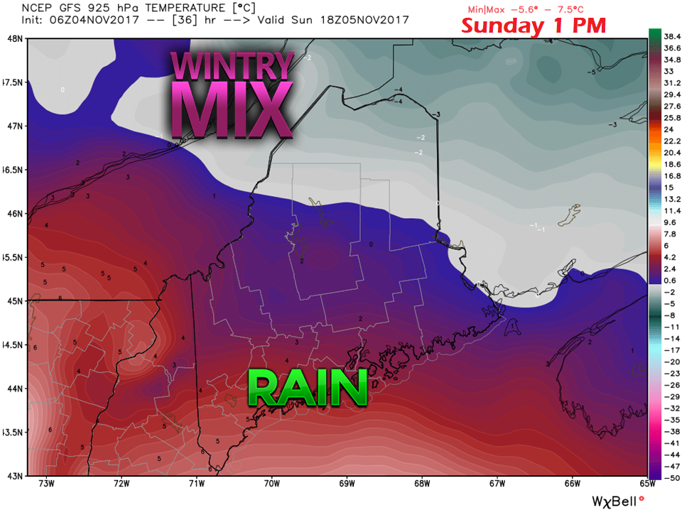 By early afternoon on Sunday, the air column begins to saturate more. Cold air appears stubborn to move out over northwestern areas around the Allagash. This appears to be short lived as the warm front draws closer and wind speeds increase. Cold air will lose this battle as the afternoon progresses. 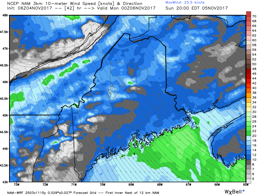 By Sunday evening, the wind becomes a concern once again. The region will be dealing with a southeast wind direction, and it appears to get gusty again. 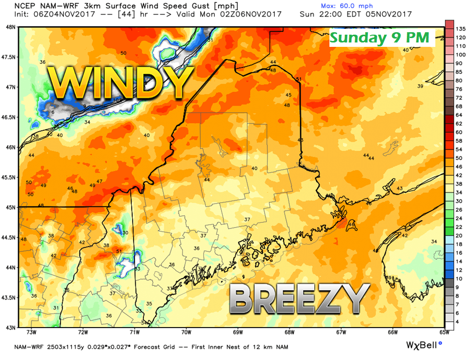 This model idea here may be a touch overdone, but gusts in the 30-40 mph range are certainly possible. A wind advisory is possible for eastern and northern areas. For southern and western areas, stiff gusts on the discussion table. For an area that had to deal with recent historic power outages, this may rattle some nerves. Granted, it won't be as bad as the Late October Gale, but anytime the wind gusts from the southeast in the 35 mph or higher, concerns are raised for potential problems. I don't want to appear alarmist, but it would not surprise me to see some spotty power outages here. The trees have been stressed a great deal given the strength of the recent storm. 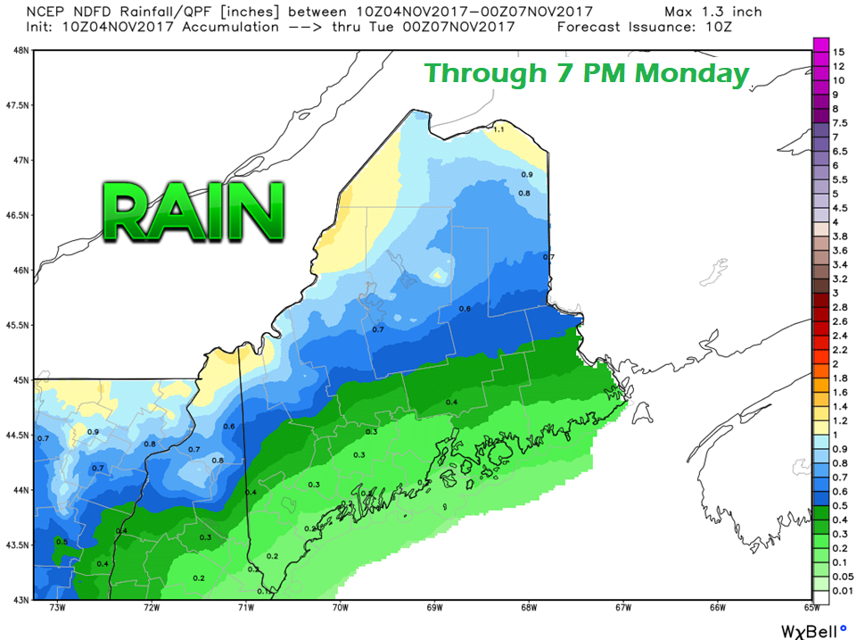 Projected rainfall for the event does not appear to cause any flooding issues. The mountains and the crown appear likely to see the most rainfall. There could be locally higher amounts in areas of the western foothills north and east in heavier showers. Given the warm air mass over the region Monday and cold air working in, the threat for thunderstorms are possible, and may contain gusty winds. Rain is on track to end Monday evening for the south and west, and in the wee hours of Tuesday morning for the north and east. A weak cold front approaches the region Thursday afternoon which may bring some snow flurries Thursday night into Friday morning. The first shot of winter cold late week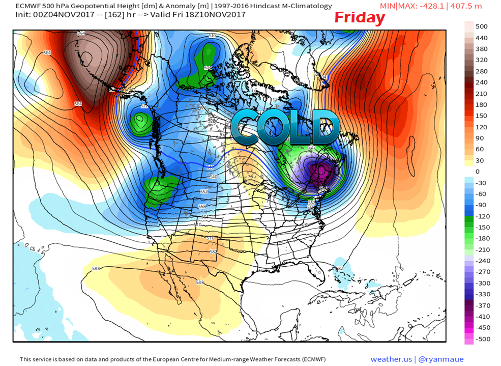 The first genuine arctic high is on tap to enter the region behind the Thursday front. Along with it appears wind chill. The roller coaster ride of gradually falling temperatures to winter in on the way. Fall back is Saturday Night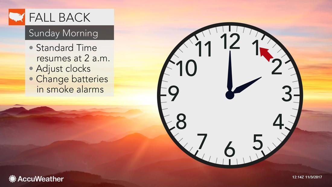 Don't forget to check and/or change the batteries in your NOAA Weather Radio, also.
The 7-Day Outlook is on that page. Thanks for your support of Pine Tree Weather. Your comments, likes, reviews, shares and retweets are always much appreciated. - Mike |

Mike Haggett
|


