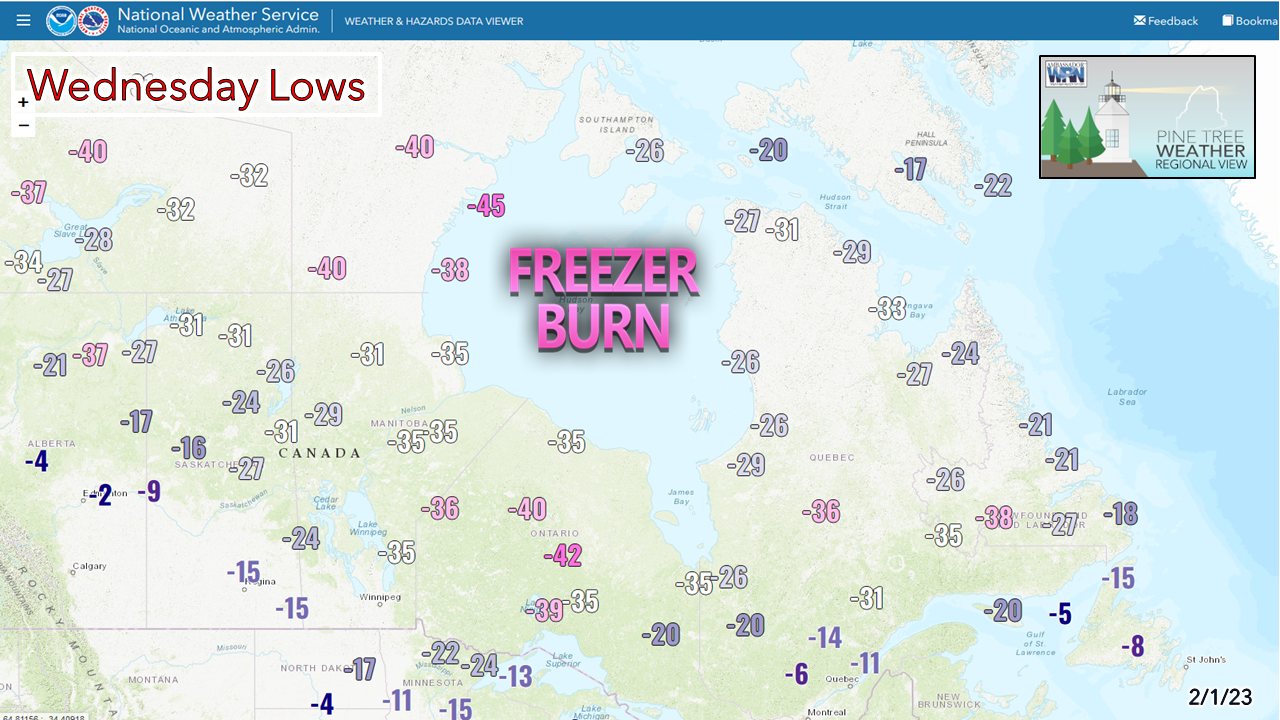
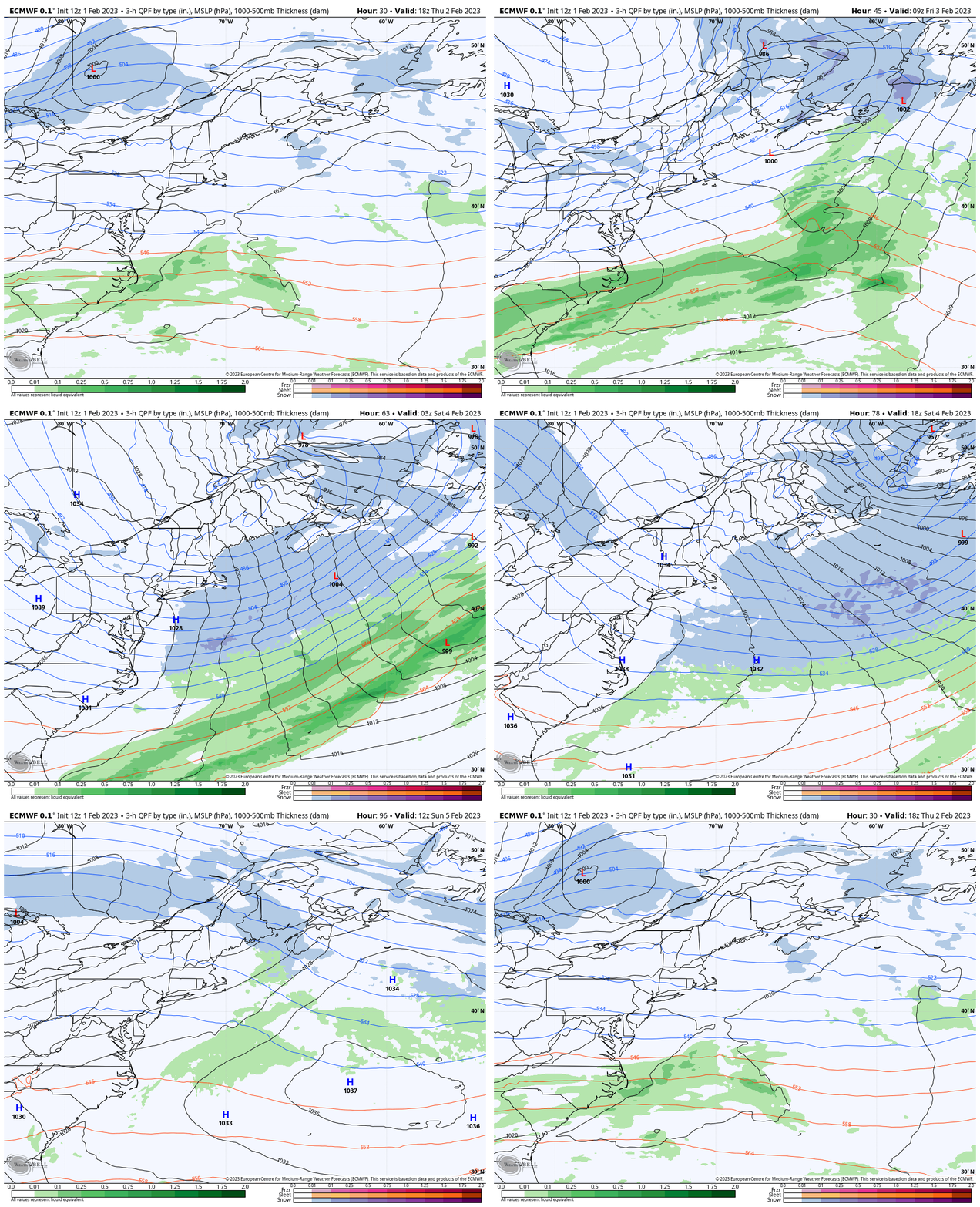
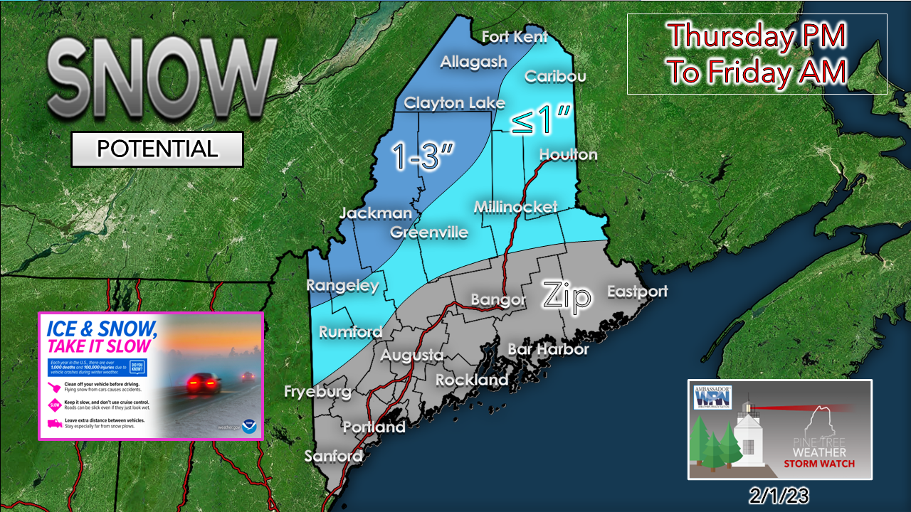
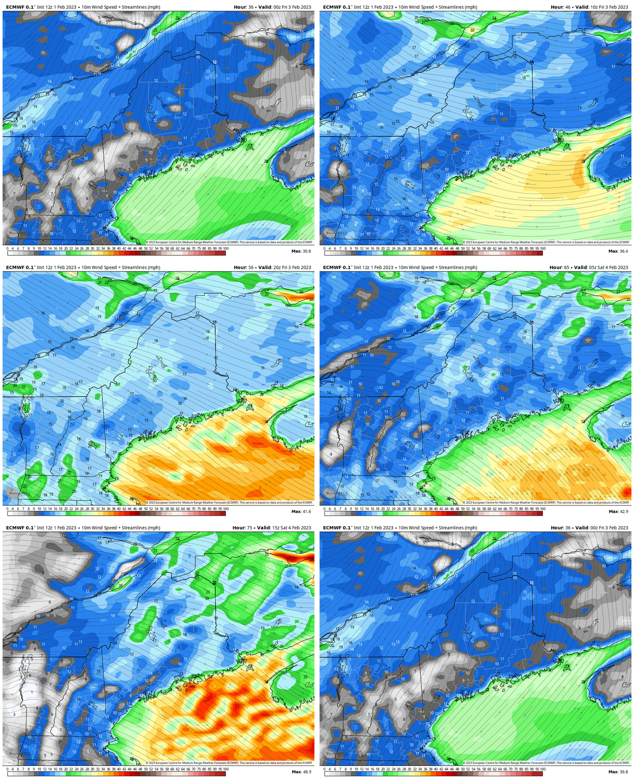
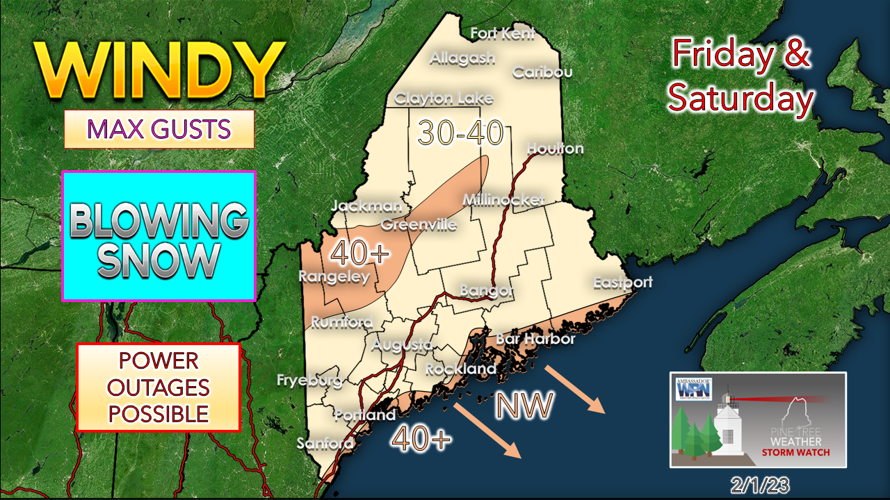
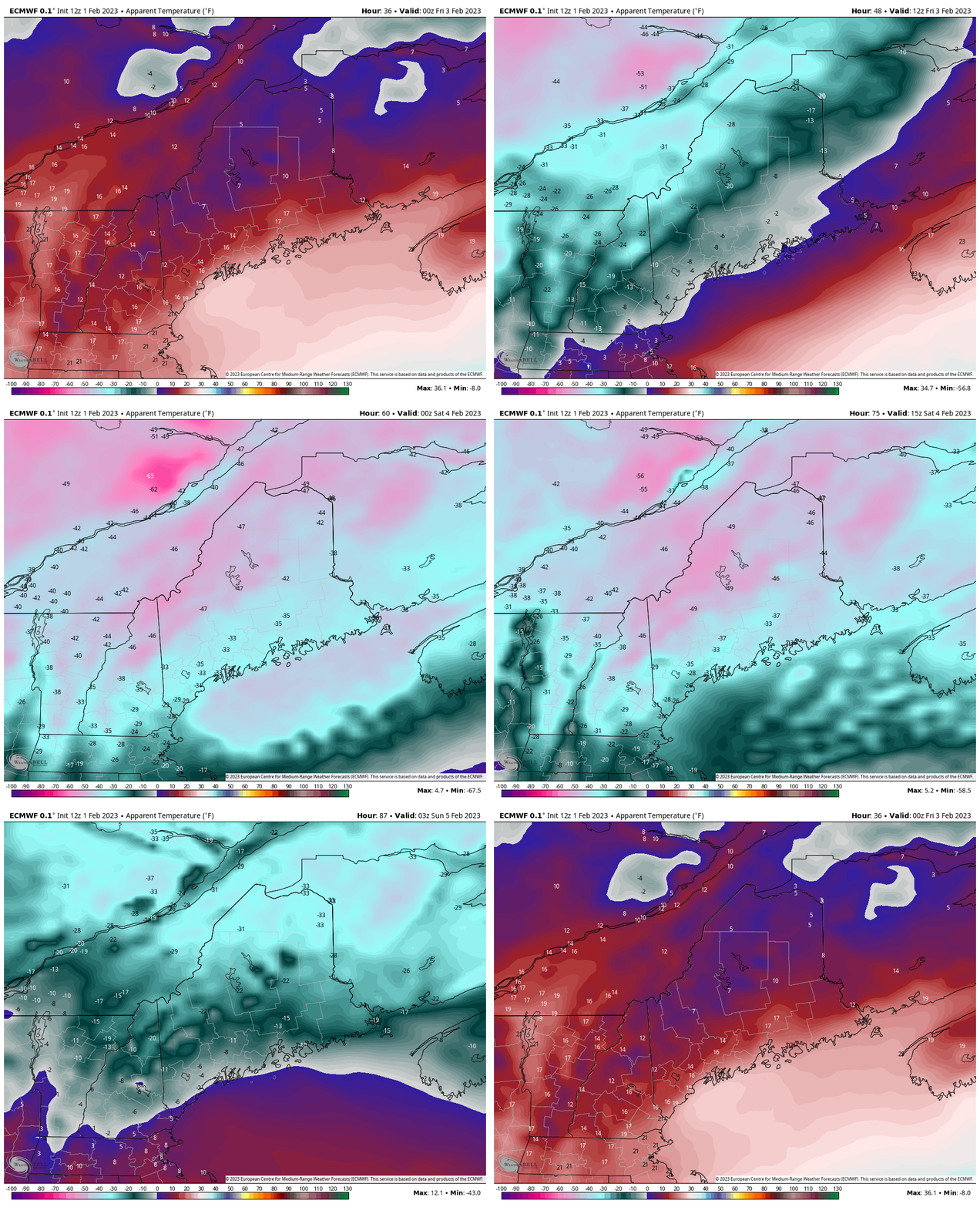
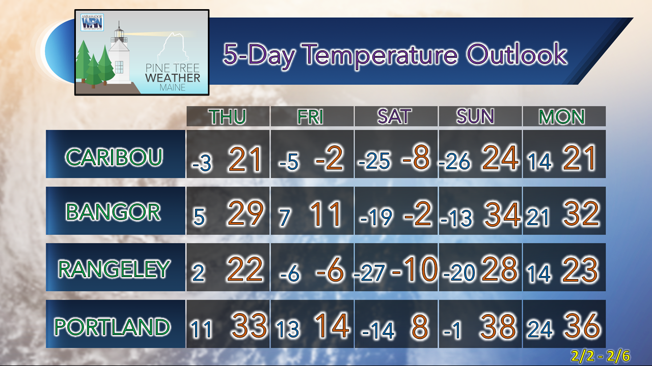
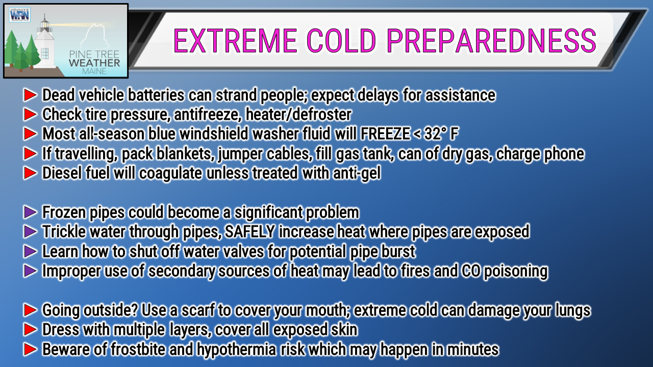
About to feel the burnThese poor folks around Hudson Bay have been dealing with temperatures in the -50 to -20 range as the cold has sat there for close to 10 days now. I know it's Canada, the Great White North, it's supposed to be cold in winter, and while all of that is true, this has been an endurance test going on there. To have this cold park itself due to blocking all around it, isn't commonplace for this long of a period. That is about to change, which will be a relief to them, and at our expense. Oh, and those temperatures are actual lows, not including wind chill. Many of those spots around the rim of the bay have seen wind chill values fall to -80°F. We get out of this rather easy. An arctic front that will be rememberedThursday 1 PM to Sunday 7 PM - At the start of the loop we see the weak low skirt across central Quebec along the polar frontal boundary, which is the developing atmospheric corkscrew that unleashes the wrath of Hoth to the southeast as that blows up over the Gulf of St. Lawrence. The higher latitudes get powerful storms in winter but this is excessive even for them. As that is intensifying along the way, it spins an arctic front through the region into Thursday night into Friday morning. Temperatures head for the dark depths of the basement that haven't been seen in this area since I was 2 years old (that would be February, 1971) and continue to fall into Saturday morning. Notice the blue that forms over the Gulf of Maine? That is snow, folks. This will be a blizzard over the open ocean. Some folks who live on the islands around Penobscot Bay and DownEast areas may get buried with ocean effect snow. Air temperature of -20 to -10 over 45° sea water is a sight to behold. Once the trailing area of high pressure arrives Saturday night, that finally shuts down the ocean effect snow and shift the wind around. Once that high exits to the east Sunday morning, the region starts to get out of the ice box. The north and the mountains may get a couple inches of snow on Sunday as a warm front moves in. We'll figure that out later. The arctic front will bring some incredibly fluffy snow to the Quebec border areas, which will be a cause for concern not only for the snow removal folks in those areas, but anyone travelling that way. I am not expecting much in the way of forecast verification on this, and the reason why is the wind. It's the wind, the wind, the wind, and the windThursday 7 PM to Saturday 7 PM - The arctic front unloads and the wind cranks and continues for the better part of 36 hours from the northwest. The high approaches Saturday night. As is does, it cuts the wind down temporarily. Some areas may go calm. Where that happens, expect some crooked double digit actual temperatures that you will want to take a picture of to share with your grandchildren. The National Weather Service Caribou has issued a Winter Storm Watch for ground blizzard conditions from blowing snow and dangerous snow squalls Thursday night through Saturday evening. I have to think the western mountains areas will be dealing with similar conditions. Whether or not a wind advisory comes out of this is yet to be seen, but it may qualify given the duration of the event. I do expect power outages given the duration of the wind. Whether isolated or scattered, it will be too many as for those that lose power that do not have a generator will be in a world of hurt. Thursday 7 PM to Sunday 7 PM - This is apparent temperatures here, which is the only thing that matters at this point. The good news is if the Martians show up, they won't land around here as it is too cold for them. This is dangerous in so many ways. If you caught my Facebook post Wednesday morning, I get into all of the concerns more in depth. Sunday morning is better. Just wait and take care of what you need to at home, which may keep you busy. Temperature outlook through MondayPrepare nowThank you as always for your support! You may not like the weather, but I hope you like what I do! Please hit the like button on Twitter and Facebook, and share! Financial donations to fund what I do are always appreciated! Stay updated, stay on alert, and stay safe! - Mike NOTE: The forecast information depicted on this platform is for general information purposes only for the public and is not designed or intended for commercial use. For those seeking pinpoint weather information for business operations, you should use a private sector source. For information about where to find commercial forecasters to assist your business, please message me and I will be happy to help you. |
Mike Haggett
|

