
The squeeze play is on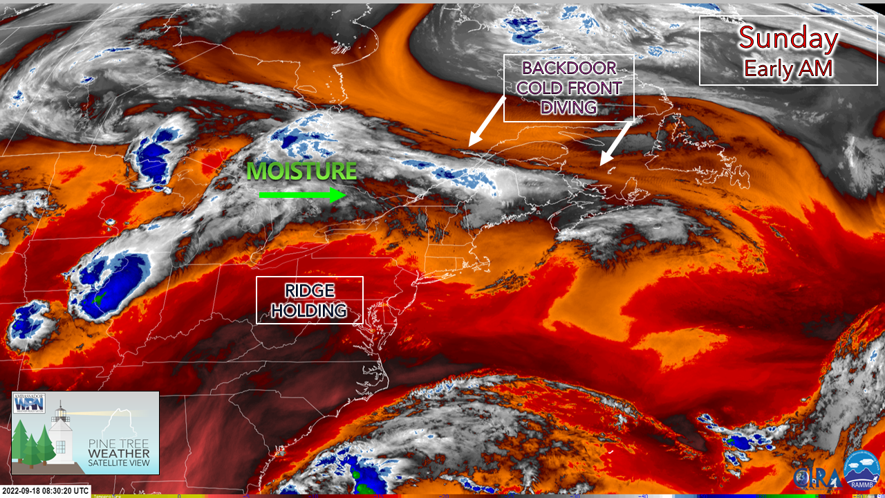 A sure sign of fall is that of a backdoor cold front. A strong trough is descending over eastern Canada and will butt heads with a ridge over the southeast. This puts Maine in the middle of the atmospheric sandwich, and the meat of it will be beneficial rain for most of the drought impacted areas.  Sunday 6 AM to Monday Midnight - A great way to show the descension of the cold front is that of this dew point temperature loop. There is a taste of three seasons going on here, which shows the strength of the trough moving into the area. Dew point values could range up to a 40° difference between cooler northern areas and warmer southern areas. Southern areas feel a touch of summer with the spike in humidity levels for a few hours Sunday afternoon, while northern areas could see some frost in spots Sunday night as dew point levels crash into the 20s in spots. A good ol' fashioned rainstorm Sunday 6 AM to 6 PM - The descension of the backdoor front keeps southern areas mainly dry through early afternoon before shower chances increase there. There is the risk of thunder in the late afternoon as dew point levels climb into the 60s. While severe storms are unlikely, there is the risk of downpours and a stiff puff of wind which accompany them in the areas where storms occur.  Sunday 6 PM to Monday 6 AM - Steady showers continue over the west, east, and south through Sunday night. Rumbles of thunder are possible through midnight. Once the lead part of the precipitation shield moves offshore, a lull sets up heading for morning. For the early commuters, heads up for areas of fog which may be locally dense in spots Monday morning.  Monday 6 AM to Tuesday 2 AM - As the trough moves east, the ridge moves in from the west which brings increased chances for rain showers over western areas through midday. Another round of steady, soaking rain arrives in the afternoon over southern and MidCoast areas by late afternoon and may impact the evening commute. Steady rain ends over the west and south by late Monday evening as the warm front moves into the north and eastern areas by around midnight on Tuesday. 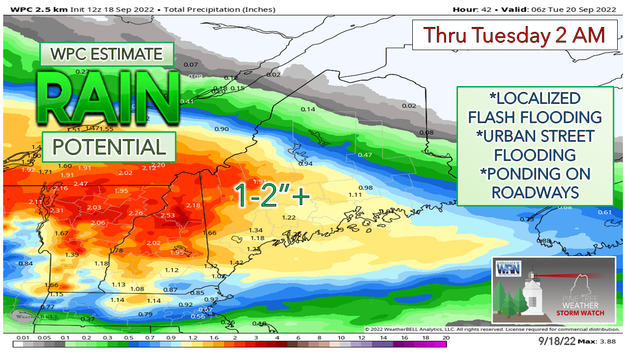 Looking at a range of guidance ideas, both deterministic and ensemble, shows high confidence of 1-2"+ from Jackman to Bar Harbor south and west through early Tuesday morning. Heavy rain could train in areas which may drive the totals locally higher, along with areas in the south that may get a running head start with late afternoon thunderstorms on Sunday afternoon. For those travelling, keep in mind you could be driving in and out of torrential rain in spots Sunday night and Monday afternoon. Thank you for supporting this community-based weather information source which operates by financial contributions from people like you. Stay updated, stay on alert, and stay safe! - Mike NOTE: The forecast information depicted on this platform is for general information purposes only for the public and is not designed or intended for commercial use. For those seeking pinpoint weather information for business operations, you should use a private sector source. For information about where to find commercial forecasters to assist your business, please message me and I will be happy to help you. |

Mike Haggett
|


