Pine Tree Weather
  • DISCUSSIONS
  • DONATE
  • MAPS
  • NWS BRIEFINGS
  • SATRAD
  • MARINE
  • SNOW / ICE OUTLOOK
  • RAIN OUTLOOK
  • CPC OUTLOOK
  • Kennebunk
  • OBSERVING WEATHER
  • Who We Are
  • My Photography
  • DISCUSSIONS
  • DONATE
  • MAPS
  • NWS BRIEFINGS
  • SATRAD
  • MARINE
  • SNOW / ICE OUTLOOK
  • RAIN OUTLOOK
  • CPC OUTLOOK
  • Kennebunk
  • OBSERVING WEATHER
  • Who We Are
  • My Photography

Areas of heavy rain, storms and high humidity to start the week for Maine

7/18/2022

Comments


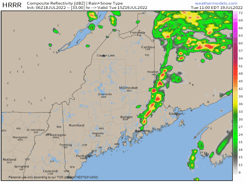
A beneficial soaker for many areas expected

Picture
For those of you who follow on Twitter may see posts like this one that indicate excessive rainfall potential when issued by the Weather Prediction Center. What does this mean? Flash flood potential. With the tropical nature of the system on the way into the region, precipitable water values are expected to skyrocket into 1½-2½" range, which pushes dew points to the upper 60s to low 70s. That kind of moisture with areas of thunderstorms brings torrential rainfall with high rainfall rates. The cynical adage in the weather world is that droughts don't end well. While I don't consider this event to be a drought buster, it should make a dent in the deficit in many areas. As dry as it has been, heavy rain on top of dry, parched soil sets up runoff because the ground cannot absorb the rainwater fast enough. This is where the flash flood concern comes in. 

For folks camping out, please respect the potential here. For those sites near brooks and streams, what may look beautiful and tranquil Monday morning could become violent and dangerous by Tuesday morning. An idea on rainfall 1-2" is the general outlook for the area, with localized higher amounts 3-5"+ where thunderstorms occur.

The air gets soupier as it goes along

Picture
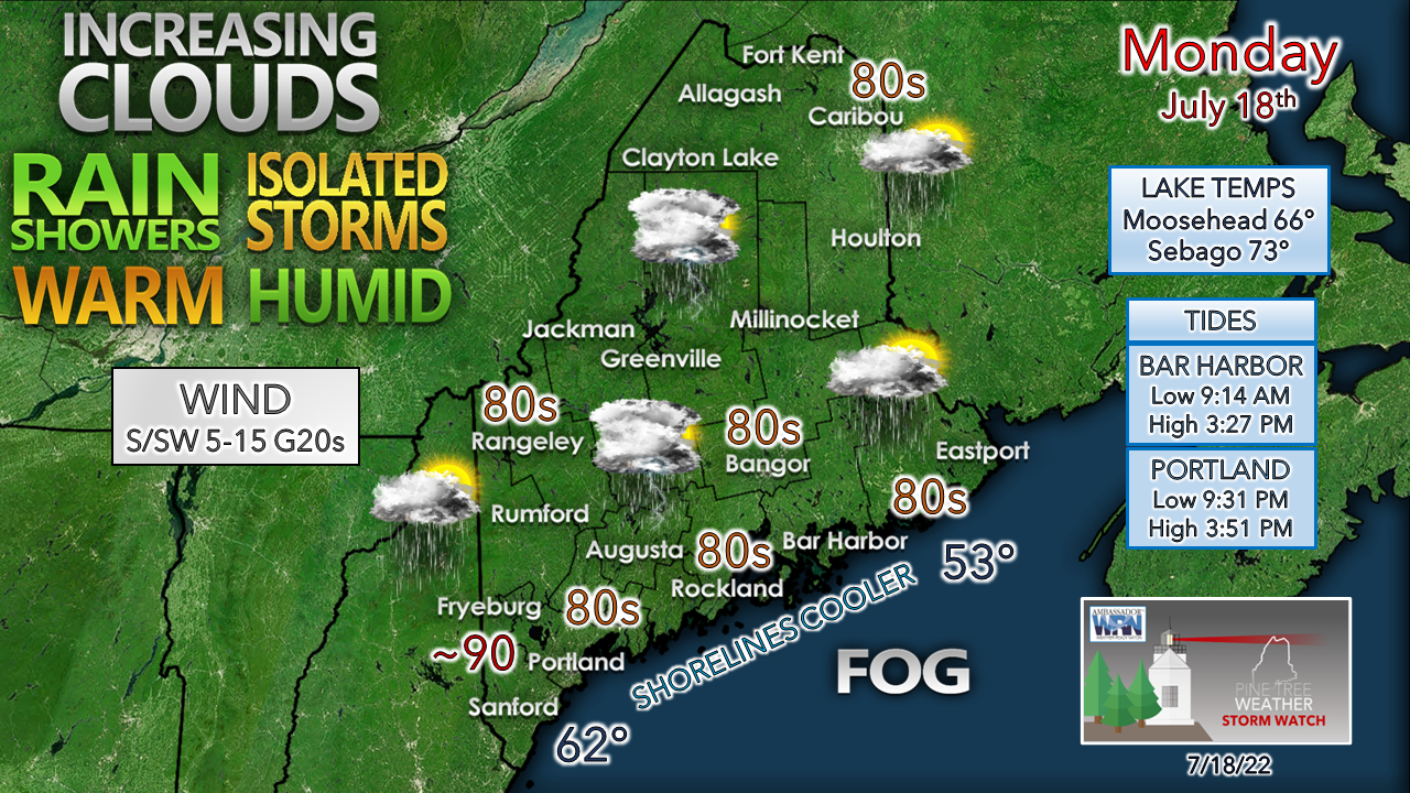
While the humidity may not feel that bad to start off, that changes by Monday night. A tropical warm front moves into the area which increases clouds. Given the saturation and the warm air over the cooler ocean with an onshore flow, that sets up fog potential, with a better chance of it for the MidCoast and DownEast regions through Tuesday.  Given the expected rainfall with high humidity, interior areas may be dealing with areas of fog Tuesday morning
Picture
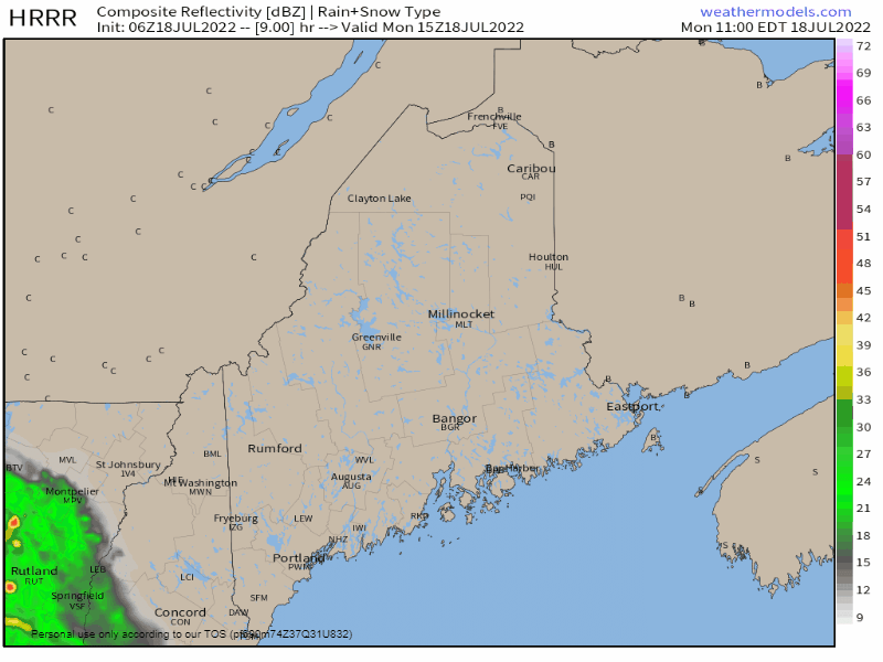
Monday 11 AM to 11 PM - Clouds increase through the day as the warm front approaches the region. Areas of rain and thunderstorms are expected to break out in the afternoon. Far northern areas stay dry through the day until showers arrive later at night. Expect heavy rain to cause ponding on roadways, which could set up potential hydroplane issues on the highways. Localized damaging wind is possible in thunderstorm activity where storms could reach severe levels. Storms are expected through the night. There is also the risk of tornadic activity given the tropical nature of the system. While that risk is very low, it cannot be dismissed. 

Areas of heavy rain and storms continue into Tuesday

Picture
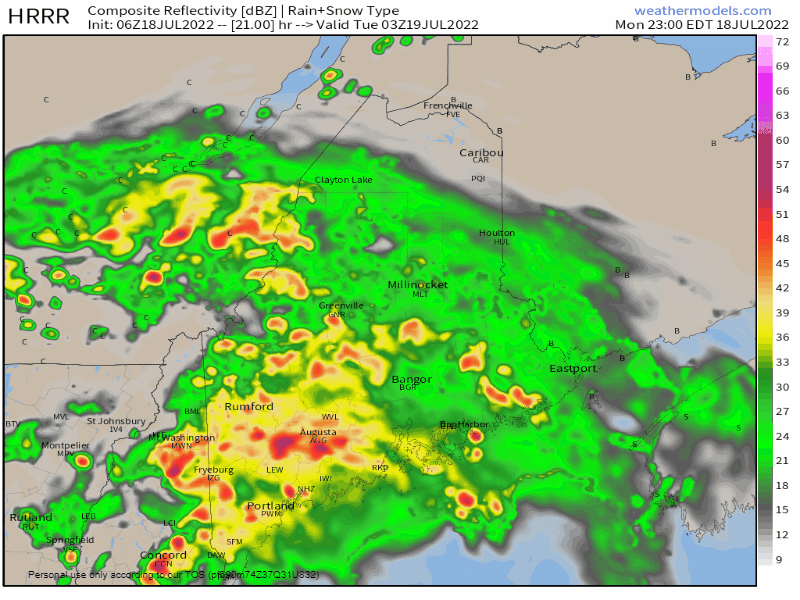
Monday 11 PM to Tuesday 11 AM - Showers and storms are expected to continue into the wee hours of the night then taper off from southwest to northeast into Tuesday morning. Very humid conditions are expected as dew points remain high as the region enters into the warm sector. Expect areas of fog around to start the day given the amount of rain from the hours previous. 

Scattered showers with strong to severe storms
​Tuesday afternoon

Picture
Tuesday 11 AM to 11 PM - A weak short wave is expected to pass through the region Tuesday afternoon. With high dew points, add sun to that which brings temperatures well into the 80s for most areas, and the combination of that sets up the risk for strong to severe storms Tuesday afternoon into the evening.  While the main risk appears over the north and eastern areas, western and southern areas could see an isolated storm or two. After the short wave passes offshore, dew point levels drop a few degrees taking the edge off a bit, but muggy conditions are expected to continue into Wednesday and beyond. 

Outlook through Saturday

Wednesday appears warm and humid. Showers along with the threat of strong to severe storms are possible for Thursday into early Friday as a short wave frontal boundary passes through. The mountains and north may see some widely scattered showers Friday, and the region is blessed with a day of relief from the humidity as drier air works in from the northwest. That break will be short lived as humidity rises Saturday and brings another chance for showers and storms for the first half of the weekend. 
Picture

Thank you for supporting this community-based weather information source which operates by financial contributions from people like you. 
​
Stay updated, stay on alert, and stay safe!

NEXT UPDATE: WEDNESDAY


- Mike

​NOTE: The forecast information depicted on this platform is for general information purposes only for the public and is not designed or intended for commercial use. For those seeking pinpoint weather information for business operations, you should use a private sector source. For information about where to find commercial forecasters to assist your business, please message me and I will be happy to help you.

Comments
    Picture

    Mike Haggett
    Kennebunk, ME

    Certified Weather
    Forecaster
    Penn State '21

    American Meteorological Society

    National Weather Association

    Weather-Ready Nation 
    Ambassador
    ​
    ​SKYWARN-CWOP

    Matthew 19:26


    Support
    Pine Tree Weather

    DONATE

    Picture

    Picture

    Picture

    Picture

    Picture

    Picture

    Picture

    Picture

    Picture

    Picture

    Archives

    January 2023
    December 2022
    November 2022
    October 2022
    September 2022
    August 2022
    July 2022
    June 2022
    May 2022
    April 2022
    March 2022
    February 2022
    January 2022
    December 2021
    November 2021
    October 2021
    September 2021
    August 2021
    July 2021
    June 2021
    May 2021
    April 2021
    March 2021
    February 2021
    January 2021
    December 2020
    November 2020
    October 2020
    September 2020
    August 2020
    July 2020
    June 2020
    May 2020
    April 2020
    March 2020
    February 2020
    January 2020
    December 2019
    November 2019
    October 2019
    September 2019
    August 2019
    July 2019
    June 2019
    May 2019
    April 2019
    March 2019
    February 2019
    January 2019
    December 2018
    November 2018
    October 2018
    September 2018
    August 2018
    July 2018
    June 2018
    May 2018
    April 2018
    March 2018
    February 2018
    January 2018
    December 2017
    November 2017
    October 2017

    RSS Feed

Proudly powered by Weebly