|
I am back at it after a weekend break. We have a beautiful state. It was great to spend time South Bristol as well as Port Clyde. The new banner above is from Marshall Point Light. It was foggy, but peaceful, and a great way unplug for a couple of days. As isolating as this pandemic can be, I thank God that we have places where we can escape, to explore, and to do so in a safe manner. Also, thanks to those who are sending along donations to keep Pine Tree Weather going. I am about 75% covered, which means my deficit is $825 for the year. Any help you can provide is appreciated. Thank you for your support! Slick spots around for Monday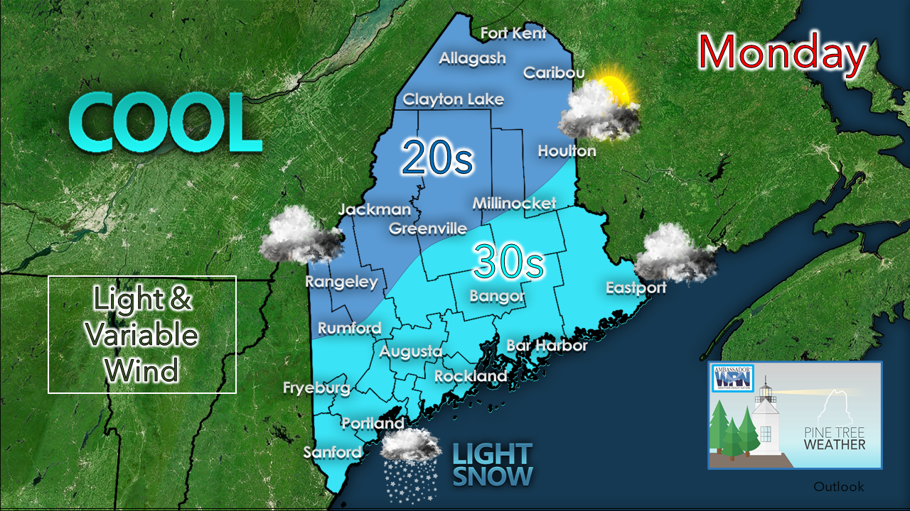 This is actually going to be the warmest day the region is likely to experience for a week, so if you can get out and enjoy it for even a few minutes, do so. It will be a bit on the cool side as compared to normal, but with little wind, it will be fair. The sun will be missing for all but northern areas. Areas of light snow will be the concern for southern areas Monday afternoon. Expect enough snow to slick up the roads in time for the evening commute. Western and northern areas see some light activity Monday night into early Tuesday. Slick spots are possible there heading into Tuesday morning. 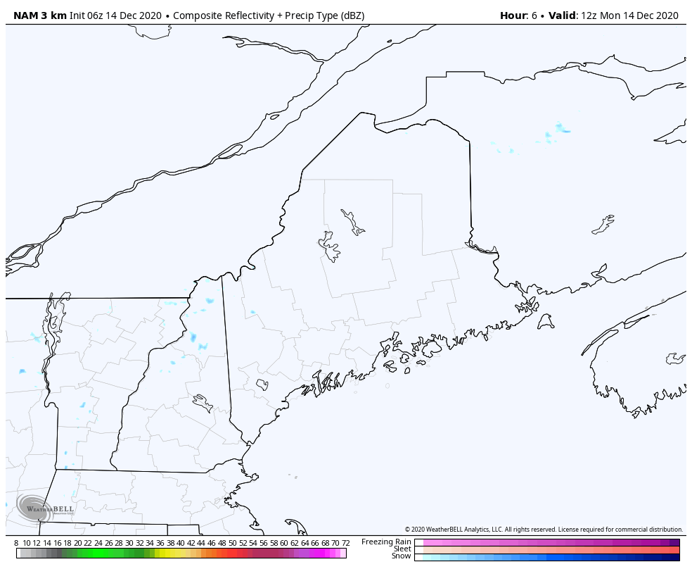 Two weather systems working through the region. First is a storm passing by to the south clips southern and coastal areas through the evening. A strong cold front works in tonight, which will fire up the snow shower machine for the mountains and north. 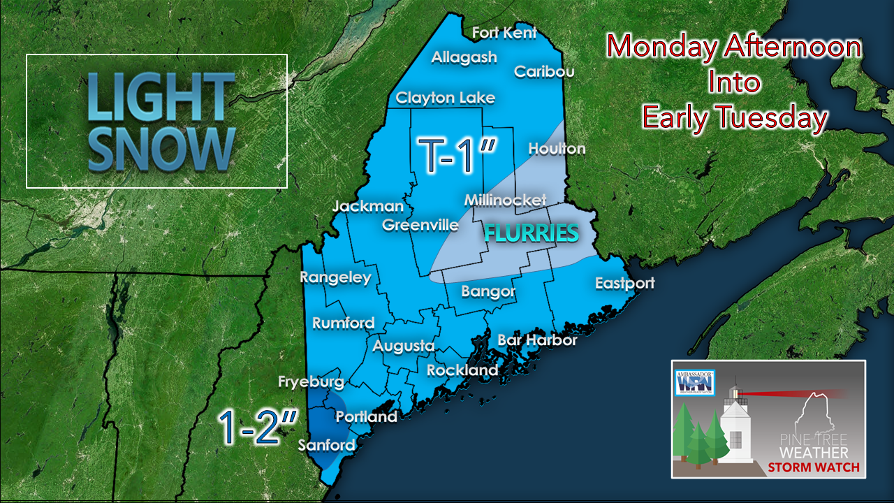 I am a bit concerned there may be an inversion along the coast that may bring an additional inch of snow from Fryeburg / Sebago to the south and west. The mountains could pick up 2-3" of fluff out of this overnight. Due use caution on the roads in areas where snow is occurring. The cold arrives Tuesday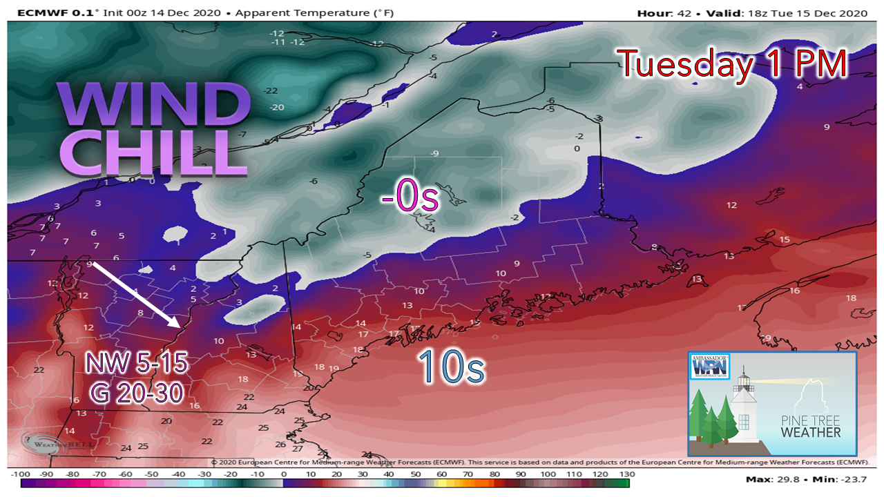 After the cold front passes through Monday night, an arctic high pressure system enters in behind it. The storm that passed by to our southeast on Monday blows up on it's way to Newfoundland, and drags the coldest air mass of the season in for the middle part of the week. Wind chill indices are likely to be below zero for the mountains and north as a northwesterly wind gusts in the 20-30 mph range. This wind will also blow around any snow that fell Monday and Monday night, so that may cause some slick spots in areas. The wind settles as high pressure takes over for Wednesday.  Storm watch for late week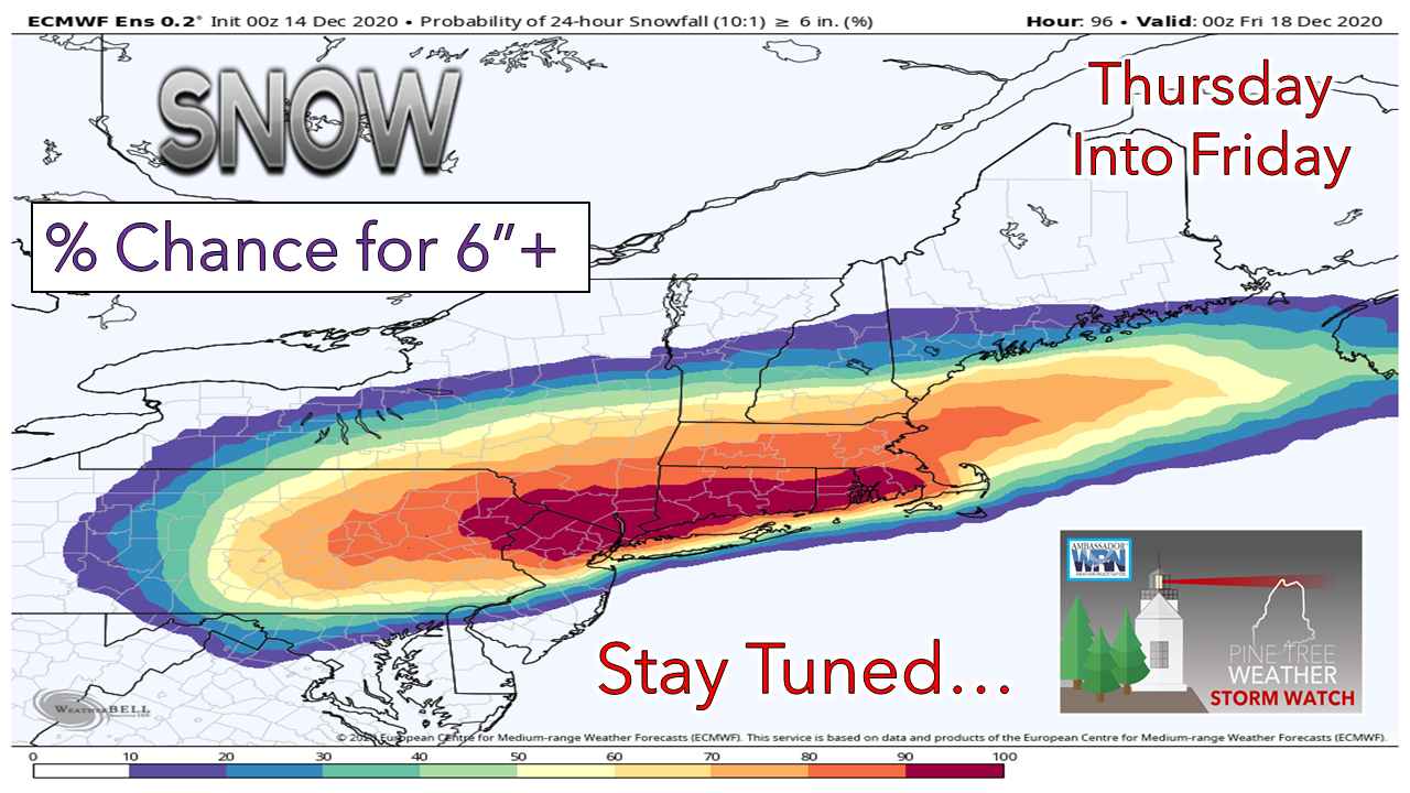 I mentioned last Friday that confidence was strong that cold air will be in place for this possible event, and that idea remains on track. Whatever happens here will more than likely be an all snow event. How much snow is yet to be figured out. The European ensemble idea above shows a 50% chance for 6" or more of snow Thursday into Friday, which is about the middle of the road between the major models. For those planning this one out, folks from Rumford, Waterville, Bangor over the Calais south should plan on a plowable snow event for now. For my friends and followers in Southern New England, southern New York, northern New Jersey and eastern Pennsylvania, prepare for a corker. There could be places that get 2 feet out of this, if not more. Expect shipping and travel delays with this one. This could cripple the I-95 system going north. More updates on this to come. Temperature outlook through SundayBelow zero forecast lows for Caribou is all you need to know to mentally and physically prepare for what is coming. The region will be running well below normal through the end of the week, and modify heading into the weekend. 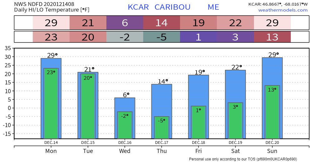 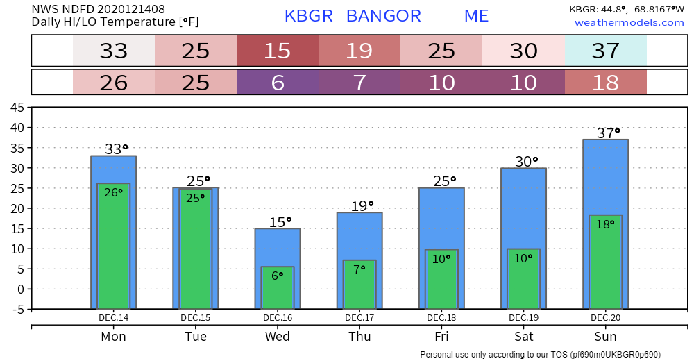 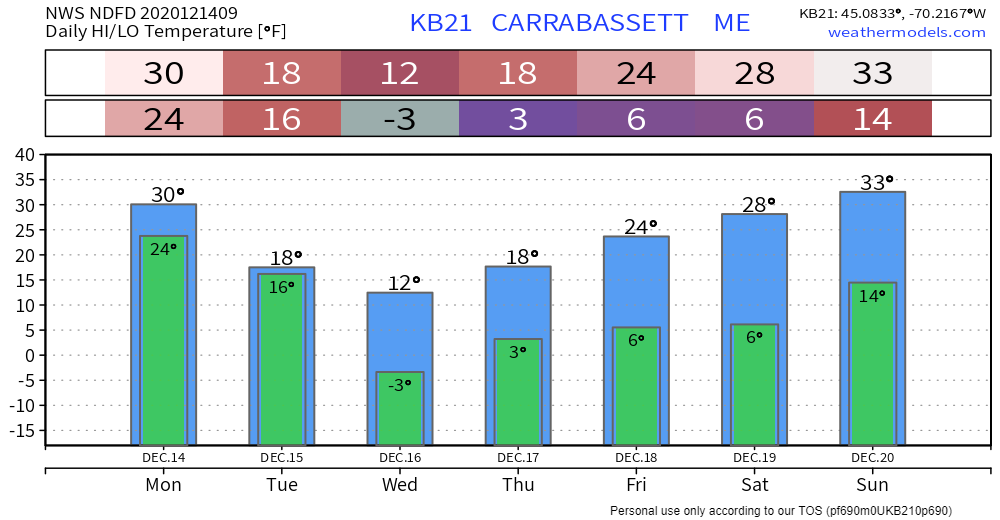 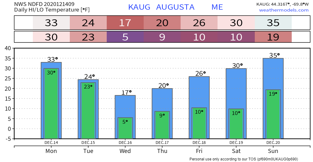 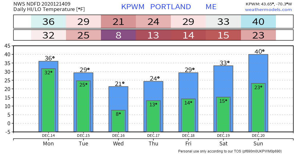 mPING season is here!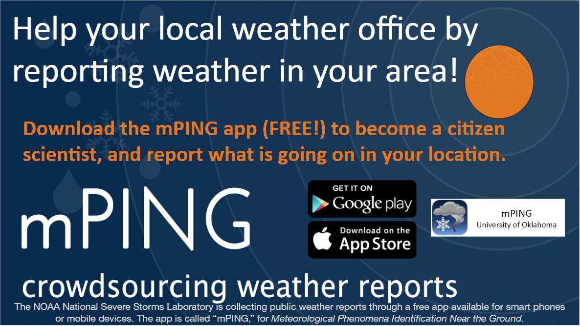 Check out mPING (Meteorological Phenomena Identification Near the Ground) project. Weird name, cool app! You can report the type of precipitation you see where you are. No need to measure! Use the free mobile app to send reports anonymously. Reports are automatically recorded into a database, which improves weather computer models. The information is even used by road maintenance operations and the aviation industry to diagnose areas of icing. mping.nssl.noaa.gov Be prepared to receive alerts and stay updated!
For more information, please follow Pine Tree Weather on Facebook and Twitter.
** FUNDING NEEDED FOR 2021 ** Thank you for supporting this community based weather information source that is funded by your financial contributions. Stay updated, stay on alert, and stay safe! - Mike |

Mike Haggett
|