
Forecast remains tricky for Sunday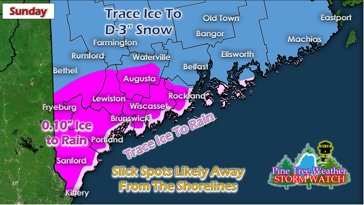 Winter Weather Advisories have been posted for the southern two thirds of the state as of the time of this post Saturday afternoon. This forecast remains a tough call for the reason noted in Friday's update of two low pressure systems splitting off and Maine being caught in the middle. There is a good chance for some slick areas early Sunday morning. Forecast confidence is good on that. How much ice depends on surface temperatures. We've seen this movie many times before where cold air digs in and holds on longer than expected. Don't be surprised if it happens again. The blessing in this set up is there isn't a whole lot of moisture associated with this, so I do not expect any issues with long duration icing. 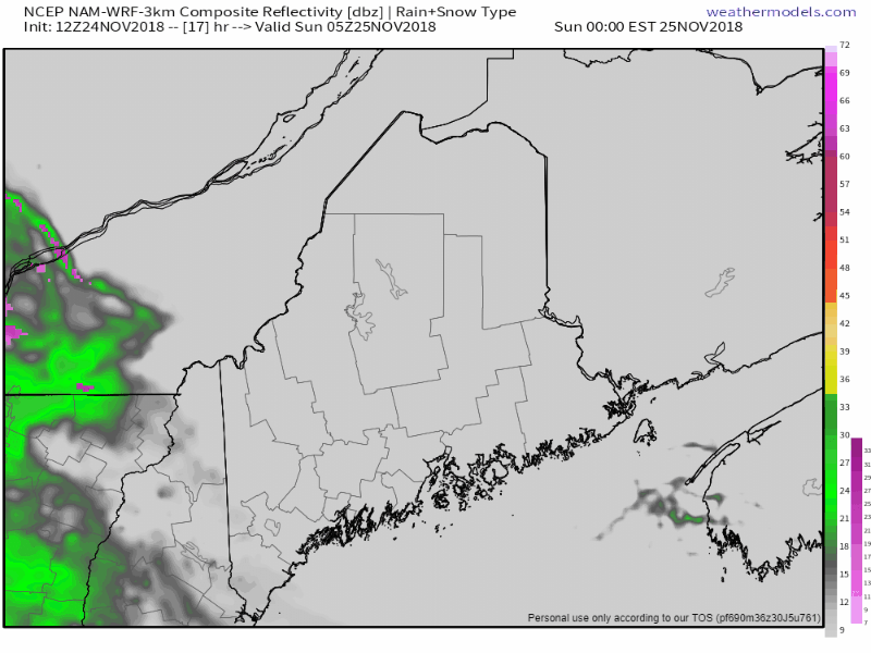 Precipitation begins in western and southern areas likely before daylight Sunday. It will overspread all areas but the far north by early afternoon. Beyond that, confidence is lower for areas of snow Sunday afternoon. If the front stays together, it will be bring some snow over the central part of the state. If it falls apart, there could be a few flakes in areas, maybe an inch in the western mountains and eastern parts of the central highlands and DownEast areas, but that is about it. Precipitation ends from southwest to northeast Sunday afternoon into the wee hours of Monday. 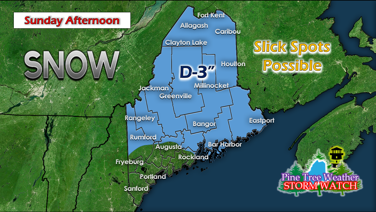 IF the front holds together, there is potential for a couple inches of snow for the northern two-thirds of the region. This continues to be a wait-and-see situation given the dynamics here, so make sure you stay updated on the latest forecast information. Snowy times ahead starting Monday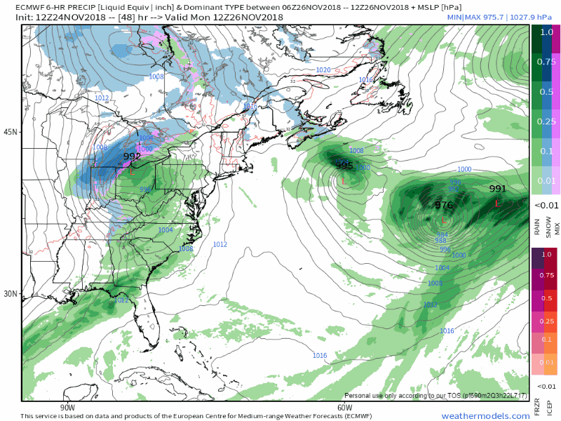 A deep trough over the eastern half of the country and associated upper level energy spinning around within it touches off yet another system on the heels of the Sunday event. Strong high pressure over Labrador acts as a block. The results of all of that is several pieces of energy spinning off several areas of low pressure which will rotate around the region until later in the week. The main concern will be for Monday night through Tuesday for the bulk of the snowfall, but northern, western and perhaps eastern areas are likely to see additional amounts through Thursday morning as it appears for now. 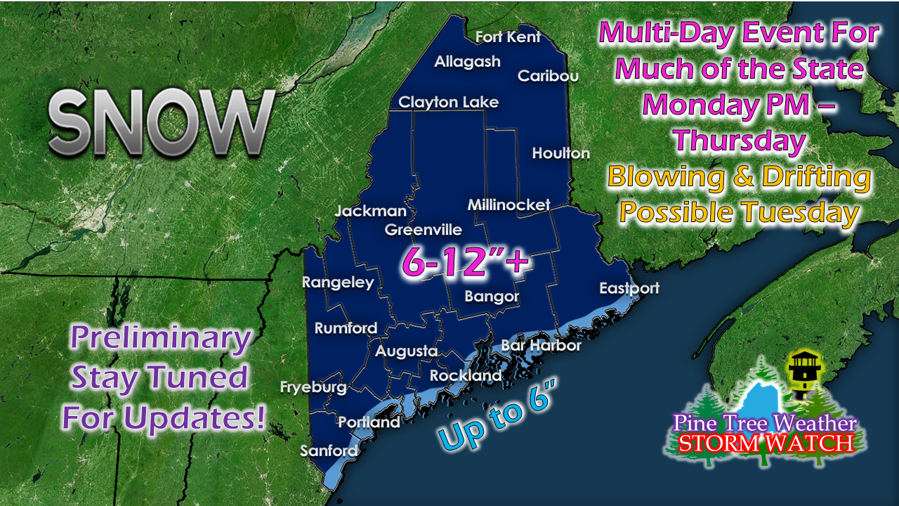 This will be a plowable event for the state, and is likely to cause travel impacts between the falling snow and wind blowing it around. Coastal areas may get lesser amounts due to mixing. This could be a heavy wet snow for much of the region pending on forecast track. Stay tuned. Regional outlook through Thursday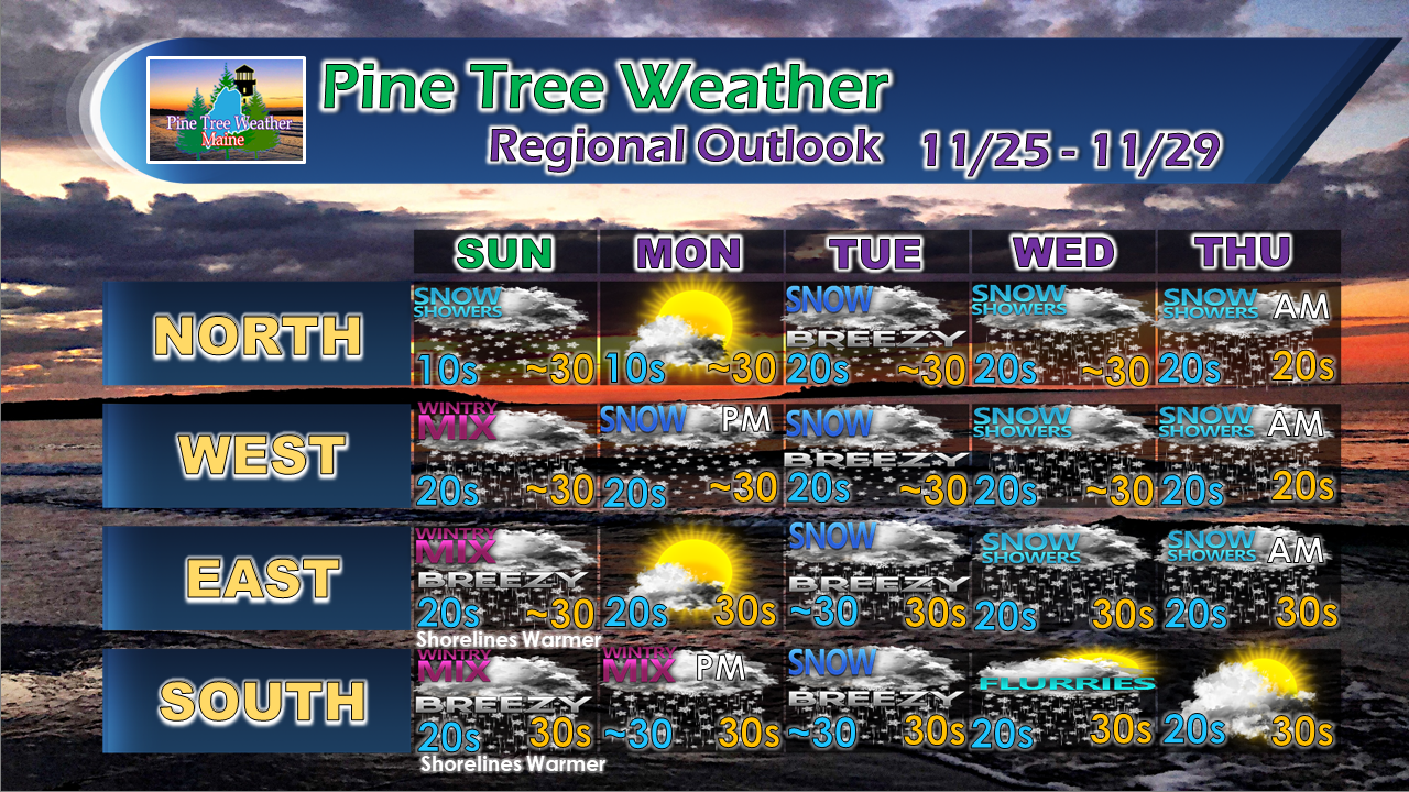 For the latest official forecasts, bulletins and advisories, please check in with the National Weather Service in Gray for western and southern areas, or Caribou for northern and eastern parts of Maine.
Please consider making a donation to keep Pine Tree Weather going through the year ahead. My data cost expense is increasing. The operation is 75% funded and needs your help to get through the winter. You can set up a monthly pledge on my Patreon page or send me a message from the Facebook page or direct message on Twitter to get my address to mail a check. For more information from me, please follow the Pine Tree Weather Facebook page and my Twitter feed. Always stay weather aware, and thank you for your support! - Mike |

Mike Haggett
|


