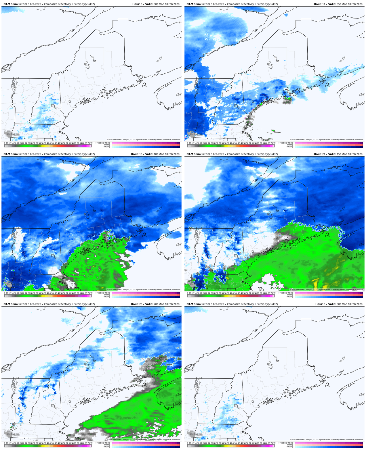
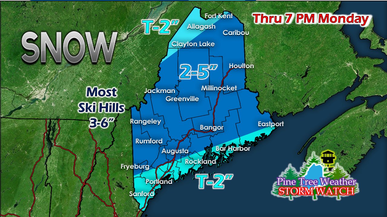
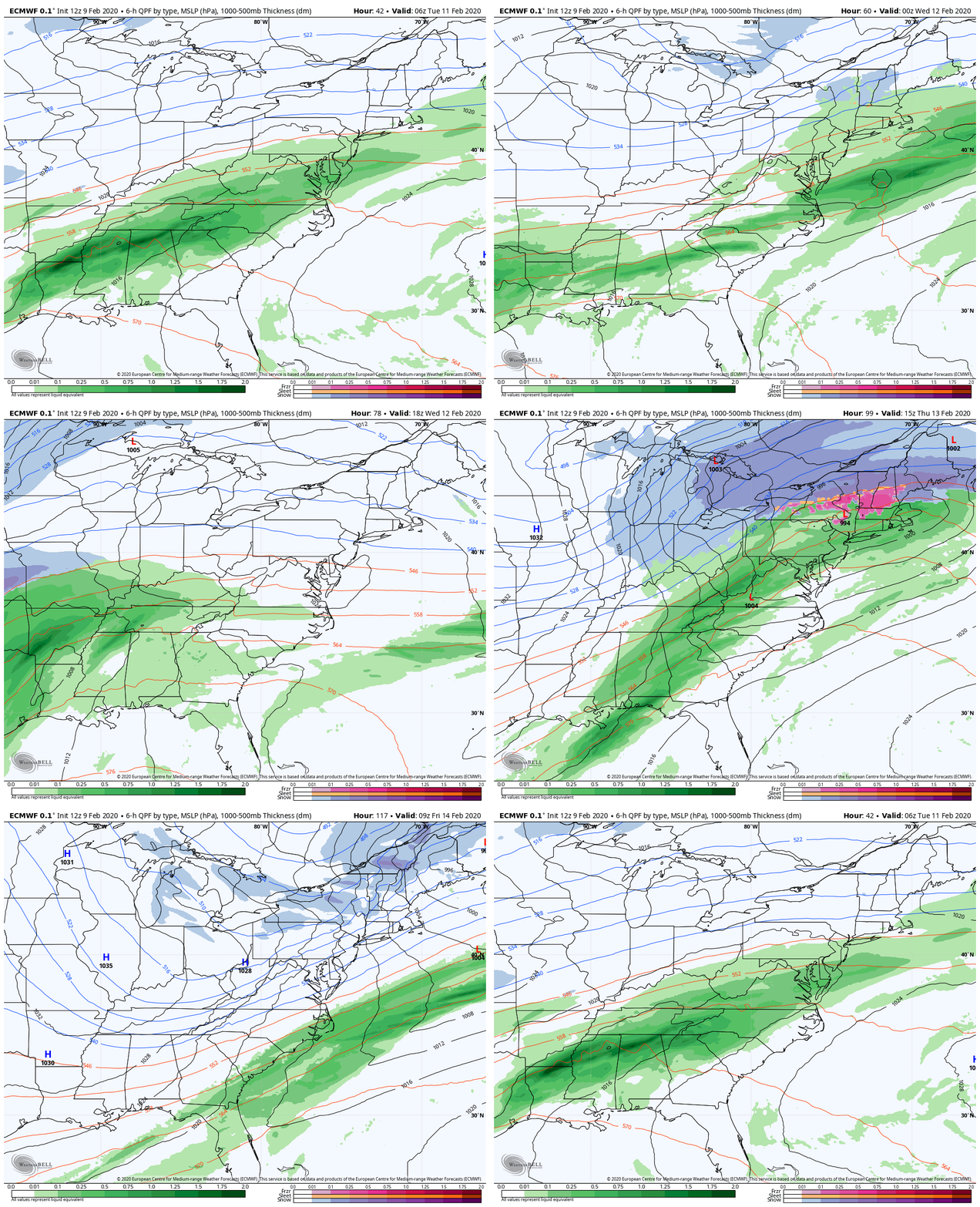
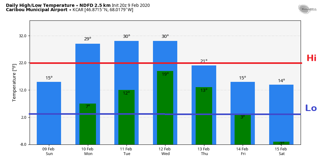
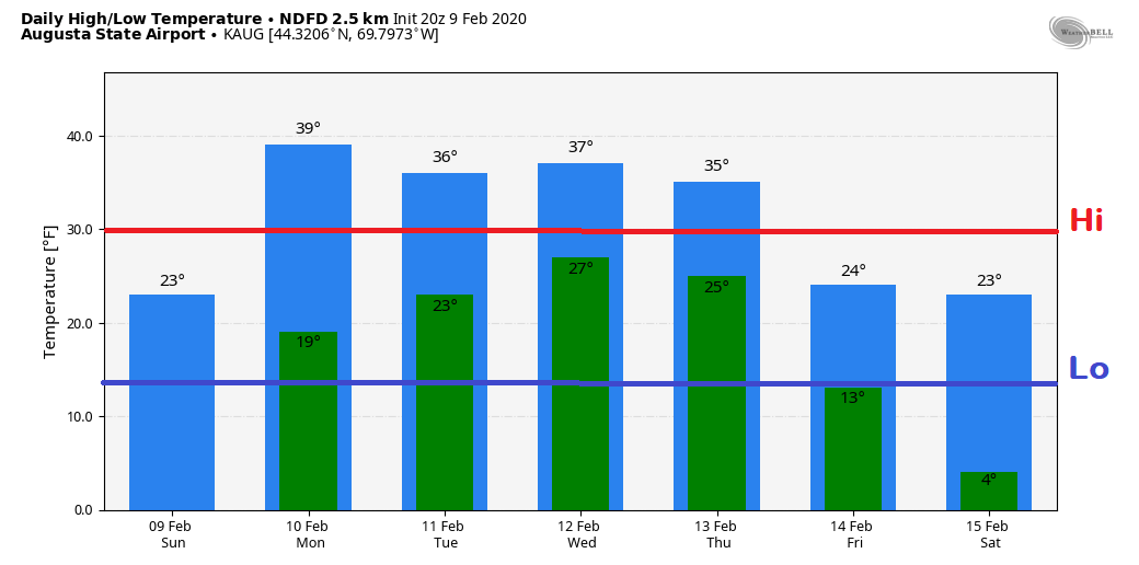
Some areas climb above freezingFor those that are living in a glass bowl, you may need a helmet if you are walking around or may get a surprise while driving. Folks in the mountains and north are likely to be exempt from this, but the rest of the region will see the risk of falling ice through Monday. Slick spots into MondayAll areas see at least a few flakes from an area of low pressure moving through the Great Lakes along with a warm front that passes through Maine. Coastal areas appear likely to see the change to rain Sunday evening. I am thinking snow showers in central areas may change to a brief mix or rain as we work through the day on Monday. The north country should stay all snow with this one. Conditions improve from west to east in the afternoon, and by Monday evening, the precipitation ends, with the possible exception of a few lingering snow showers in the mountains. For most areas, 2-5" is what can be expected, with the higher totals for higher elevations in the west and for the Houlton / Millinocket region. The ski hills may pick up a half a foot out of this. Unsettled at times through the rest of the weekAfter the storm clear the region Monday, a long wave frontal boundary stalls offshore. Weak areas of low pressure travel along it, and brings a chance for precipitation Tuesday afternoon into early Wednesday. A stronger storm is possible to impact the region on Thursday. For now that appears to be split between snow in the north, mix over the foothills, and rain for the coast. It may not stay that way. Stay tuned for updates on that as the week unfolds. Temperature outlook through the weekFor Caribou, temperatures appear to remain below freezing and above normal through the middle part of the week before heading below normal late week. For the Augusta region, the pattern is similar but with above normal temperatures through Thursday before cooling below normal into the weekend. More website updates to come A few of you have reached out to me about not being able to access my Facebook posts due to not having an account or would rather avoid it. You have been heard. Going forward I will do more updates on the website so all can access them.
I have a busy week ahead here with school, work and family. I will do my best to post updates here when I can. Thank you for your patience and understanding. ► ► For the latest official forecasts, bulletins and advisories, please check in with the National Weather Service in Gray for western and southern areas, or Caribou for northern and eastern parts of Maine. ► ► Due to a revised budget there is a $125 shortfall for the year ahead! You can help keep Pine Tree Weather going with a donation of ANY amount now through VENMO @PineTreeWeather, a monthly donation on Patreon or messaging me on Facebook or Twitter to send a check in the mail. Thank you for your support! For more information from me, please check the Pine Tree Weather Facebook page as well as my Twitter feed. Always stay weather aware! - Mike |
Mike Haggett
|


