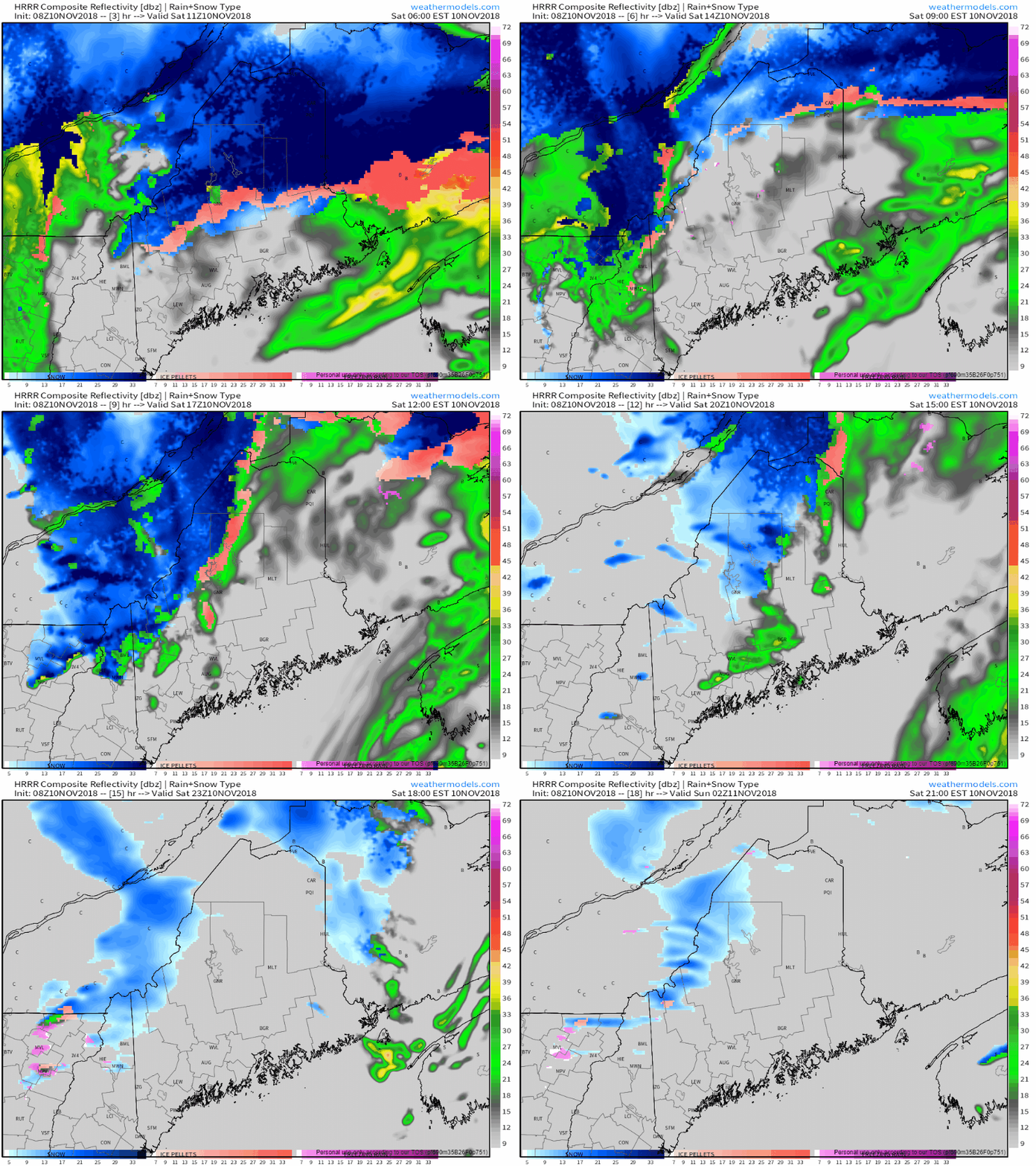
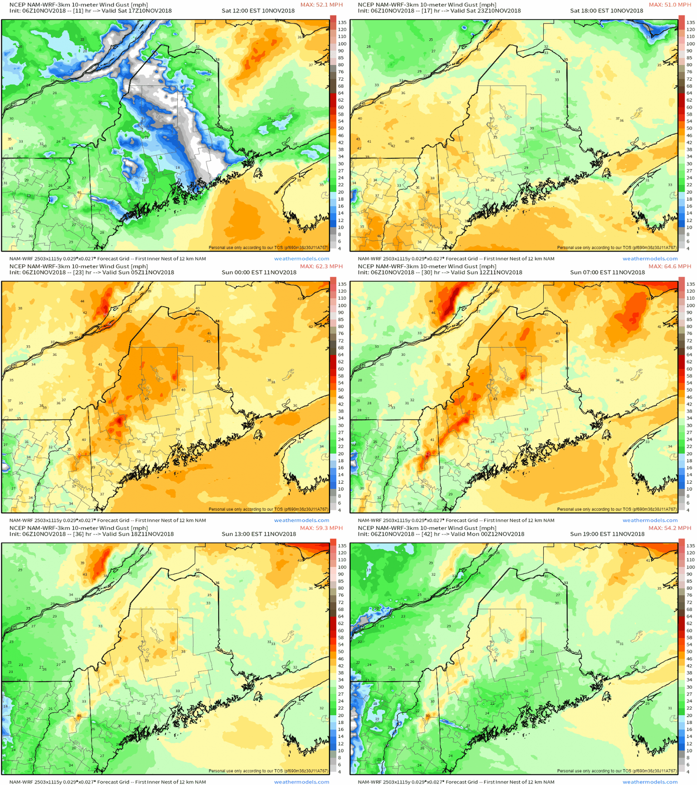
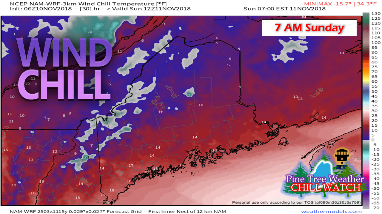
End gameIf the precipitation hasn't ended by the time you read this, it will shortly as the steady moisture is moving on out. A cold front will kick through this afternoon and bring a chance for some snow or rain showers primarily in the north and central parts of the state. A weak trailing wave behind it brings downslope snow showers tonight over the higher terrain near the Quebec border. Wind to increase through the afternoon into tonightWIND ADVISORY has been posted for the western half of the state and I suspect the eastern half will follow suit with either that or a High Wind Warning, Folks in the north and east should keep in touch with NWS Caribou for the latest from them. Wind gusts could exceed 40-50 mph and cause power outages, especially in areas where the snow sticks to trees limbs and utility lines. Another thing the wind will do is bring very cold wind chill temperatures to the region. Higher elevations could see the indices fall around -10° to 0° with single digits for the north country, and teens for the coastal plain. High pressure settles over the area on Monday which will shut the breeze down for the day. Our next system arrives Tuesday and appears to be another mixed precipitation event. More on this from me Sunday. Stay Updated!For the latest official forecasts, bulletins and advisories, please check in with the National Weather Service in Gray for western and southern areas, or Caribou for northern and eastern parts of Maine.
For more information from me, please follow the Pine Tree Weather Facebook page and my Twitter feed. Please consider making a donation to keep Pine Tree Weather going through the year ahead. My data cost expense is increasing. The operation is 70% funded and needs your help to get through the winter. You can set up a monthly pledge on my Patreon page or send me a message from the Facebook page or direct message on Twitter to get my address to mail a check or set up bill pay. Always stay weather aware, and thank you for your support! - Mike |
Mike Haggett
|


