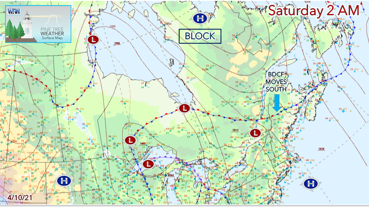
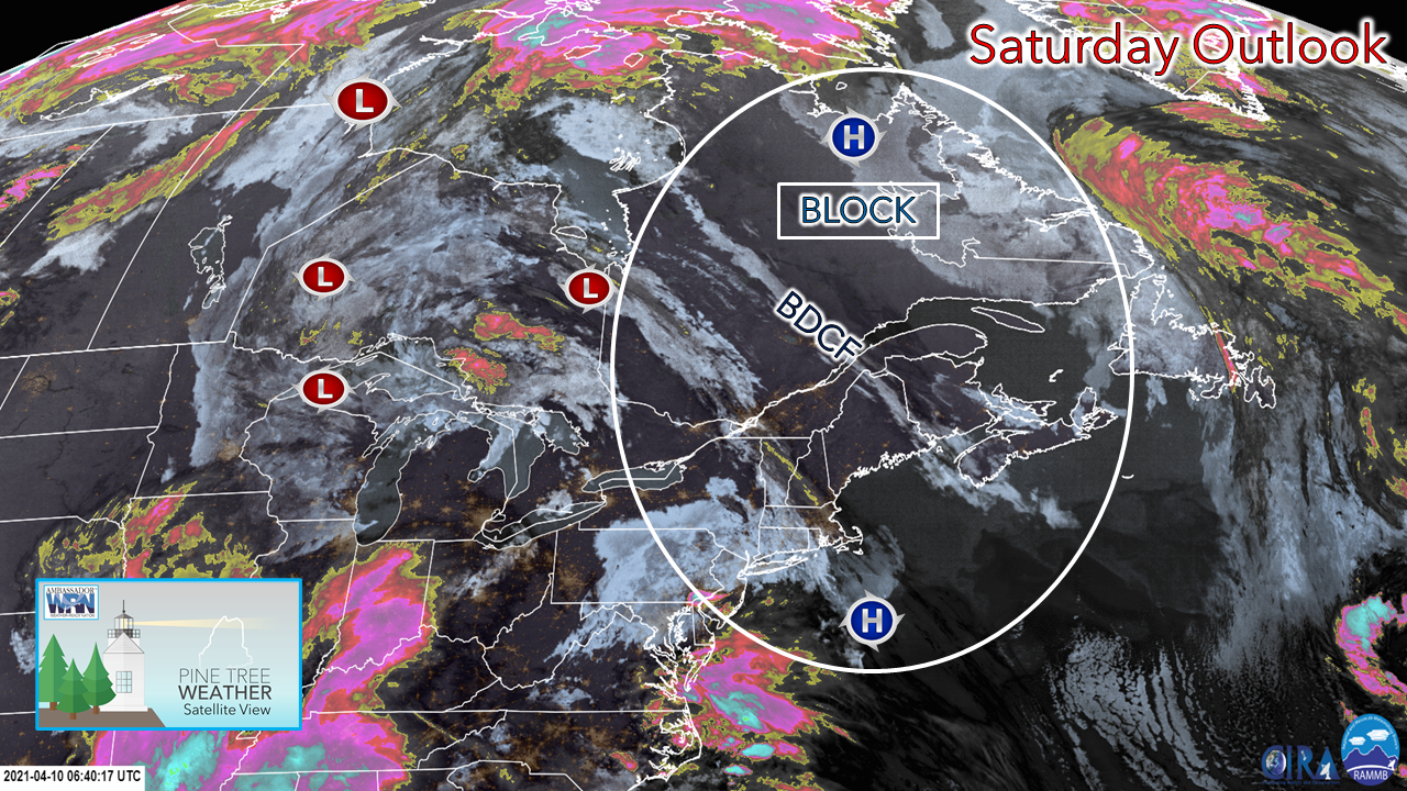
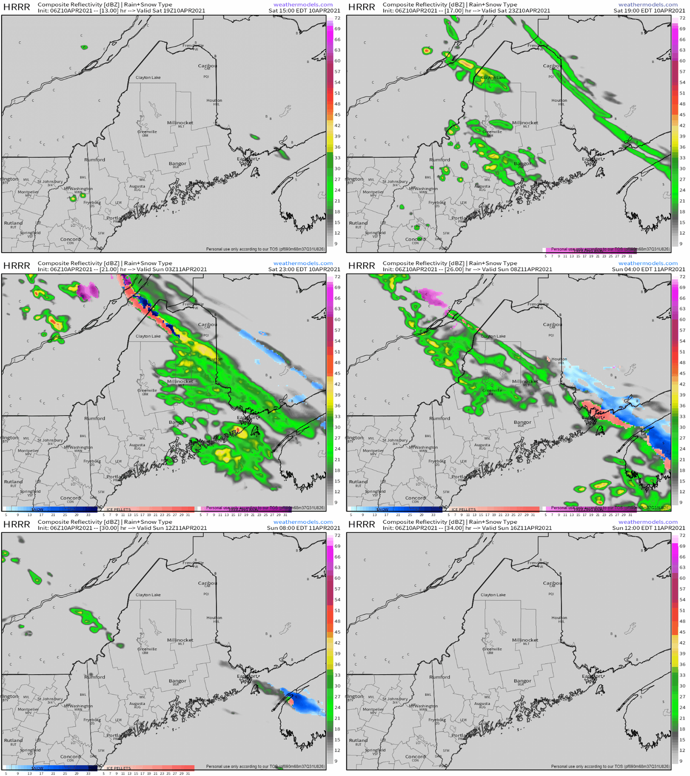
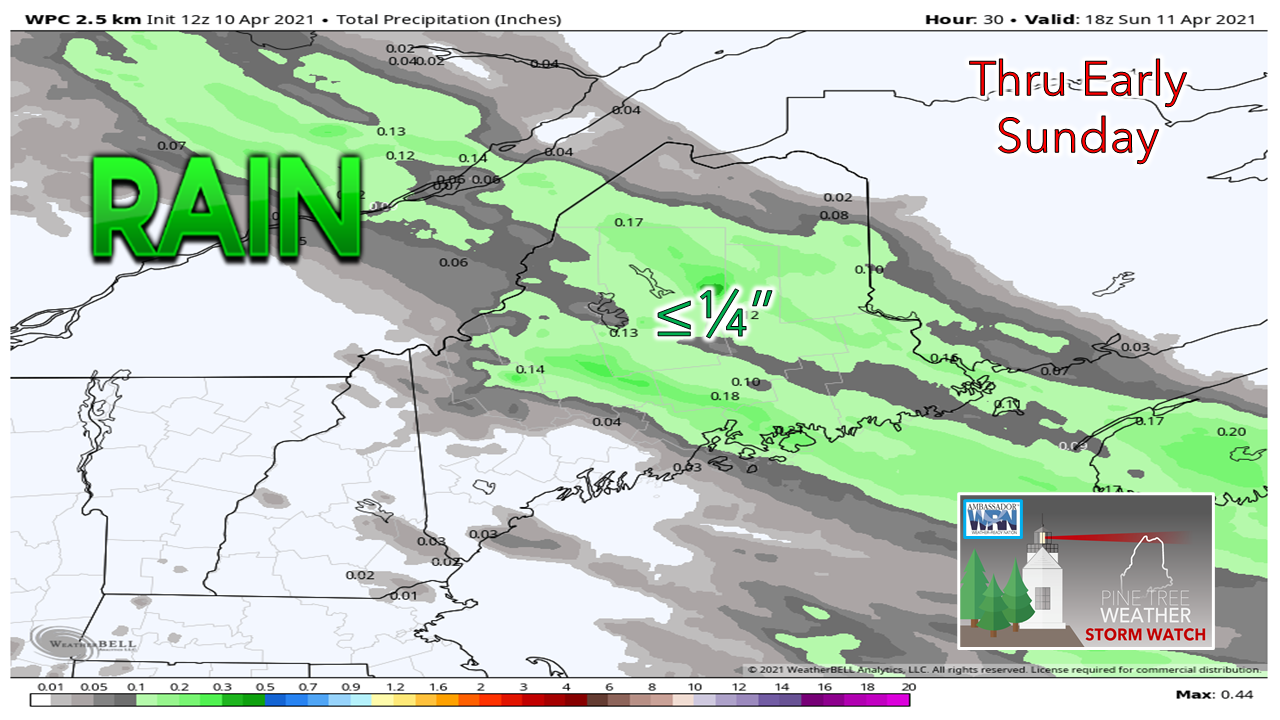
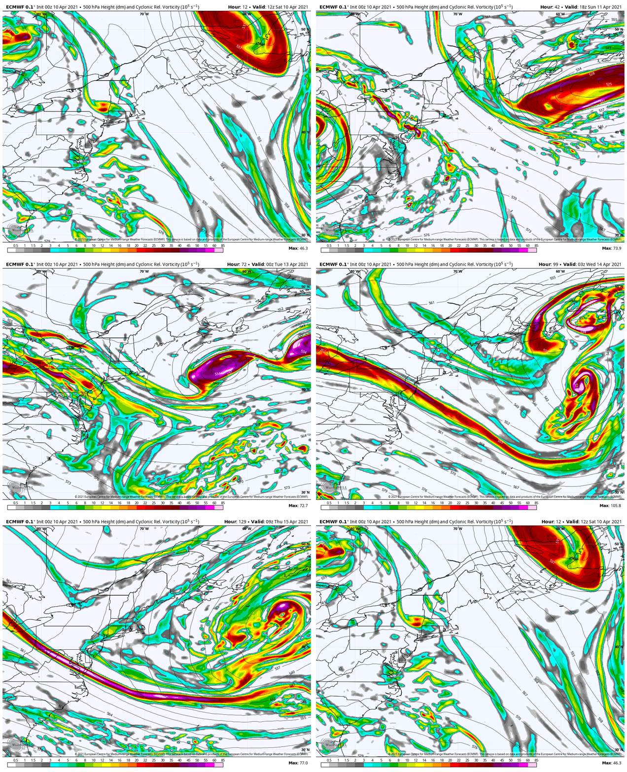
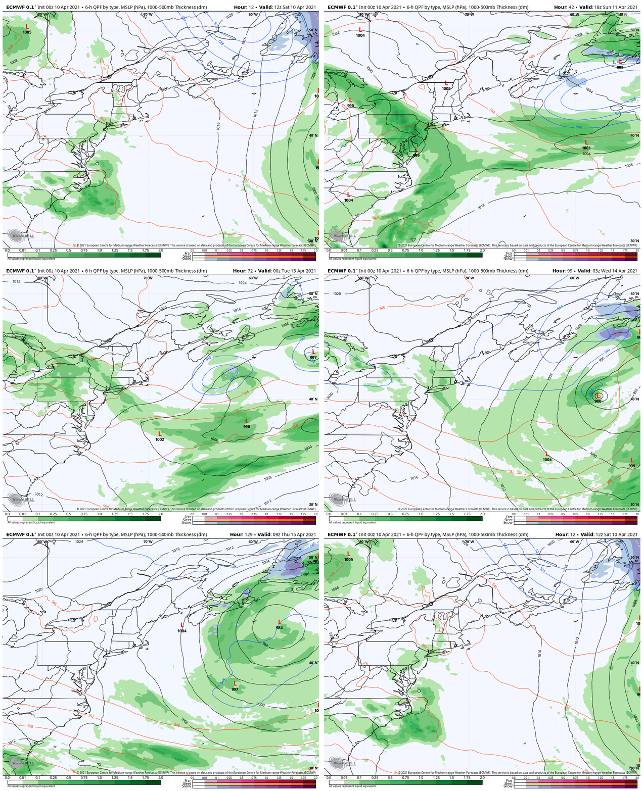
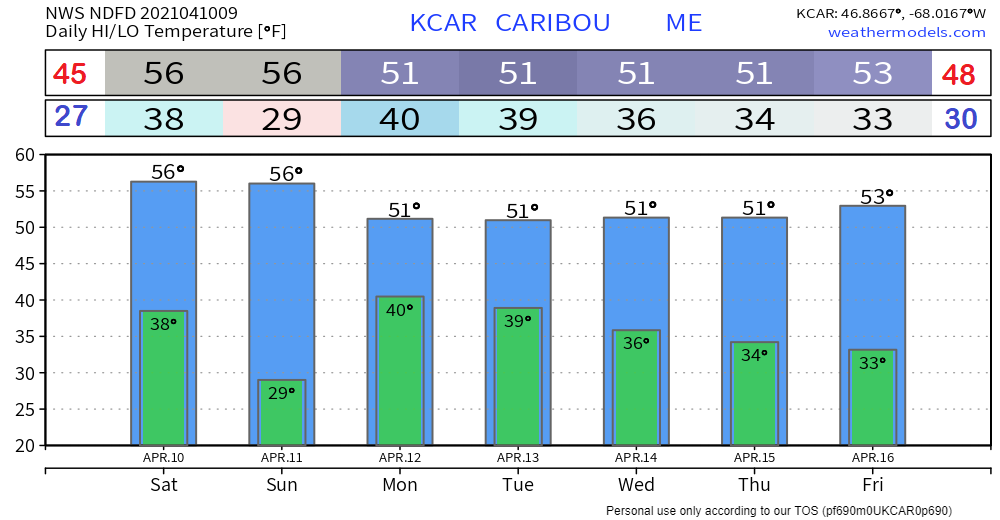
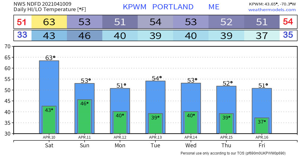
'Tis the seasonOne more day of mild weather for southern areas before reality returns. A back door cold front is moving south. The surface high to the north that is controlling the pattern over the northeastern part of the continent moves south, and brings cooler, more seasonable air with it. A look from above shows the block in place. This omega block set-up is steering away any storms of significance and will keep the region generally dry into next week. The moisture starved frontal boundary will bring some shower activity primarily over the north, mountains, and eastern areas Saturday afternoon into the night, ending early Sunday, Less than ¼" of rain is expected overall through the period. This may be the most rain we see in the week ahead. Omega block to clouds and cooler temperatures aroundBackdoor cold fronts are typical in Maine in spring, and this year will be no different. With the omega blocking ridge firmly in place, upper-level disturbances (shown above) will pinwheel around it through the week. The net result of that is varying amounts of clouds with a slight risk of a spot shower or sprinkle at times, potential for fog and perhaps some patchy drizzle. Dry times will persist into the foreseeable future. Temperature outlook through the weekLooking specifically at Caribou and Portland, normal high and low temperatures are anointed in for contrast. Caribou runs a few degrees above normal for the period on both the high and low end, Portland on average overall on the high end and warmer than normal on the low end. Be prepared to receive alerts and stay updated!
For more information in between posts, please follow Pine Tree Weather on Facebook and Twitter.
Thank you for supporting this community-based weather information source which operates by reader supported financial contributions. Stay updated, stay on alert, and stay safe! Thank you as always for your support! - Mike |
Mike Haggett
|

