
A couple of dreary days before a dry spell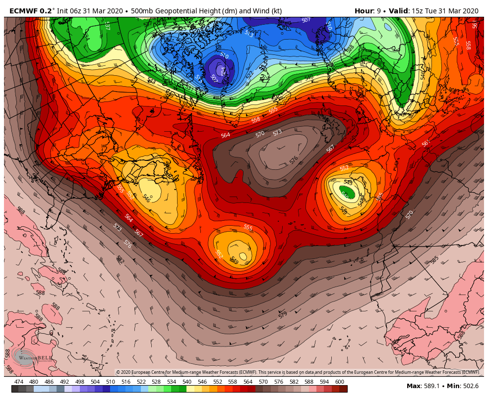 Blocking south of Greenland over the Atlantic creates a traffic jam for the storms to the south and east. It will take a couple of days for the area of high pressure to weaken, and allow the storms in the region to move eastward. 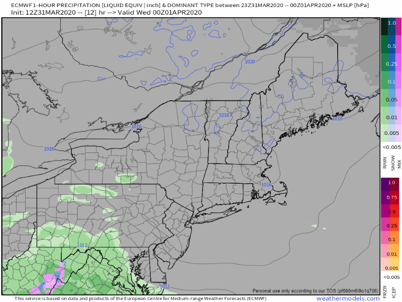 The result is a backdoor cold front being pushed in from east to west. For those longing for spring, this is clear sign that it is on the way. Snow showers will be the main feature on Wednesday into Wednesday night, with some areas of light sleet and freezing rain. Any frozen precipitation changes to rain for most areas on Thursday. Showers end for most but southern areas by Friday morning. Along with the precipitation, will come the breeze from the storm offshore, along with 10-15' surf and a 1-2' storm surge. Astronomical tides are building heading towards the weekend, but the worst should be over by then. Some minor splash-over is possible for low lying areas with the Friday morning high tide around 7 AM. 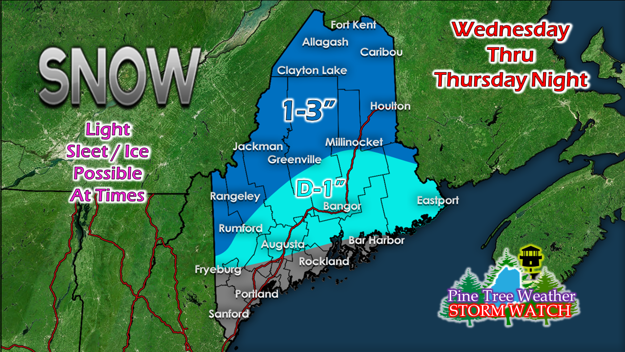 Higher elevations get the most snow, and most of this falls Wednesday into Wednesday night. Temperatures & outlook through the weekendAfter the storm moves to the east on Friday, the breeze gradually settles down Friday night into Saturday. Saturday looks partly to mostly sunny at times as an upper air disturbance works through the region. Clouds increase Sunday as a weak clipper moves through the region Sunday afternoon into the night., which may bring a shower. Temperatures gradually warm through Sunday. The next widespread storm of any concern appears roughly mid next week. 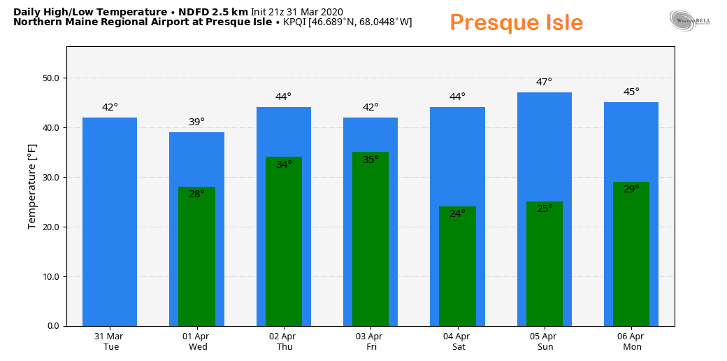 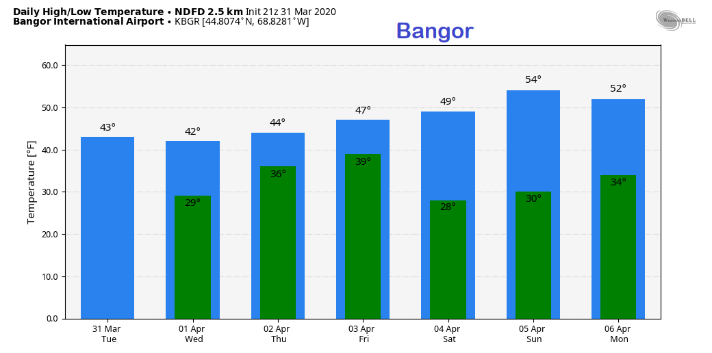 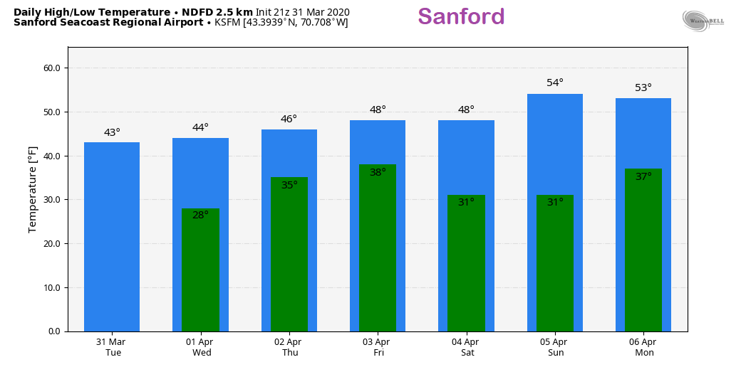 Feel free to use the many pages available on this website for many types of forecasts on rainfall, snowfall, marine, longer range CPC outlooks and maps.
Thank you as always for your support! ► ► For the latest official forecasts, bulletins and advisories, please check in with the National Weather Service in Gray for western and southern areas, or Caribou for northern and eastern parts of Maine. Always stay weather aware! - Mike |

Mike Haggett
|


