
Surface map outlook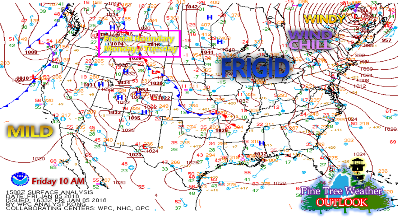 The latest blizzard is continuing to work its way into Labrador and dragging the coldest air of the season (aren't you just tired of me saying that?) for the weekend. For now, it appears this arctic blast will be short lived. A front is on track to work the deep cold out of here by the first of the week. Another cool high trails in behind for Wednesday, and signals of the January thaw are growing for late in the week. So. Nasty. Cold.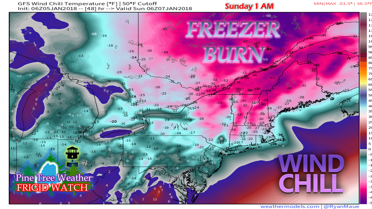 Wind chill advisories and warnings will be a certainty for Saturday and Sunday. Saturday's high temperatures won't make it above zero, unless you are out on an ocean island, and then it won't be by much. Double digit below zero temperatures are on the docket for Saturday night most everywhere. Temperatures modify a bit heading into Sunday. By Monday this round of cold is headed offshore as the front approaches. Monday / Tuesday a bit snowy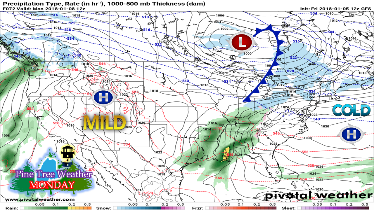 As the arctic high heads offshore, a southwesterly flow develops and warms temperatures to a bit more of a bearable level. The side effect will be the threat for some light snow around the area. Not to cause any alarm, but I smell a skunk in the barnyard here for Tuesday. Guidance at one time indicated a spin up area of low pressure along the front that looked like a decent snow maker for coastal areas. Models have backed down on that idea for now. A chance for snow showers for Tuesday is in the 5-Day Outlook, and I will track this through the weekend and update in case of a change. Not quite shorts and flip-flop weather, but...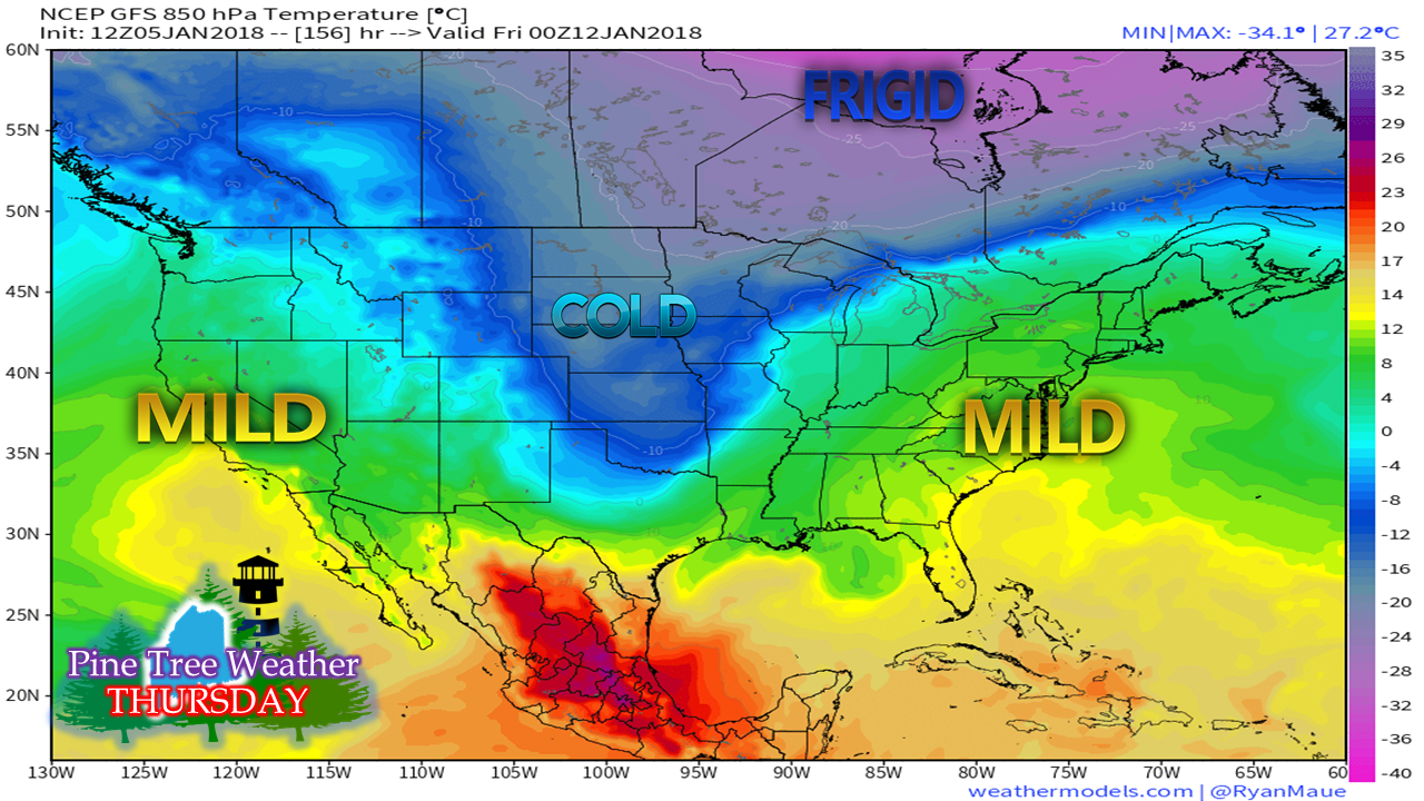 We may see some widespread 30s and perhaps 40s statewide by Thursday as the cold air retreats. I will caution that this warm up may be short lived. That cold over the Midwest is headed eastward. Wherever cold meets warm, there is a storm. Keep that in mind for any plans for next weekend.
The 5-Day Outlook page has been updated. You can click on the menu tab to get you there. Thanks for all of your support. It has been a banner week. I hope you have found the information I provide to be helpful to you. Be blessed, and stay warm! - Mike |

Mike Haggett
|


