Forecast coming together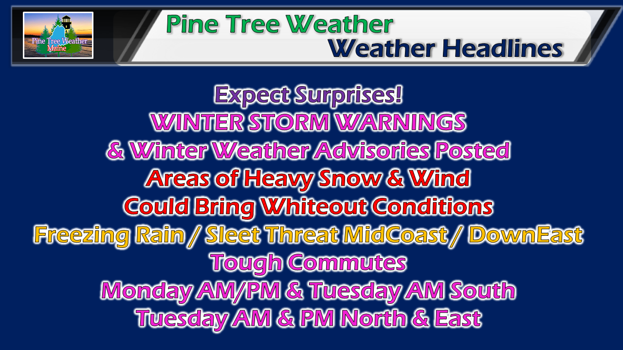 Already double digit snow amounts reported in New Hampshire from banding that set up overnight, and as much as 7" reported in Ogunquit as of 5 AM Monday morning. There will be a lull for a few hours today, and then as the storm organizes tonight, that is when it will get interesting for most of the state going into Tuesday. Why this forecast has been tricky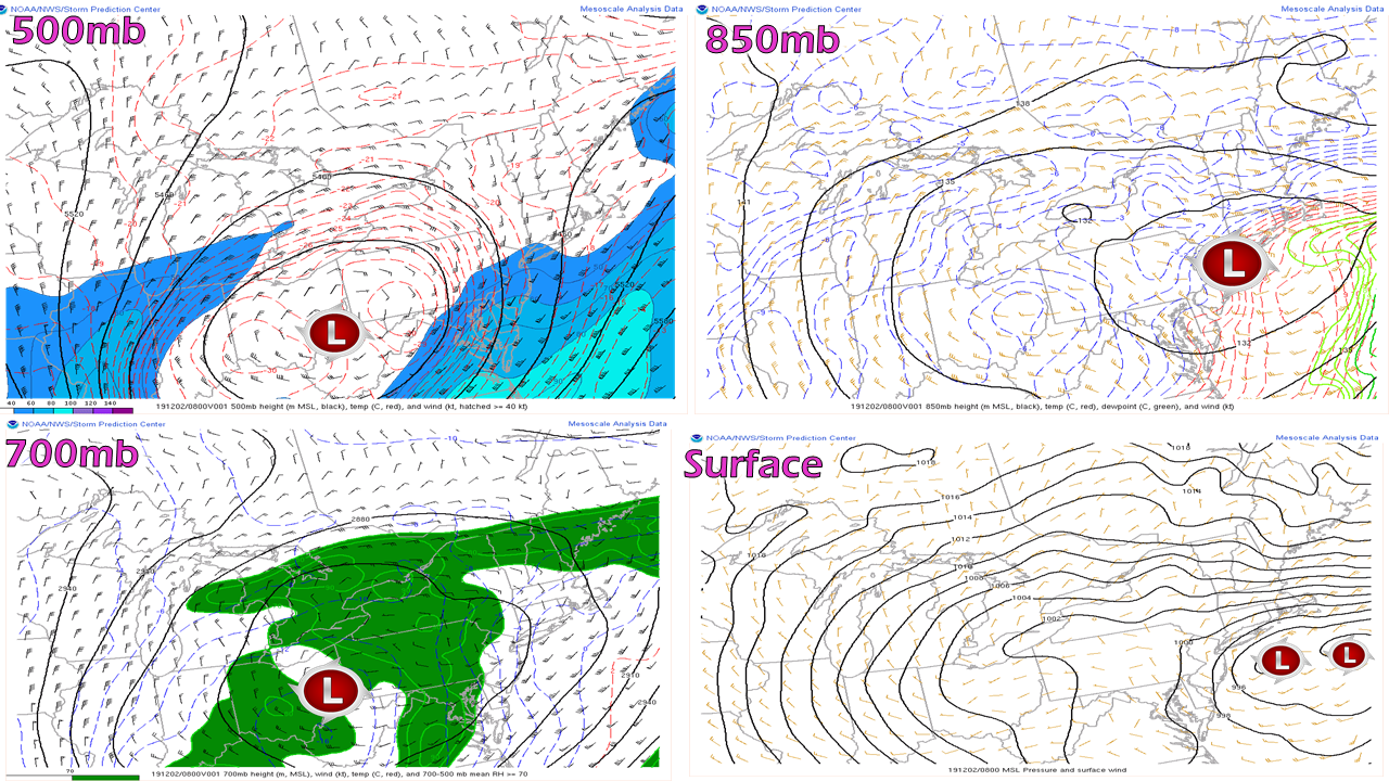 Each level of the atmosphere has its own areas of highs and lows as the surface does. When those lows arrange on top of each other, the storm becomes vertically stacked, and in the case of a winter NorEaster, can become powerful. These images above show a storm that is about as disorganized as it can be, yet was able to bring a foot of snow in areas to the south and west of the state, which had much to do with frontogenesis at the 700 mb level (9,882 ft) above the surface. As scattered as the lows are, it makes for a tough call. Every model is different with their ideas, which creates more headaches. I don't want to make excuses for those of us who forecast, but I wanted to share this with you in hopes you'll better understand why ideas have been scattered and that the forecast goes far beyond surface and snowfall charts. Mother Nature is quite a machine. Timing remains on track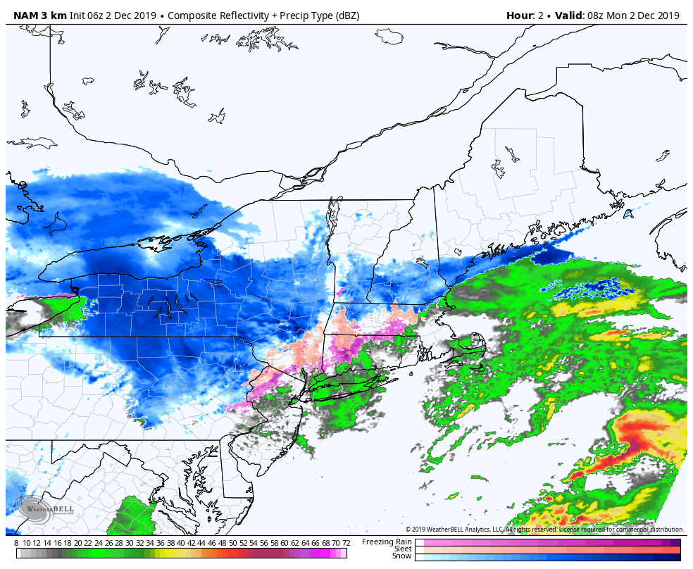 5 AM - 7 PM: For all but southern areas, it will be a waiting game on Monday. There will be a lull of activity for road crews to catch a breath, before precipitation picks up toward the evening commute. 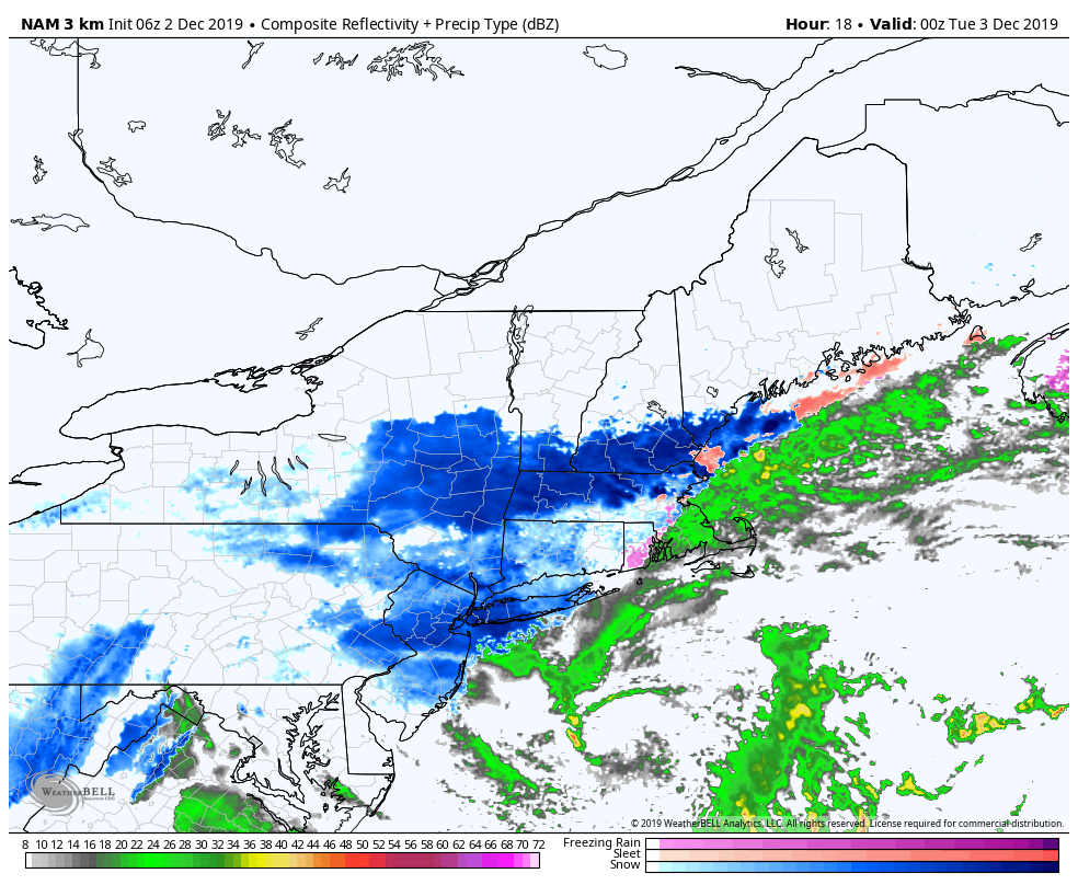 7PM - 7AM: Overnight, the storm begins to stack up vertically over the Gulf of Maine. As it gets its act together, precipitation begins to spread north and east. Concerns for sleet and freezing rain causing a messy situation for MidCoast areas DownEast as warm air aloft and near the surface intrude. 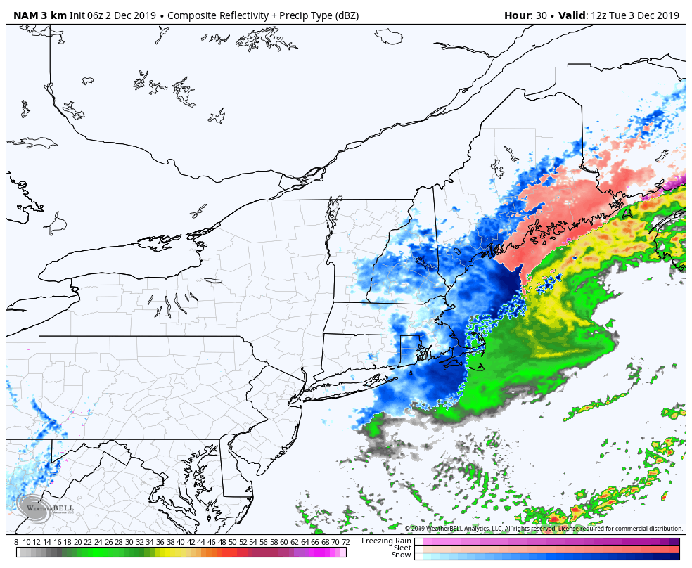 7 AM Tuesday to early Wednesday: Concern remains that once the low organizes that it may sneak back to the west before moving eastward. As the storm intensifies, areas of heavy snow and wind will cause travel problems as road crews will have difficulty keeping up. Deformation bands could blow up snow totals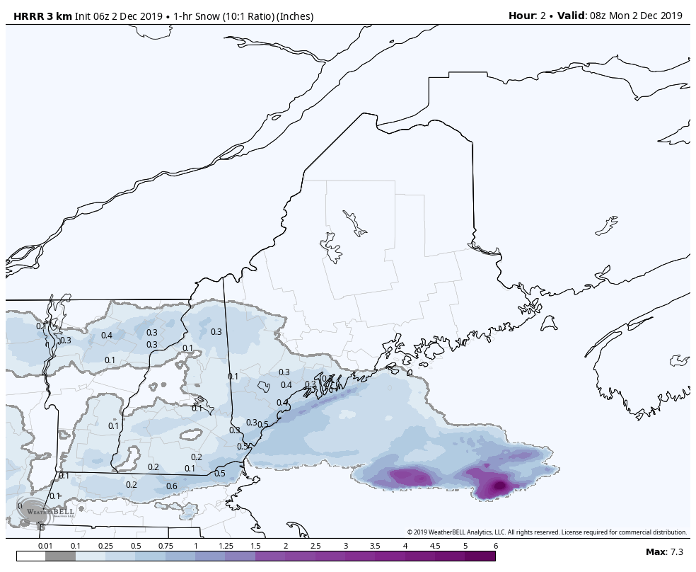 As I mentioned late Sunday afternoon on Facebook, these deformation bands (areas of heavy snow) are very tricky to forecast. Guidance hints at their possibility, but where they set up and for how long is a nowcasting situation between radar and surface reports. As I have said over the past couple of days, expect the unexpected, prepare for surprises, and expect very tricky travel or possibly impassable roads for a time as a result of this. 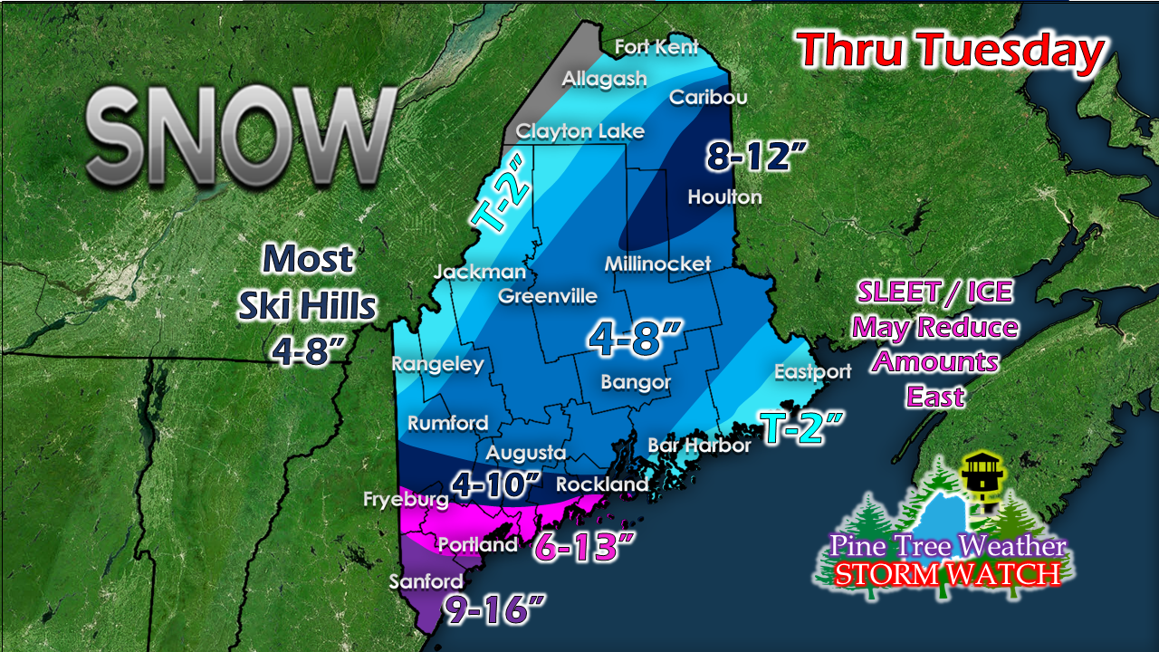 Just a minor adjustment to snow totals to bump accumulations up in northern areas. I suspect with the deformation bands some areas will bust very high, perhaps as much as 18". Southwestern areas may get a touch of sleet, but the main concern for that will be MidCoast up through DownEast areas. ► ► For the latest official forecasts, bulletins and advisories, please check in with the National Weather Service in Gray for western and southern areas, or Caribou for northern and eastern parts of Maine. Please #mPING today! Maine needs mPing support from residents to better assist weather forecasters during storms. It's simple, easy, anonymous, and a totally free way to report weather conditions ► http://mping.nssl.noaa.gov Thank you for your assistance! Please consider Pine Tree Weather |

Mike Haggett
|