
It's going to feel like summer real soon For those that love the heat and humidity of summer, your time has come. A warm front approaching from the south and west on Thursday will certainly bring a tropical feel to the region that is likely to hang on through the Fourth and beyond. The cool, comfortable nights without fans and air conditioners are on hiatus until further notice. One upside in all of this, rain chances increase. Let's talk about rain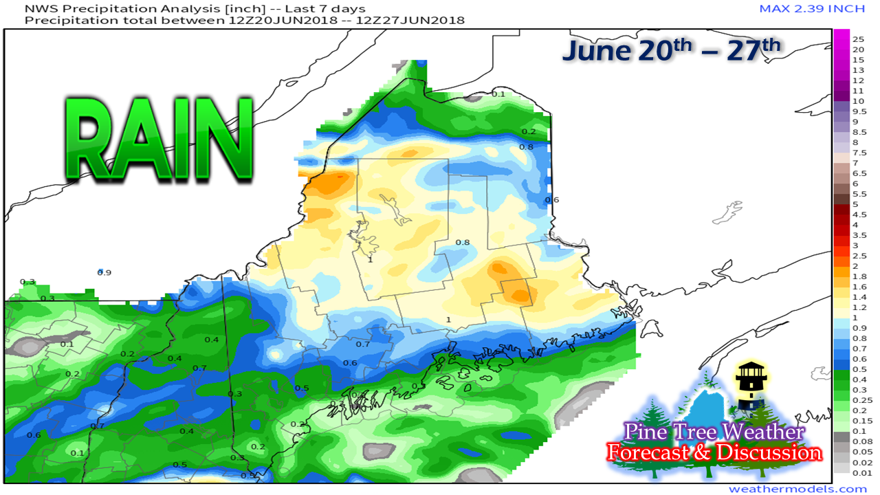 The last week has been helpful to cut rainfall deficits in parts of the western mountains and central parts in the state. The southwestern part of the state along with the far north remains on the lean side of things. 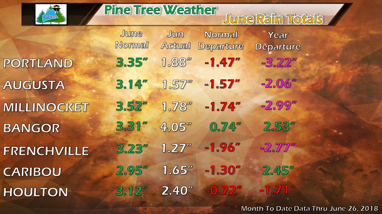 The only recording station showing a rain surplus for the month is in Bangor at the airport. Bangor and Caribou are the only areas showing a surplus for the year. Recent rains have cut deficits statewide. This system on the way will help cut those deficits more. 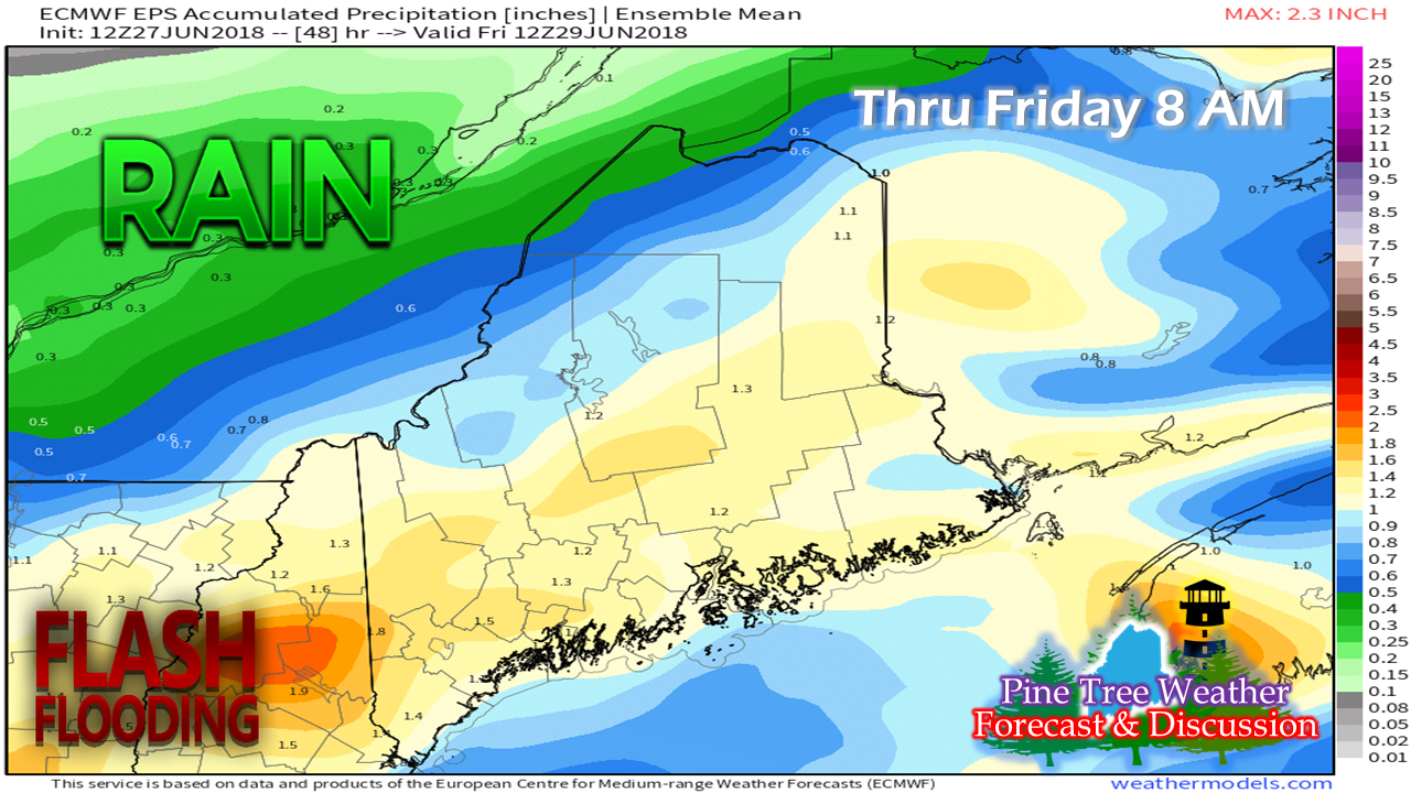 There is a good chance that areas of the region will pick up 1-2"+ of rainfall through Friday morning. The warm front is being enhanced with tropical moisture, which will bring a soaker to much of the state. I will also point out that latest operational guidance on Wednesday has the higher amounts in the western mountains and DownEast areas. Some areas will come in higher, others lower. Isolated areas could see 3-4"+ from this event. Due to the tropical nature of the system, there are flash flooding concerns. When you come across a flooded roadway, turn around, and don't drown. It's not worth damage to your vehicle, personal injury, or loss of life. There is a threat for some embedded thunderstorms. Severe chances appear isolated. Expect gusty winds, downpours and lightning. When you hear thunder roar, get indoors. Lightning Safety Awareness Week Every year there are incidents reported where people are injured or killed as direct results of lightning strikes. Maine receives approximately 40,000 lightning strikes during the year, according to National Weather Service data.  This is the time of year where people love to be outside to enjoy the warmer conditions. With tropical air around that is on the way, there is always a threat for thunderstorms to develop, and could happen rapidly. It is wise to keep an eye on the sky, and at the sound of the first rumble, seek shelter as quickly as possible. If on a boat, get to shore immediately. For more information including safety tips, please consult the Lightning Safety Tips and Resources pages from the National Weather Service. Be smart, don't be another statistic. Pine Tree Weather is proud to be Weather Nation Ready Ambassador for the state of Maine. After the rain, here comes the heat I pass this around on Twitter annually which is always good for a few laughs. Our summer is a short one. With due credit to Paul Gant, the pastor at the Sea Road Christian Church in Kennebunk, he calls the time between Memorial Day and Labor Day "the fastest 90 days in Maine", and he's right on the money. For us cold blooded types, I expect the complaint meter to increase as we head into next week. 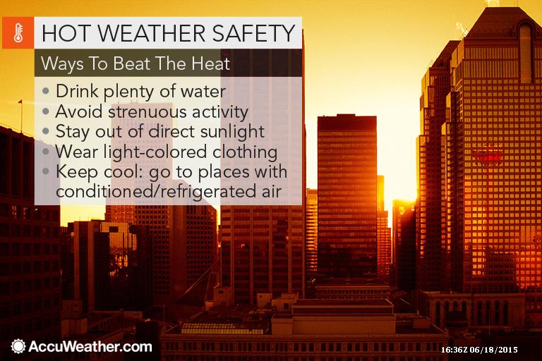 The only item I would add to this graphic supplied by my friends at AccuWeather is to wear liberal amounts of sunscreen if you are outside. It won't take long for skin to burn. For those that have to work in these conditions, prepare appropriately. If you have held off on buying that fan or air conditioner, do it now. I suspect inventory on those items will become thin rather quickly. 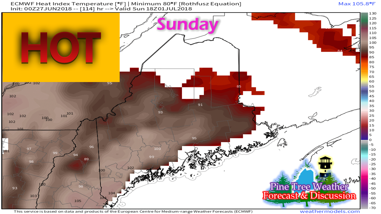 While the temperature and humidity builds Friday and Saturday, the heat indices really amp up starting on Sunday. 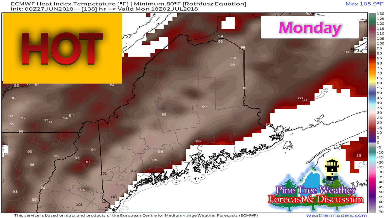 By Monday, areas away from the coast statewide are on track to feel the full effects of the blast furnace. Triple digit "feels like" temperatures are increasingly likely for the southwest interior both days. A frontal boundary drops down from Quebec Monday afternoon, which may touch off some widely scattered showers and thunderstorms. That will help take the edge off a bit in areas where they pass through. With the dampness, expect the humidity to amp up after their passage. If you plan on heading to the ocean beaches to escape the heat, be advised that high tide will cramp space during the 1 - 2 PM hour on Saturday and 2-3 PM hour Sunday and Monday. Plan accordingly when picking your spot, and expect plenty of company. Regional outlook through Monday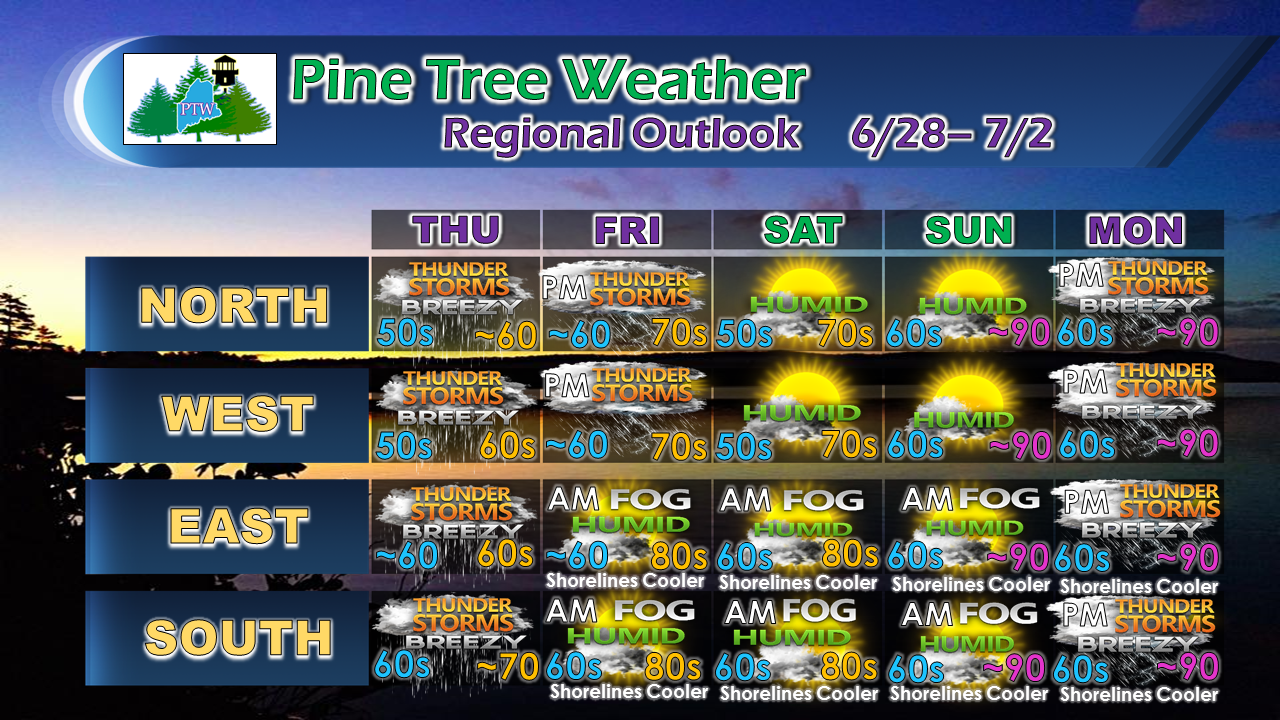 The thunderstorm threat for northern and western areas on Friday, and statewide on Monday appear to be widely scattered, but could pack a surprise punch, so keep that in mind. As I mentioned in my previous update, I expect fog to be an early morning issue for coastal areas through the weekend. Sunday still concerns me that it may hang on for awhile. If you get to the beach and set up in a fog bank, don't be surprised. The one good thing about this heat blast is it will warm up the lakes and ocean temperatures more comfortable for swimming. Many hazards to think about Heat, humidity, flash flooding, lightning, and severe storm potential are all possibilities going forward. Coastal areas may have to deal with fog which may reduce visibility. These are all typical summer weather hazards we have to be considerate of here in Maine.
Have a plan in place if you are heading out. Talk about it with your family, friends, spouse or significant other. Keep an eye to the sky. Don't simply rely on the free standard weather app on the smartphone. Download one from a local news station, AccuWeather, or my personal choice is Weather Radio by WDT app for bulletins and advisories. Make sure notifications are turned on. The old reliable NOAA Weather Radio works like a charm if it is set up right, either as a stand alone or in a public safety scanner. I am not predicting gloom and doom by mentioning this, it is just simply out of concern that all of my readers stay safe. It is the season. As always, stay in touch with the National Weather Service in Gray for western and southern Maine and Caribou for eastern and northern areas for the latest forecasts, advisories and bulletins. God bless you all... thanks as always for your support! - Mike |

Mike Haggett
|


