
Beneficial rainfall from Florence possible Tuesday; frost concerns for the north Wednesday night9/16/2018 Typical early fall pattern underway Shorter periods of daylight. Trees showing some signs of color. Potential for hurricane remnants. A good chance for frost for the north country later in the week. It is indeed mid-September in Maine. For our friends in the Carolina's, our thoughts and prayers are with you. As Harvey proved last year in the western Gulf of Mexico and what Florence is proving this year, tropical systems with no frontal boundary to whisk them away leads to historic levels of fresh water flooding. Cut off areas of low pressure with tropical characteristics never end well, no matter where they are. What about Florence for Maine?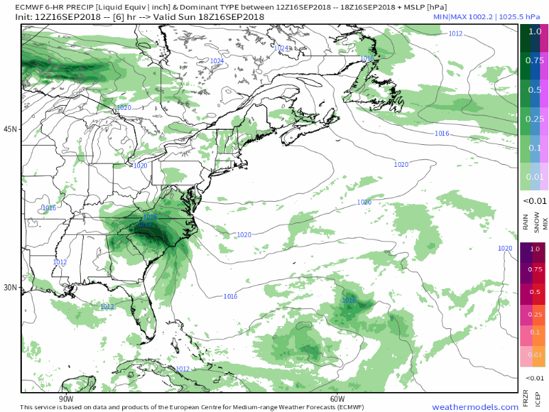 Refer to the headline of the post. The key word in all of this is "potential". Over the weekend, guidance has varied a bit in its idea on what Maine could get out of this. Notice two systems on this Euro model loop I have provided here. A frontal boundary over the north, remnants of Florence quickly moves northeastward from the south. All guidance is on board with the idea that the two systems won't phase until the two meet in vicinity of Nova Scotia. That is a bit too close for comfort for me, so I throw up a caution flag on this until tomorrow. 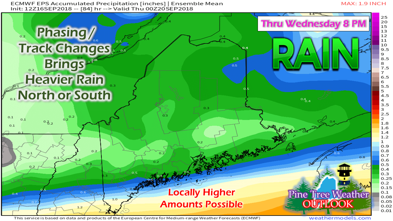 The latest European ensemble mean idea keeps most of the heavier rain to the south, but it's real close. What I am saying here is there could be bust potential either way with this. The track could go further south or north, pending on the timing of all of this. For now, I will agree with the ideas the models are selling on this, but color me a tad skeptical. Folks along the coastal plain (Fryeburg / Waterville / Bangor / Calais south) should prepare for a rain event, one that could be heavy at times, bring some gusty winds, potential for training downpours with flash flood potential, and thunderstorms. I will be right out front that this could be a bust, but it is too close in time and track to fool around here. Showers begin Monday night over southern areas and Tuesday morning over the north with the approaching system up there. The western and eastern areas could see a few showers in the late afternoon / Tuesday evening time frame overnight into Wednesday. I will update this on the Pine Tree Weather Facebook page Monday evening. In the aftermath... frost / freeze potential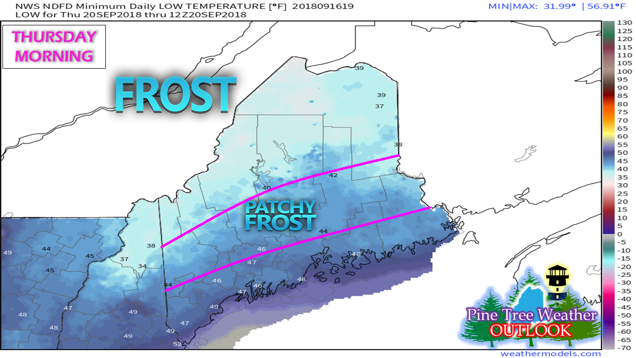 In the wake of Florence departure of the continent, Canadian high pressure moves into the region temporarily and this time of the year means frost / freeze potential comes along with it. Don't let the forecast temperatures on this chart fool you here. This has a good chance to be colder than this. Folks who are still growing or put the mums out for fall should prepare to cover them over in the areas away from the coast noted above. Protected areas in the coastal plain should stay in touch with forecast overnight low temperatures Wednesday night into Thursday morning. If this validates, this may kick off fall foliage color over the mountains and north in the next week. Keep that in mind if you want to plan your trips and photography excursions. Outlook through Friday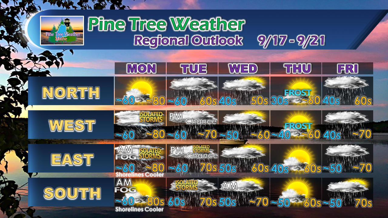 Southern and eastern areas may have to deal with some areas of fog once again Monday morning, which could be locally dense. Folks along the coast should put their headlights on as you head out to work. Western and eastern areas may pick up an isolated shower or thunderstorm as a stalled frontal boundary over the central region may touch off some precipitation. Tuesday, rain showers are likely for the north, with heavier rain possible south. Western and eastern areas should stay tuned for updates. Showers begin to gradually clear out of the region from southwest to northeast on Wednesday. Thursday will be a cool one for the state, with frost / freeze potential to stay updated on over interior areas. A warm front approaches Friday which brings the chance for showers and possibly some rumbles during the day, and if all goes well, a trailing cold front tracks through Friday night and a dry weekend appears to follow. Stay tuned. Stay updated! Updates this week are likely to be of the short and to the point variety as I return to the office from a business trip. You can check the Facebook page or my Twitter for what information that I can provide. As always, stay in touch with the National Weather Service for the latest official forecasts, bulletins and advisories from them. Check in with the Caribou office for northern and eastern parts of Maine, or the Gray office for western and southern areas of the state.
Always stay weather aware! - Mike |

Mike Haggett
|


