
Thursday delivers a taste, Friday delivers the punch Hopefully everyone is aware they are either a winter storm warning or a winter weather advisory. If you have a smartphone with a good weather app on it, you should have been alerted of it. The trend continues colder and a bit more offshore, so that means snowier for the interior. This is still a junk storm (sleet, ice) for the coastal plain. Shorelines are a toss up for now on whether the coastal front makes it on land and for how long. Given the severe weather going on in the southeast, there could still be changes here, so be aware of that. TimingI am going to try to break this down a bit. This is a two day event here. There are two areas of low pressure moving through. There may be areas where it could be slow getting started. There will be lulls in activity. Thursday's precipitation amounts may give you the false impression the storm is bust. Don't take the bait. 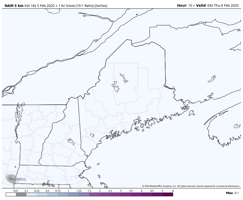 Phase one is Thursday through 7 PM. This graphic is HOURLY SNOWFALL ONLY. A general 1-4" statewide by early evening. Some slick conditions for the morning and evening commutes. If you are headed out, allow for extra time, expect reduced speeds due to the conditions. Road crews should handle this part without too much issues. Be aware of potential greasy conditions on the roads less traveled. 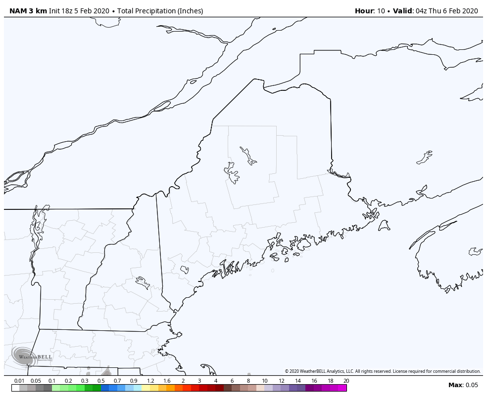 This is LIQUID EQUIVALENT here. Why am I showing you this? After the snow passes through, this is where the mix starts in. For southern areas, that appears to be Thursday afternoon. It appears to me to potentially be some sleet, with light ice possible. Onto stage two... 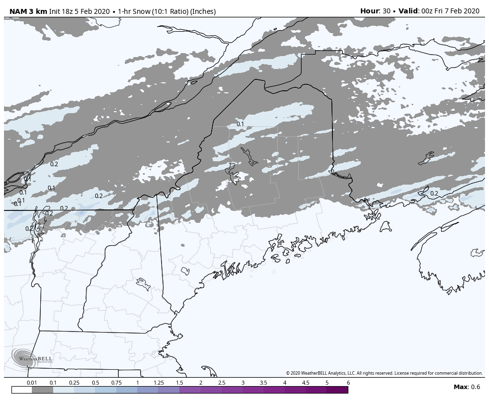 This HOURLY SNOWFALL loop runs through 1 AM Saturday. Northern areas may get the lull for a few hours Thursday night. As the second low approaches, it begins to intensify, and this is where the banding gets going, with the greater impact Friday afternoon. Snowfall rates at 1-2" per hour or more is possible. In other words, it is going to dump. This will make it tough on road crews to keep roads clear. This will cut down on visibility. The wind will pick up and bring whiteout conditions in areas as the low travels through the Gulf of Maine into the Bay of Fundy. ALL AREAS WILL END AS SNOW. I want to make the clear for you folks along the coast. In areas where you see blanks, comes the mix again... 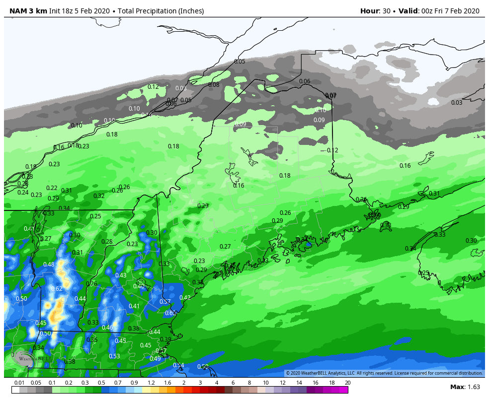 Picking up from 7 PM Thursday through 1 AM Saturday, there will be some sort of mixing, either sleet, freezing rain, and perhaps a brief shot of warm rain for the immediate coast. There is quite a surge of moisture that comes in Friday afternoon. Regardless of end time, I do think the roads will be slick Friday night most areas into Saturday morning. It will take some time to get treatment out, and for northern areas, plowed out. Chances are real good that we'll have some tired snow removal folks come Saturday. Total amounts for both storms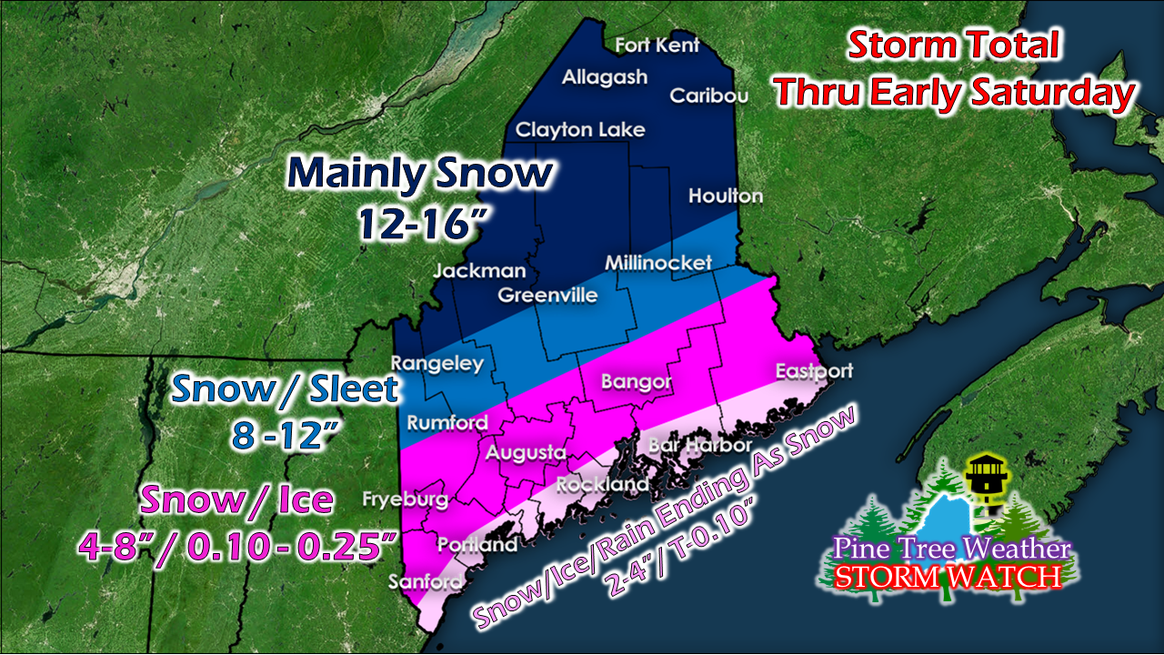 Confidence at this point is good. I can see where snow totals could increase or decrease pending on storm track. The amount of sleet and freezing rain could change in either direction as a result also. As I have said, with the severe weather over the southeast feeding into the front that is carrying these two storms, that could throw a wrench into this. This is the best estimate as of Wednesday afternoon. There will be another update. The aftermath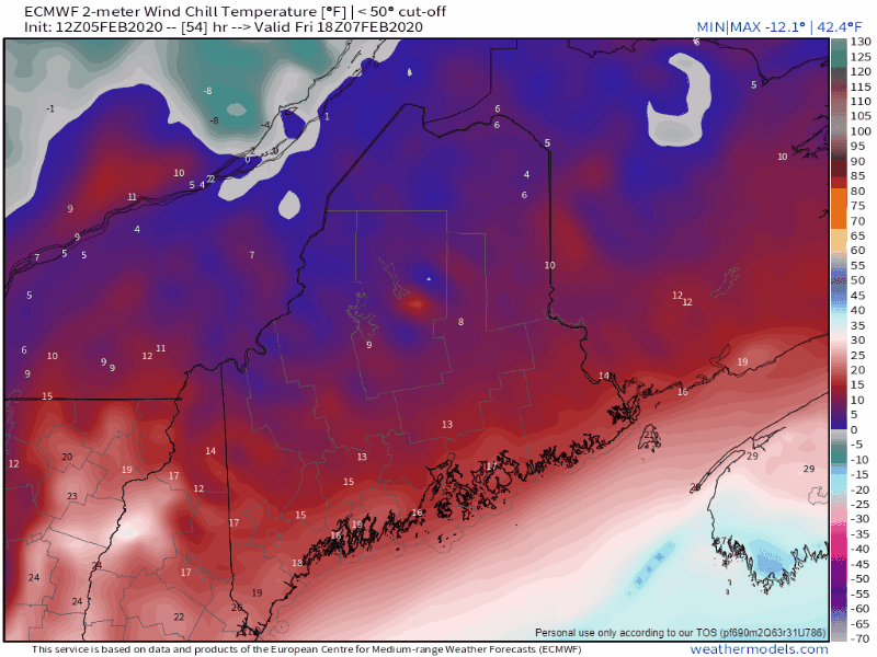 As the storm pulls away, the cold and windchill pours in Saturday into Sunday. Folks that get fluffy snow can expect it to blow around, cause whiteout conditions and slick roads. It will be bitter statewide into Monday. Winter is back. Stay updated! ► ► For the latest official forecasts, bulletins and advisories, please check in with the National Weather Service in Gray for western and southern areas, or Caribou for northern and eastern parts of Maine.
► ► Due to a revised budget there is a $125 shortfall for the year ahead! You can help keep Pine Tree Weather going with a donation of ANY amount now through VENMO @PineTreeWeather, a monthly donation on Patreon or messaging me on Facebook or Twitter to send a check in the mail. Thank you for your support! For more information from me, please check the Pine Tree Weather Facebook page as well as my Twitter feed. Always stay weather aware! - Mike |

Mike Haggett
|


