|
I am going to focus this update strictly on the holiday given the importance of it. For your Wednesday forecast, check in with the National Weather Service or your other preferred source for weather information. There is much to be concerned about here. 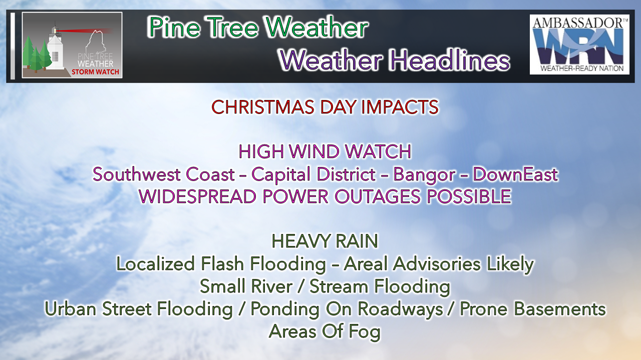 A Christmas mess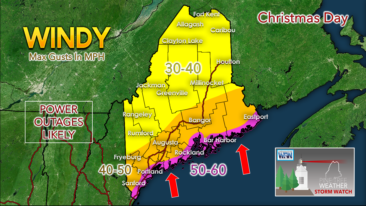 Overnight the National Weather Service in Caribou expanded its High Wind Watch into the Bangor area, as well as interior Hancock and Washington Counties. The idea on the low level jet at 2500 feet screaming near 100 mph is big concern here. Given the south/southeast direction of the wind, coastal areas are going to get the brunt of it. Friction of the land surface will help knock that speed down a fair amount, but it would not surprise me to see Matinicus Rock hit 70 mph, with 60+ mph along the shorelines. If you have not yet secured lawn ornaments, holiday lights, grill covers or anything else that could go airborne, it would be wise to do so. 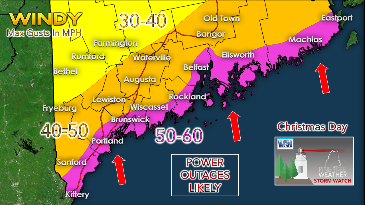 I mentioned this previously and will remind everyone again, with wind is two directional threat. There is the horizontal threat from wind stream, then the vertical threat from the atmosphere. In areas of heavy rain, downpours, and possible thunder, precipitation could bring damaging downdraft wind to the surface. Plan on the power going out. Of all the south/southeast storms we've seen recently, this is likely the strongest. It's not October 2017 strong, but I can see well over 100,000 losing power here. Have your food prepared, electronic devices charged, batteries, flashlights, and alternate fuel sources ready. If you have a generator, make sure that is ready to go as well. 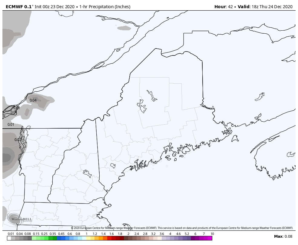 European model idea of 1 hour rainfall between 1 PM Thursday and 1 PM Saturday The timing of the wind is also in conjunction with the rain. On that note, I mentioned in a previous update the potential of the frontal boundary potentially slowing down its west to east forward progress, and that appears to be a more of a distinct possibility. The European model above showing a rough idea of 1 hour rainfall rates indicates that. Outflow showers ahead of the front appear on track to form Christmas Eve over western and and southern areas and expand east overnight into Christmas morning. Where the European model had been rather progressive with ending rain and wind Christmas night, that idea has shifted into Saturday morning for eastern and northern areas. Western and southern areas see the precipitation and wind threat end by roughly midnight Christmas night. 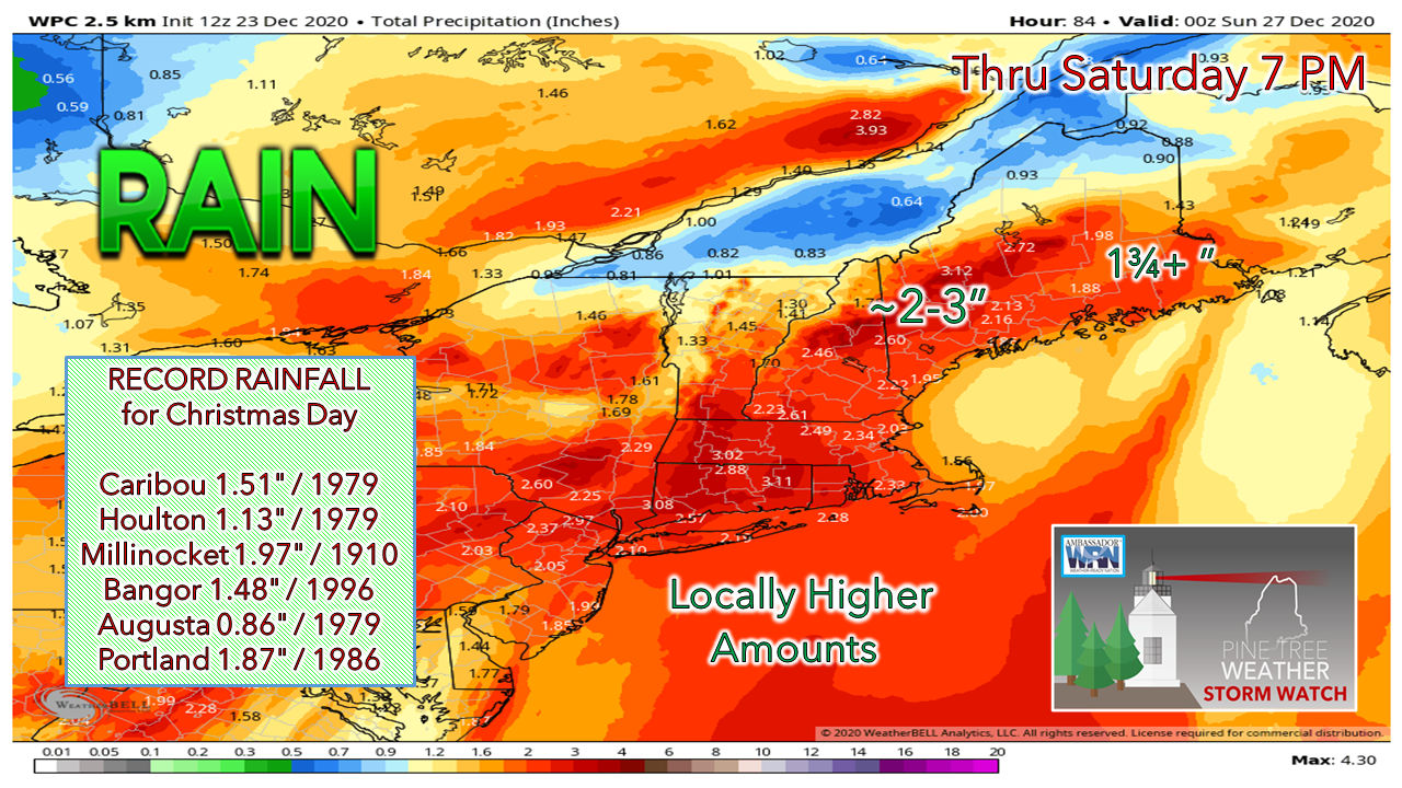 With the potential slowdown of the progression of front coming into possibility, that brings additional rainfall into the picture. For the mountains, 3" of rain is roughly the average point for now. Not to pour extra salt on an already large open wound for ski country, but I have to be honest and say that 4-5" of rainfall is not out of the question on the southern facing slopes due to orographic lift. This is line of rain and wind is more potent than the one we had earlier in the month that caused runoff damage at Sunday River, and places up there hit 3" of rain with that event. All of this rain, along with the rapid melt of recent snow that has anywhere between 1-2" or more of water content within it, add that to the rain total and for much of the region, it is a 3-5+" water event. This is where the flooding comes in for brooks, streams, small rivers, ditches, urban storm drains and basements. If you do not have a sump pump hooked up to a generator and you lose power, you could have big problems in your cellar. If your cellar is susceptible to flooding, expect it to flood, and prepare accordingly. 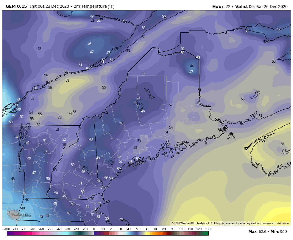 GEM model idea of 2 meter temperatures from 7 PM Christmas to 7 AM Sunday Given the potential for delay of the frontal boundary departure, that delays the freeze up. That may be a blessing for the utility crews working in that environment. Rest assured by Sunday morning the state will be froze up tighter than a drum as temperatures fall after the front passes through.  Are you ready to lose power?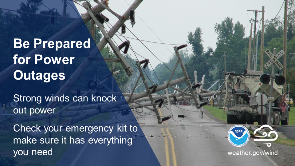 Powerful storms can pack a windy punch. Don’t wait until you’re in the dark! Check your emergency kit now to ensure you have plenty of batteries and other essential supplies on hand. ready.gov/kit Be prepared to receive alerts and stay updated!
For more information, please follow Pine Tree Weather on Facebook and Twitter.
** FUNDING NEEDED FOR 2021 ** Thank you for supporting this community based weather information source that is funded by your financial contributions. Stay updated, stay on alert, and stay safe! - Mike |

Mike Haggett
|