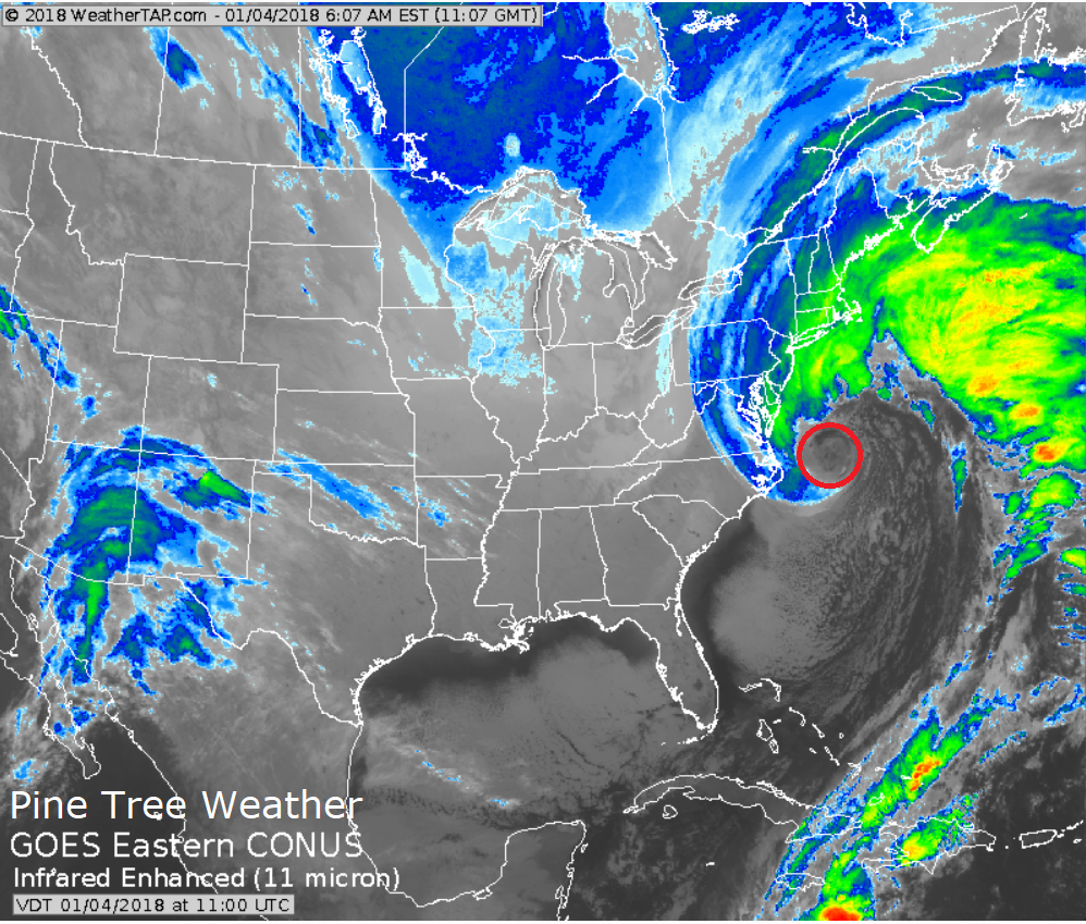
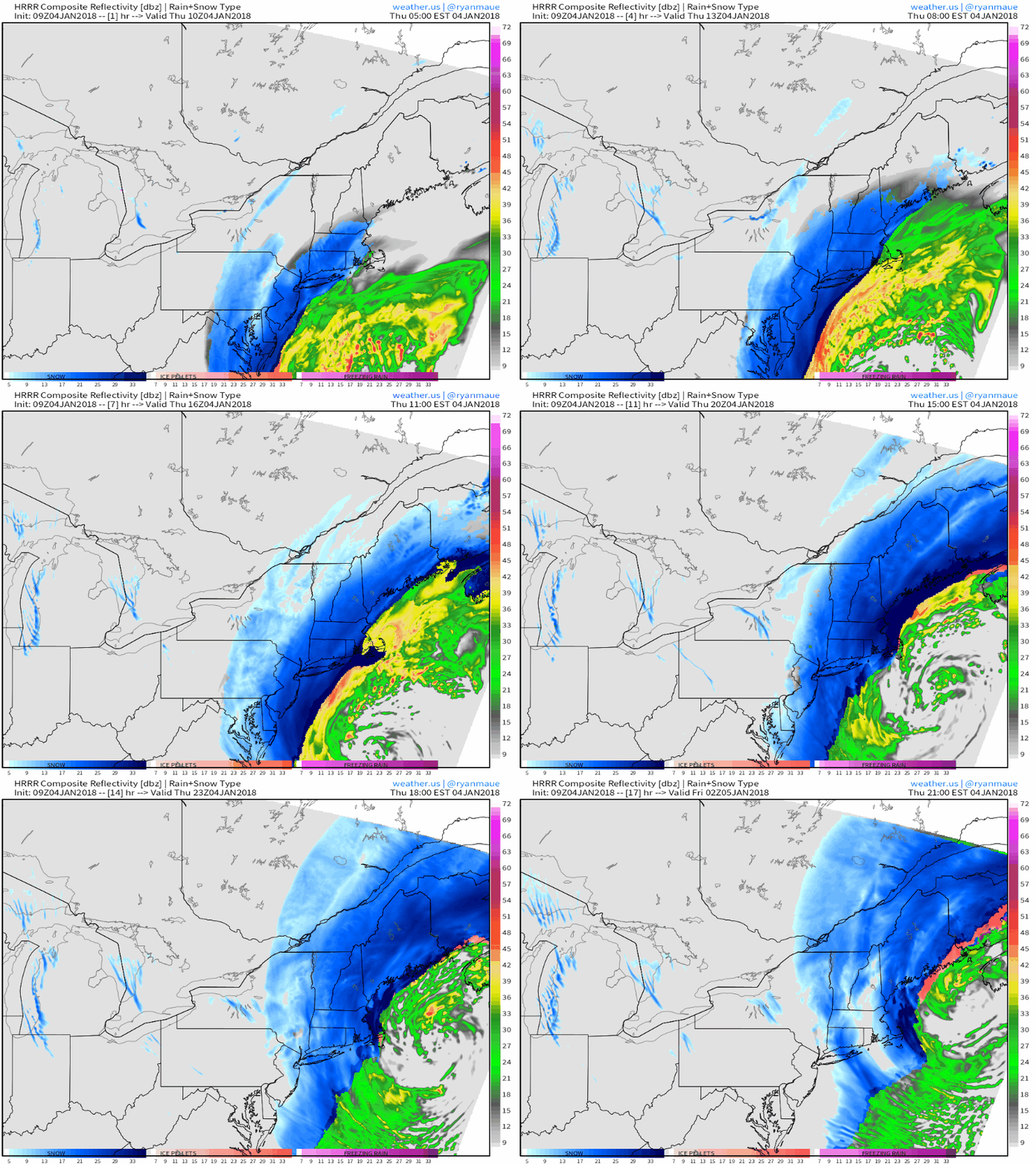
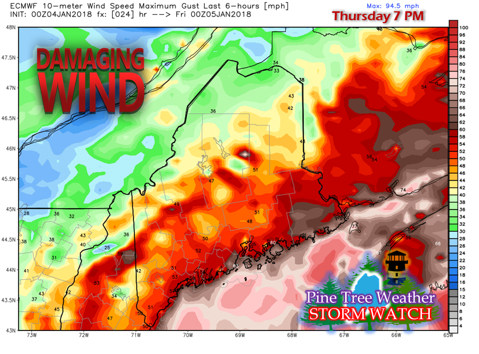
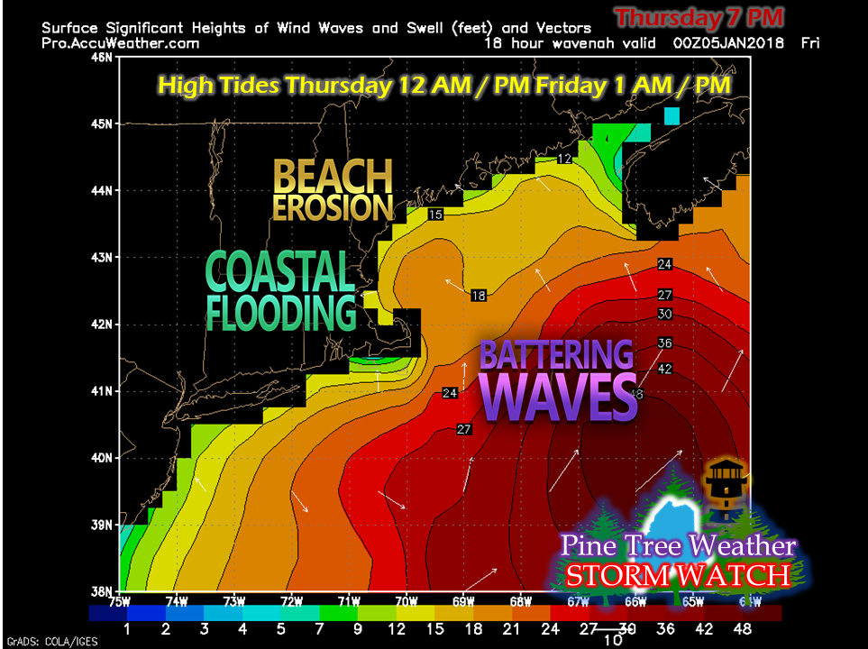
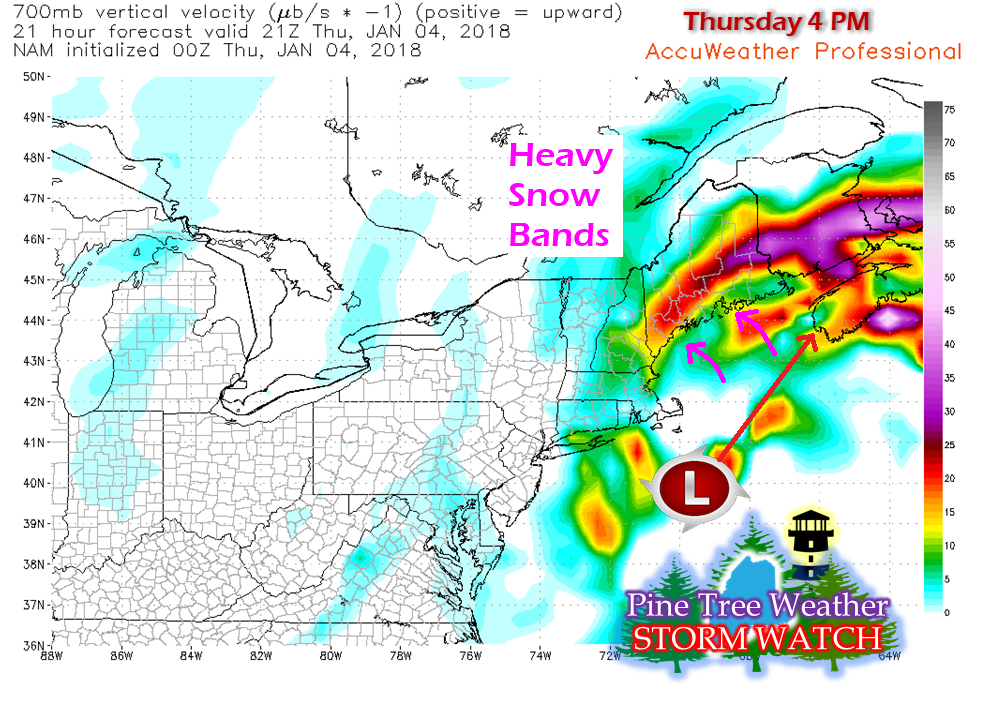
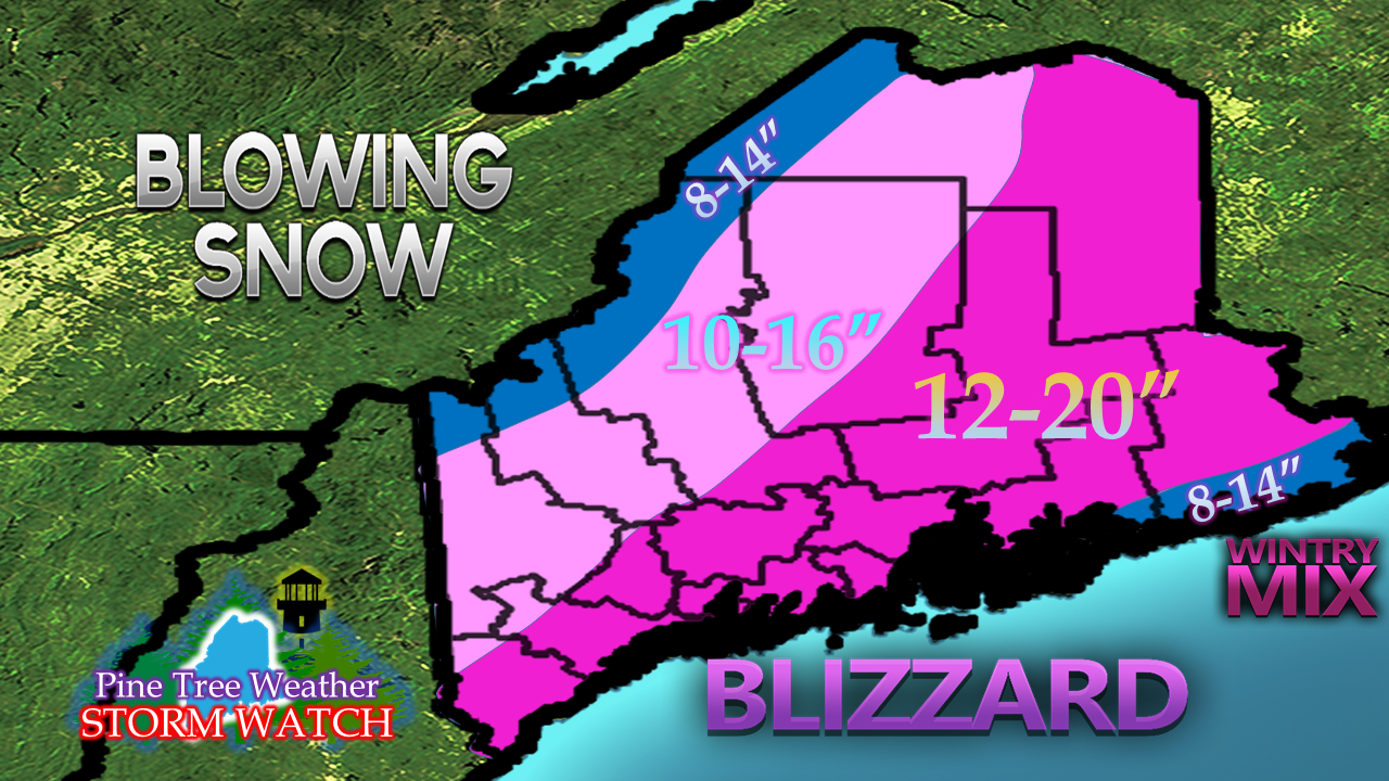
The storm is impressiveEnhanced satellite imagery shows a very strong storm. An eye is visible, and it is very large. This is a classic high impact NorEaster that will deliver very strong wind, copious amounts of snow and coastal flooding to the state Thursday into Friday. Snow overspreads the regionHRRR model idea issued at 09z (4 AM) shows snow developing over the state through the morning. Confidence is increasing that the DownEast coast may see a period of mixing as the storm approaches Nova Scotia this evening. High wind concerns elevatedGiven the strength of the storm with a track that is slightly west, wind concerns continue to grow. Hurricane force wind warnings have been issued by the National Weather Service for the offshore areas of Penobscot Bay through Washington County. As I have stated several times leading up to this storm, the ice over the interior from the pre-Christmas storm is a big concern of mine. With the projected wind over land expected to reach 40-60+ mph, power outages are likely to happen. Coastal concerns continueWith the ice in the harbors, astronomical high tides, strong wind, a 1-3 foot storm surge and seas 16-21 feet, the high tide at 1 AM Friday could bring substantial damage to areas along the shorelines. Anyone with shoreline property and/or watercraft should stay in touch with the National Weather Service for the latest bulletins. Snowfall totals increasedWith the storm evolving into a sub 960mb cyclone as guidance has suggested with tropical moisture attached to it, snow will be copious with this event. Bands of very heavy snow will impact the region this afternoon which road crews will have difficulty keeping up with. Snowfall rates could be in 1-4" per hour range, possibly higher for eastern Maine into Aroostook. With the cold air locked in for much of the state, I expect a high ratio snow event. This will be a storm that won't be measured in inches, but in feet of drifts. Shoreline areas from Penobscot Bay to around Eastport may be spared the big snow due to a coastal front bringing sleet and rain as the storm approaches Nova Scotia this evening. The ski hills will do extremely well with this storm, but with the coldest air yet to arrive in the aftermath of the storm, it may be difficult to get out to enjoy the fresh powder. Wind chills in the -20° to -40° are expected by Saturday morning.
PLEASE stay in touch with the National Weather Service through NOAA Weather Radio or use the Weather Radio by WDT smartphone app to get the latest bulletins in regards to this event. - Mike |
Mike Haggett
|

