
Major storm to affect the whole east coast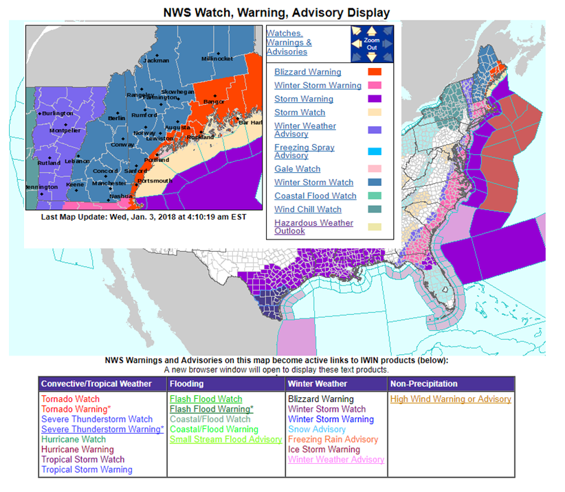 Overnight, the Gray and Caribou National Weather Service offices hoisted blizzard warnings. Yes, those are hurricane wind warnings offshore of North Carolina that extend all the way to Georges Bank. As I mentioned in Tuesday evenings post, I expect many other types warnings to be issued in regards to this storm. The situation is very fluid, and I strongly suggest you stay tuned to NOAA Weather Radio or use the Weather Radio by WDT app for your smartphone to get the latest bulletins for your area. The pieces are coming together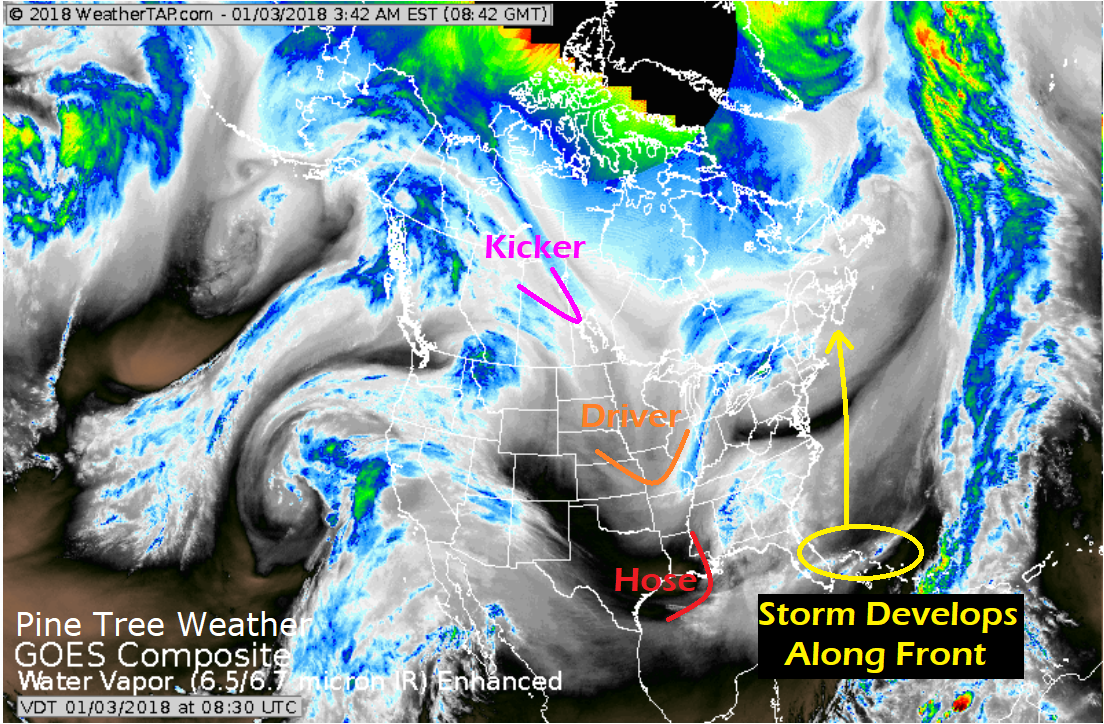 The three main players in storm formation are coming together. The hose energy has reached the Gulf of Mexico. The driver energy over the Midwest will push the hose eastward along a frontal boundary and form the storm this morning. The kicker energy will drop down from the Canadian Prairies and force the rapidly developing cyclone northeast, and deliver even colder air to New England after the storms departure. Storm track continued west overnight Overnight guidance has shifted the storm slightly west yet again. The center of the cyclone slides slightly east of the 40°N / 70°W benchmark location. It is on track to make landfall near Yarmouth, Nova Scotia based on the latest trend. As a result, heavier snow and wind is possible for Maine and points southeast. Wind the major concern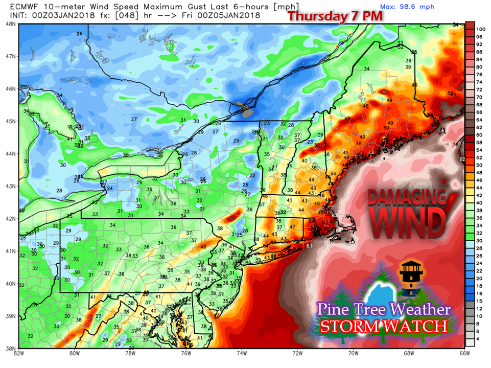 The greatest threat affecting the region is the wind and remains worrisome for me. With the area iced up from the pre-Christmas storm, the power outage concern is a real one. Hurricane force winds are likely for the Gulf of Maine, Cape Ann and Cape Cod. With the ice in the harbors, the wind, in combination with the waves will move it. This is set up to be a very nasty coastal storm, with damage more than likely to occur along the shorelines. Storm timeline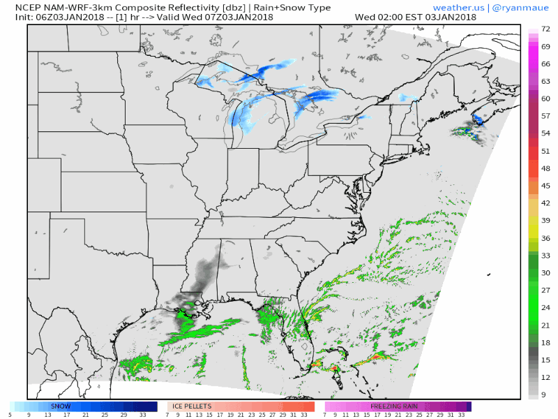 Presented here is the 06z (1 AM) NAM-WRF model run through Friday at 1 PM. I will forewarn you to not focus on the precipitation type as the model has a warm bias among other issues. The arctic front and weak low over the Great Lakes converges with the approaching storm, and as I mentioned in a post two days ago, has drawn the storm closer to the area. The area will see conditions deteriorate Thursday morning, with snow and wind increasing with intensity during the afternoon and evening. Steadier snowfall ends Friday morning, but gusty winds and snow showers are on track to persist for much of the day, and into the evening for northern Maine. Snowfall idea remains the same... for now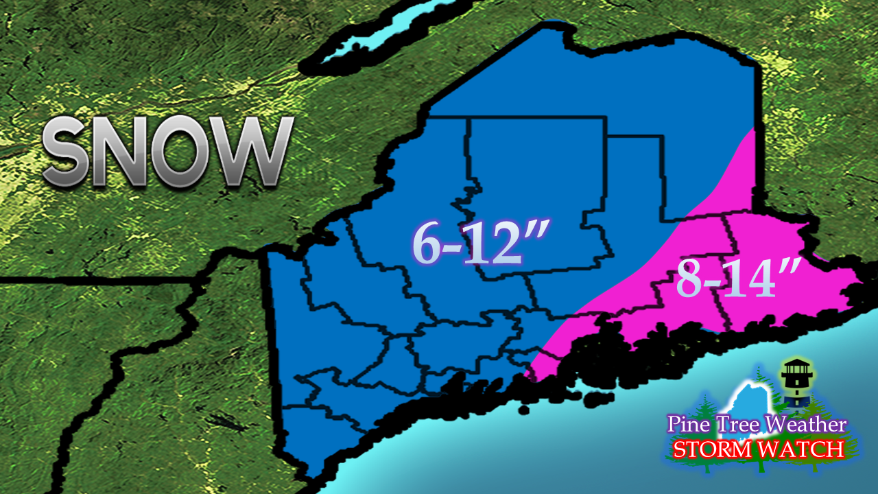 I am not going to change my idea on projected snowfall just yet. I have concerns of whether the westward trend is going to continue, and suspect there may be an adjustment to the track to the east. The other concern is the 06z NAM run above. If guidance continues west like the idea the NAM is presenting, that brings a wintry mix into the equation and bumps up totals further west into the mountains. I will monitor the morning model suites and adjust, if necessary, later this afternoon.
This storm is shaping up to be a memorable one. Make sure you finish preparations for your property and top off the gas tank in you vehicle before you end the travel of the day. Stay tuned. - Mike |

Mike Haggett
|


