
Synopsis Outlook No real changes from the ideas posted in last night's update through the weekend. I have adjusted snow totals slightly for Thursday. The storm every three day trend is likely to continue into the middle part of next week. Buyer beware... a couple of models locked on to a potential significant snow event next week. I am not ready to buy what they are selling yet, because their ideas do not fit the trend we are in right now. Remember that most model ideas beyond 7 days are science fiction, and rarely do they verify, no matter what season. We have two storms to deal with between now and then. This update is focused on first one. I will deal with the others as they come. There is no hype with what I do... ever. Another bitter start Wednesday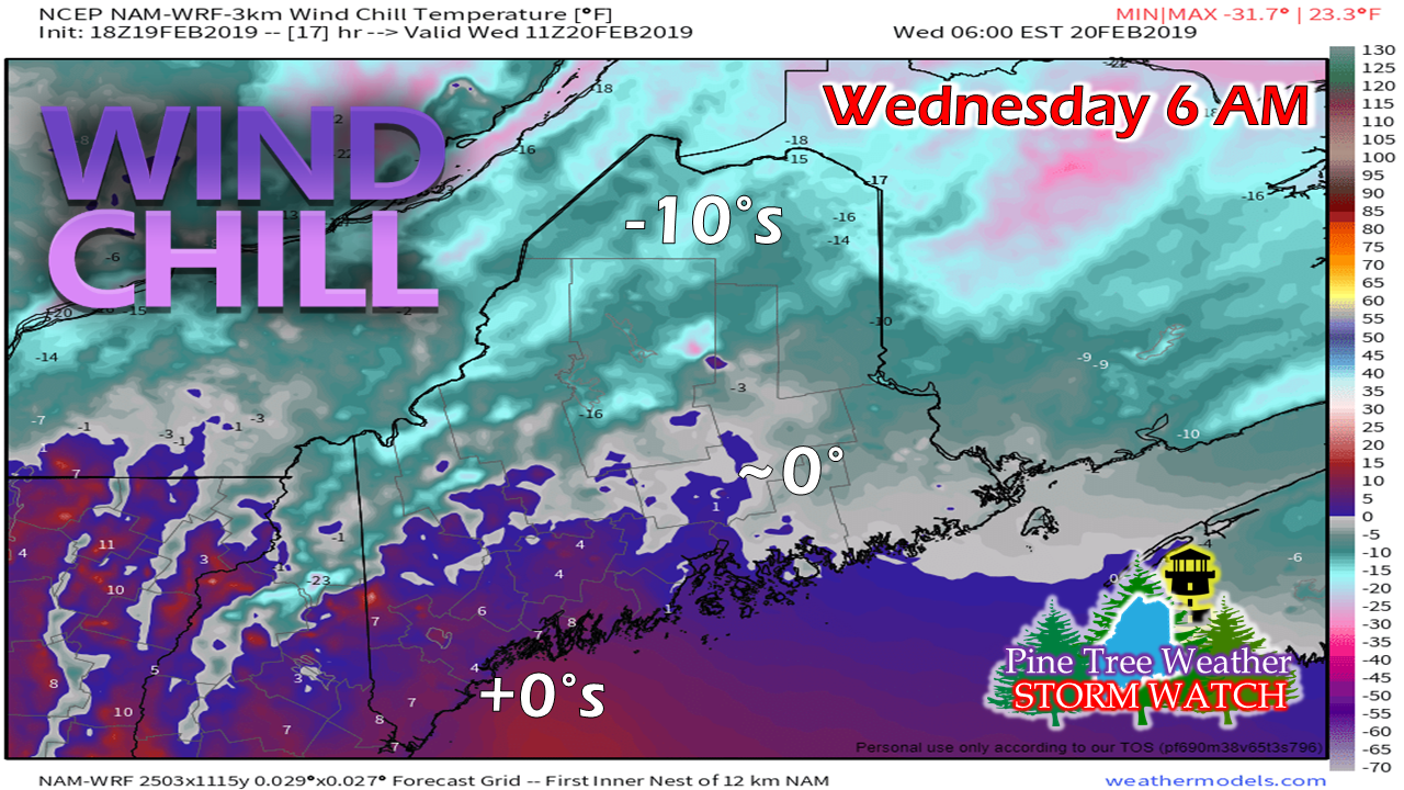 Another night, another wind chill advisory in place for the north into early Wednesday. The wind is expected to drop as we head towards morning. The arctic high over the region moves eastward during the day. A southwest flow develops and clouds will be on the increase for all areas but the north during daylight hours. A Body Shop Special Thursday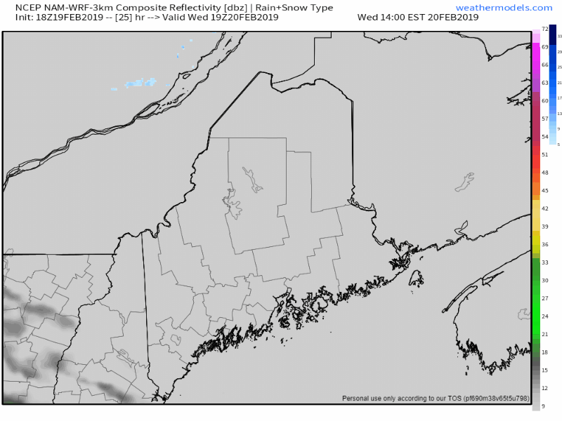 Areas over the south and west may see a few outflow flakes Wednesday afternoon, but the accumulation does not appear to begin until late evening to around midnight. Snow quickly expands across the state, with most areas seeing snow on the ground by daylight. Precipitation ends in western and southern areas Thursday morning, eastern and northern areas Thursday afternoon. Snow showers may linger in the mountains through early evening. 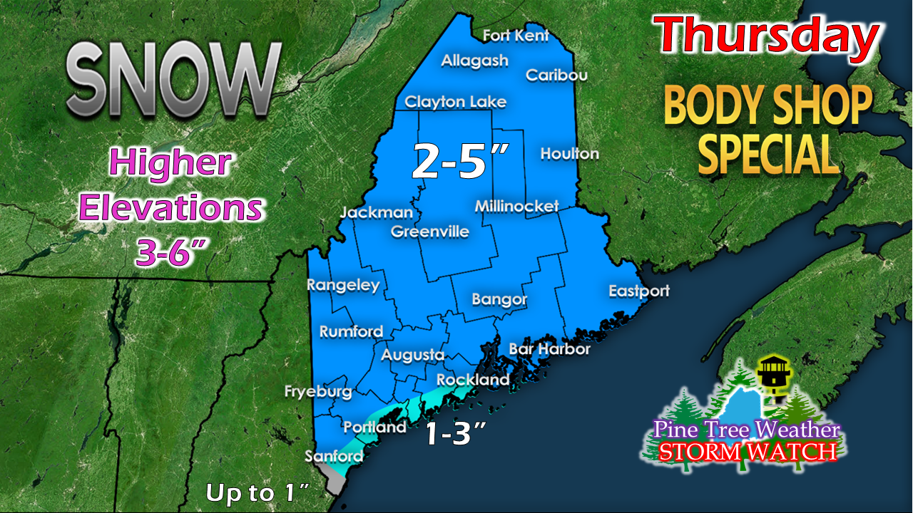 For the newcomers, a bit of an education on my terminology. The National Weather Service issues a "Winter Weather Advisory" when snow is expected to accumulate 4" or more in a 12 hour period. They offer "Hazardous Weather Outlook" when accumulations are expected less than that. You won't turn on your TV or get a notification on your smart phone of a Hazardous Weather Outlook. This is where I fill the gap. When we have these borderline snow events where there is enough snow to cause accidents due to careless driving, I use the term "Body Shop Special". I listen to public safety radio on days like this. First responders and tow truck drivers are often busy on days like this. I suspect this day will be no different. There is just enough snow associated with this to make for slick travel and stupidity by careless drivers. 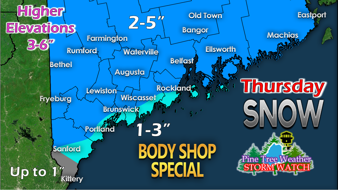 With the coastal front developing, I don't expect much for the MidCoast and southwest coast. Extreme southern York County may wonder what the fuss was all about. I will monitor forecast data and observations overnight and into Wednesday morning. I will update on Twitter and/or Facebook by noon of any changes to this snowfall idea. Outlook through Sunday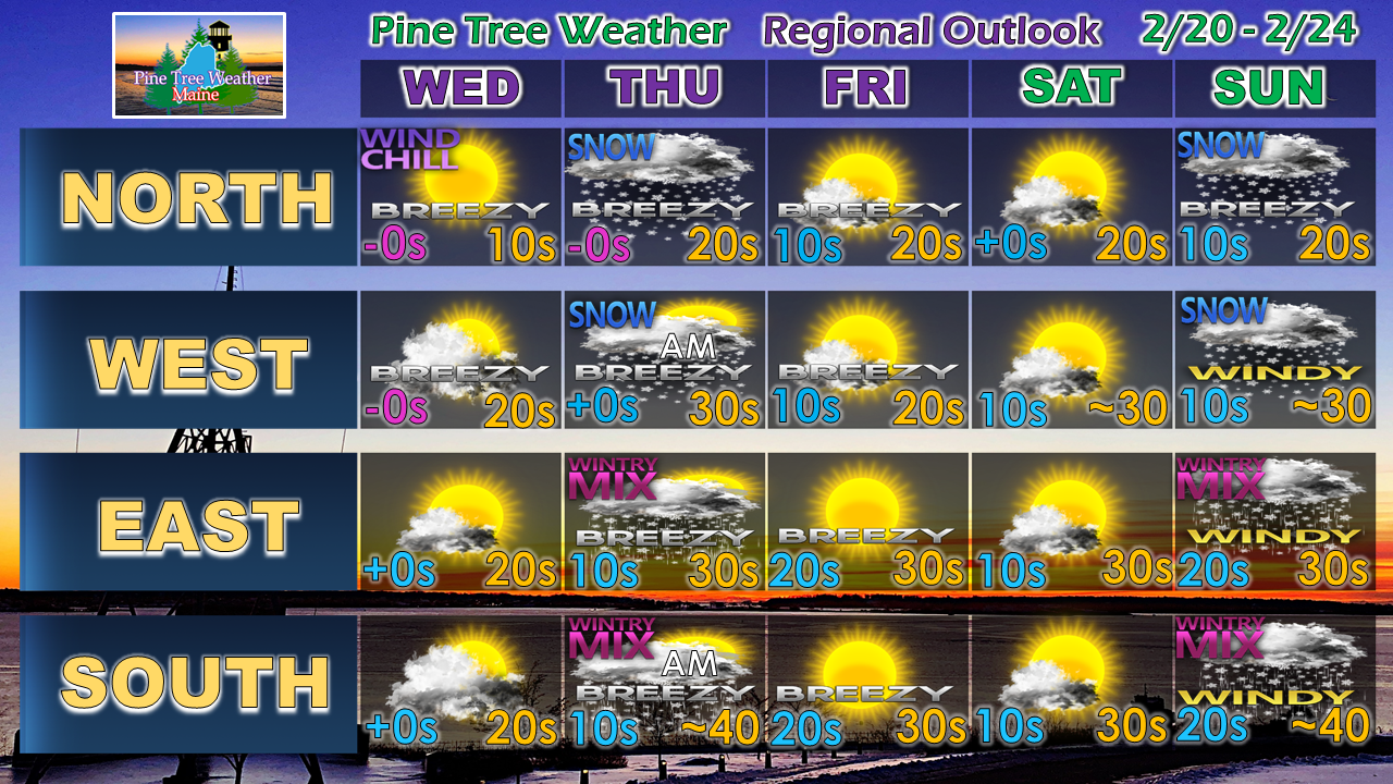 After the storm on Thursday, a couple of quiet days to start the weekend. For now, the Sunday storm appears to start off with snow, with the mountains and north staying that way. The solution to that idea will come more into focus as we head into the latter part of the week.
I am going through a busy time right now. Keep watch on my Twitter feed and Facebook in case this page is silent. ► ► For the latest official forecasts, bulletins and advisories, please check in with the National Weather Service in Gray for western and southern areas, or Caribou for northern and eastern parts of Maine. ► ► Your financial donations are much appreciated to keep this site funded and for further development. I sincerely appreciate your support not only financially, but also in sharing my efforts with others. Always stay weather aware! - Mike |

Mike Haggett
|


