
|
A couple things before I get into the forecast... First, I had a full update in the works Tuesday and then the company internet server decided to cut out on me, so that ended that idea. That is a rarity of occurrence, so I am not that upset about it, other than the fact I had a good one lined up. The forecast from Monday held up, so it was all good. C'est la vie. Second, financial support continues to trickle in, for which I am grateful. I am most encouraged by those signing up on Patreon with a monthly donation which helps me with my monthly budget, which is $300 with every calendar flip. Of course cash through VENMO and checks help as well, and I appreciate that. If you can help out with a couple bucks, great. If you can't, please do me a favor and share what I do with your friends. Thanks in advance! Cooler times ahead, but...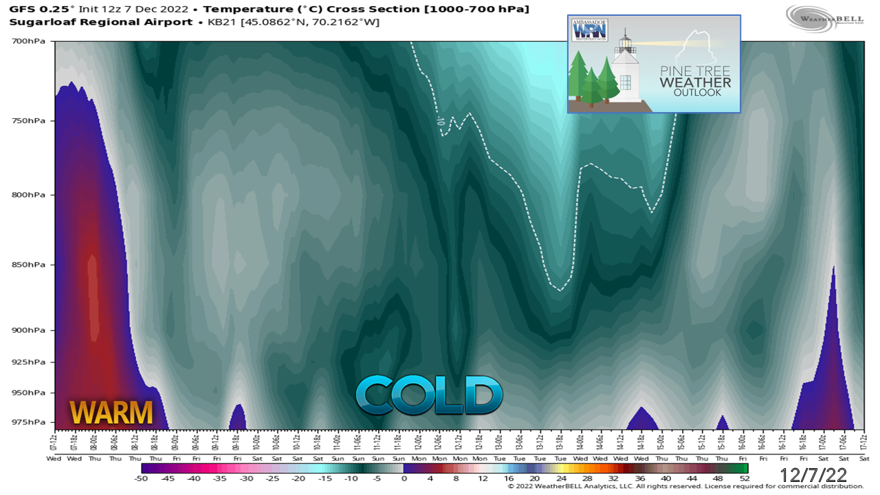 So models have been absolute trash beyond day 5 as of late and it has much to do with what is going on in the northeast Pacific. Models are not reading what is going on there very well, and consequently, it messes everything up downstream. There are black holes that trip guidance up, and energy offshore there away from radiosondes (weather balloons) and that screws everything up. Today is Wednesday, and we are just now getting a fair read on the weekend. Anything beyond Sunday is a mystery. Expect that trend of herky-jerky long term forecasts and silly operational model output beyond six days out that you may find on the socials. The storm for December 15th I spoke of Monday is now kicked back to December 17th / 18th. More on that in bit. For snow lovers, we are heading into cooler times. As I warned a couple weeks ago, that doesn't mean that it will be snowier. It will be good for the ski hills to make snow, but I don't expect much help from Mother Nature other than that. The above graphic shows the cold coming in for the mountains rather well. Things may get a bit warmer later next week, and that will be something to watch with the potential storm in that timeframe. A strong high, a pair of offshore lows, and what to watch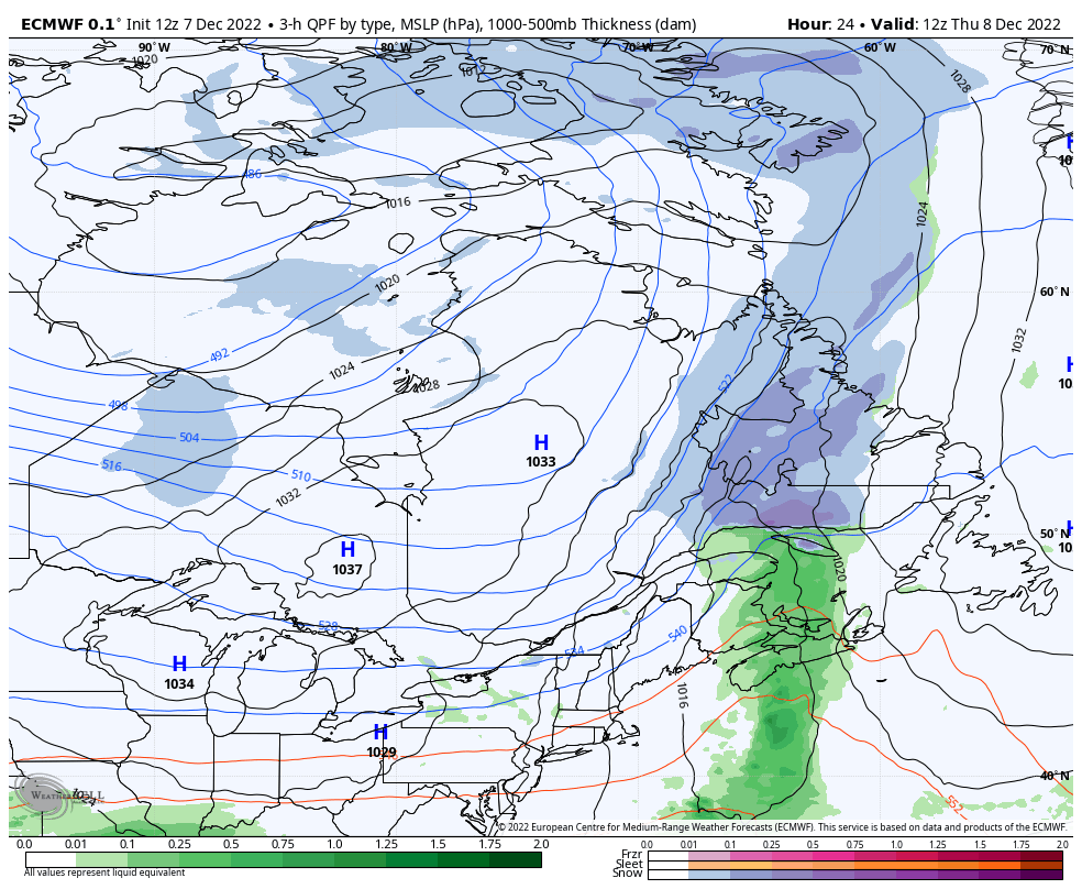 Thursday 7 AM to Sunday 7 PM - Watching this loop on the first run through may not appear like much is going on, but there is a couple things of intrigue here. The frontal boundary that passed through with the rain runs into a roadblock over eastern Nova Scotia, an ocean storm spins up off the severed front tail, then tracks to the southwest. Guidance up until today had the storm a bit further west, enough so that there was potential for rain and/or snow showers for the coast for Saturday and Sunday. The wind pattern from the approaching high out of the northwest on Thursday shifts to the north on Friday, then northeast on Saturday. With the 49° ocean temperature and high temperatures in the 30s with wind coming in off the water still smells like the chance for rain and/or snow showers to me. The high does bring in very dry air aloft, but along the shorelines there is plenty of warm moisture from the ocean, so we'll see. There is a better chance for that on Sunday. In either case, I do not expect any travel issues, and if anything some festive flurries may come out of it. We'll see. The other piece of intrigue is a cut-off upper low that spins up over Labrador and drifts to the southwest towards Maine on Sunday. There is an inverted trough set up that brings snow over the eastern Great Lakes and western New England to wrap up the weekend. It's close enough to watch Sunday night into Monday. For a better look at that... 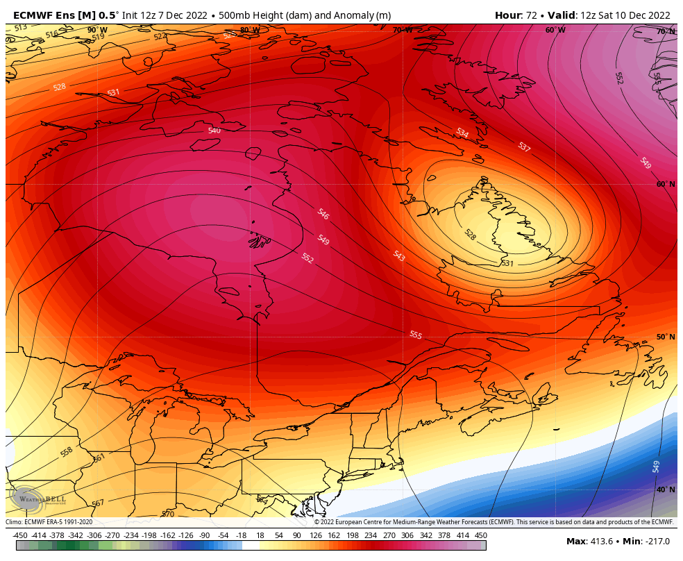 Saturday 7 AM to Wednesday 7 PM - The cut-off upper low drifts to the southwest and sets up a backdoor cold front similar to what we see in the spring and fall and then gets dragged into the inverted trough to the south. Maine is caught right in the middle of that pickle. It's close enough that it could bring frozen precipitation to the coast Sunday and possibly Monday. How much? It may just be flurries or snow showers. Color me skeptical that models are handling this right given the track record of late. Oh, and about the trough creeping in from the west at the tail end of the loop on Wednesday, that is the seed of potential for the late week storm. The Climate Prediction Center indicates above average temperatures and precipitation late next week. Remember that coastal hugger potential I mentioned on Monday? Yeah, that idea is still alive. Current deficit for 2023: $1500 Temperature outlook through MondayThe normal high and low for Caribou for December 7th is 30° and 17°. For Portland, 41° and 25°. Temperatures trend to below normal levels by the weekend. 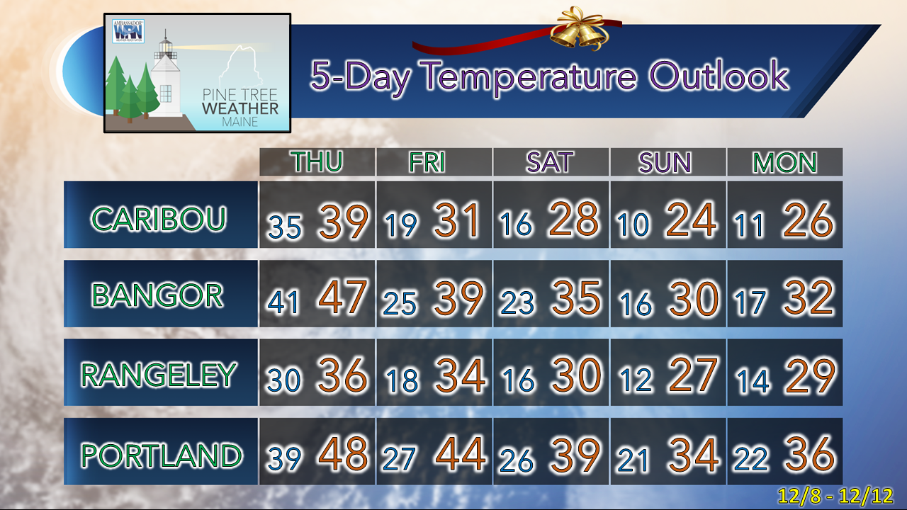 Thank you as always for your support! Stay updated, stay on alert, and stay safe! - Mike NOTE: The forecast information depicted on this platform is for general information purposes only for the public and is not designed or intended for commercial use. For those seeking pinpoint weather information for business operations, you should use a private sector source. For information about where to find commercial forecasters to assist your business, please message me and I will be happy to help you. |

Mike Haggett
|


