
It's easy to shovel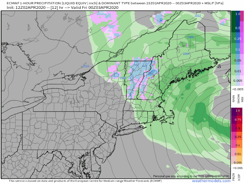 A powerful ocean storm backs into New England on Friday southeast of Georges Bank and near the 40° N / 70° W benchmark point before moving southeast and away from the region Friday night. Rain will be the main source of precipitation along with breezy conditions through the day. Peak wind gusts come Friday morning in the 20-30 mph range, 30-40 mph for the higher elevations, coastal shorelines and islands. The breeze will be slow to subside Friday afternoon and night, and settle down by around midday Saturday. Southwestern coastal areas may hear a rumble of thunder in the wee hours of Friday morning until around mid-morning. No severe weather is expected. For northern areas, the precipitation ends before daylight Friday. For the western and eastern parts of the state, it will be roughly mid-afternoon to early evening. For southern areas, the last of the showers fall in before sunrise Saturday. Temperatures and outlook for the weekendWith upper level disturbances trailing the ocean storm, I am going with partial sun for both Saturday and Sunday. A weak cold front works through the region Sunday night in the wee hours of Monday which may bring a snow shower to the north and a rain shower elsewhere. After that, the outlook appears dry until the middle part of next week. 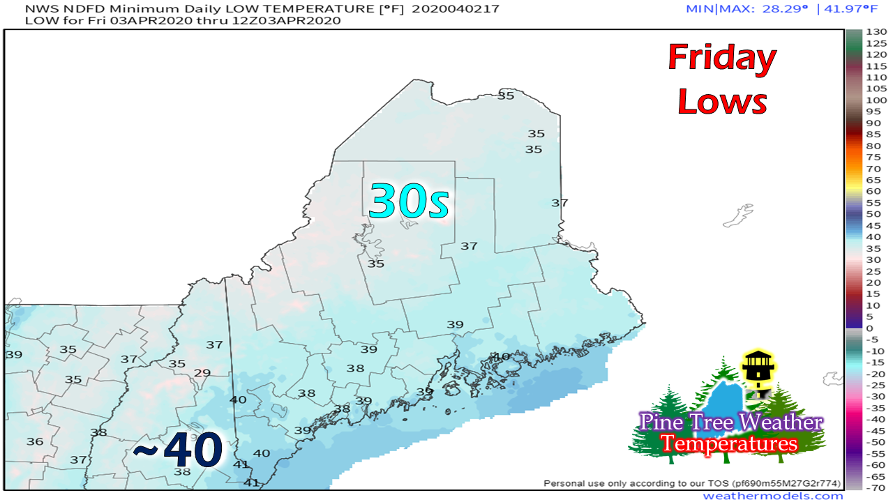 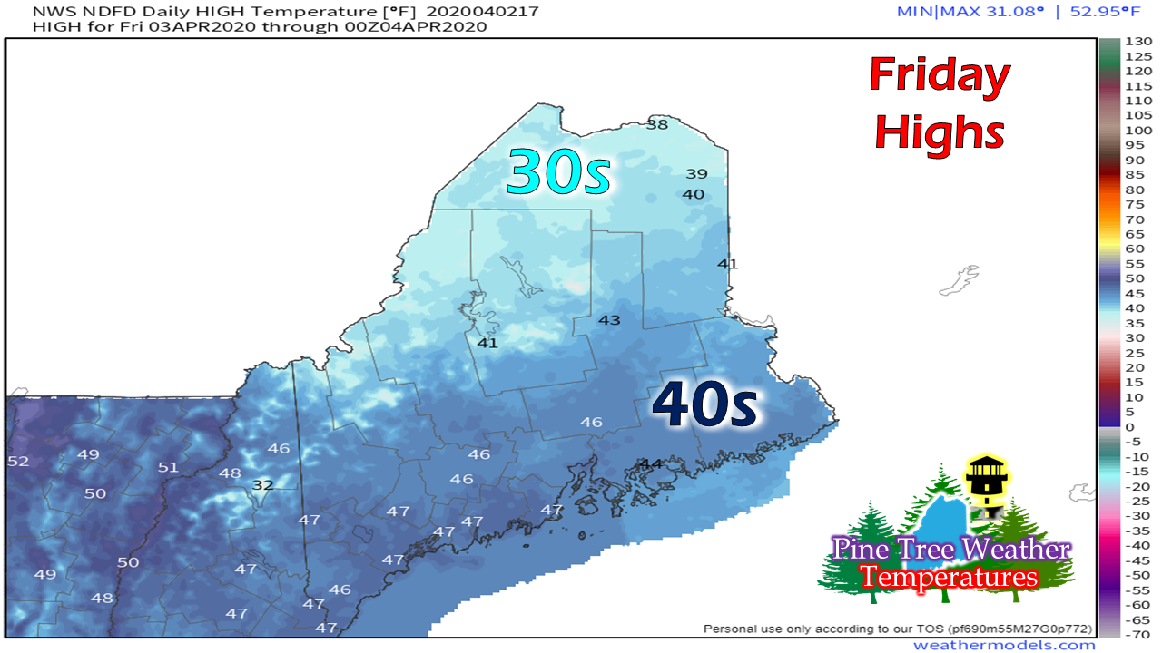 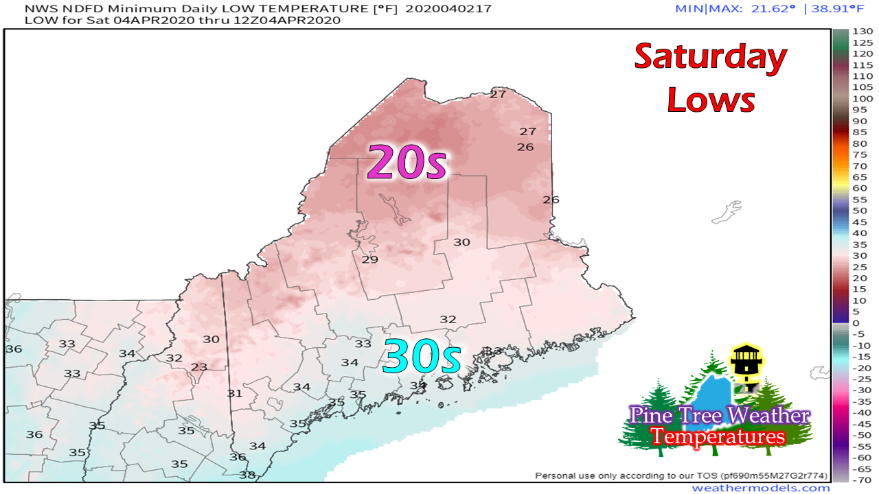 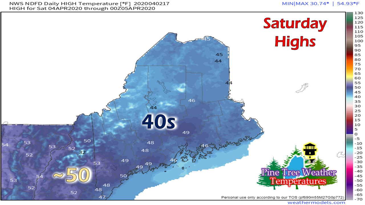 Feel free to use the many pages available on this website for many types of forecasts on rainfall, snowfall, marine, longer range CPC outlooks, and maps.
Thank you as always for your support! ► ► For the latest official forecasts, bulletins and advisories, please check in with the National Weather Service in Gray for western and southern areas, or Caribou for northern and eastern parts of Maine. Always stay weather aware! - Mike |

Mike Haggett
|


