
Cooler, drier times ahead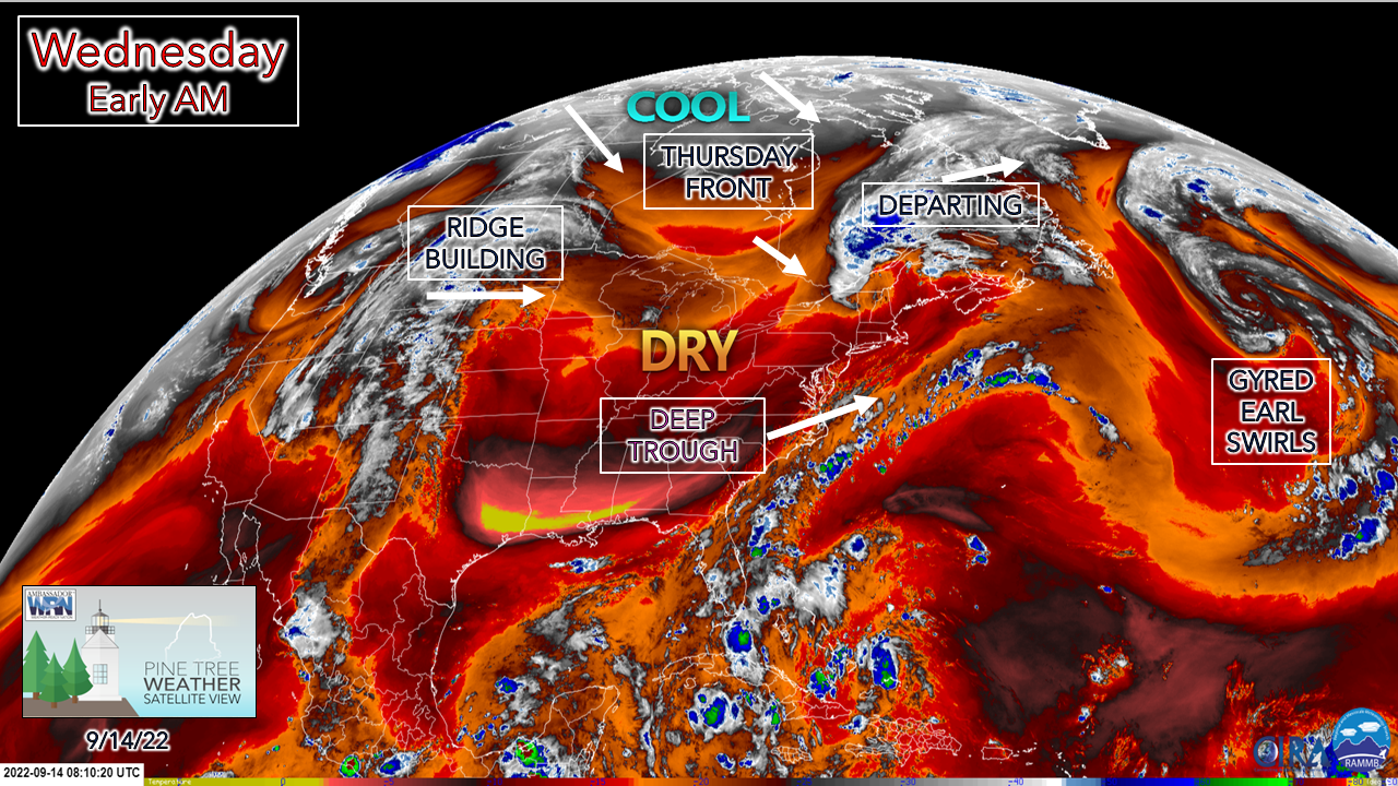 A cut-off upper low over far northern Maine will be moved along as a shortwave frontal boundary drops down from Quebec. A reinforcing weak cold front brings cooler air in from Canada on Thursday. High pressure controls the weather for the region through Saturday morning. A ridge in the west moves east and brings the potential for showers to parts of the area on Saturday afternoon into Sunday. Storm gradually moves northeast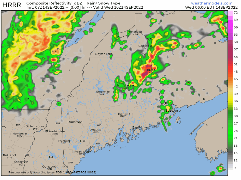 Wednesday 6 AM to 9 PM - The north awakes with showers along with isolated thunderstorms that lift to the northeast this morning. A cold front passes through the region in the afternoon, with upslope showers possible for the mountains and north through early evening. 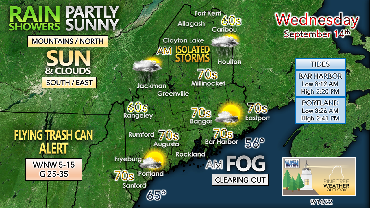 The main weather story for the day for all areas will be the breeze. As the upper low and associated surface low head for the Gulf of St. Lawrence, the intensification of the surface low in conjunction with high pressure moving in behind it increases the wind. Another reminder to secure any loose objects and grill covers, along with securing trash cans and totes. DownEast areas seeing fog to start off will see that blow out around mid-morning. Southern areas are likely to see the most sun. Expect breezy conditions to continue both Thursday and Friday, albeit with reducing speeds, until high pressure settles in. When it does, a reminder of the time of year arrives for Saturday morning. A gardener's F-bomb potential to start the weekend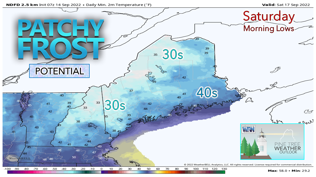 We're in the middle part of September with the harvest moon recently past, so to see the gardener's F-bomb for "frost" isn't a huge surprise. Caribou's first frost on average is between September 21-30, which makes it a bit early climatologically speaking. It's not a slam dunk bet that it will happen as clouds advancing in from the west may keep temperatures above freezing, but for those growing, it would be wise to prepare just in case. An atmospheric squeeze play for Sunday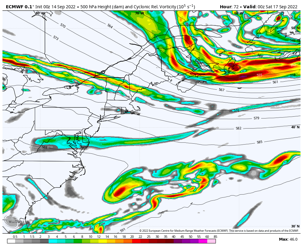 Friday 8 PM to Sunday 8 PM - A look at the 500mb heights and vorticity loop from the eyes of the European model shows two important features. First, the building ridge from the west. Second, an upper-level low dropping down from the north. This puts Maine in the middle of the traffic jam. Upper-level disturbances riding along the ridge interact with the blocking upper-low and sets up the chance for rain. 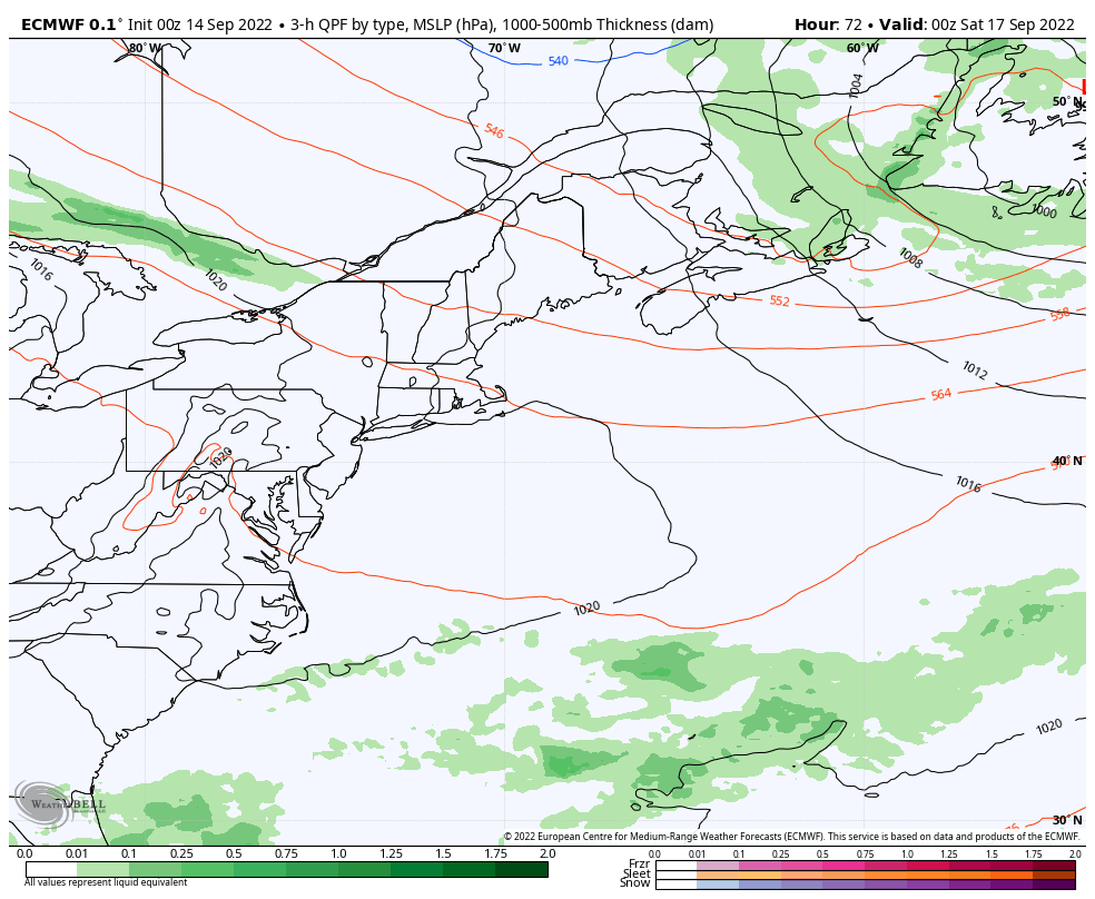 Friday 8 PM to Sunday 8 PM - A look at the interpretation of the surface map shows rain shower potential across southern and western areas. It's important to note that other deterministic ideas show differing opinions on where the disturbances aloft line up, so this is not a forgone conclusion just yet. For now, a chance for showers is in the forecast statewide for Saturday afternoon for the mountains and Great North Woods, and all locations for Sunday until confidence increases. An additional note, it's interesting to see the blue 540 decameter height isotherm enter the picture. That is an indicator that the air column aloft is cold enough for snow. There could be some flurries in Labrador over the weekend. The F-bomb and S-bomb were both used in this September 14th post. Winter is coming! Temperature outlook through TuesdayThe average high and low for Caribou for September 14th is 68° and 47°. For Portland, 72° and 53°. Temperatures are expected to run below normal for the north through the period, and for the south until Saturday. 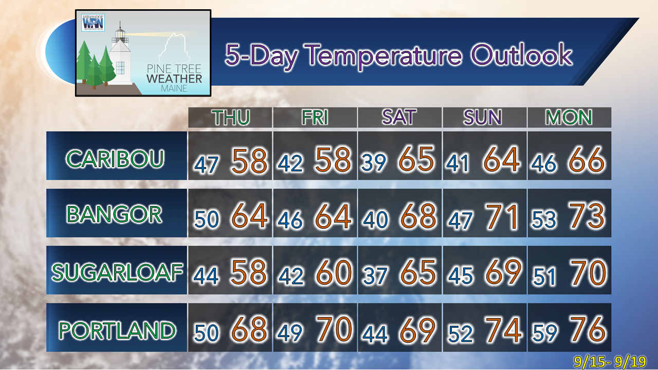 Thank you for supporting this community-based weather information source which operates by financial contributions from people like you. NEXT UPDATE: THURSDAY Stay updated, stay on alert, and stay safe! - Mike NOTE: The forecast information depicted on this platform is for general information purposes only for the public and is not designed or intended for commercial use. For those seeking pinpoint weather information for business operations, you should use a private sector source. For information about where to find commercial forecasters to assist your business, please message me and I will be happy to help you. |

Mike Haggett
|


