
|
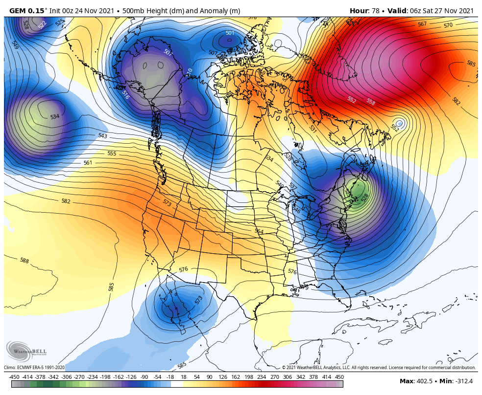
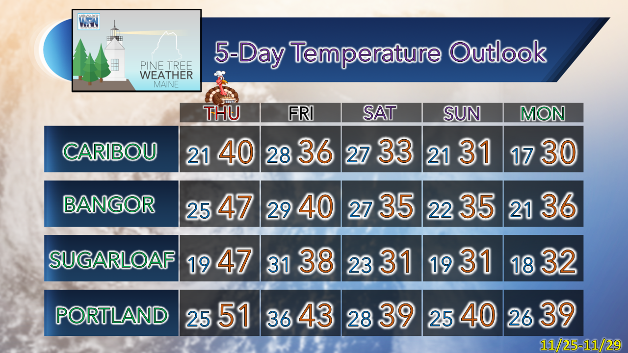
A quick update to start off to say thank you to my new Patreon monthly donors along with those who have contributed via VENMO. Looking at the tally through Tuesday, PTW is 70% funded for the year, for which I am most grateful. This is the third year that I have asked for donations to fund what I do here, and this is by far the best response, thanks to those who have stepped up. That said, I am short $900. If you have not contributed yet, please consider PTW with your annual holiday giving. You can click on the banner below or the DONATE page from the menu for details. Thank you for your words of encouragement, and for passing along to others what I do. A brisk Wednesday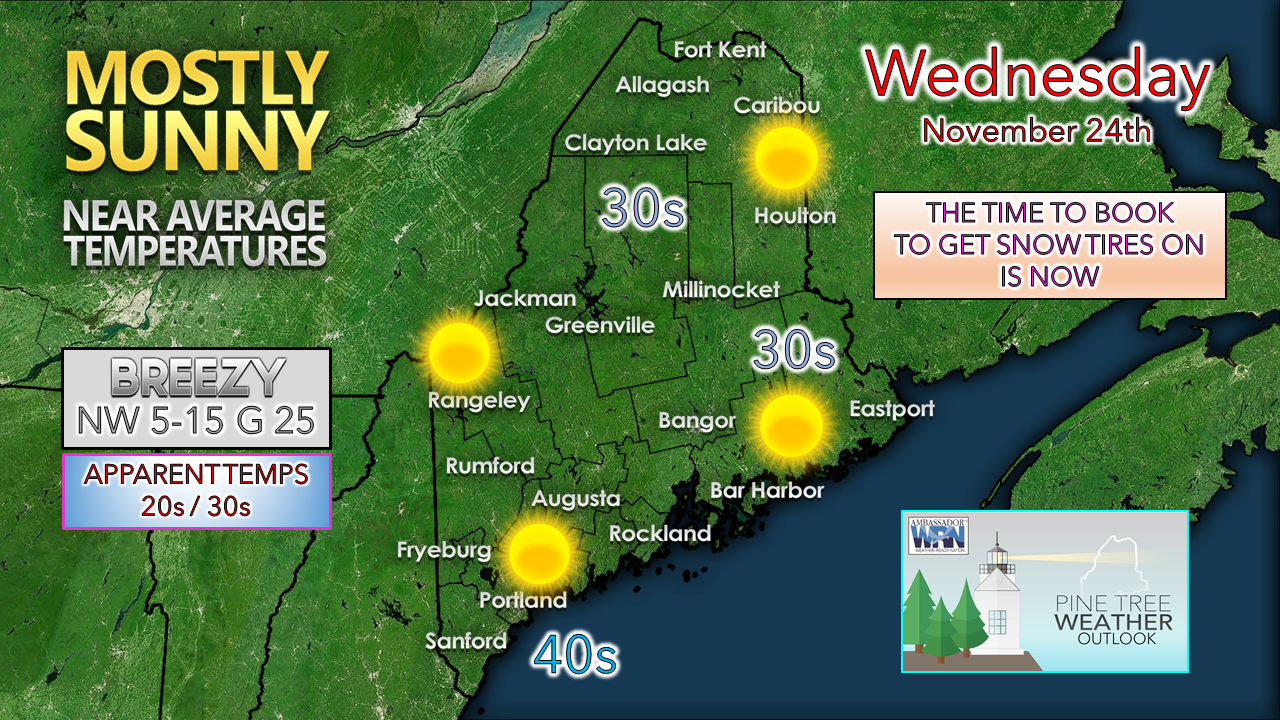 Another breezy day means apparent (feels like) temperatures will be 5-10° cooler than actual thermometer readings. Any morning clouds over the mountains and north clear out by midday. High pressure settles in, the breeze slacks off and cold night is on tap ahead of the holiday. I keep mentioning about snow tires. I've been saying periodically here that repair shops are booked solid. Since I am in the commercial vehicle end as my primary income, I talk to other repair facilities locally and in the northeast and they are booked solid, dealing with shortages on techs and parts. There are rumblings that when the first big snow hits that the new snow tire supply could evaporate quickly. The annual meeting of the summer tires club with the first widespread impactful storm could see several other gatherings over the course of the winter given the situation. For the procrastinators, it's time to get on the stick and book an appointment. A quiet Thanksgiving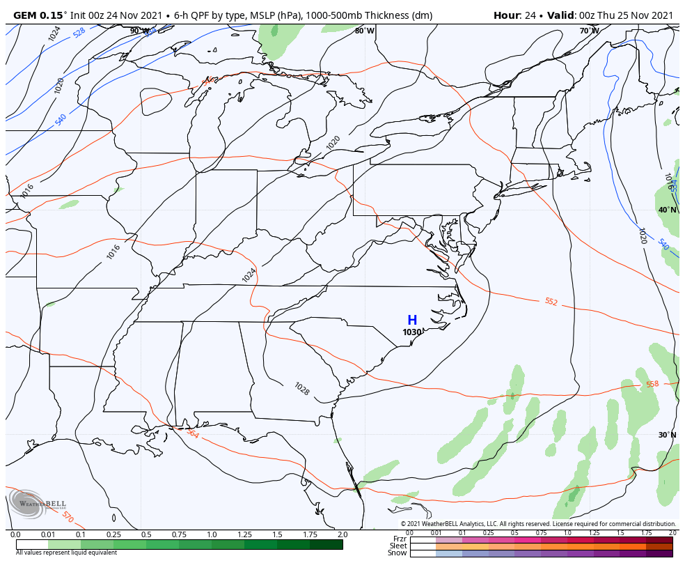 Wednesday 7 PM to Friday 1 AM - High pressure settles the wind and controls the holiday. The sky looks mainly clear. Temperatures warm up from the chill of the previous two days into the 40s and 50s. Our next storm organizes itself over the Great Lakes and approaches the region for Friday. Snow for interior areas for Black Friday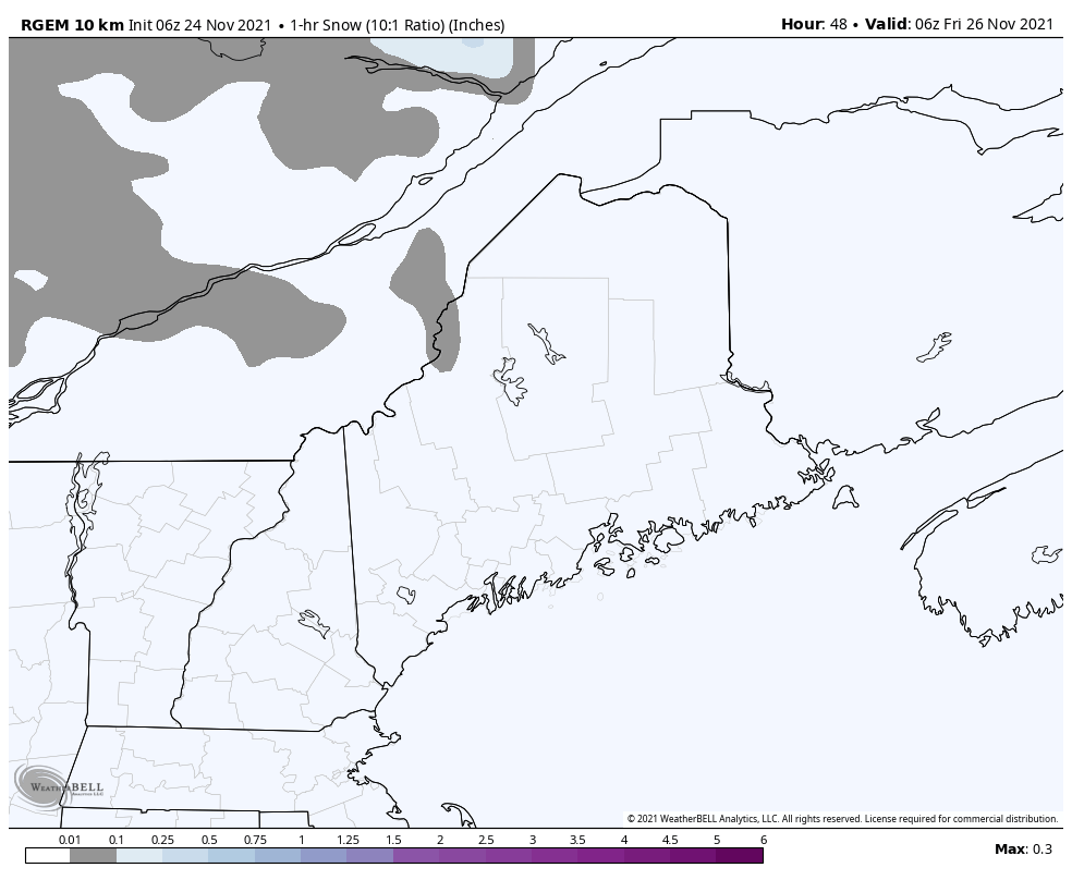 Friday 1 AM to Saturday 1 PM - This loop provides an idea of 1-hour snowfall accumulations. The mountains and north appear to be the chief benefactors of the frozen precipitation, with the coast deals with rain. There could be some mixing of snow and rain over the coastal interior on up into the foothills. Snow appears to be of the heavy and wet variety during the day, then loses water content and becomes drier and accumulate more heading into Friday night and early Saturday. 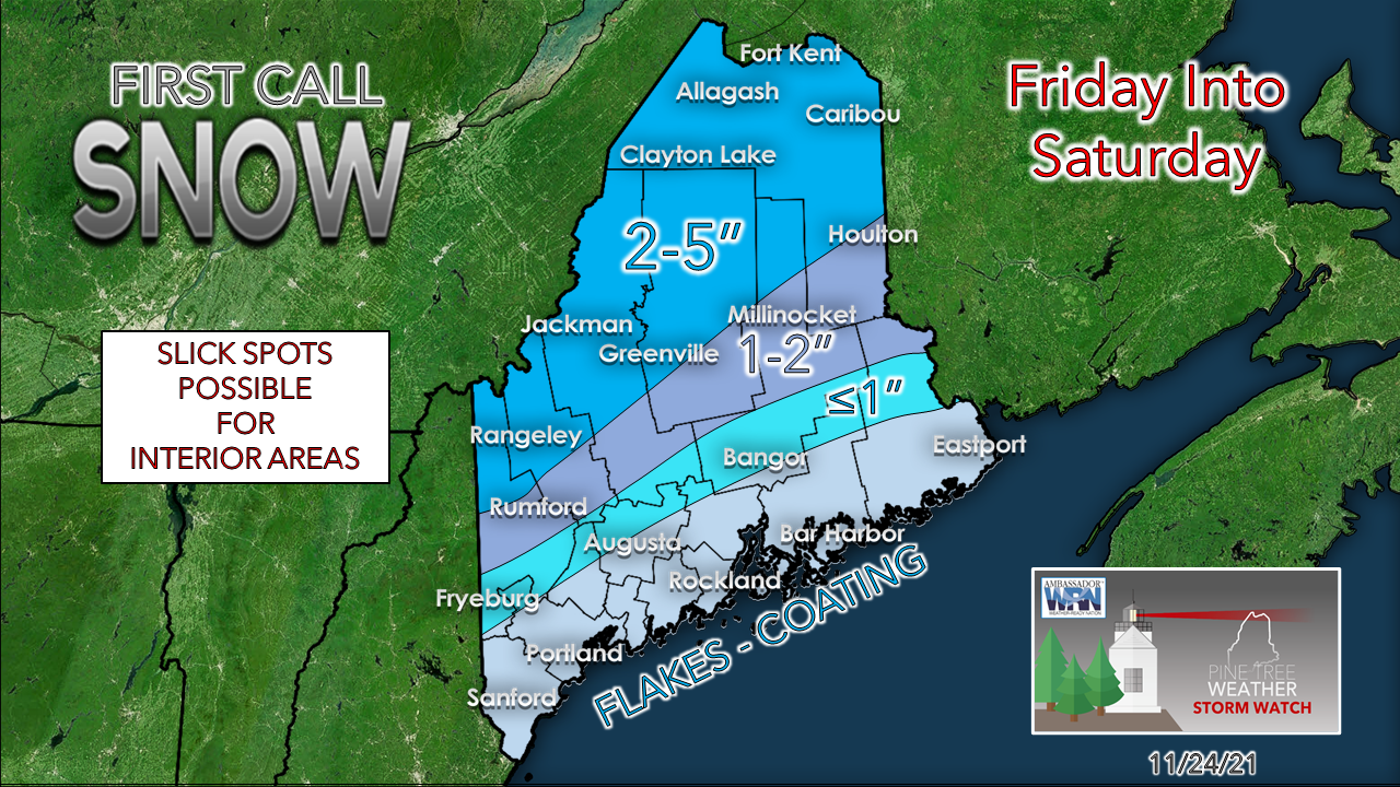 The first call for snow amounts shows the interior areas receiving a manageable amount to start off. Where I may make an adjustment is over eastern areas as models keep toying with an idea of low pressure forming over the ocean along the front. Timing and intensity will dictate whether snow amounts may increase there, but the jury is out on that thought for now. I will monitor and update on that.  Spurts of cold and chances for precipitation |
| | BE PREPARED WITH A NOAA Weather Radio. For $20-$40, it could provide vital information to you when you need it. The weather bands are standard on most public safety scanners, and newer scanner models. Weather radios can be programmed for auto alert. Click here for more information. |
| ► ► For the latest official forecasts, bulletins, and advisories, please check in with the National Weather Service in Gray for western and southern areas, or Caribou for northern and eastern parts of Maine. |  |

Thank you for supporting this community-based weather information source which operates by reader supported financial contributions.
- Mike

Mike Haggett
Kennebunk, ME
Weather-Ready Nation
Ambassador
Certified Weather
Forecaster
Penn State '21
American Meteorological Society
National Weather Association
SKYWARN-CWOP
Matthew 19:26
Please
Support
Pine Tree Weather
In 2024


Archives
July 2024
June 2024
May 2024
April 2024
March 2024
February 2024
January 2024
December 2023
November 2023
October 2023
September 2023
August 2023
July 2023
June 2023
May 2023
April 2023
March 2023
February 2023
January 2023
December 2022
November 2022
October 2022
September 2022
August 2022
July 2022
June 2022
May 2022
April 2022
March 2022
February 2022
January 2022
December 2021
November 2021
October 2021
September 2021
August 2021
July 2021
June 2021
May 2021
April 2021
March 2021
February 2021
January 2021
December 2020
November 2020
October 2020
September 2020
August 2020
July 2020
June 2020
May 2020
April 2020
March 2020
February 2020
January 2020
December 2019
November 2019
October 2019
September 2019
August 2019
July 2019
June 2019
May 2019
April 2019
March 2019
February 2019
January 2019
December 2018
November 2018
October 2018
September 2018
August 2018
July 2018
June 2018
May 2018
April 2018
March 2018
February 2018
January 2018
December 2017
November 2017
October 2017