
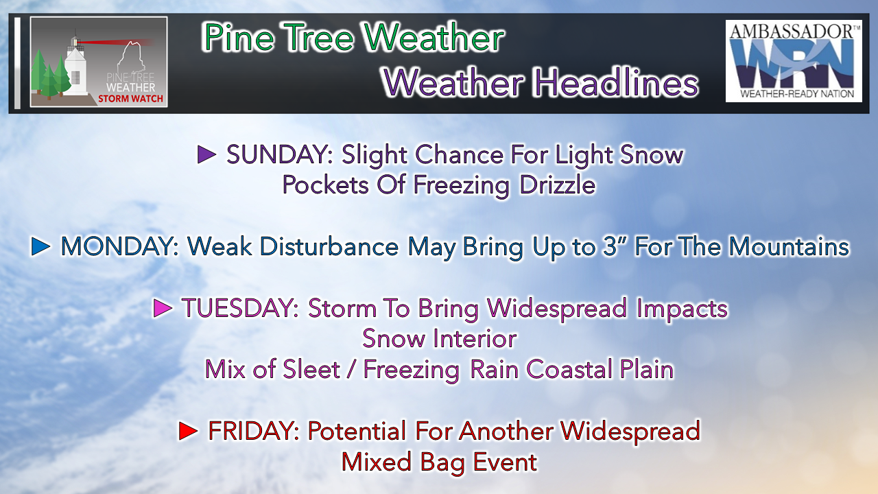
 If you love winter, this is your week. It appears to be a good start of the week for snow for the mountains. Sunday will be hit or miss for snow showers or freezing drizzle pockets, with the best chance over southwestern areas. Monday is iffy also, pending on dynamics. It may be flurries, or it could be a couple of inches for the mountains and not much elsewhere. Tuesday is complicated, which I will get into. I am just going to mention potential for Friday, but I am not going to get into that until midweek as it is too far out to get into specifics on that. Time to buckle up and get into it. Tuesday track determines who gets what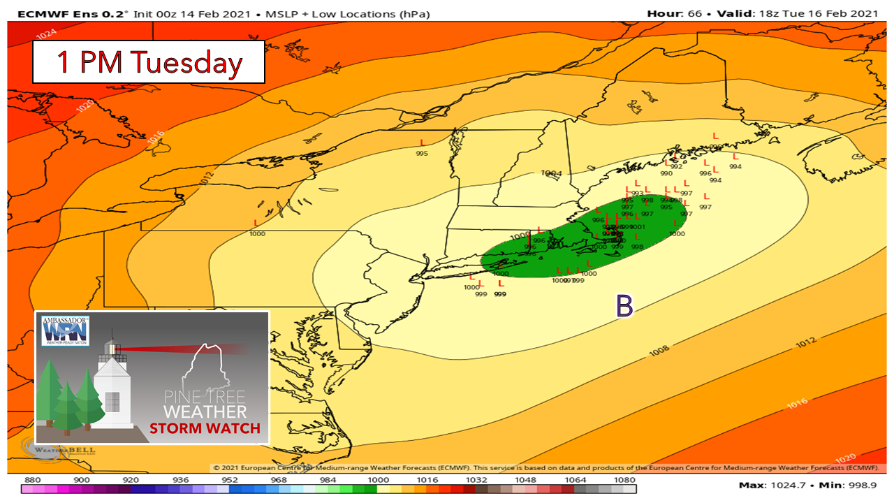 One of the things forecasters look for is consensus, and this chart brings it. The European idea here for the positions of low pressure for 1 PM Tuesday shows the storm well inside of the benchmark "B" 40°N / 70°W point, so that is the first indicator of snow for interior and mix potential for the coastal plain. The question at this point is how far inland does the mix get. 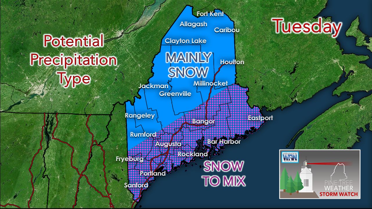 My idea for now has the mountains and north staying snow and snow to start, with mixing to come into play for the coastal plain. A closer track to the coast means the mix line goes further inland, a track more southeast into the Gulf of Maine brings snow into the foothills and interior Washington County. I am going to present two potential outcomes here to show where track is everything in determining potential precipitation type. These loops run from midnight Tuesday to midnight Wednesday: 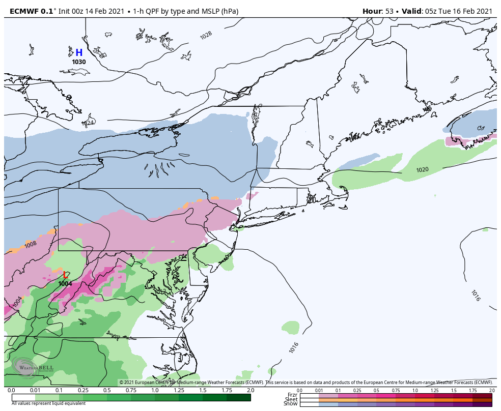 The European deterministic idea from 00z/7PM Saturday shows the track that is more southeast into the Gulf of Maine, and thus snow to start everywhere, then the chance to freezing rain and sleet for the coastal plain, with snow hanging on over interior areas. There is potential for a flip back to snow on the backside of the storm as it exits into the Canadian Maritimes. 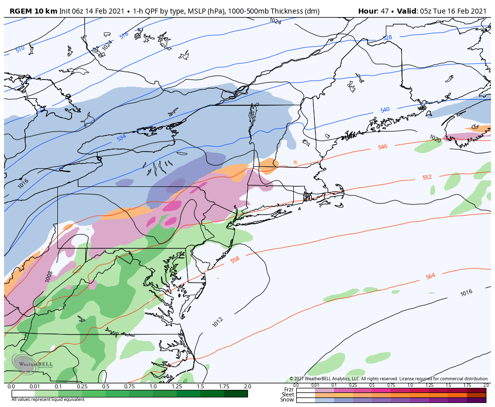 The Canadian RGEM short term idea shows a warmer solution, with a shoreline hugging track. In this case, it is snow to sleet for the western mountains, a straight ice / sleet event with no snow at all for the coast, and straight snow for northern areas. 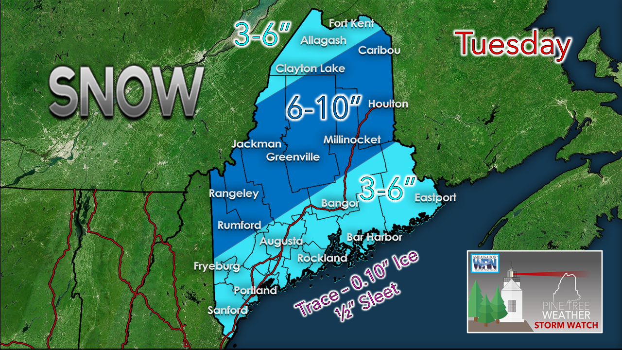 My first call on snow potential sticks with the cooler scenario with at least some snow to start off everywhere. Ensemble ideas have not abandoned that idea to this point, and I can't write it off. I think the majority of the interior ski hills stay mainly snow, or get a good dose of it before a flip if the storm track does hug the coastline. Word to the wise moving the frozen precipitation for this one along the coastal plain is to wait if you can as there as a crust may form on top of the snow, making it easier to clean up with less use of snow melt. I will monitor this and update on timing and amounts Monday morning.. 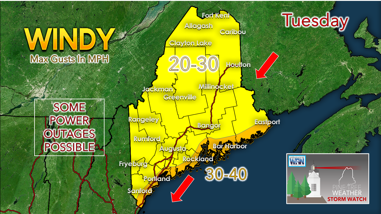 With the developing storm comes the wind. I don't expect anything too crazy for power outages at this point as the wind speeds appear to stay below advisory level. There is the potential for pockets of wet snow, along with icing, so that will depend on where and how much. A coastal hugger means winds in the 30-40 mph could move further inland. Make sure the storm supplies are stocked just in case.  Use mPING to report your weather! Check out mPING (Meteorological Phenomena Identification Near the Ground) project. Weird name, cool app! You can report the type of precipitation you see where you are. No need to measure! Use the free mobile app to send reports anonymously. Reports are automatically recorded into a database, which improves weather computer models. The information is even used by road maintenance operations and the aviation industry to diagnose areas of icing. mping.nssl.noaa.gov Temperature outlook through Saturday 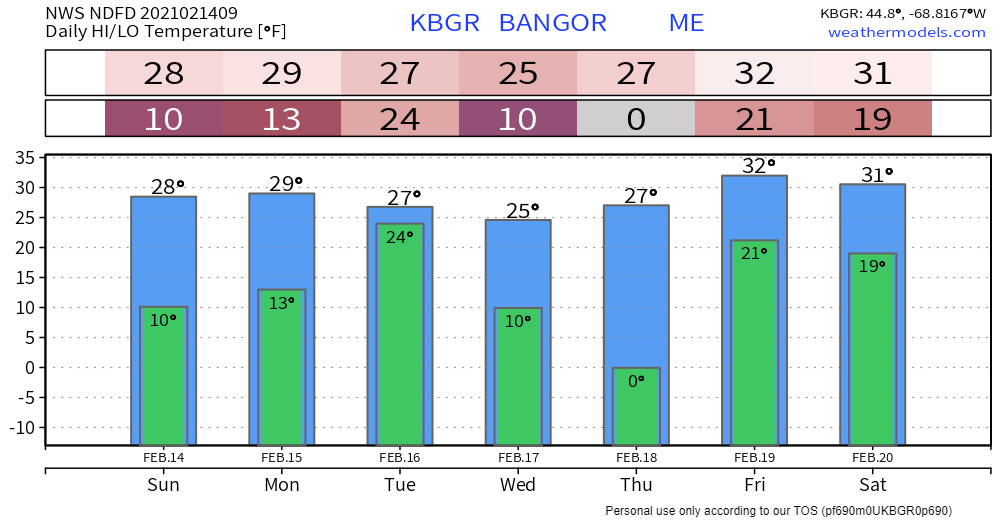 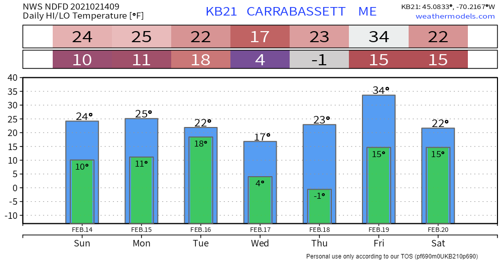 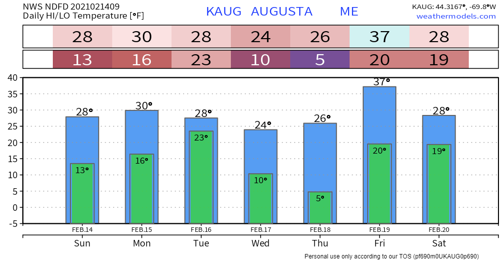 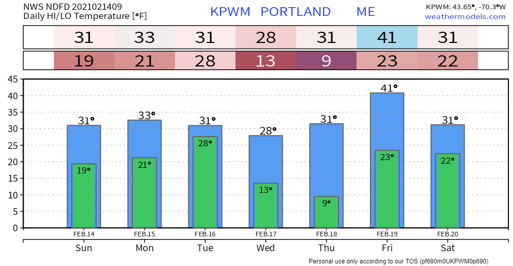 Be prepared to receive alerts and stay updated!
For more information in between posts, please follow Pine Tree Weather on Facebook and Twitter.
Thank you for supporting this community based weather information source which operates by reader supported financial contributions. Stay updated, stay on alert, and stay safe! Thank you as always for your support! - Mike |

Mike Haggett
|


