Steady rain early in the north, severe potential for the coast of Maine on Wednesday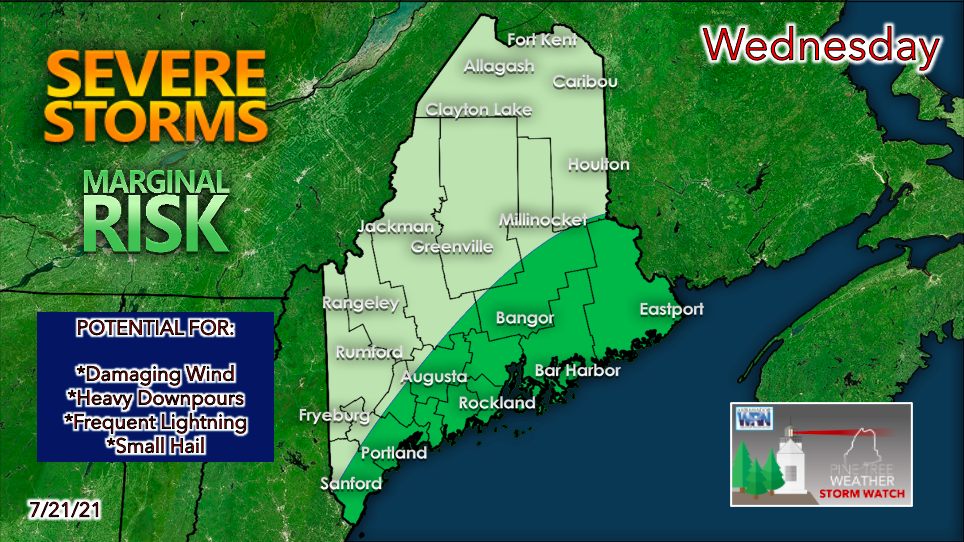 Northern Maine may see some significant rainfall on Wednesday as a system originating in the Great Lakes makes its way through the area. The heaviest precipitation will likely fall during the morning hours with showers lingering during the afternoon. For those in the southern half of the state, the threat of strong to severe thunderstorms returns on Wednesday. An upper-level disturbance and an associated surface low is expected to cross over our region, providing a spark for convective activity. Cooler air aloft, combined with ample moisture and strong vertical wind shear should lead to an increasingly unstable atmosphere throughout the day. The Storm Prediction Center has the entire coast and nearby areas of Maine under the MARGINAL risk category for severe weather. This means that there is a potential for isolated thunderstorms to develop containing heavy downpours, damaging winds, hail, and even a tornado. 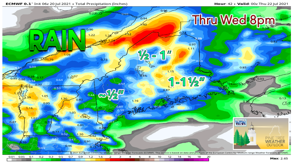 Between the first round of rain in the north and the later storm potential in the south, the entire state of Maine has a chance of seeing measurable precipitation on Wednesday. Certain areas could see upwards of an inch of rain over the course of the day. Localized heavier amounts are possible in locations hit by strong thunderstorms. Shower and thunderstorm activity should begin to taper off during the evening as the low-pressure system exits off into the Canadian Maritimes and the atmosphere stabilizes. Hazy skies due to western wildfires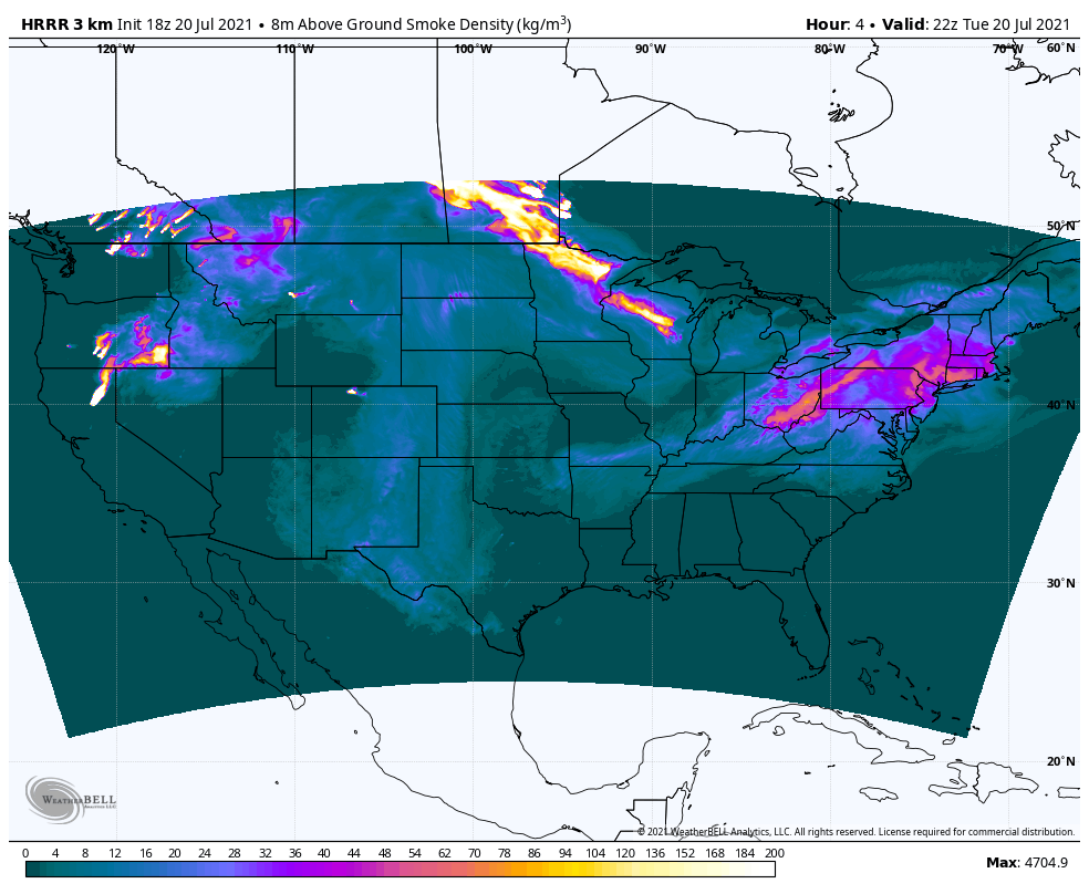 Smoke from wildfires originating in the western United States and Canada has traveled thousands of miles away to New England. This smoky air can result in a hazy look to the sky and can also lead to poor air quality. These effects are most likely to be felt by sensitive groups, which includes children, those with asthma, those with heart and lung conditions, and the elderly. For Tuesday evening, it appears that much of the above-ground smoke is to our west, but there are some elevated areas in western Maine. Smoke density begins to improve overnight lasting through Wednesday. Mostly dry on Thursday, showers for Friday with a pleasant weekend likely Thursday appears mainly dry and comfortable for most as dew points hover around the 50s. Clouds are expected to build during the afternoon, with a very slight chance of showers in the mountains and northern areas. High temperatures on Thursday will likely be below-average with most areas reaching the 70s. The southwest interior and coast have a chance of seeing 80° with enough sunshine, but will otherwise be in the high 70s. 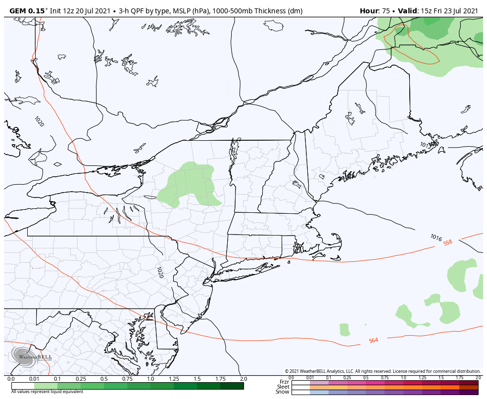 This model begins late Friday morning and takes us through the weekend. It appears that showery weather is possible Friday afternoon into the evening. Surface high pressure looks to be in store for Saturday, keeping the day dry. Sunday also begins dry before a low-pressure system approaches from our west bringing the potential for precipitation late Sunday night into early Monday. More details on rainfall amounts and timing will be discussed later this week as forecast confidence grows. Wildfire Air Quality Predictions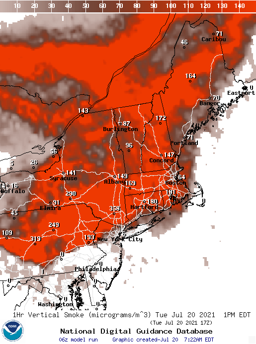 During wildfire season, visit airquality.weather.gov to get hour by hour predictions of wildfire smoke and other pollutants for your area. Temperature outlook through MondayTemperatures appear mostly pleasant for the next week, hovering around normal to slightly below-average. Extreme heat does not look to be a risk in the short term. 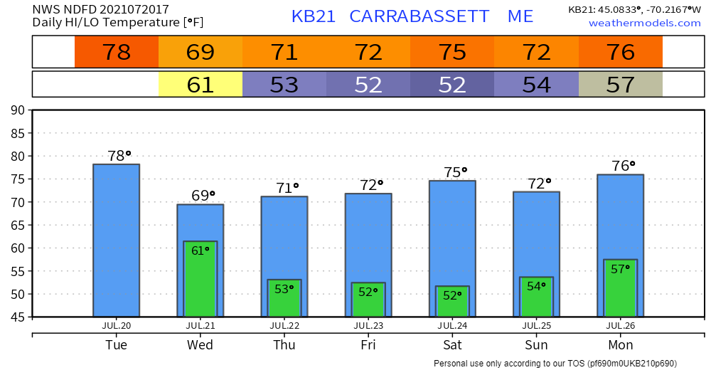 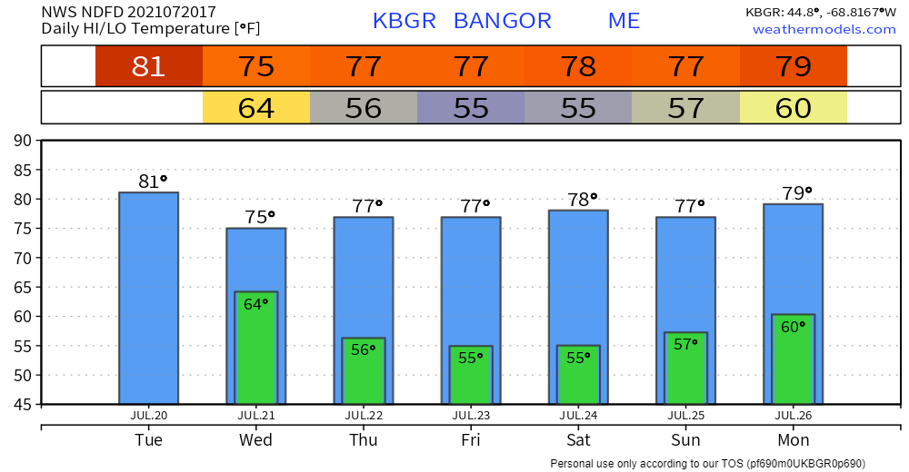 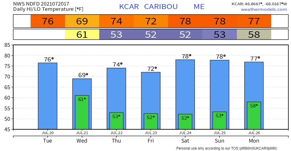 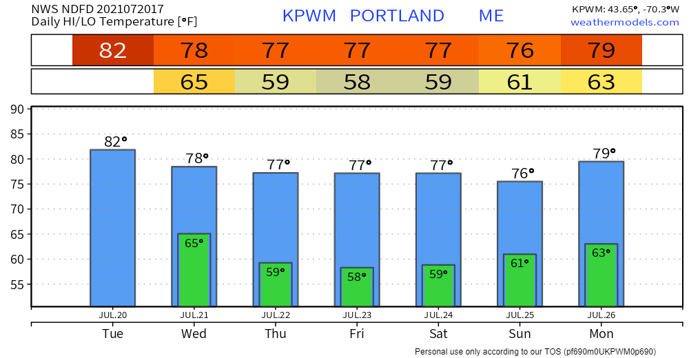 Be prepared to receive alerts and stay updated!
For more information in between posts, please follow Pine Tree Weather on Facebook and Twitter.
Thank you for supporting this community-based weather information source which operates by reader supported financial contributions. Stay updated, stay on alert, and stay safe! |

Mike Haggett
|