
|
Welcome to November! Or is it mid-September? Looking at the highs and lows statewide over the next few days, there is significant disagreement between what the calendar says and what the weather will be like climatologically speaking. The upside of the warm temperatures is less dependent on heating, which we can all save a few bucks there. It's looking more and more like a late start to winter, which hasn't been anything new over the past several years. Weak frontal boundary passes through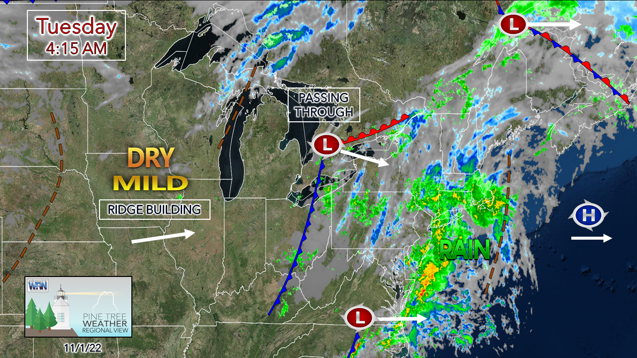 A weak trough passes through the area on Tuesday. High pressure to the southeast is holding dry air over the region, which will make it tough for the atmosphere to produce any rain of value. A ridge building over the Midwest heads northeast and will control our weather through the weekend and into next week. 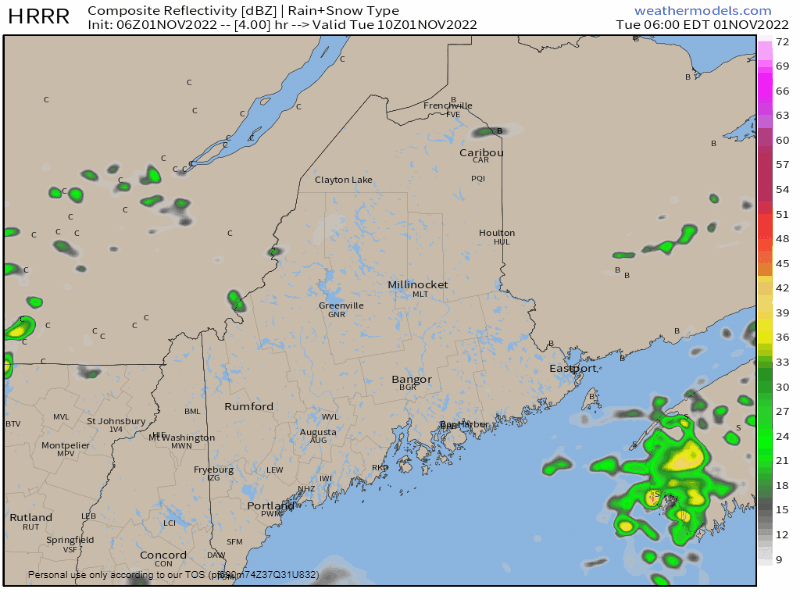 Tuesday 6 AM to Wednesday Midnight - The best chance for rain for the day will be in the mountains, and that is a slight chance at best. A sprinkle or a quick smatter of rainfall is all that can be expected from this. Most places may not even get that. 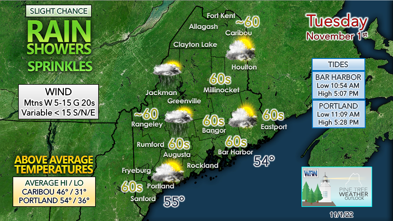 The sun pokes out as the weak boundary moves east. Another mild day with temperatures 10-15° above normal on both the high and low end. The mountains could see the wind pick up a bit as the front slides through. For those who want to get out for an oceanside stroll, the tide is favorable for much of the day until sunset. With the Gray radar down until next week, if you see weather happening, please report it! 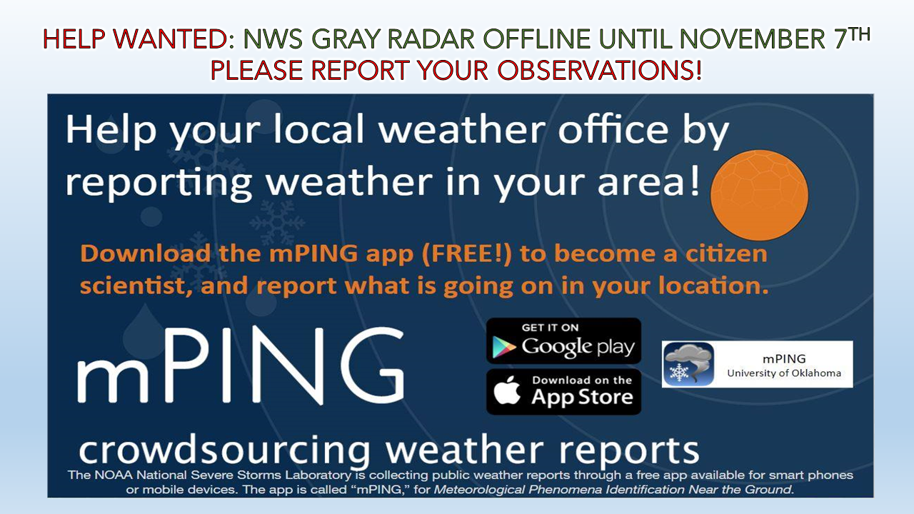 SKYWARN sessions begin Tuesday & Wednesday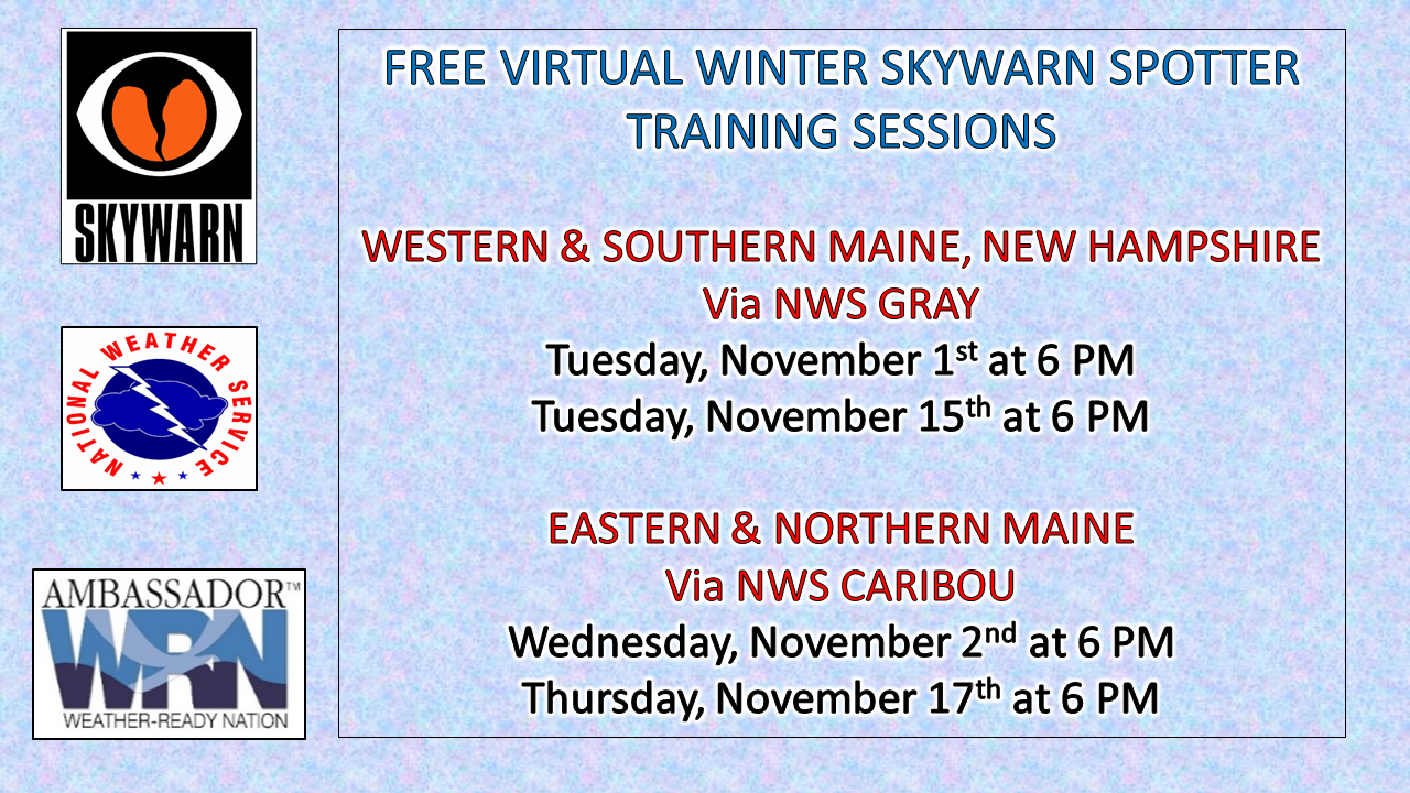 LINKS TO REGISTER: For western and southern Maine and New Hampshire, please register with NWS Gray. For eastern and northern Maine, please register with NWS Caribou. These are fast paced, fact-filled, and informative sessions for weather enthusiasts ages 16 and up, younger is good with an adult present. These sessions are completely FREE of charge. If you aren't sure which office to sign up with, please leave a comment on Facebook or send me a tweet. Outlook through the weekend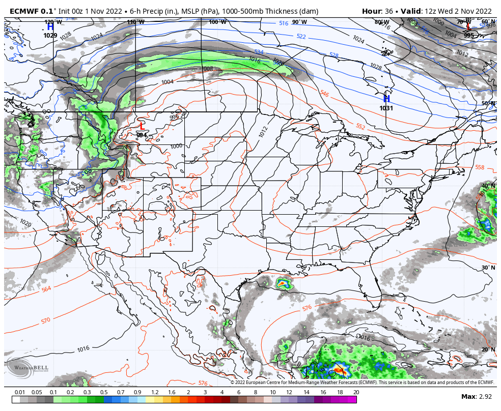 Wednesday 8 AM to Sunday 8 PM - High pressure moves in midweek and brings a breezy northwest wind. With dry conditions, low dew points and the air flow runs the risk of fire danger. Please hold off on any brush burning, and check with your local fire department or forest ranger for burn guidance. The high sets up shop and stalls just to the east over the Gulf of Maine and shifts the wind direction to the southwest on Thursday. Coastal areas can expect a bit of a breeze off the water through the weekend, with Sunday the breeziest of the stretch. A Colorado Low is expected to form late week and spin up a strong storm running up against the ridge over the weekend that tracks into northern Quebec. Other than the potential for a shower or two for the mountains and north Sunday, no rain is expected throughout the period. Some areas may see temperatures in the 70s on Saturday and Sunday. Don't put away the flip-flops just yet! 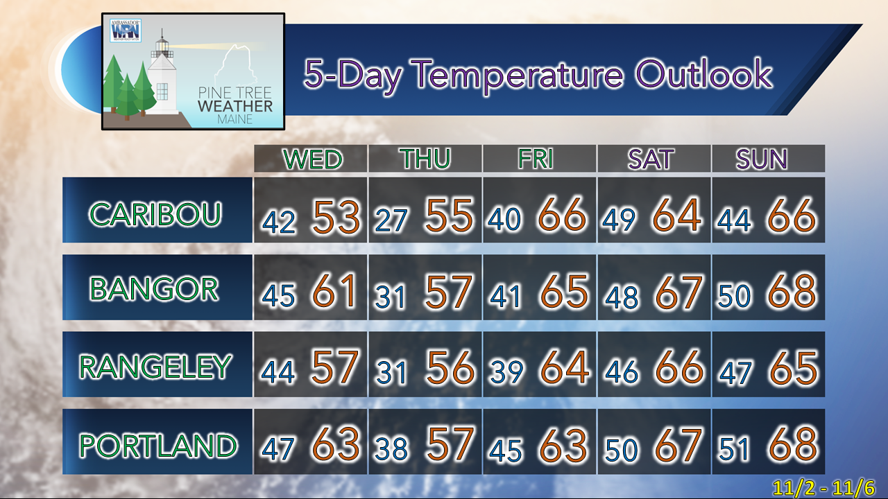 Please support PTW in its 11th year! NOTE: The forecast information depicted on this platform is for general information purposes only for the public and is not designed or intended for commercial use. For those seeking pinpoint weather information for business operations, you should use a private sector source. For information about where to find commercial forecasters to assist your business, please message me and I will be happy to help you |

Mike Haggett
|


