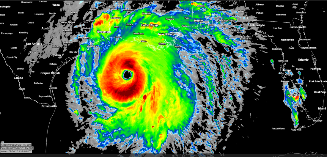
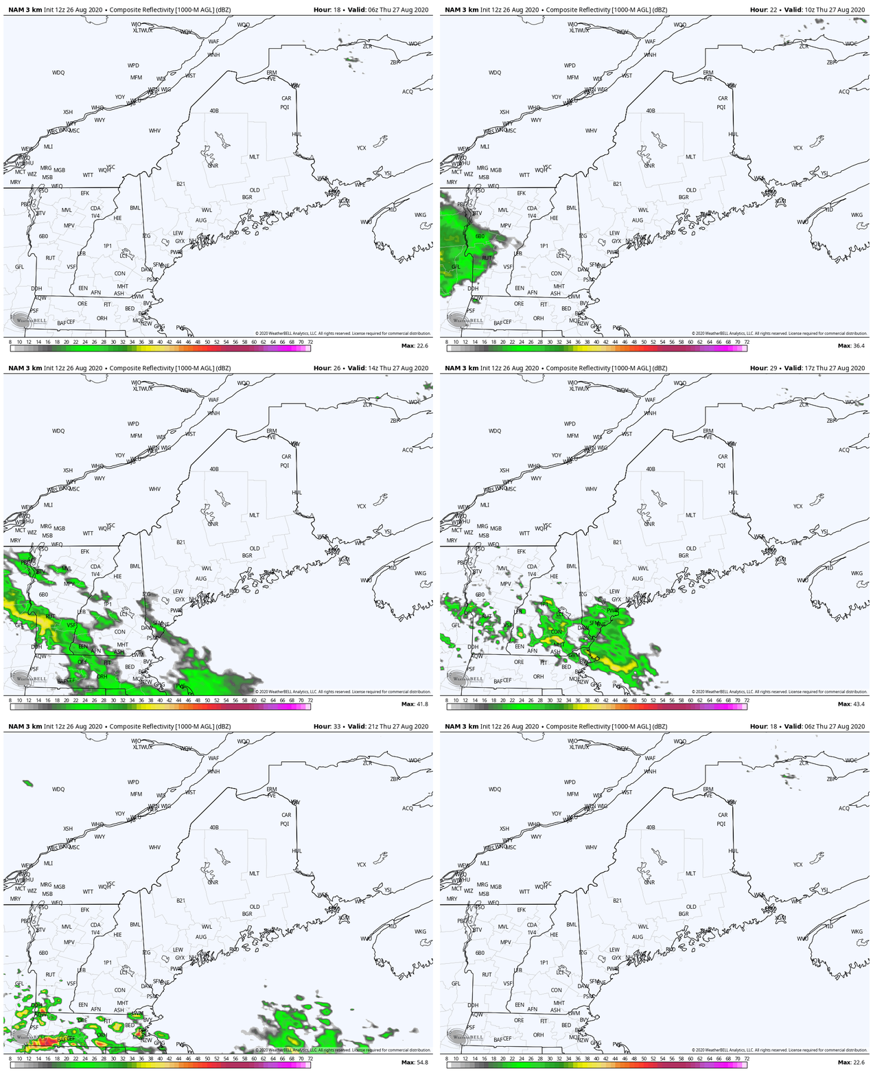
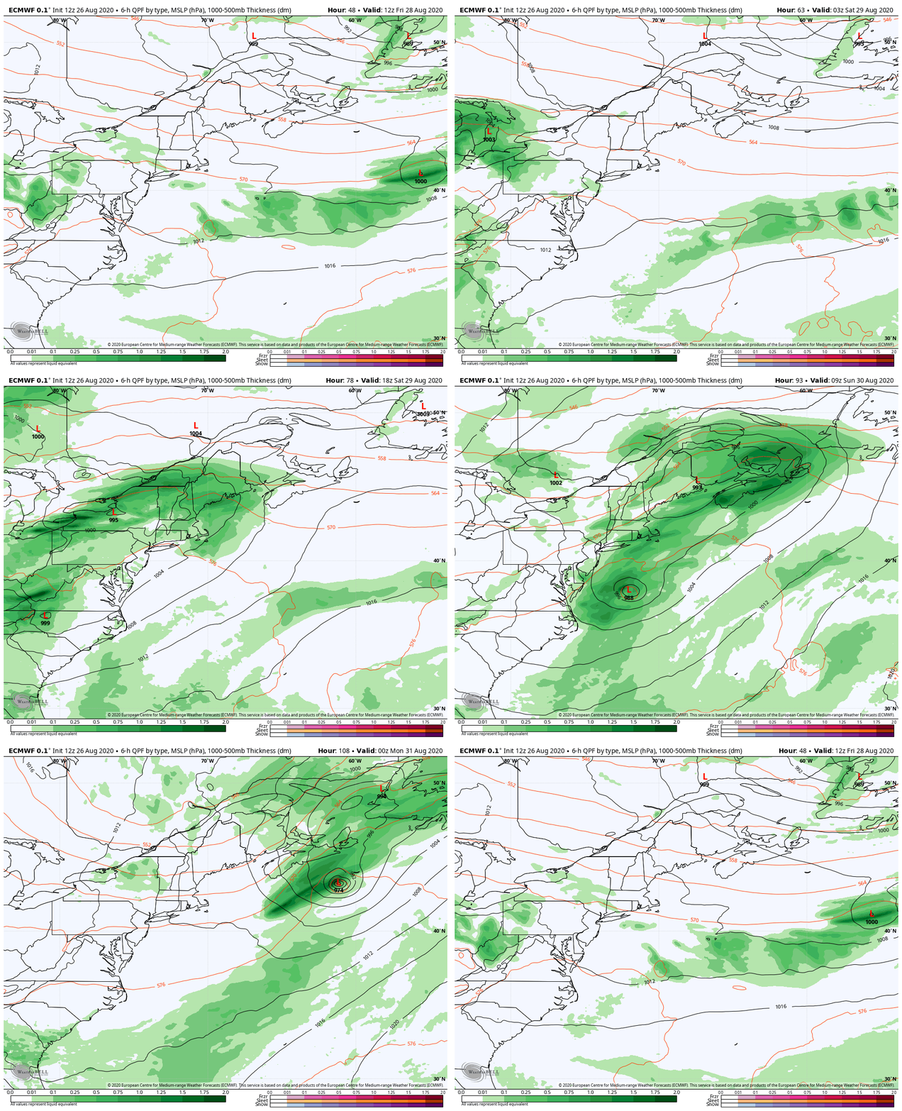
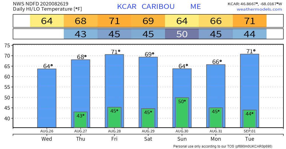
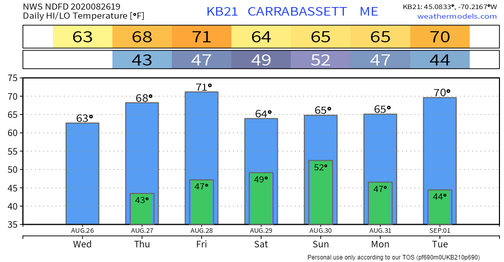
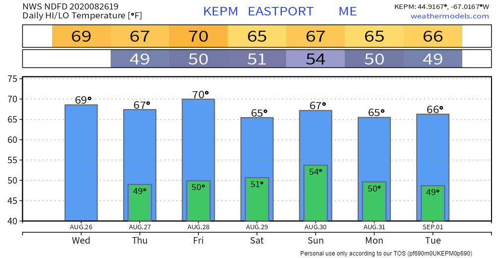
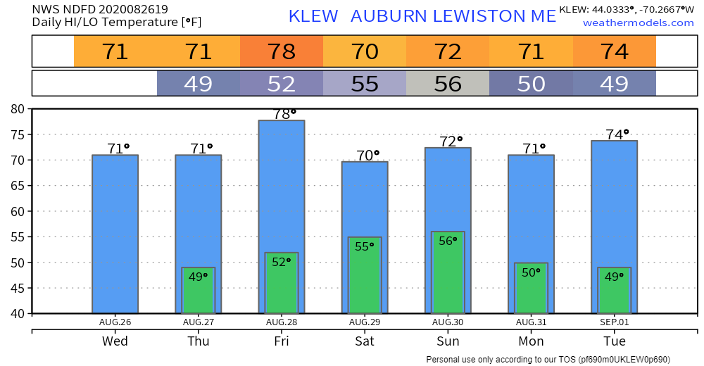
Hurricane Laura to leave lasting impactsSince I started my journey into forecasting, I've seen these monsters develop. The weather nerd in me is fascinated by them. The empathetic part of me sees what is going on with a lump in my throat. With the oodles of forecast and observational data available, it can be overwhelming. At the time of this post, reports were coming in that folks were trapped in the bayous of Louisiana from the rising water from the storm. A storm surge of 15-20 feet or more with waves 40-50 feet will bring catastrophic damage to the southwest Louisiana / southeast Texas shoreline. The geography is going to change. Lives are likely to be lost from those who decided to ride it out. It's sobering to watch. I pray for everyone in the area, and for those who have family or friends there. For the latest, check with the National Hurricane Center. Outlook through the weekendSouthern parts of the state will be on periphery of a ridge to the southwest. An area of convection associate with low pressure brings showers and potentially a thunderstorm over southern parts of the state Thursday morning into early afternoon. Best chance for that will be roughly Fryeburg to Portland south. Further to the south and west, it could be rough afternoon over western Massachusetts into Connecticut with severe storms with potential tornadoes. For us up here, the worst appears to stay away from the state. A weak area of high pressure passes through the region Friday. An area of low pressure over the Great Lakes moves into the region for Saturday. While this is going on, the remnants of Laura moves eastward across the Mid-Atlantic. Given the northern jet stream meeting the southern jet stream and the timing of it, it appears Laura stays well to the south. What is not clear is how much additional moisture may inject into the northern stream with this interaction. It's looking good that most of the state could pick up 1" of much needed rainfall from the system right now. There will be a better idea to come how this will all play out. For Sunday, showers appear to start the day and taper off during it over northern and eastern areas. Southern areas may see an early shower, before dry conditions take over. Temperature outlook through early next week
For more information, please follow Pine Tree Weather on Facebook and Twitter.
Thank you for supporting this community based weather information source that is funded by your financial contributions. Stay updated, stay on alert, and stay safe! - Mike |
Mike Haggett
|

