
Chances for light precipitation in areas through Friday; snow possible Saturday into Sunday1/2/2020 Happy New Year to everyone! I am starting off January with some sort of a stomach bug, which may impact the frequency and content of my updates. I've been up most of the night. Hopefully I can kick this soon as the saying goes, "I ain't got no time for that". If I am quiet here, check Facebook or my Twitter in case I drop something in there. Light snow possible north Thursday Thursday features varying amounts of clouds and chance for some snow showers or flurries for the north country today. Temperatures will be above normal with most areas reaching the 30s for interior areas and 40s for the southwest coast. Thursday night, cloud cover keeps overnight lows above normal as well, with widespread 20s, a bit cooler in the far north, and a bit warmer south. Light rain showers / ice possible Friday Friday sees a chance for some light rain showers and perhaps a slight risk for light freezing rain over the western foothills. Ice accretion may be a trace, and at this point does not appear to cause any concern. High temperatures are expected to reach above freezing for most locations with 30s and 40s. Clouds once again keep temperatures above normal with lows around 30 for most, upper 20s north. Coast has the best chance for snow SundayAs time goes along, I am finding that I am losing faith in long term model ideas (beyond 4 days) and seriously questioning guidance even 36, 24, or even 12 hours ahead of a storm. This weekend event has gone from mostly rain to a snow/mix, to snow, to a chance for snow, all within the past two days. This is irritating, and in some cases, unnerving. The recent performance of storms in December has me through the caution flag up and want to challenge models and their ideas. While deterministic models show one thing, ensembles show another. 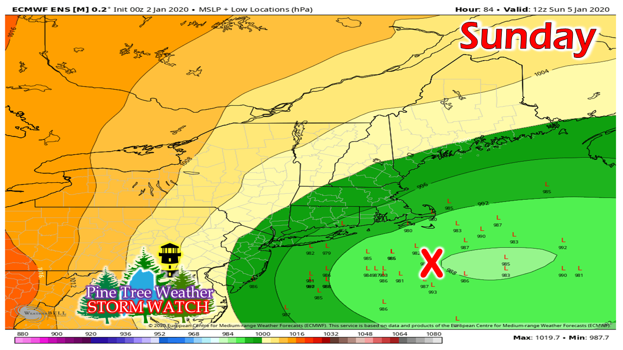 Cold air returns on Saturday as a weak front passes through. This is not the deep cold that gets me excited for a big snow event for the coast. It will be this front and the position of it which determine the track of what happens with this one. In this chart, this is the European ensemble idea for low pressure positions Sunday morning. That big red X is the benchmark location (40° N / 70° W) which helps determine snowstorms with cold in place for winter. While the ensemble mean is east of that, there is a fair amount of ensembles further west, and north of that point. The further north, a better chance for coastal mixing. Further west indicates the chance the storm may slow down forward progress. which presents an assortment of other forecast challenges, if that happens. I am going to show you three different sets of LIQUID equivalent ideas to get the complete picture. Because deterministic models flip/flop like pancakes in a diner, ensembles are a safer bet to figure out trends and potential outcome. These are 72 hour totals through 7 AM Monday: 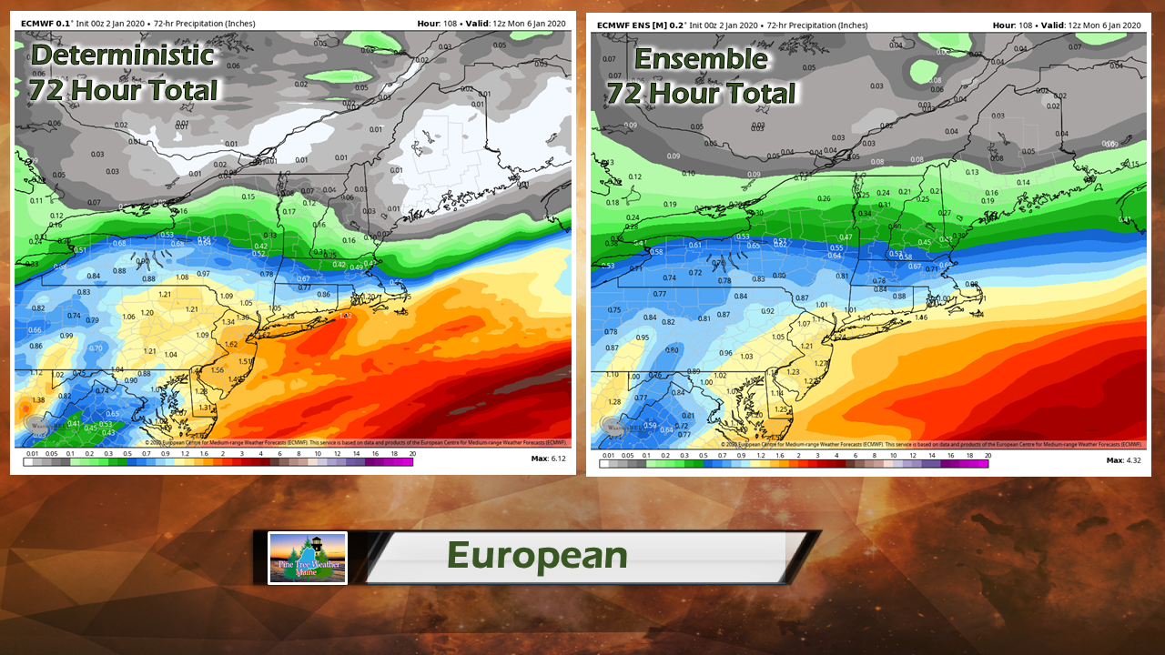 In this case, the deterministic European model idea shows hardly any liquid, and with hardly any liquid, there is very little snow. The deterministic run has been consistent over the last two runs. But wait, the ensemble shows a bit more moisture to work with. Northern areas may see flakes, western and eastern areas may pick up an inch or two of snow, and Fryeburg / Portland south may see 2-5" based on this idea. 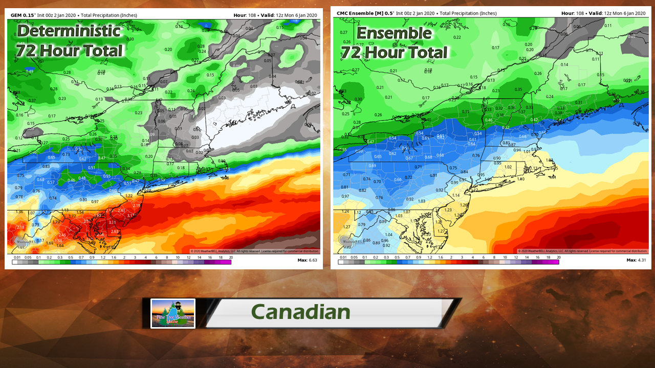 The Canadian idea is similar to the European idea. It's a bit juicier with the weak wave on Saturday and further south with the storm track on Sunday with its deterministic idea. The ensemble idea is juicier as well, with a decent 2-5" snow for western and eastern areas, and a 4-8" snow for southern areas. 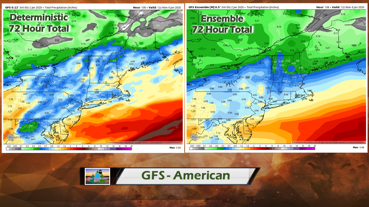 The GFA idea is very juicy with the deterministic output, which would bring potentially a foot of snow for southern areas, a good 8-12" over central areas and a sharp cut off to the north. The ensemble paints a much different picture, and looks very similar to the Canadian ensemble idea with 2-5" for eastern and western areas, and 4-8" for southern areas. So you think forecasting is easy? The only area that has a sensible chance for snow at this point is southern areas. Western and eastern areas should stay tuned. Northern areas may see some light accumulations, but may sit this one out. Stay tuned. ► ► For the latest official forecasts, bulletins and advisories, please check in with the National Weather Service in Gray for western and southern areas, or Caribou for northern and eastern parts of Maine. Almost funded! ► ► $85 shortfall for the year ahead! You can help keep Pine Tree Weather going with a donation of ANY amount now through VENMO @PineTreeWeather, a monthly donation on Patreon or messaging me on Facebook or Twitter to send a check in the mail. Thank you for your support!
For more information from me, please check the Pine Tree Weather Facebook page as well as my Twitter feed. Always stay weather aware! - Mike |

Mike Haggett
|


