 Bundle up for Tuesday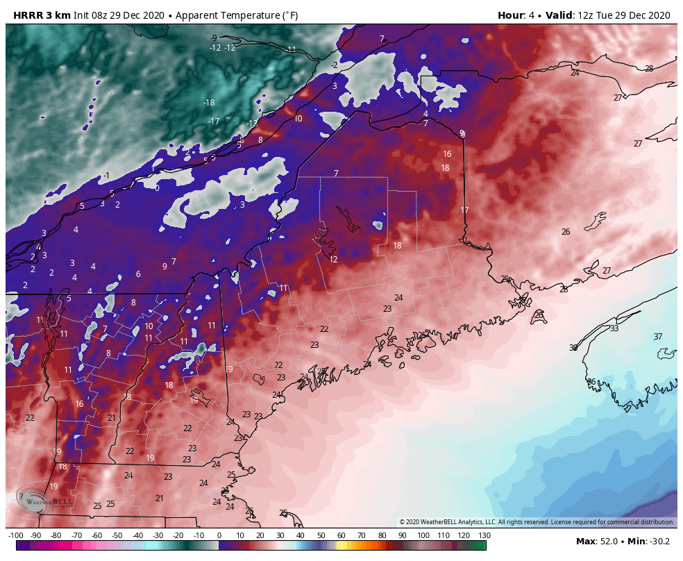 HRRR model idea of apparent (feels like) temperatures from 7 AM to 7 PM Tuesday As you head out the door Tuesday morning, enjoy the "feels like" high temperature of the day as it heads downhill into the evening. Wind chill indices fall below zero for the mountains and north by evening, with teens along the coast. A gusty west / northwest wind at times could reach 20-30 mph through tonight settles in most areas by Wednesday morning. A bit of snow on the way Wednesday night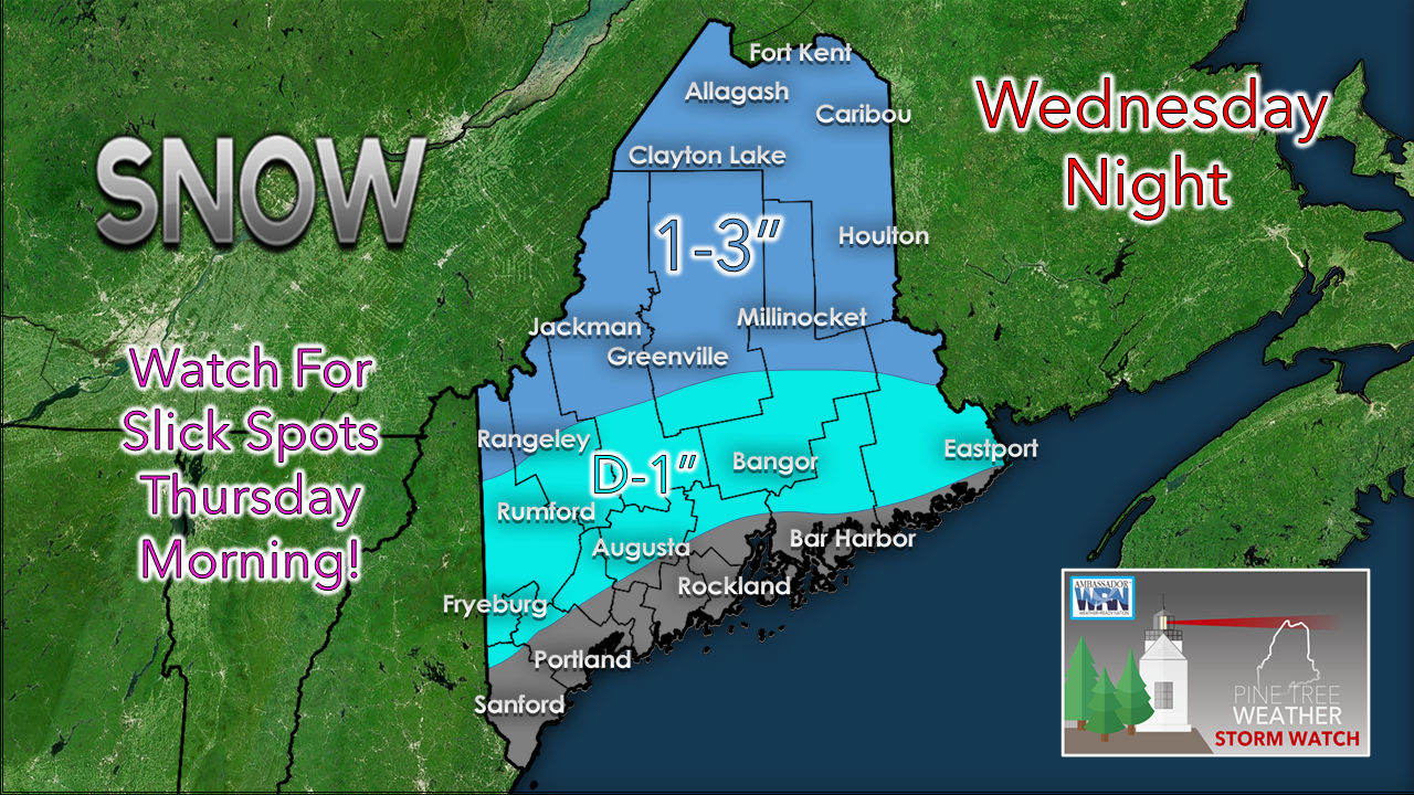 Wednesday stays mainly precipitation free until late afternoon as a warm front noses in from the southwest and touches off snow showers over northwestern areas of The County and then gradually spreads out overnight as a cold front approaches from the west. The plows may be needed over the mountains and northern areas, and a salting may be warranted over western, central and eastern areas. This is a quick mover, appears over and done by around daybreak Thursday morning. Odd set up for the Saturday storm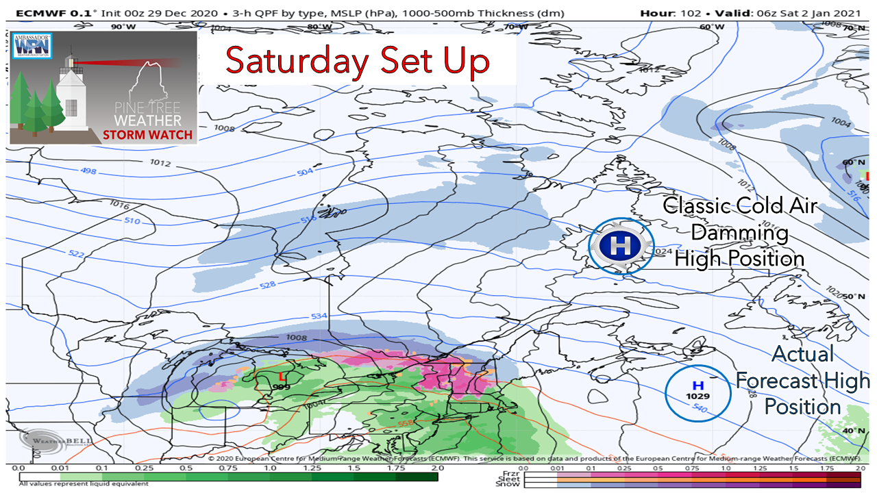 High pressure moves into the region New Year's Eve into New Year's Day. That slides to the east late New Year's Day. An inside runner moves into the Great Lakes and the precipitation shield enters Maine New Year's night into early Saturday morning. As I have articulated on the chart above, this is a different set up for a cold air damming situation. In the classic case, the high is centered over Labrador which allows of arctic air to bleed into the state and set up freezing rain problems for the interior. The strength of the high in this case is south of Cape Breton Island. The positive of that is the cold is not as strong as it could be, which any period of icing appears reduced. 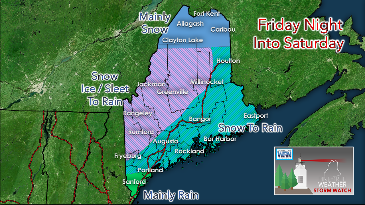 For most areas, it starts as snow. For the western foothills, mountains on up into the Great North Woods, it appears to chance to a freezing rain / sleet mix, ending as rain Saturday afternoon. For central and eastern areas, it appears to from snow to rain, and for the southwest coast and far southern areas, a mainly rain event. For the far north, this appears to be a mainly snow event for now. I do not expect any big problems from this event. It is more a travel concern than anything. Temperatures appear to climb above freezing for all but the far north. Timing and more details to come on this as it gets closer.  The science of wind chill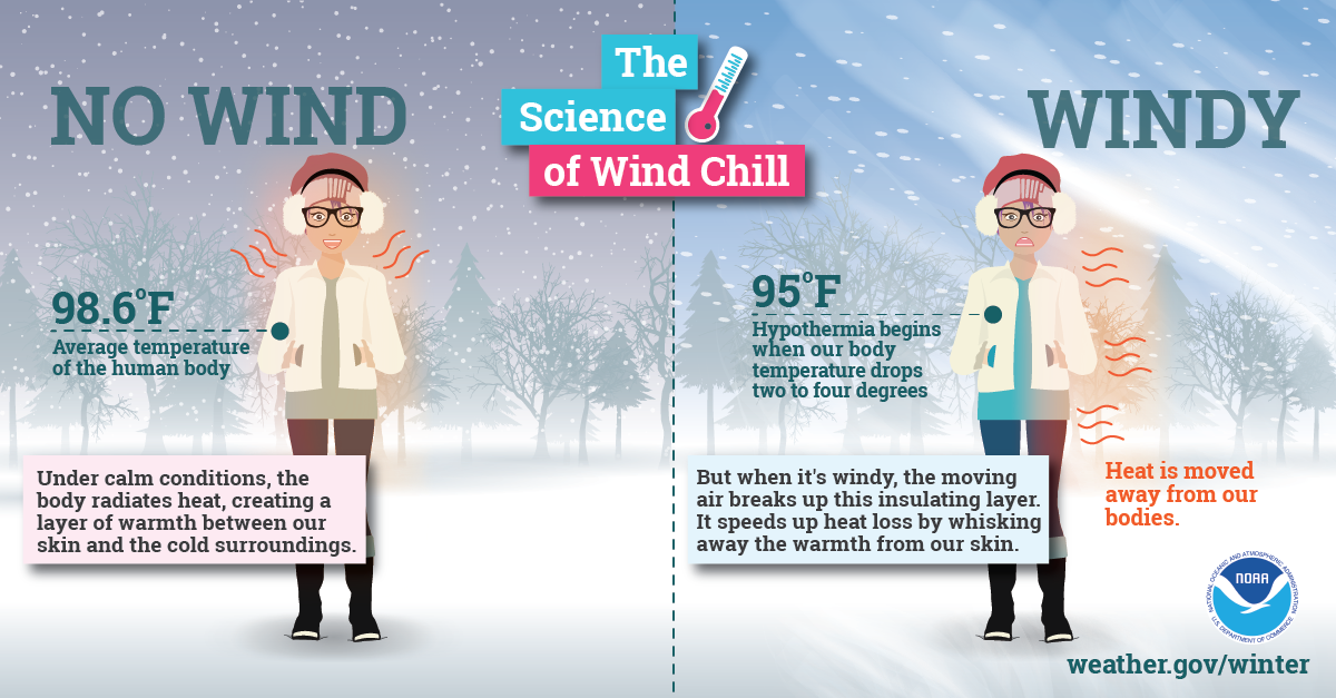 With little wind, your body is able to maintain a thin layer of warmer air between your skin and colder air surrounding you. However, higher winds can eliminate that thin layer, and your body can begin to cool at a dangerously fast rate. Visit weather.gov/safety/cold for more winter science! Temperatures & outlook through MondayAfter the Saturday storm, ideas become widely scattered on what happens next. There is a hint of a potential coastal storm that may bring more of an impact to southern New England and perhaps brush the shorelines of Maine, but that is very low confidence for now.  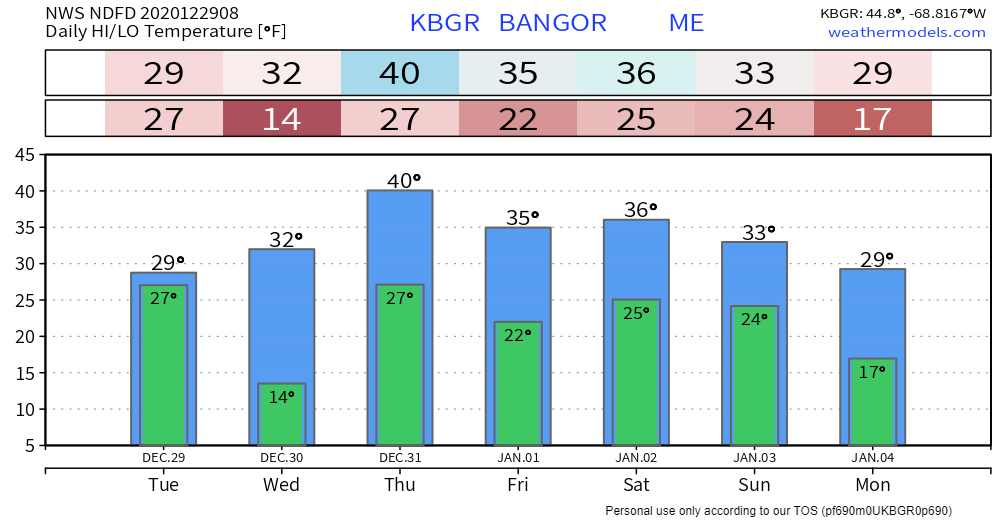 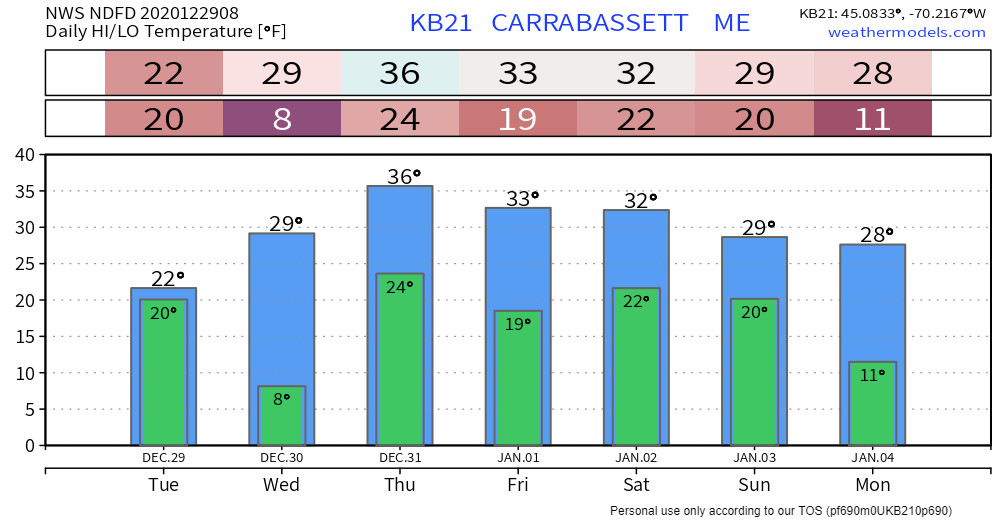 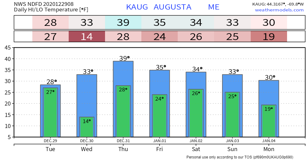 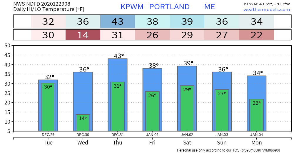 Be prepared to receive alerts and stay updated!
For more information, please follow Pine Tree Weather on Facebook and Twitter.
** FUNDING NEEDED FOR 2021 ** Thank you for supporting this community based weather information source that is funded by your financial contributions. Stay updated, stay on alert, and stay safe! - Mike |

Mike Haggett
|