It's starting to look like spring... finally One advantage of the below normal cold is that we haven't had to deal with severe weather potential very much so far this spring. With the trend changing this week, that will begin to increase as we head through the rest of the month and into summer. One disadvantage of the chilly temperatures is foliage has been very slow to pop out and grow, hence the fire risk has been more of a concern, and that threat returns mid week. A chance for rumbles for southern areas Monday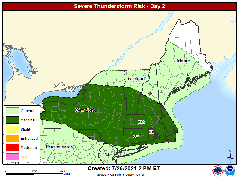 Worth mentioning again, I have set up a new severe weather page here on the website that shows forecasts from the Storm Prediction Center three days out, that is updated automatically. With summer coming, it is important to stay up to date with the forecast in order to be prepared for strong to severe storms. As the graphic indicates above, southern New England and southern York County are at a Class 1 - Marginal Risk for severe storms, with gusty wind, small hail and lightning the potential hazards. This threat could occur outside the forecast area. Folks in southern areas should be aware of rapidly changing conditions and be prepared to seek shelter when thunder is heard or lightning is visible. When thunder roars, head indoors! 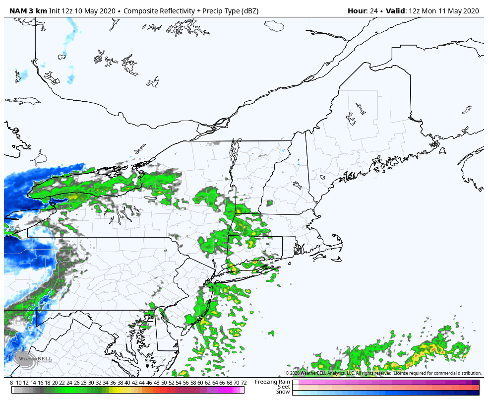 NAM model forecast for precipitation from 8 AM Monday to Noon Tuesday Los pressure to the west works eastward into the region Monday. Showers are possible over western and southern areas around midday working into northern and eastern areas Monday afternoon into the evening. For southern areas, the threat for strong to severe storms happens late Monday afternoon into the early evening. As the storm heads into the Canadian Maritimes, it begins to intensify. As that happens, it drags down cold air from the north, and brings the potential for snow showers to northern areas Monday night into early Tuesday. Some areas of The County may get an inch of accumulation, but for most appear a dusting or less. Dry air works in behind the system for Tuesday. It will be on the cool side again, but most areas see a good amount of sun outside of the higher elevations. Dry air means fire threat increases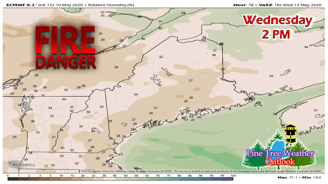 With these crisp, cool Canadian air masses comes dry air. Anytime the relative humidity levels drop to less than 35%, a slight breeze and a flame is all it takes to get a brush fire going. 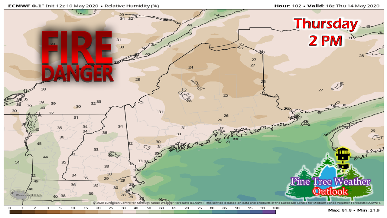 For those planning to do any burning, please check the Maine Forest Service Wildfire Danger Report and your local fire department or forest ranger for burn guidance and permits. As always, use caution with any open flame, and dispose of any embers or smoking materials properly. Rain potential to end the week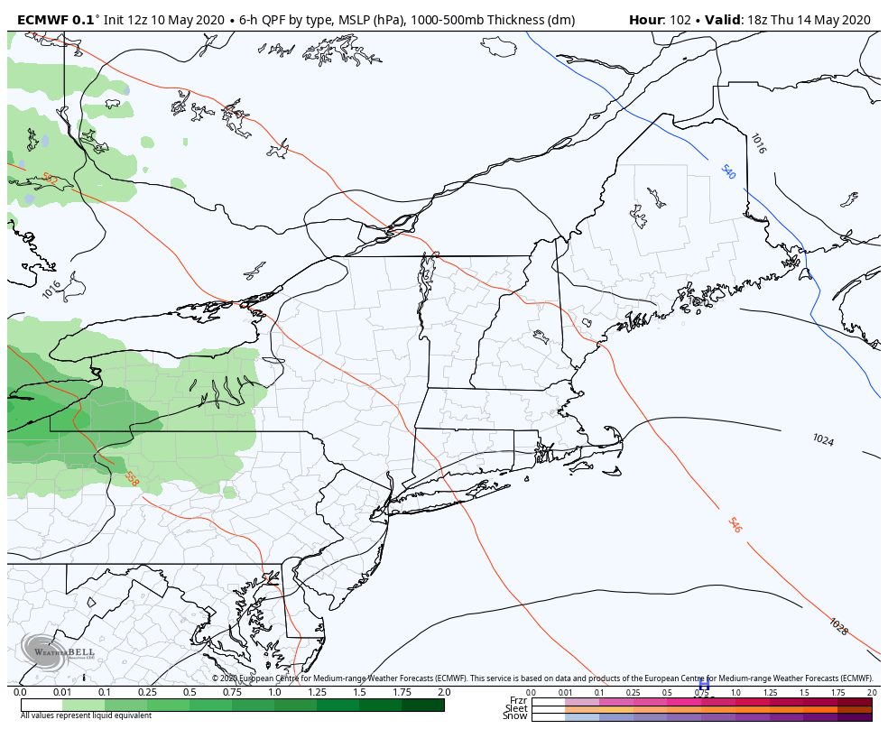 European forecast for precipitation and sea level pressure from 2 PM Thursday to 2 PM Saturday With the cold trough over the east breaking down and a warm ridge working its way in from the southwest, precipitation rides along it in the form of warm front that could bring impacts to the region late Thursday night through Friday. A trough over eastern Quebec may drop down and bring precipitation to northern areas in the process. While the forecast trend appears warmer, the one component that could spoil the rise in temperatures is a backdoor cold front. These are typical in the area in spring where cold air backs in from the east, northeast or north. Guidance is showing hints of that possibility as we head into the weekend. Time will tell if it happens. 5-Day Temperature Outlook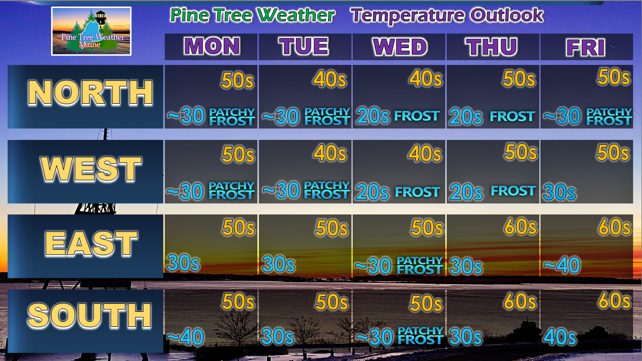 Help the weather community and stay informed!
For more information, please follow Pine Tree Weather on Facebook and Twitter.
Thank you for supporting this community based weather information source that is funded by your financial contributions. Stay on alert, stay updated, and stay safe! - Mike |

Mike Haggett
|