
 Consistent temperatures as a small high pressure system resides in the Gulf of Maine The GIF above displays temperature in Fahrenheit from the 3km NAM NEST model for 7 PM Saturday to 7 PM Monday. The small high pressure system to the south of Maine brings generally northwest winds into coastal region, meaning temperatures in the southern areas of Maine will be slightly warmer than up north. From Sunday night to Tuesday morning, temperatures remain consistent in the low- to mid-20s statewide since no medium/large-scale phenomena disturbs the atmosphere in Maine for a day and a half. In the early morning hours of Tuesday, temperatures increase because of a warm front of a low pressure system moves in north of Maine, so the state is engulfed in the warm sector of this small low pressure system. Small low pressure system moves in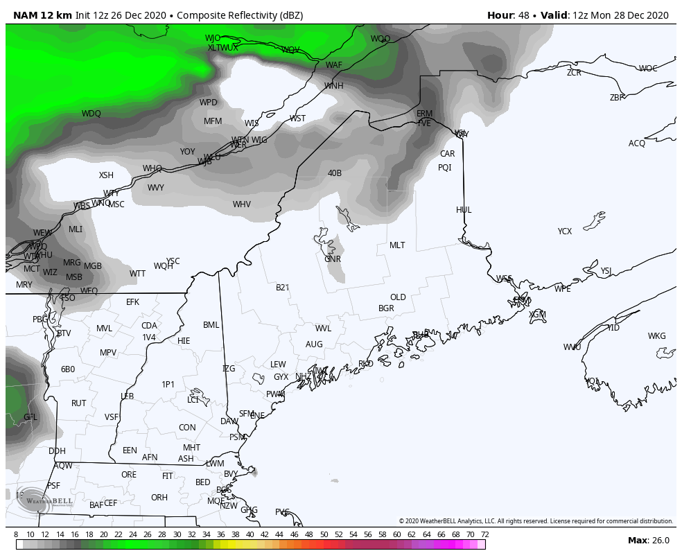 The GIF above displays reflectivity from the 12km NAM model from 7 AM Monday to 1 AM on Tuesday. In conjunction with this low pressure system, some light to moderate rainfall is expected for Monday afternoon and into Tuesday morning. This is a typical run-of-the-mill system and is not expected to cause any major flooding. For some secluded areas in the middle of the state, there may be a slight chance for flash flooding on smaller streets. Because of the system's warm sector engulfing the state, there is a low chance of widespread snow, but there is a possibility for a wintry mix of snow and rain for more northern areas that are within the precipitation forecast. New Year's Day potential storm: Mostly rain for now, but possible snow in the north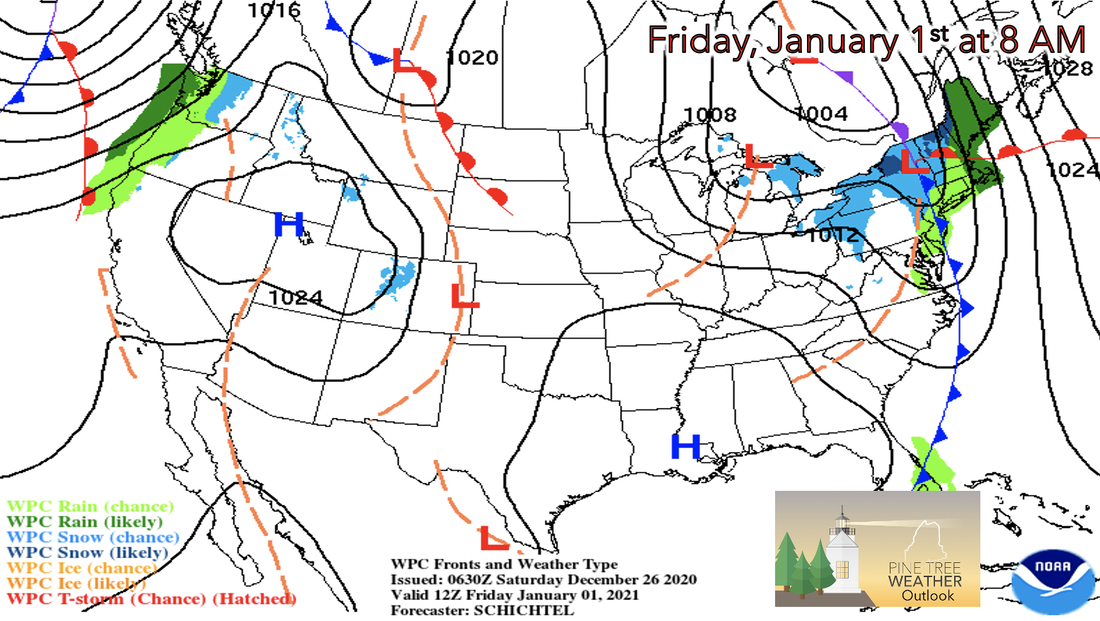 For the last week of the year, the most interesting aspect in terms of the weather is the potentially strong low pressure system that is medium/long-range forecasted to swing into Maine on New Year's Day in the morning hours. Everything about the storm is subject to change (temperature, precipitation type and amount), but it has appeared on multiple medium/long-range models. So far, precipitation amount ranges from 0.3-0.5 in of rain in 3 hours for most of the state, besides northern regions where there looks to be snow, where amounts vary. Confidence in amount and precipitation type is low for now, but there is higher confidence of getting persistent rain/snow this upcoming week. 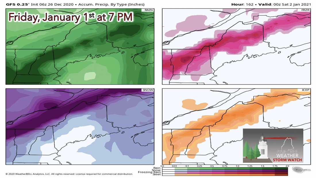 The amount of precipitation may not be impressive, but the scariest part of this potential storm is the type of precipitation that may occur. The freezing line of 32 degrees Fahrenheit seems to cut right in the middle of Maine, leaving room for potential for freezing rain in some areas. Freezing rain generally occurs when most of the vertical atmosphere above a certain area is above 32 degrees Fahrenheit, but a small layer of the atmosphere near the ground is below 32 degrees Fahrenheit, and the water droplet freezes on impact of the surface. This can be incredibly dangerous for driving, since this phenomena is associated for creating the term "black ice". Be prepared to receive alerts and stay updated!
For more information, please follow Pine Tree Weather on Facebook and Twitter.
** FUNDING NEEDED FOR 2021 ** Thank you for supporting this community based weather information source that is funded by your financial contributions. Stay updated, stay on alert, and stay safe! Have a great rest of your weekend! - Kaitlyn |

Mike Haggett
|


