
Below average temperatures... get used to them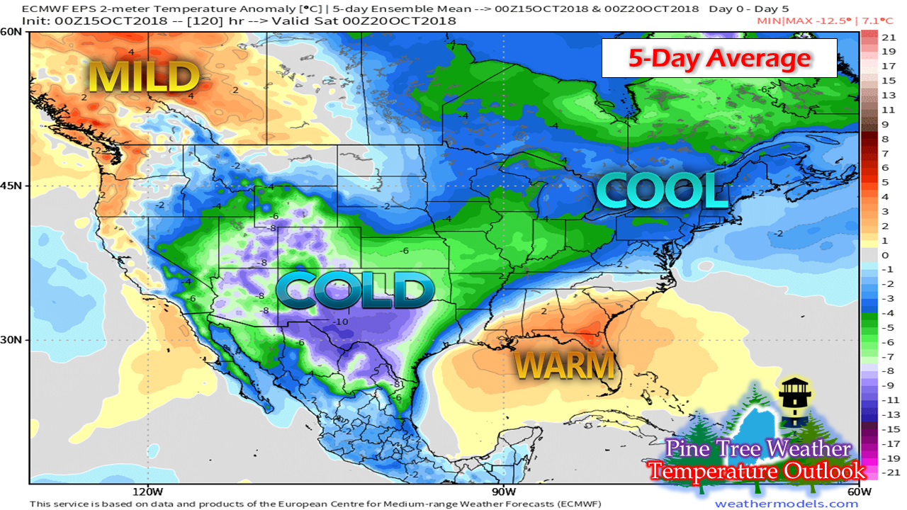 There is no question the pattern has flipped to a much cooler trend as we head into the third week of October, and it appears that it will stay that way for a while. When temperatures are running below normal like this during this time of the year, the chances for snow or wintry precipitation increase. Hopefully your wood is stacked, the snowblower has been tested, and snow tires are scheduled to be installed. I don't say this to cause panic or alarm. I say this because the chance is there for an early snow event under the right circumstances. Don't be caught off guard. Showers through early Tuesday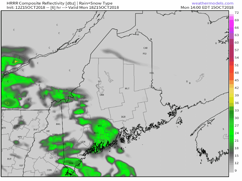 A cold front slides through the state Monday bringing some shower activity. I don't expect much in the way of liquid accumulation out of this for most of the region. It will be raw and damp, and the wind will pick up. A leaf stripping wind through Tuesday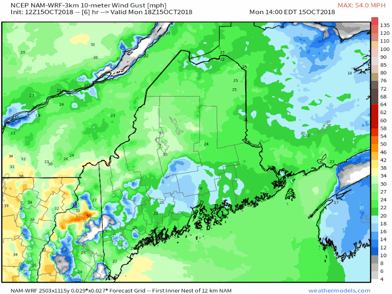 The folks at the Caribou National Weather Service office have a High Wind Watch posted for the rooftop of Maine that could go to a warning (click on the link to get the latest). Western areas will feel a stiff breeze also Monday night into Tuesday. Some power outages are possible. Northern and western areas will play this game again on Thursday. Time will tell if the wind will be this strong. Stay tuned for updates on that. Light snow Wednesday night into Thursday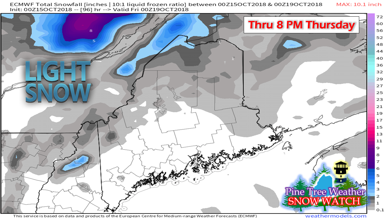 I've mentioned this in previous updates, so if you have been reading along, this won't come as much of a shock. It does not appear to be much in the way of accumulation. For most that see flakes, it will blow around more than anything else. Higher elevations may pick up an inch or two, but again, with the breeze, it will be difficult to get an accurate read on amounts. Precipitation generally light through Saturday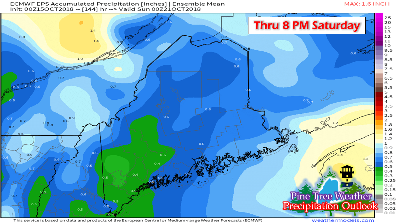 Roughly 1/4" to 3/4" is expected in total through the week, with some areas coming in higher or lower. It's mostly of the nuisance variety with systems Monday into early Tuesday, Wednesday into Thursday, and Saturday. No real heavy rain makers in sight for the time being. The region is stuck in an west to east zonal flow through the week, and may stay that way into next week. With no moisture hose from the south to plug into, the systems that pass through appear to contain light amounts of precipitation. 5-Day Outlook through Saturday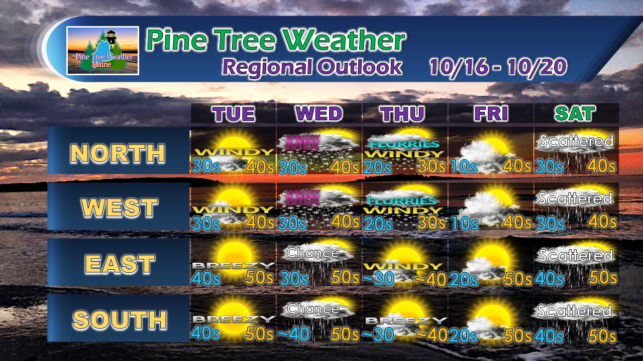 The mountains and north country may see a mix of rain and snow showers pending on elevation and temperature on Wednesday, with eastern and southern areas at risk for light showers. Flurries and snow showers arrive as the coolest air of the season arrives from the northwest on Thursday. Interior locales may see teens for overnight lows Friday morning if the breeze settles down in time. A warm front arrives for Saturday, bringing up temperatures closer to normal with some scattered rain showers around. Sunday may see some early morning flakes in the higher elevations, dry elsewhere with high temps in the 30s/40s as it appears for now.
For the latest official forecasts, bulletins and advisories, please check in with the National Weather Service in Gray for western and southern areas, or Caribou for northern and eastern parts of Maine. For more information from me, please follow the Pine Tree Weather Facebook page and my Twitter feed. Thanks as always for your support! Please consider making a donation to keep Pine Tree Weather going through the year ahead. Check out the donate page on how to contribute. Always stay weather aware! - Mike |

Mike Haggett
|


