
Eye to the sky through Sunday With the dew point levels in the 60s and low pressure passing through the region, a bit of sun is all it will take to touch off strong to severe storms, especially over western and southern areas Saturday into Saturday night. If you see sun, think storms! As the low exits, the upper level low over the region pinwheels more energy through the region on Sunday, and brings the risk for showers and thunderstorms through Sunday night. Any severe storms that form could be rather nasty. Damaging wind, small to large hail, flash flood potential downpours, frequent lightning are all possible. When thunder roars, head indoors. Rain accumulations from the two day period range from roughly ½-1" of rain statewide, with locally higher amounts possible in areas of downpours. Please stay on alert and take appropriate action to protect yourselves and your family if a severe storm approaches your area. Regional outlook through the Fourth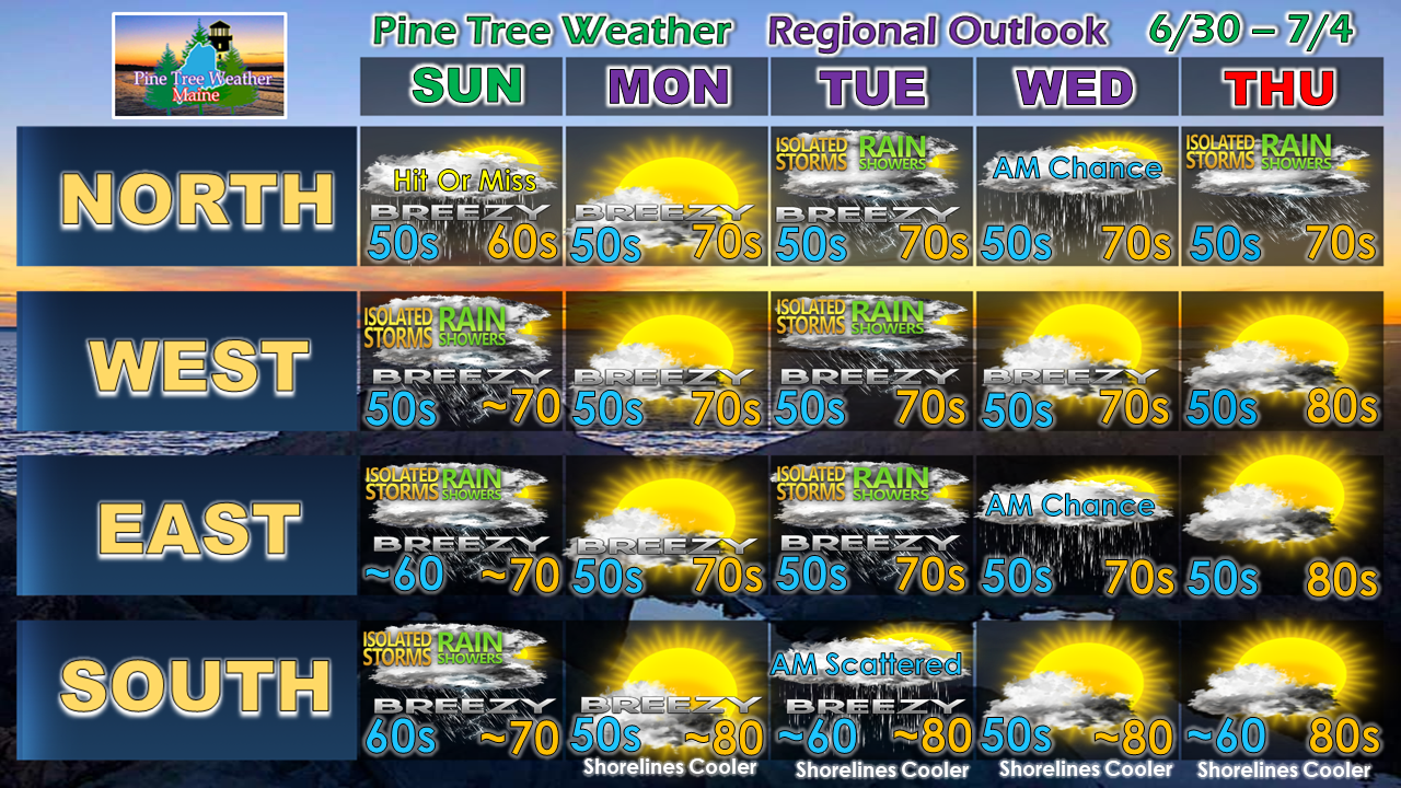 Another round of showers and thunderstorms are possible on Tuesday. The Fourth appears to be a warm and humid one, with daily high temperatures rising into the weekend.
► ► For the latest official forecasts, bulletins and advisories, please check in with the National Weather Service in Gray for western and southern areas, or Caribou for northern and eastern parts of Maine. Please consider supporting Pine Tree Weather ► ► Your financial donations are much appreciated to keep this site funded and for further development. I sincerely appreciate your support not only financially, but also in sharing my efforts with others. For more information from me, please check the Pine Tree Weather Facebook page as well as my Twitter feed. Always stay weather aware! - Mike |

Mike Haggett
|


