
It's an eye-to-the-sky kind of day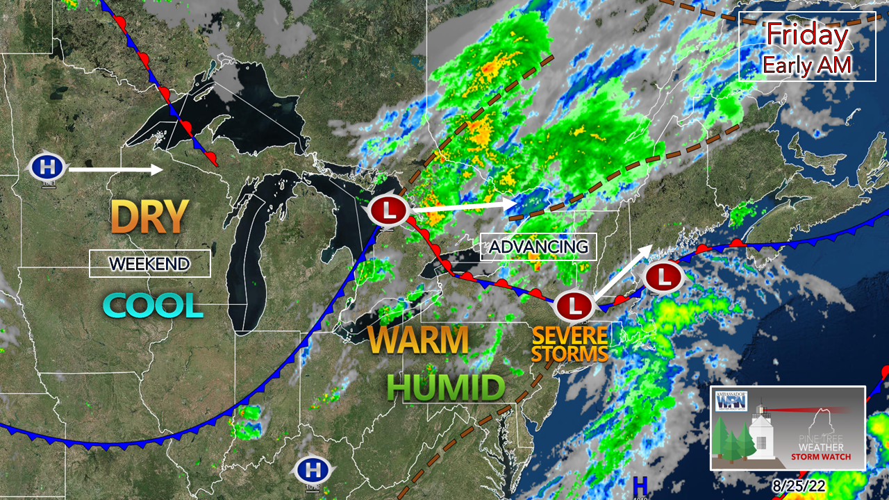 A cold front advances east Friday as a stationary front turns into a warm front. Areas enjoying dew points in the 50s to start off are likely to see a spike as humid air returns as the warm front advances in ahead of the cold front. As low pressure moves east, it will bring an injection of moisture from the southwest and bring a mainly rain event to the state, with the isolated chance of a strong to severe storm. 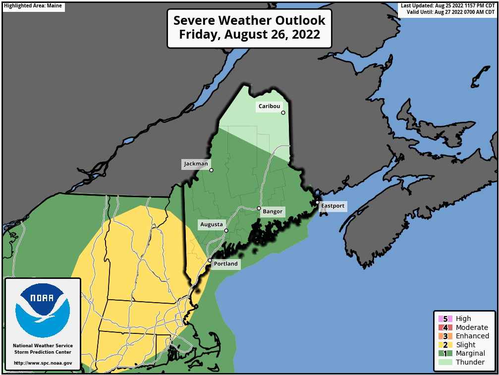 Storm Prediction Center has scaled back the potential for severe storms over the north. It's maintaining the idea for the rest of the region for now. Looking over guidance in the past 18 hours and sampling soundings gives me the impression that the severe threat coincides with how much sun is available. Cloud cover as the front approaches Friday afternoon will dictate how strong storms will become. 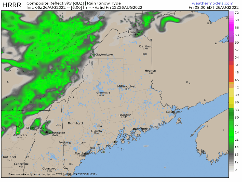 Friday 8 AM to Saturday Midnight - The short-term convection-allowing models (CAMs) like the HRRR model here are still rather bullish on the sky breaking enough in areas to pop a few strong storms. That is their job to note that potential. What I see when I look at this is as the storms pop over New Hampshire and the cloud debris they generate could race ahead of the storms and take the punch out of them as they pass east. I do think western areas along the New Hampshire border have the better chance of seeing isolated strong to severe storms, again, depending on the available sun. While I am pessimistic on the storm chances, I am confident that the showers that are generated are likely to bring torrential downpours, which could bring gully-washer localized flash flooding, reduced visibility and ponding on roadways that could bring the risk for hydroplaning on the highways. The bottom line for the day is simple, if the sun gets out this afternoon, look out. Storms that form could bring damaging straight-line wind, frequent lightning, large hail, and a brief tornado. 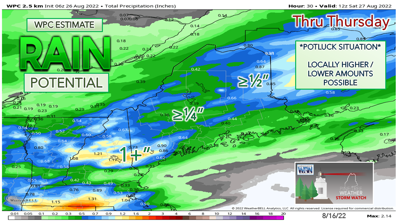 I pass along the Weather Prediction Center's estimated rainfall amount to present the idea of range in amounts. This is not gospel. Some areas could see a soaker in the 2-3+" range and some places may not get much of any value. Such is life in potluck shower and storm season. 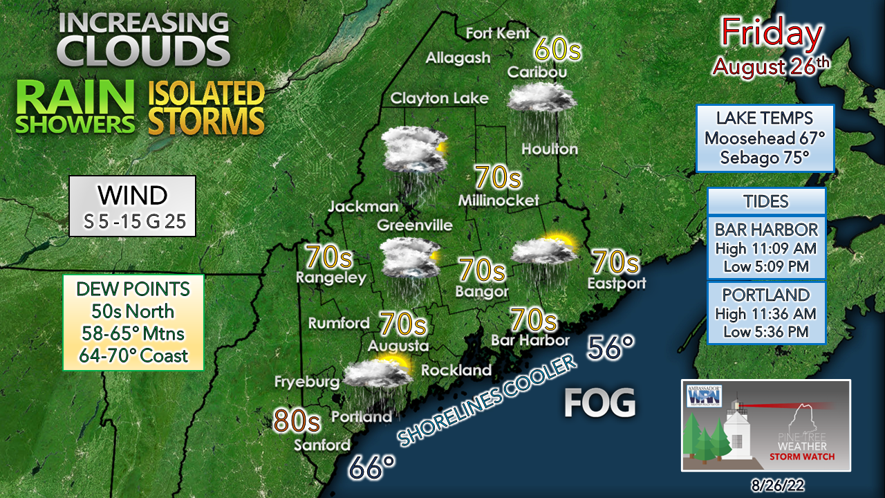 Again, on the point of cloud cover, temperatures for the day will be dependent on that. While areas see sun Friday morning, it's where the cloud cover is this afternoon that matters the most. By then the dew points will be at their peak, which with sun creates fuel for storms. Northern areas will be lucky to get a rumble of thunder as that appears to be a stratiform rain event there. Fog continues to lurk for areas Penobscot Bay eastward, and the marine influence of stable air may spoil any storm threats up and down the coast. I will be keeping watch on activity and will provide updates via Twitter at times during the day.  Outlook through midweek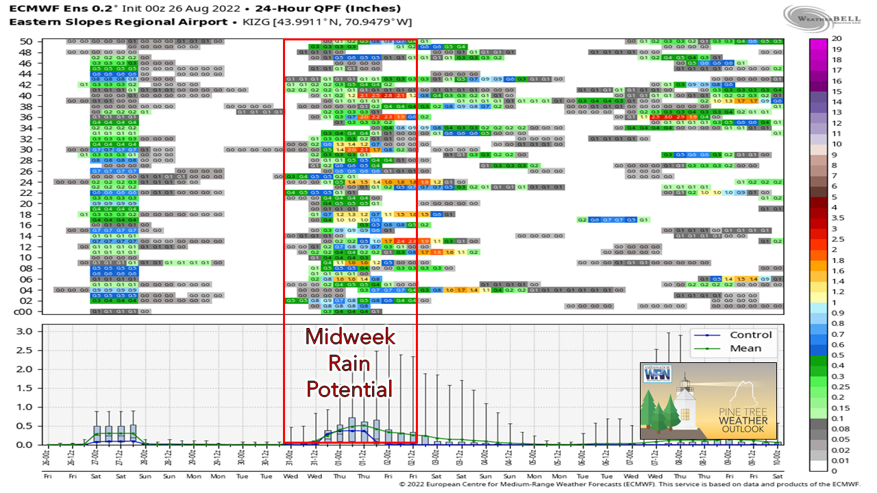 After the showers and storms pass through Friday, a dry weekend is ahead with comfortable dew points and temperatures right around average or cooler. Northern areas and the mountains get a taste of sweater weather to start both days. Warmth and humidity begin to build back in Monday as high pressure slides east. A cold front brings the next chance for rain midweek. For the north, an unsettled week is expected as that area appears to be on the boundary of the moist and dry air. 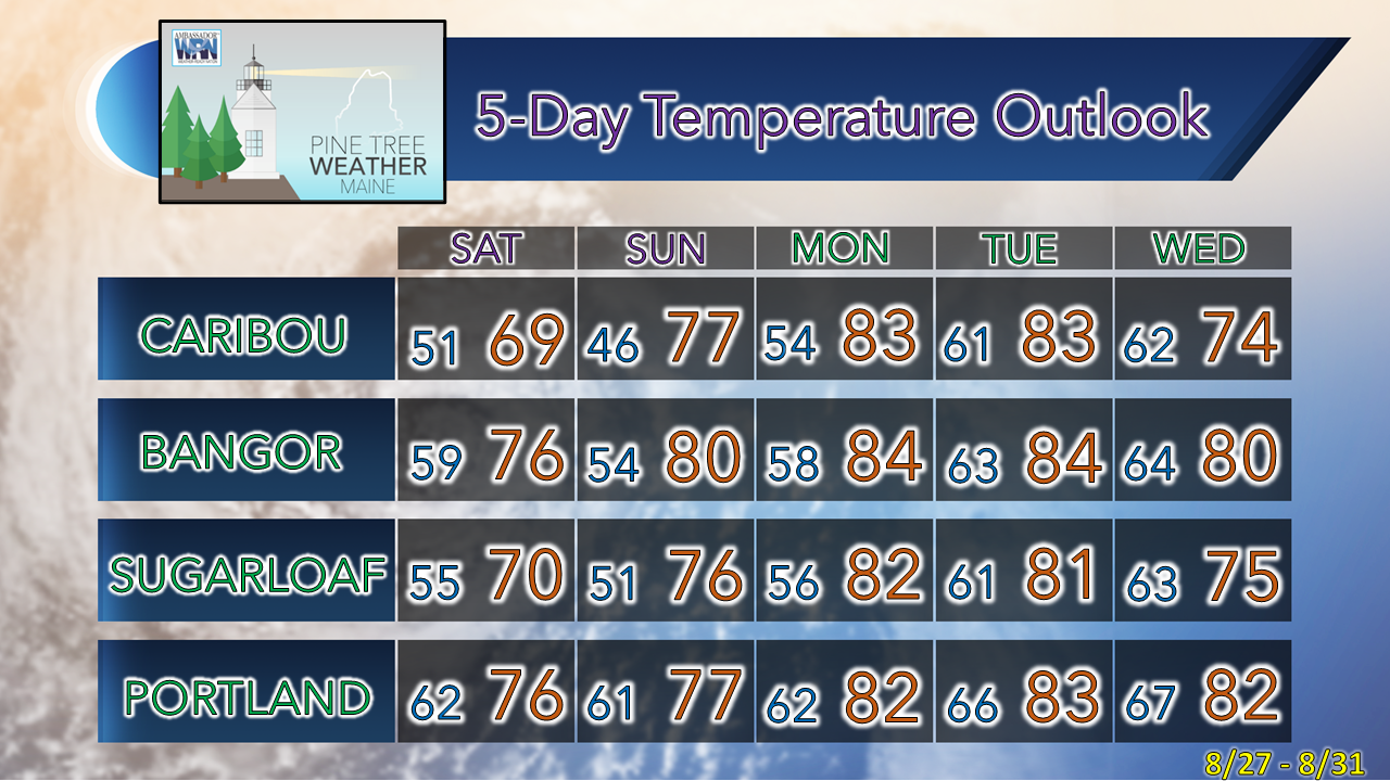 Thank you for supporting this community-based weather information source which operates by financial contributions from people like you. NEXT UPDATE: SUNDAY Stay updated, stay on alert, and stay safe! - Mike NOTE: The forecast information depicted on this platform is for general information purposes only for the public and is not designed or intended for commercial use. For those seeking pinpoint weather information for business operations, you should use a private sector source. For information about where to find commercial forecasters to assist your business, please message me and I will be happy to help you. |

Mike Haggett
|


