
Clouds increase ahead of showers on the way overnight, heat arrives Friday; weekend update6/29/2022 High pressure controls the day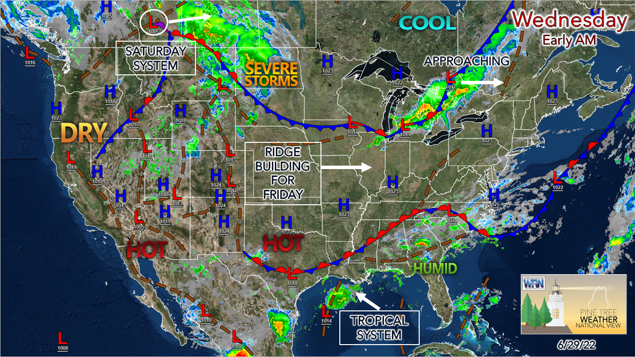 Looking over future ideas indicates dry and generally cool times are expected to continue into July. Shower chances appear to be of the potluck variety. Any heavy rain is likely to be localized. For those irrigating their gardens and lawns, expect to continue to do so for a while. Hot, humid summer ridges appear to be short lived events. I don't see any real change to the pattern until mid-July at the earliest at this point, and confidence in that isn't strong. With no widespread beneficial rain in sight, for those depending on groundwater wells, you should monitor them closely. 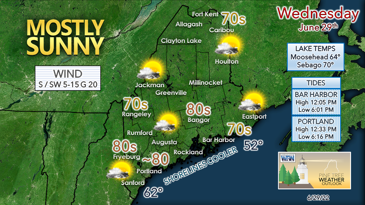 Any areas with fog early see that clear off. Clouds increase through the day as the cold front from the northwest moves in later in the day. Temperatures warm up a bit, but dew points remain comfortable. A sea breeze keeps the shoreline counties cooler. Showers and a possible rumble overnight into Thursday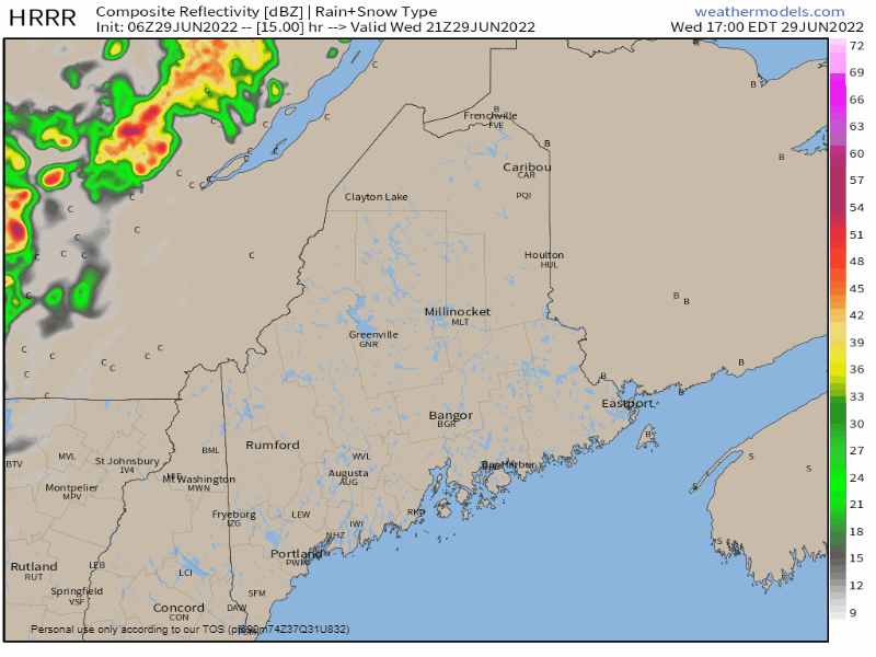 Wednesday 5 PM to Thursday 5 AM - I can't rule out a late afternoon shower around the Quebec border region, but the best chance for some rainfall is after dark. Folks camping out in the mountains and North Woods may be awakened with a rumble or two of thunder and may receive a short-lived downpour. The best chance for showers appears over the interior. The front is expected to approach the eastern shorelines by around daybreak Thursday morning. Isolated spot showers possible for the north Thursday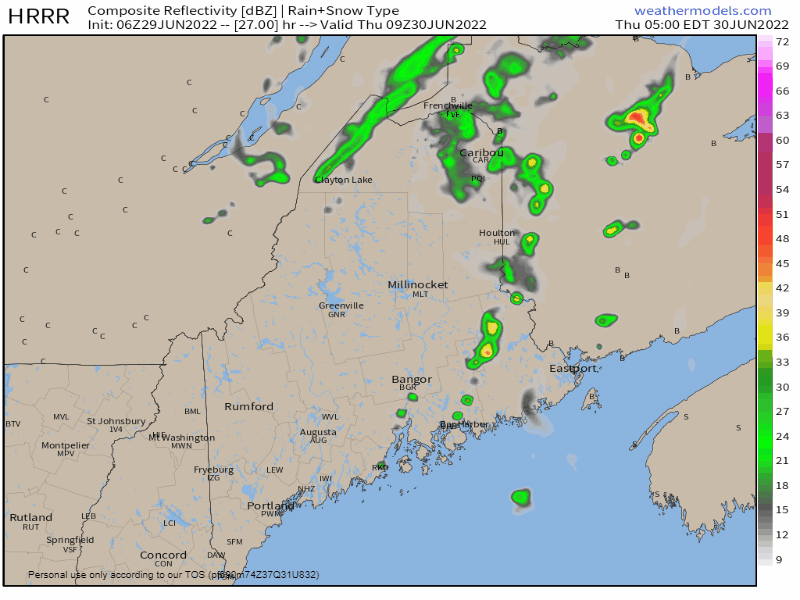 Thursday 5 AM to 5 PM - As the front departs an upper-level trough passes through the region bringing some morning clouds and a chance for a shower over the north, and perhaps interior eastern areas. Clouds will be on the increase in the afternoon as a warm front approaches from the rest ahead of a ridge that brings the summer heat back for Friday. Showers likely for Saturday, timing still to be ironed out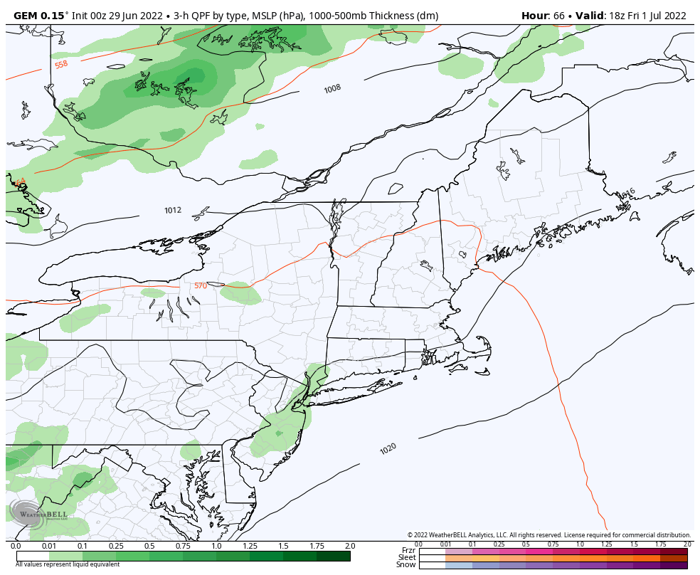 Friday 2 PM to Sunday 8 AM - Operational model ideas continue to vary on the timing of the cold front and thus what the potential outcome may be. At this point the idea of an overnight shower chance Friday into Saturday morning is a fair bet. The chance for showers and potential thunder for Saturday for now appears better for the mountains and north through early afternoon, and for the coast late afternoon. As I mentioned previously, I do not expect the day to be a washout, however with the humidity and high precipitable water values around I do expect some localized downpours which may bring a surprise to those unprepared. It all depends on timing and the amount of forcing in the atmosphere as to what the impact may be. As far as the rest of the weekend is concerned, an upper-level low to the north may pinwheel waves through the region as it hangs around. That could bring a risk of a light shower / sprinkle for the mountains and north through Monday. Temperature outlook through the FourthThe average high and low temperature for Caribou is 75° and 55° and for Portland, 78° and 59°. After a short spike in heat and humidity for Friday and Saturday, expect drier and near average temperatures through the remainder of the weekend. 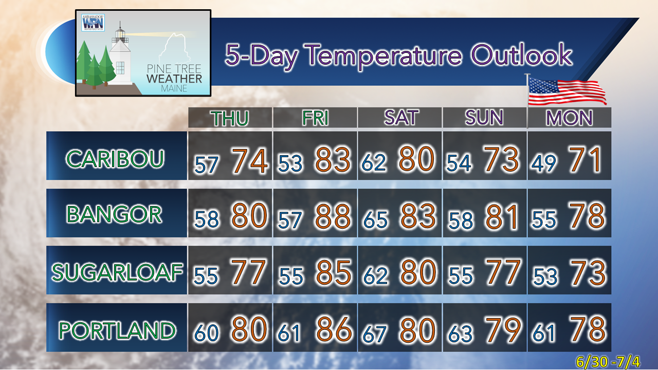 Thank you for supporting this community-based weather information source which operates by financial contributions from people like you. Stay updated, stay on alert, and stay safe! Have a great day! - Mike NOTE: The forecast information depicted on this platform is for general information purposes only for the public and is not designed or intended for commercial use. For those seeking pinpoint weather information for business operations, you should use a private sector source. For information about where to find commercial forecasters to assist your business, please message me and I will be happy to help you. |

Mike Haggett
|


