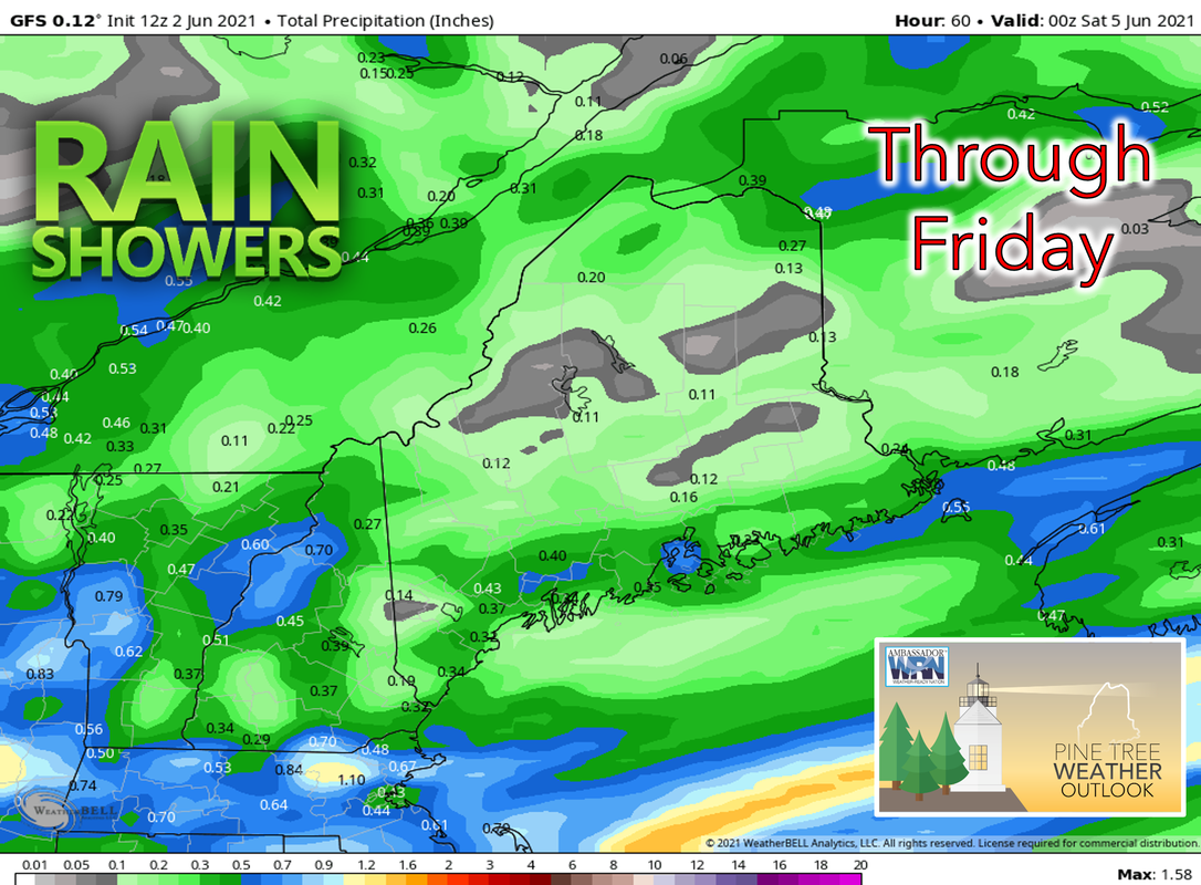
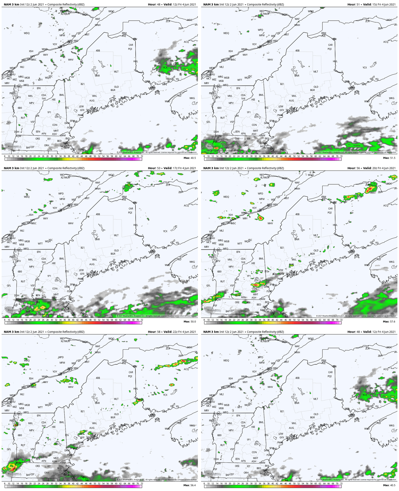
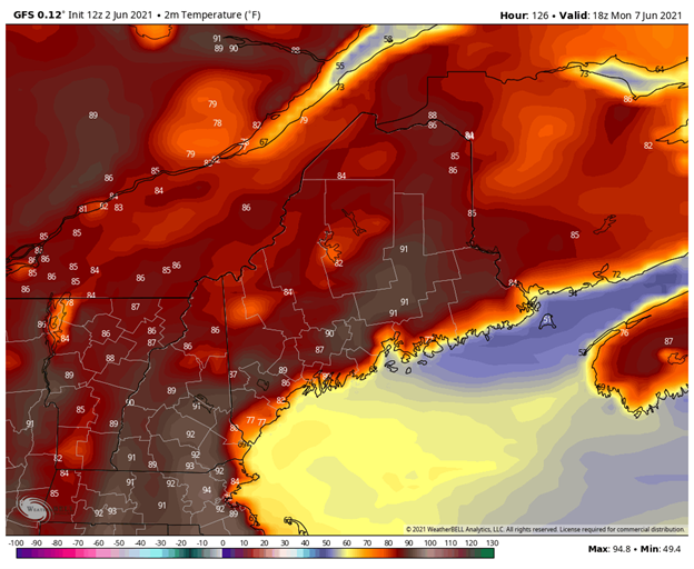
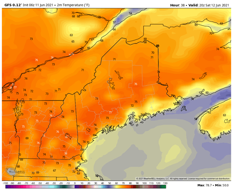
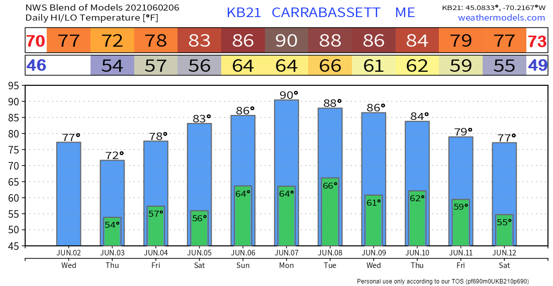
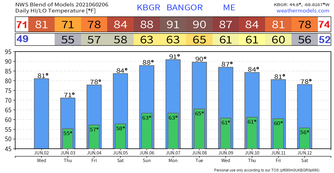
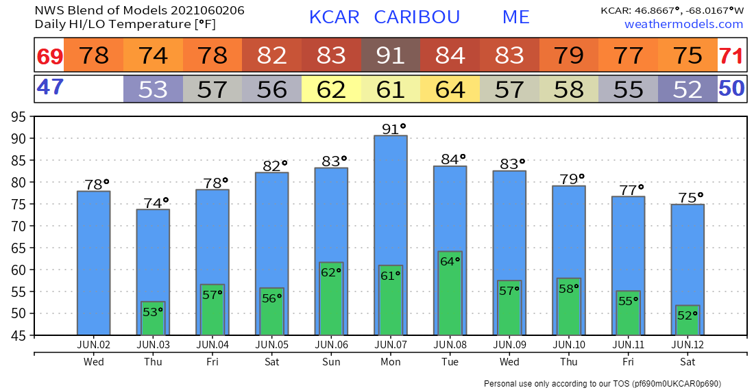
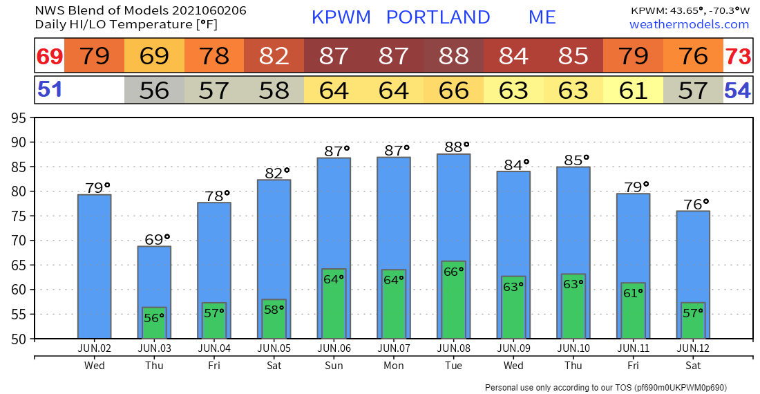
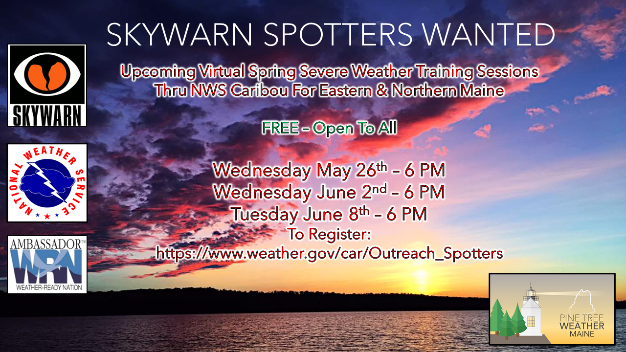
Scattered showers ThursdayEnergy associated with a 500mb trough moving east will be pushing into Maine later Wednesday evening and overnight providing the forcing necessary for scattered showers and perhaps a few rumbles of thunder during the day on Thursday. Temperatures will be seasonable, reaching the mid 70’s in the southern interior portions of the state while the northern regions will see temperatures hover near 60. Coastal regions will see cooler temperatures that may dip below 60 degrees due to the presence of a strong sea breeze that will transport cooler air from the ocean inland. Coastal thunderstorms on FridayA few showers are possible early in the day on Friday, primarily in the Western Foothills, Western Mountains, and Great North Woods regions. Breaks in the cloud cover will allow for modest instability to build along a weak cold front and scattered storms should begin to fire along the front beginning in the afternoon. Initiation should begin in the Western Foothills and Central Highlands regions before moving southeast towards the coast. The presence of a sea breeze along the coast may also help to initiate storms. No severe threats associated with these storms are expected due to weak lapse rates. Warm on Saturday with a chance of a few thunderstormsSaturday will bring much warmer temperatures, reaching the mid 80’s along much of the southern interior regions and upper 70’s elsewhere. As a weak trough passes through the state, weak instability along it may lead to a few thunderstorms. Otherwise, Saturday looks to be mostly sunny with a few clouds building later in the day. Summer weather ahead for Sunday and the beginning of next weekMostly sunny and very warm temperatures ahead past Saturday. Temperatures will be in the upper 70’s in the northern regions and upper 80’s in the south on Sunday and around 90 across the state on Monday. Associated with this warm weather will be high dewpoints especially on Monday where they may reach an uncomfortable 70 degrees as seen in the image below. The plots below show the trend of the high and low temperatures for Carrabassett, Bangor, Caribou, and Portland over the next week and a half. Temperatures will increase over the next several days, becoming hot on Monday, before decreasing towards the end of next week. Join the weather community as a storm spotter!Here's a wonderful way to become active in the weather community and help the broadcast media and forecasters like myself with storm reports. This information is vital during and after an event for forecasting and alerting purposes. I can't tell you how many times I have seen the importance of these reports in the past 9+ years I have been involved. Pine Tree Weather followers have stepped up in the past and participated, and with the readership base continuing to grow, I know there are more out there. This is the spring/summer session which discusses severe weather, what to look for, and how to report it. These sessions run for about 90 minutes. They are fact filled, educational and interesting. You can get the whole family involved from the comfort and safety of home. Once completed, you will get your spotter ID, and will be ready for the season ahead. For those who trained for the winter session, this will complete your full year training. It's important to have both sessions done. The link to register is here ► https://www.weather.gov/car/Outreach_Spotters Be prepared to receive alerts and stay updated
For more information in between posts, please follow Pine Tree Weather on Facebook and Twitter.
Thank you for supporting this community-based weather information source which operates by reader supported financial contributions. Stay updated, stay on alert, and stay safe! |
Mike Haggett
|

