Clouds hang on in Southern areas Tuesday, best chance of sunshine in northern parts of the state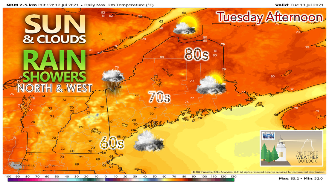 Expect more clouds and showers in the forecast on Tuesday as a warm front enters the area from the south. Wednesday looks to be more active with a warm front bringing showers and thunderstorms to parts of the state. Thursday and Friday the sun likely returns along with the heat and humidity. We'll once again have a chance for rain showers in the forecast heading into the day on Tuesday. A warm front that brought showers to the area on Monday will once again try to lift its way north during the day on Tuesday. This will likely bring more cloud cover to the southern and central parts of the state. The northern third of the still likely has the best chance of seeing sunshine during the afternoon. 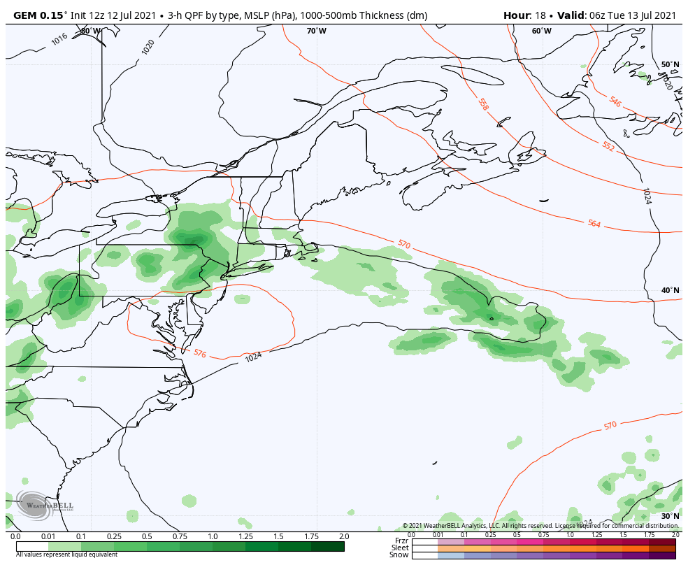 Northern parts of the state will see the best chance of sunshine thanks to the high-pressure system that will continue to slide off to the east. Rain showers likely move into northwestern parts of the state first before bringing the chance of showers to the entire southern half of the state heading into Tuesday evening. High temperatures on Tuesday struggle to make it close to 70 degrees in the southwestern part of the state, whereas places further north and east that see some sunshine likely climb into the upper 70s and even a couple low 80s. With rain showers possible over the southwestern half of the state Tuesday night, we could see some fog develop through the overnight hours and into Wednesday morning. Shower and thunderstorms possible Wednesday afternoon and evening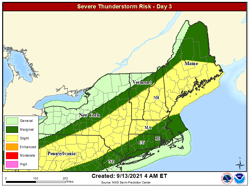 As the warm front continues to slowly make its way through the state on Wednesday, it will likely bring with it a better chance of showers and thunderstorms during the afternoon and evening hours Wednesday. Because of this, the Storm Prediction Center has issued a marginal risk for the western mountains of Maine for the day Wednesday. This is thanks to the possible daytime heating leading to thunderstorm activity during the afternoon. We will have more information on this threat tomorrow, as the models continue to trend in the direction of potential formation of storms. 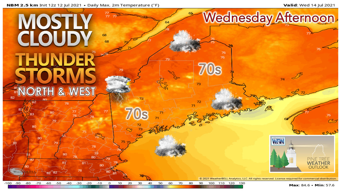 The rest of the state tomorrow likely remains under the clouds for much of the day. This likely keeps temperatures in the lower 70s for most spots, with places further to the north creeping up into the mid and upper 70s. There is a chance for scattered thunderstorm activity for the rest of the state through the afternoon and evening hours Wednesday, however the majority of the activity looks to stay confined to the western mountains. With the air mass becoming more saturated during the day Wednesday, the entire state likely has a better chance of seeing fog develop through the overnight hours and into Thursday morning. Heat and humidity build once again late week into the weekend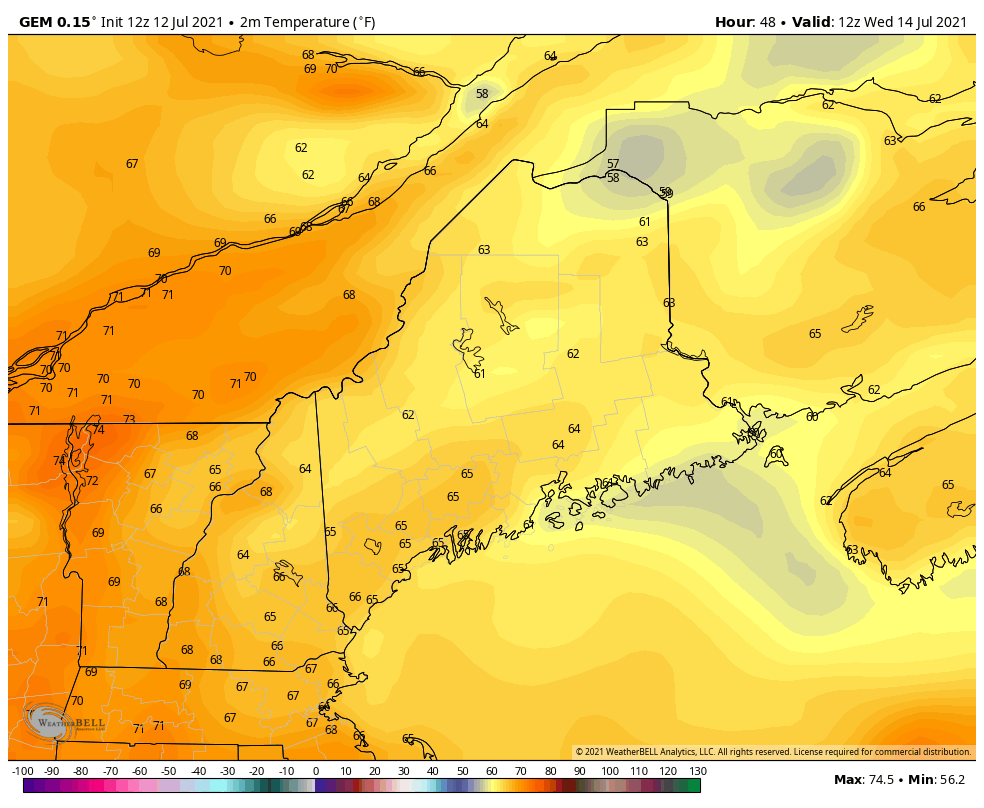 Once any fog burns off during the early daylight hours of Thursday, temperatures likely begin to heat up. High temperatures on Thursday likely climb into the upper 70s and lower 80s for the region with the sunshine making a return. Heading into Friday, temperatures continue to climb with highs making it into the lower 80s in the mountains, to mid and upper 80s through the coastal plain. Saturday looks to see an increase in cloud cover with scattered showers possible during the afternoon. 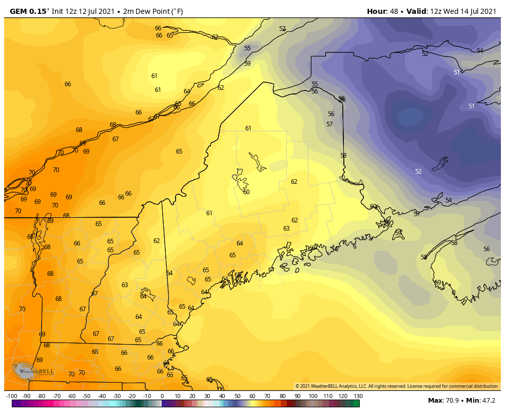 The one thing people will notice the most over the next few days will likely be the increase in the humidity. By Thursday morning, most places across the state will already have dew points in the low to mid 60s. Heading throughout the rest of the day dew point will only continue to climb. By Friday dew points will likely be in the mid to upper 60s with some spots in far southern areas getting closer to 70 degree dew points. By the time we get to Saturday the humid air mass will likely have setup over most of the state, resulting a lot of locations seeing 70+ degree dew points during the day Saturday. 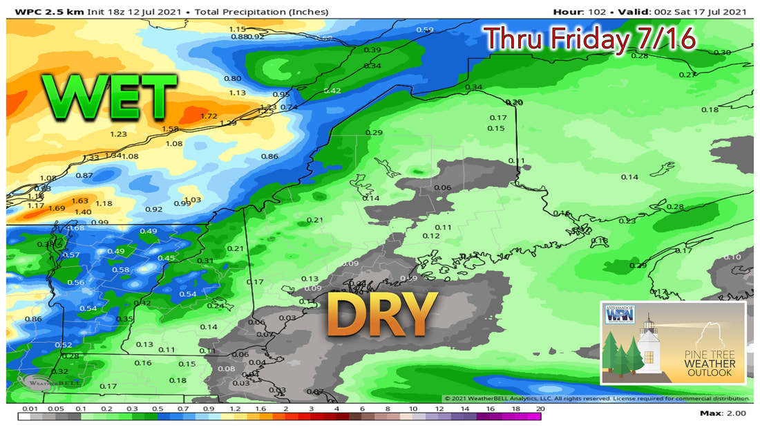 Looking at precipitation through the end of the work week shows that any showers and thunderstorms likely won't result in much precipitation. The best chance of seeing any measurable precipitation is likely over the mountains of western Maine where they have the best chance of seeing showers and thunderstorms Tuesday and Wednesday. After the rain we received from Elsa, we'll have to wait and see later this week how much of a dent that put in the drought situation. Temperature trend through the middle of next weekWe've hit that time of the year when temperatures are usually at their warmest, and we're seeing the trend over the next several days. While we won't be seeing any major heat after this weekend, temperatures likely remain close to if not a couple degrees above average heading into the middle of next week. Once again low temperatures will likely be a few degrees above the average lows heading through the next week, aligning with the trend of warmer overnight low temperatures that we've seen over the past several years. 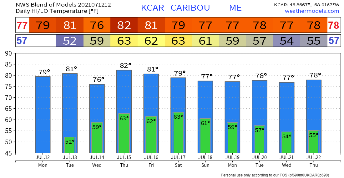 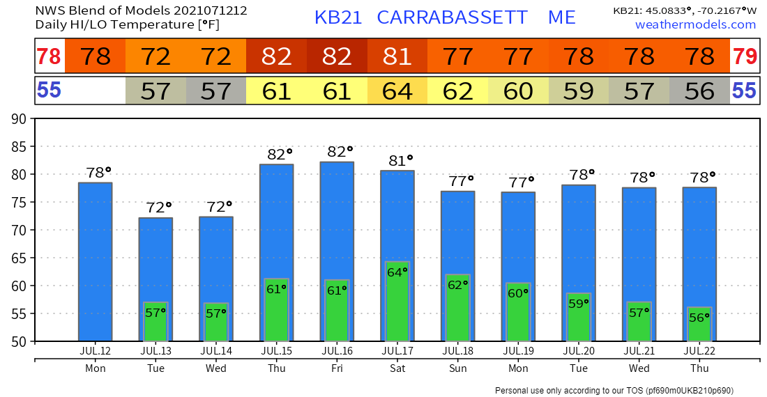 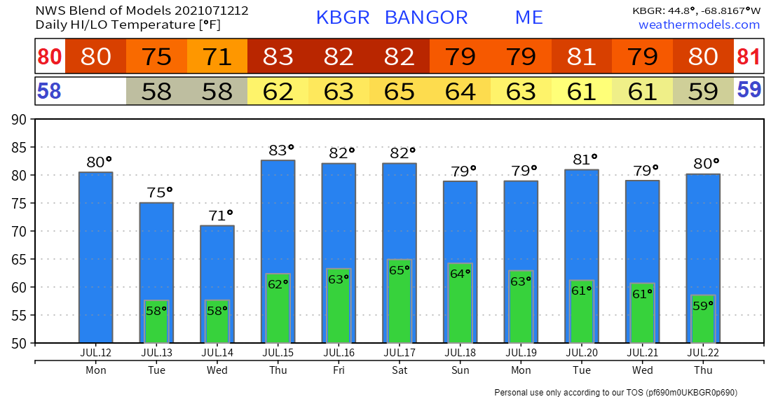 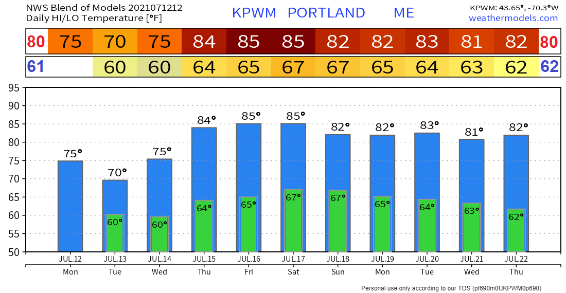 Maine Hurricane Preparedness Week - Develop Your Evacuation Plan Take some time to make sure you have a hurricane evacuation plan. The first thing you need to do is find out if you live in a storm surge hurricane evacuation zone or if you’re in a home that would be unsafe during a hurricane. If you are, figure out where you’d go and how you’d get there if told to evacuate. You do not need to travel hundreds of miles. Identify someone, perhaps a friend or relative who doesn’t live in an evacuation zone or unsafe home, and coordinate with them to use their home as your evacuation destination. Be sure to account for your pets, as most local shelters do not permit them. Put the plan in writing for you and those you care about. hurricanes.gov/prepare Be prepared to receive alerts and stay updated!
For more information in between posts, please follow Pine Tree Weather on Facebook and Twitter.
Thank you for supporting this community-based weather information source which operates by reader supported financial contributions. Stay updated, stay on alert, and stay safe! |

Mike Haggett
|