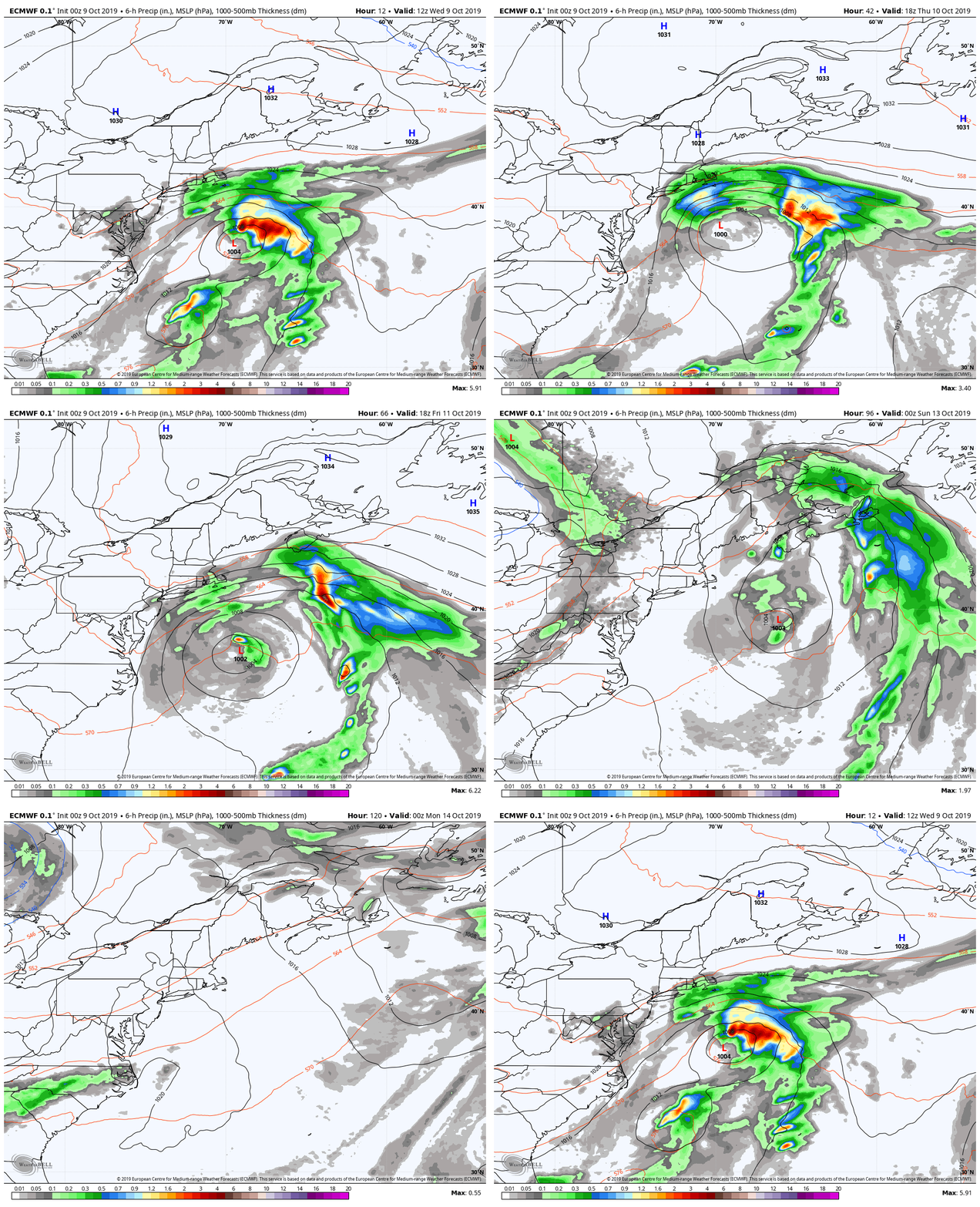
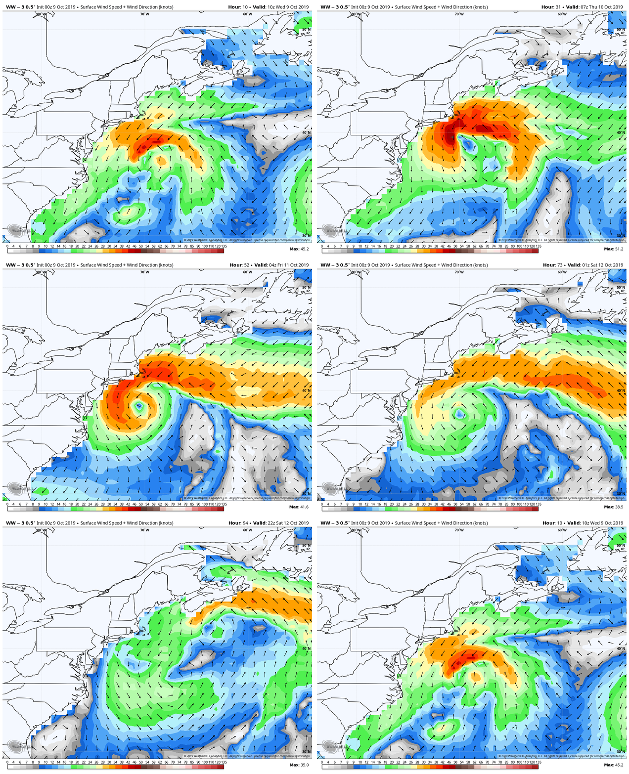
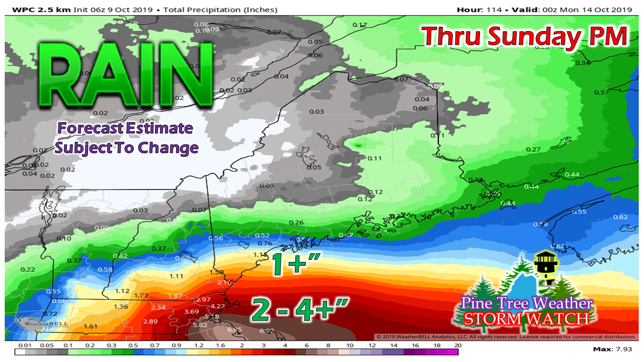
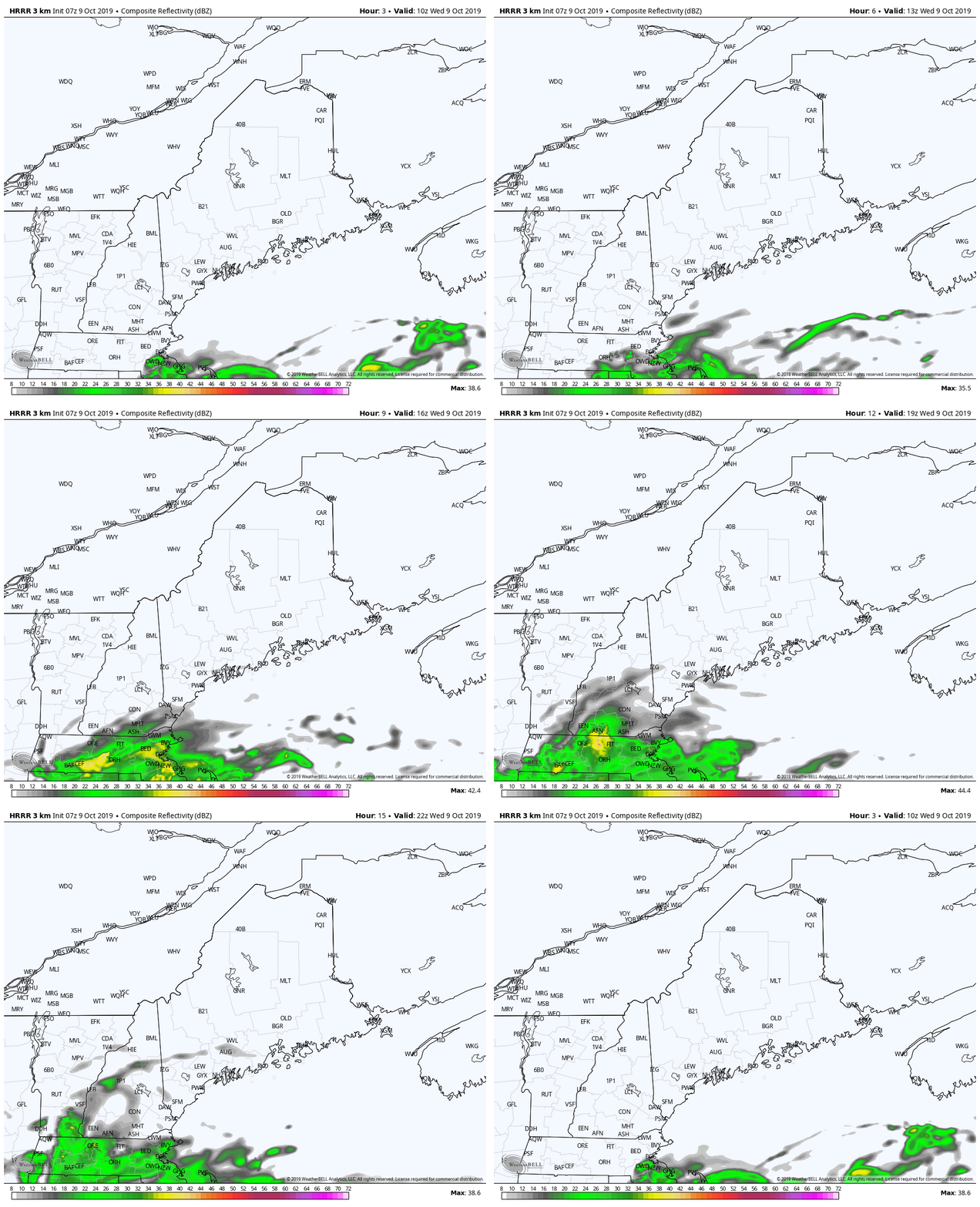
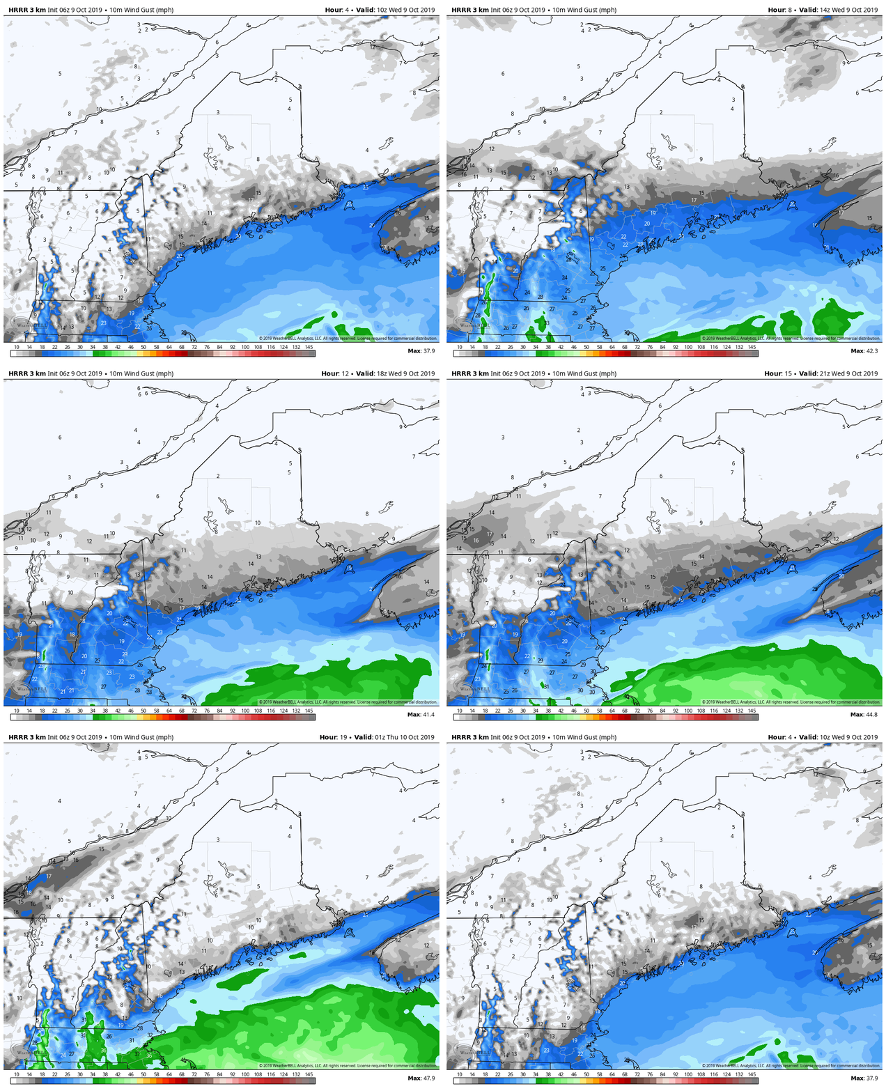
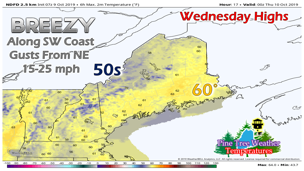
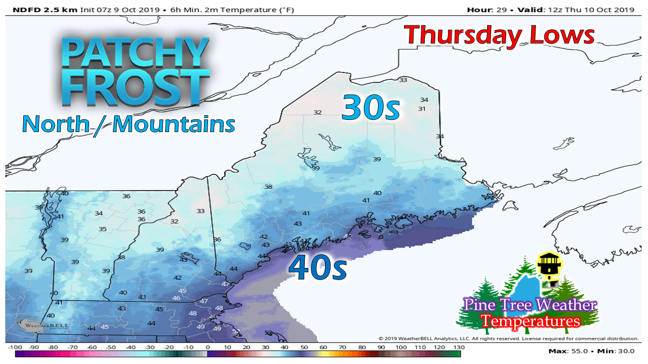
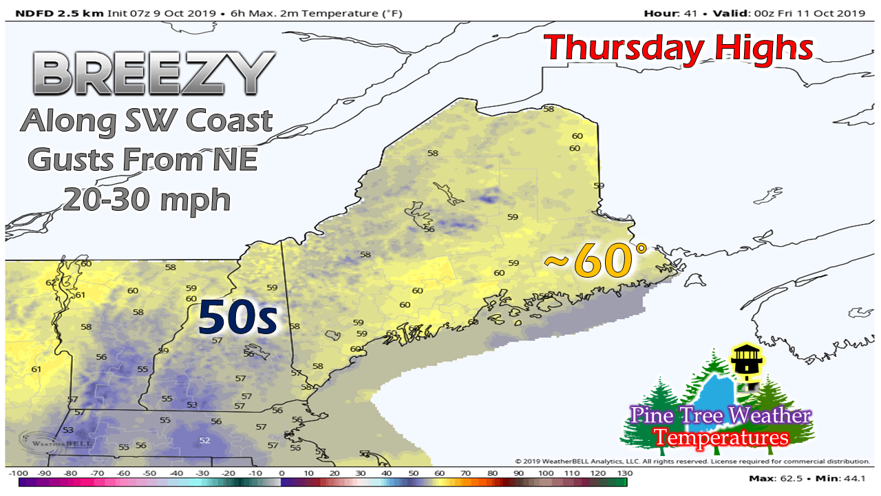
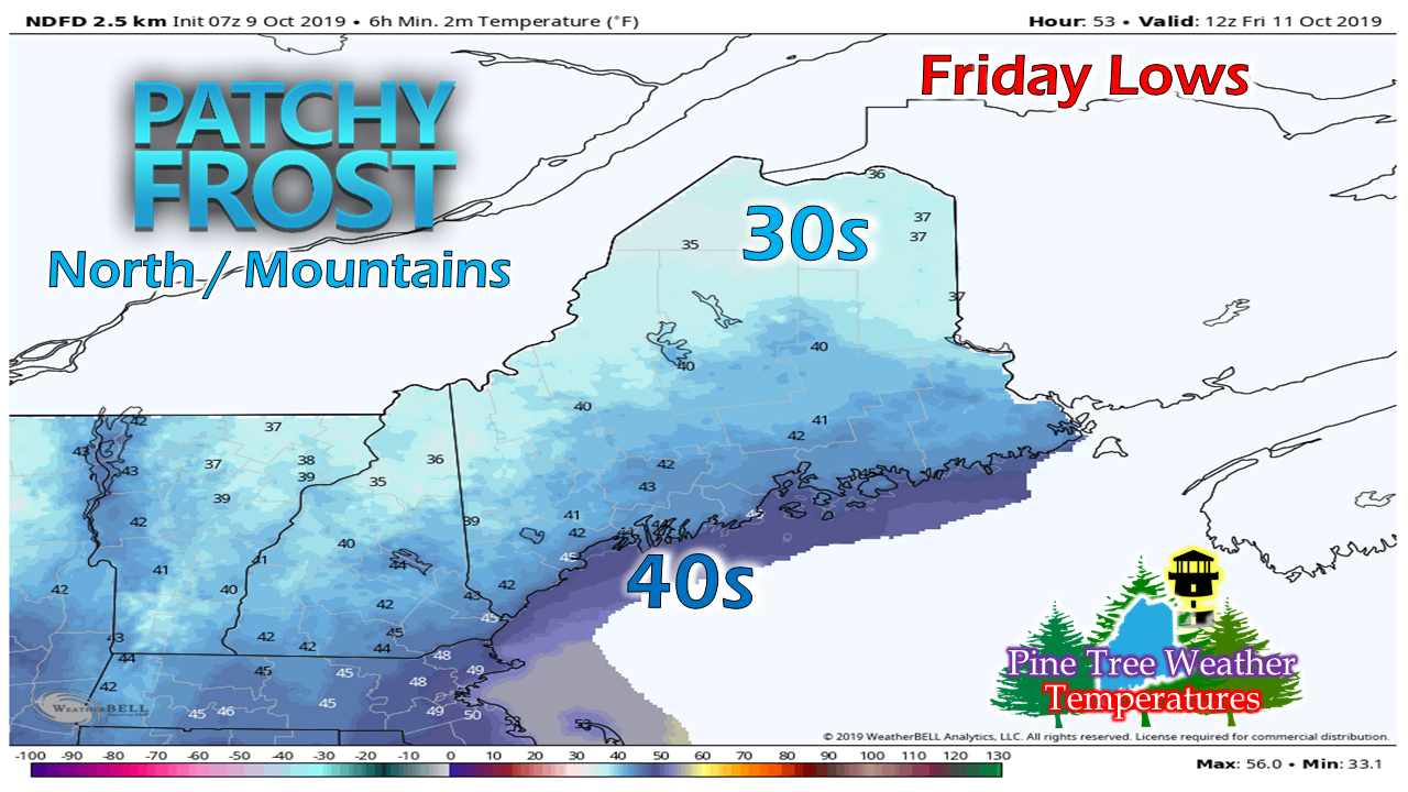
New website featuresIf you are on a PC, look up at the top of the page. If you are on a mobile device, click the menu at the top left corner. You will see a bunch of new pages that I have added to bring you more information than what is covered here in my discussions for your benefit. I still have work to do, but I am making progress and will continue to tweak and add in the coming days. I hope you will find the new features helpful, and would appreciate any comments on the new additions. Storm to bring effects to the shorelines for several daysHigh pressure over eastern Canada provides blocking which will keep the worst of the storm to our south. The storm stays to the south - southeast of benchmark 40° N / 70° W enough to keep the shorelines of Maine on the fringe, and bring some needed rain to southern areas of the state. For my followers in southern New England, this is likely to bring trouble to your region with flooding, strong wind that will lead to power outages, travel impacts, and battering waves for the coastline. A meticulously detailed discussion posted by NWS Norton/Boston is worth your time to read. The heavier seas of 20-25' will hammer the southern New England coast Thursday before slowly subsiding as the storm weakens and meanders to the east. Seas are expected to reach the 12-15' range along the Maine shoreline, which may be enough to cause splash-over in the usual locations. To keep tabs on what is happening with the ocean, check out the new Marine page for updates as well as direct links to NOAA's forecasts. Since coastal Maine is on the fringe of the storm, a tight gradient is setting up. A few miles may make the difference on amounts. Most of the rainfall ends for southern and western areas Saturday, with showers ending early Sunday for eastern areas as it appears for now. A few showers for southern areas possible WednesdayAs the storm nudges northward, it will run up against dry high pressure and keep the bulk of the rain to the south. Some light shower activity is possible for the southwest shorelines and southern areas through the day, with little accumulation. A northeast breeze will pick up along the shorelines and could be gusty at times along the immediate shorelines. As the storm meanders to the south, wind speeds increase then decrease Wednesday as it changes position. Temperatures will be right around season normals much of the state. With the storm bringing clouds and a threat for light rain, southern areas appear to run a bit below normal. Temperature outlook through Friday morningWhere there is a clear sky and no wind, there is a chance for frost, which makes far northern areas likely for that to occur Thursday morning. As the ocean storm nudges north again on Thursday, southern areas are only expected to top out in the 50s to near 60. Showers are expected once again for coastal and southern areas through the day. Once again, patchy frost may impact far interior areas Friday morning.
► ► For the latest official forecasts, bulletins and advisories, please check in with the National Weather Service in Gray for western and southern areas, or Caribou for northern and eastern parts of Maine. ► ► DONATION DRIVE UPDATE - $1020 shortfall for the year ahead! You can help keep Pine Tree Weather going with a donation of any amount now through VENMO @PineTreeWeather, a monthly donation on Patreon or messaging me on Facebook or Twitter to send a check in the mail. Thank you for your support! For more information from me, please check the Pine Tree Weather Facebook page as well as my Twitter feed. Always stay weather aware! - Mike |
Mike Haggett
|

