
Heating systems to get a workout moving forward Cold air will be settling in over the region, and the trend is for it to get colder heading into next week. It would be a good idea to check your oil / propane tanks, your wood pellet stash, and have firewood ready to go. The blues, whites, pinks and purples indicate the cold air at ~5,000 feet over the next week. It won't be going too far, and as it rotates, reinforcing shots are likely to come along with it. 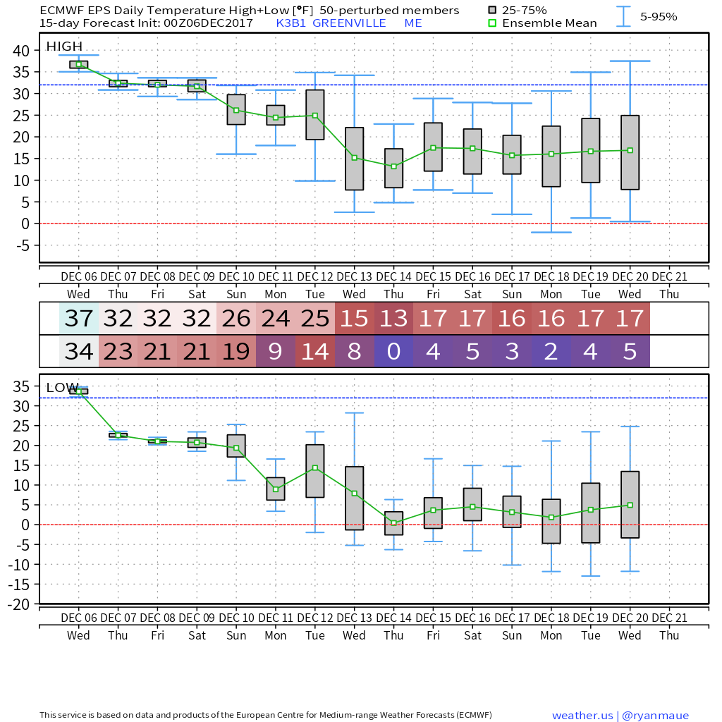 A look at the European ensembles indicates that colder trend. Using Greenville as an example, one can see the downward trend without much help. High temperatures appear headed for the teens by the middle part of next week, with overnight lows flirting with zero. This is one ensemble run, and results may vary, but temperatures are headed for double-digits below normal for much of the state beginning in the next 7 days. Weekend snow potential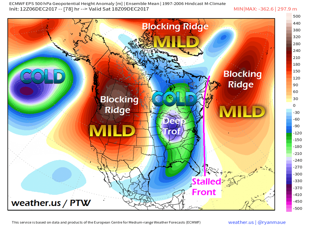 With operational models having feedback and bias issues, the default for this forecaster is to keep an eye on ensembles to get a better read. The operationals are varying from run to run handling the stalled front that will set up in the vicinity of the Gulf of Maine on Saturday. The ridge and mild air to the east will wobble as will the trough and cold to the west as each battle for control. Given the deep nature of the trough going into the Gulf of Mexico, moisture will have an area to build against the ridge. Where exactly the front sets up will tell the tale on what areas get snow and how much. 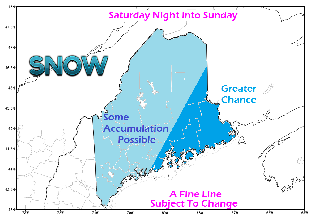 My preliminary thoughts is that it will be a snowy overnight Saturday into Sunday. MidCoast and DownEast areas up through Bangor and Houlton appear to have the better chance of the higher accumulations, for now. There is roughly 75 miles of variance on the frontal boundary. The further west the front, the more areas likely to see higher accumulations of snow, the more east, that number drops. 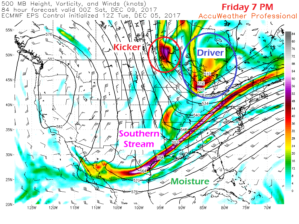 The piece the holds the cards in how this will end up is the kicker energy. At the time of this post around 5:30 PM Wednesday, that player is over in Siberia. That parcel of energy will race east and head south by Friday. The interaction of that energy in conjunction with the driver against the southern stream will bow the front. 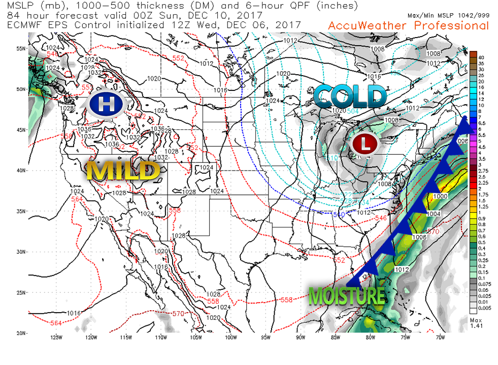 Looking at a surface map at 7 PM Saturday evening, the front is just offshore. Light snow is possible Saturday evening for the coastal areas. How far inland it goes, and how much, are still questions that can't be answered just yet.
With the stalled front likely to linger into the first of next week, chances for snow are likely to remain in the forecast for the coast at the very least. The 5-Day Outlook page has been updated through Monday. More updates to come. - Mike |

Mike Haggett
|


