Early Sunday Morning Temperatures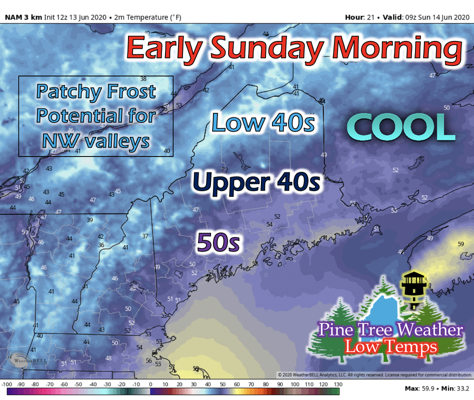 Overnight temperatures decrease statewide for Saturday night and early Sunday morning. Portland, Mid Coast, and Down East areas are going to see low temperatures in the 50s. Portions of northern Maine, northwest valleys, and higher elevated areas can get low temperatures in the low 40s. Elsewhere in the state will be in the mid to upper 40s. Dew points for northern Maine drop into the low 30s. Winds will be fairly calm, and skies will be mostly clear, meaning radiational cooling can potentially drop temperatures close to or at their dew point. Patchy frost in the northwest valleys and higher elevated areas cannot be ruled out and are possible for Saturday night. Sunday Daytime Temperatures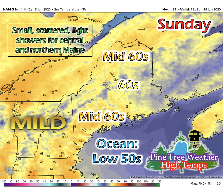 Daytime temperatures for Sunday warm up from the previous day as the high pressure system in Canada moves easterly towards Maine. Temperatures in the mid 60s are expected for northern, Mid Coast, and Portland areas of the state, while elsewhere will see temperatures in the 60s. An upper-level shortwave from Canada will make its way southeast into the state during the afternoon, with potential to create small, scattered, light showers for northern and central Maine. A Look Ahead into Next Week The GIF above runs from 7 PM Monday to 7 AM Thursday of next week. The Canadian high pressure system finally settles over Maine during the beginning of next week and resides there for a few days. During this time, no significant precipitation is expected statewide. Fair weather is expected with the system over the state. It seems a low pressure system is building in the Washington state/Canada border around Tuesday, and moving east throughout the week. This system may be the next significant rainfall that Maine will see, and potentially be this weekend. As more information is released, we'll keep you updated on the rainfall outlook. 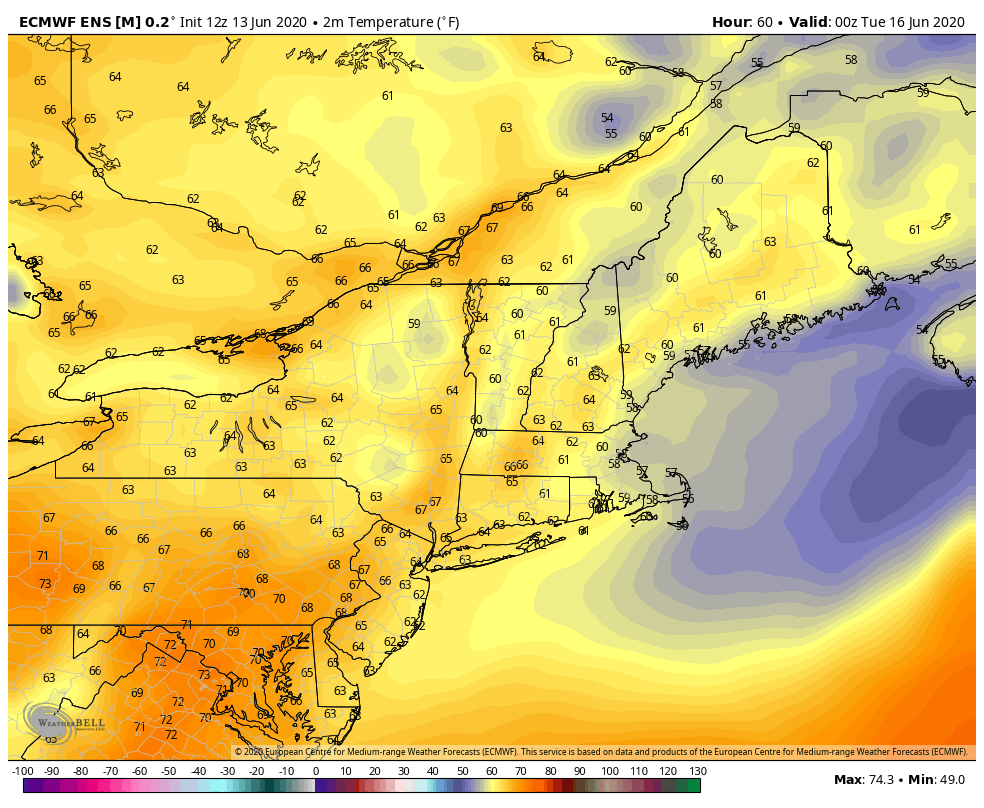 The GIF above runs from 7 PM Monday to 7 AM Thursday of next week. As that high pressure sits over Maine, a daytime temperature increase is expected. Winds are much calmer and won't mix the air as much, and the surface will be able to heat up. Although temperatures may be warming up into the 70s and 80s next week, ocean and lake temperatures are still in the 50s and 60s respectively, and are too cold to swim in yet. Cold Water Safety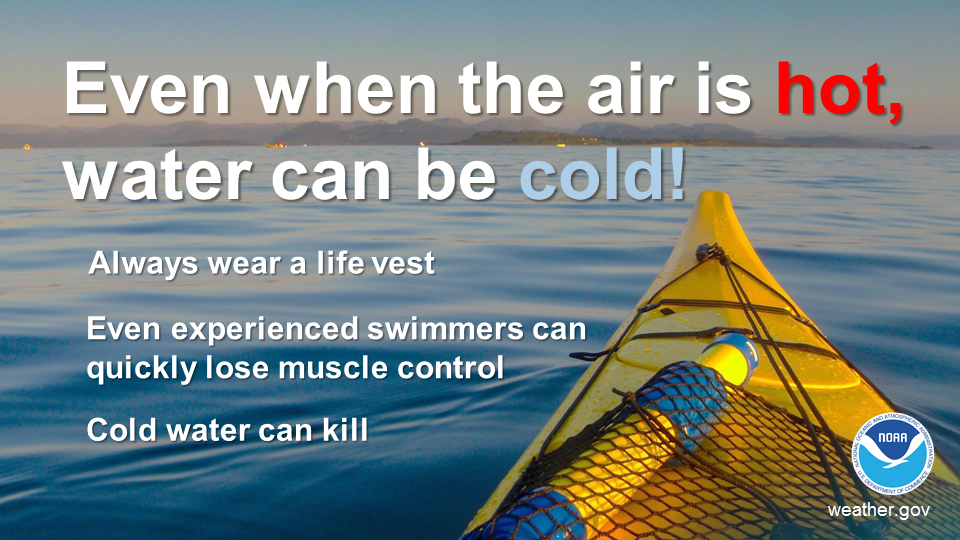 Ocean and lake temperatures for Maine are 50s and 60s respectively. Warm air temperatures doesn't necessarily mean warm water temperatures. Cold water drains body heat up to 25 times faster than cold air. When cold water makes contact with your skin, cold shock causes an immediate loss of breathing control. This dramatically increases the risk of sudden drowning even if the water is calm and you know how to swim. Practice cold water safety by staying out of waters below 70 degrees! Help forecast verification, and stay informed!
For more information, please follow Pine Tree Weather on Facebook and Twitter.
Thank you for supporting this community based weather information source that is funded by your financial contributions. Stay updated, stay on alert, and stay safe! Enjoy the rest of your Saturday! - Kaitlyn |

Mike Haggett
|