
Synopsis Headlines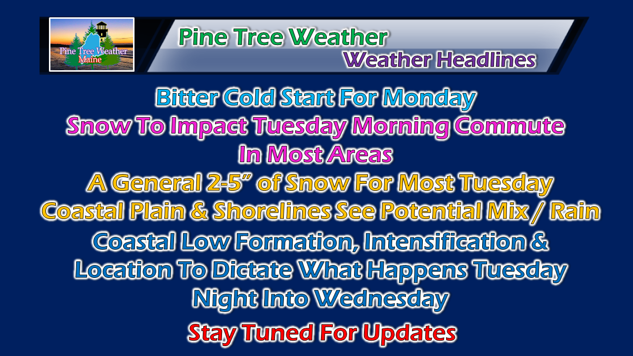 Still many questions as to how the midweek storm plays out. Confidence is good for Tuesday, but it gets a bit tricky after that. Regardless, this should be a decent event for the ski hills and northern areas and help reload snow pack levels lost before Christmas. To the new followers: I am not here for hysterics and hype. I make a concerted effort to shoot straight in all weather situations. Weather is impossible to be 100% accurate, but I work hard to be in the ball park as close as I can. I am not responsible for others forecast ideas or messages. I am total responsible for my own, and I hold myself accountable to it. For those seeing model generated snowfall ideas and hysteria published by other sources, please read my Winter Weather Hysteria Survival Guide posted last winter while I was writing for the Bangor Daily News. Please read ALL of my updates, and do so carefully. Bundle up Monday morning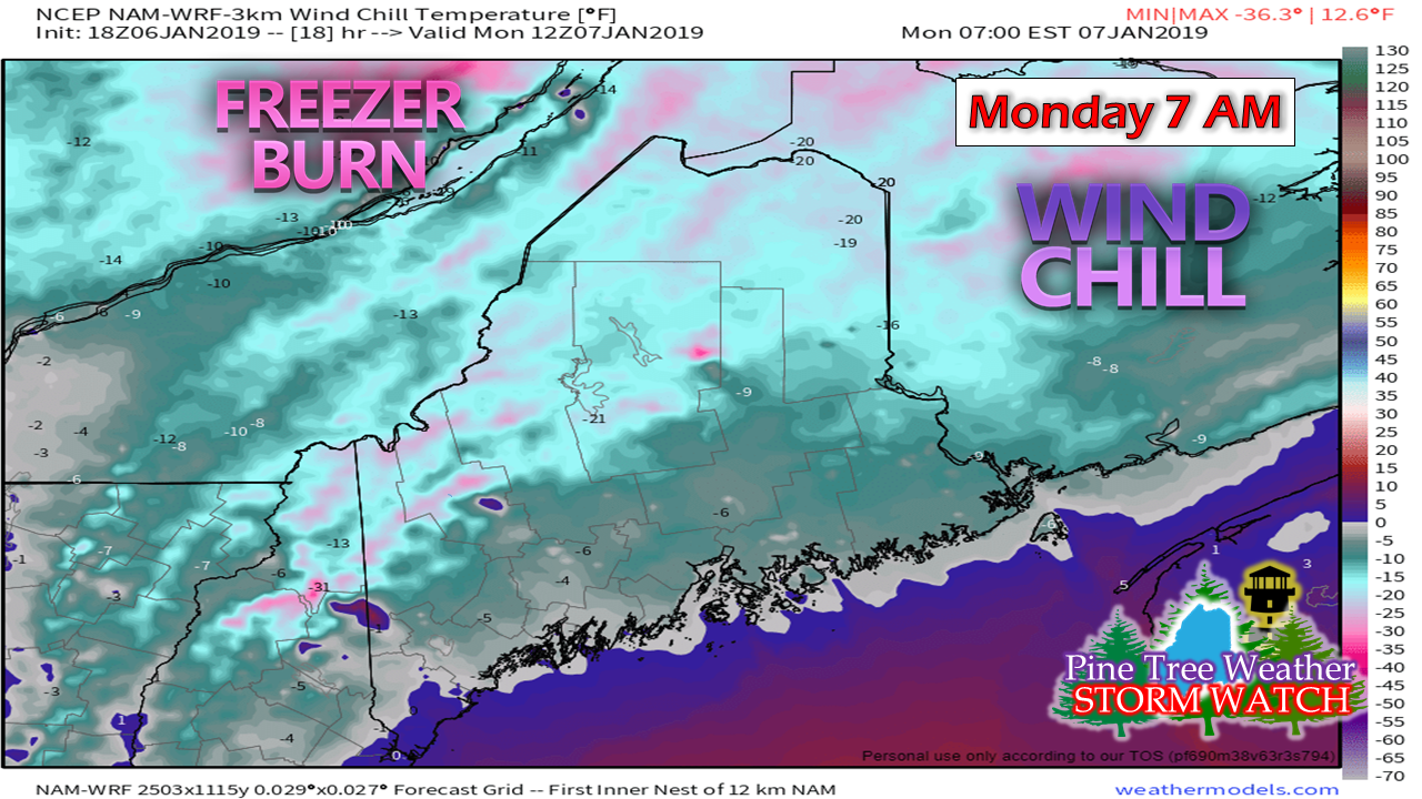 The National Weather Service Caribou has issued a wind chill advisory for northwest Aroostook and northern Somerset Counties Sunday night into Monday. Monday will be a breezy and cold as low pressure intensifies in Atlantic Canada and moves northeast. It is this cold that sets the stage for what is coming midweek. Many working parts to midweek system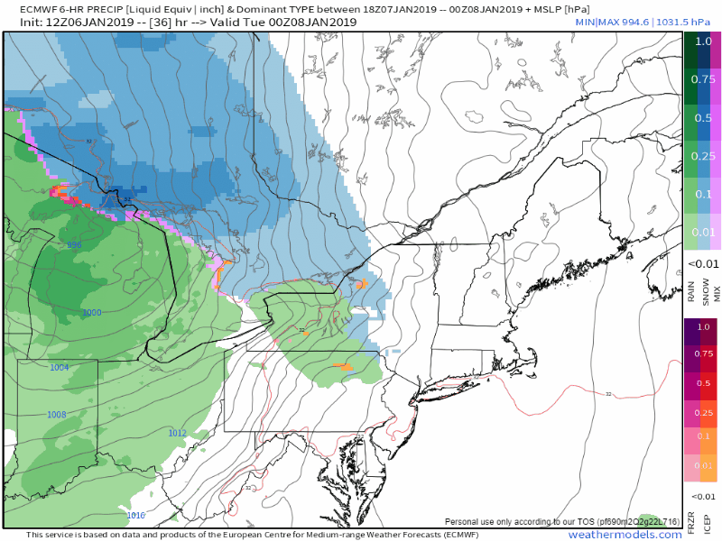 A warm front moves into the region Monday night into Tuesday and will bring snow to the region. Coastal areas start off as snow, and appear at this point to change to a wintry mix and then rain. Interior areas appear to remain all snow for the duration of the event. Low pressure over Hudson Bay transfers energy to a forming low over central New England and/or the Gulf of Maine later Tuesday into early Wednesday. As I said in my synopsis outlook, the result of that is dependent upon location, formation and intensification as to how this plays out. There is plenty of upper level energy, there is a decent moisture stream from the southeast, and ample cold for the interior to get a decent snow out of this. What happens for the coastal plain is still to be determined. For now, it appears to start as snow Tuesday, switch to a mix/rain, then potentially back to snow on Wednesday as the storm intensifies and moves eastward. This is not the final answer as of yet. First Call On Expected Snow Amounts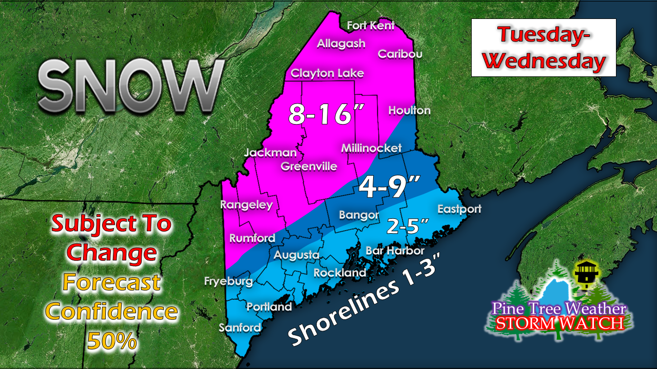 Forecasting multi-day snow totals with so many questions this far out is a bit of a crap shoot. The only certainty is for the interior where snow will be the main precipitation type. Any time there is rapid development of low pressure, there runs the risk of dry slotting and potential for heavy banding. I don't want to put the cart too far ahead of the horse here, but the mountains could score as much as 2 feet of snow, with accumulations continuing into Thursday. It all depends on how this plays out. Outlook through Friday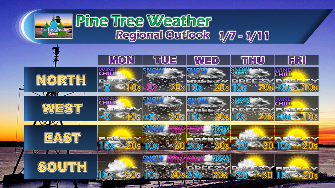 Another issue for the interior will be the wind. I don't expect anything more than potential of spotty power outages as the snow appears to be more powder. Blowing and drifting snow will be an additional travel hazard issue to contend with from Wednesday onward through the remainder of the week.
For the latest official forecasts, bulletins and advisories, please check in with the National Weather Service in Gray for western and southern areas, or Caribou for northern and eastern parts of Maine. For more information from me, please follow the Pine Tree Weather Facebook page and my Twitter feed. Your financial donations are much appreciated to keep this site funded and for further development. I sincerely appreciate your support. Always stay weather aware! - Mike |

Mike Haggett
|


