|
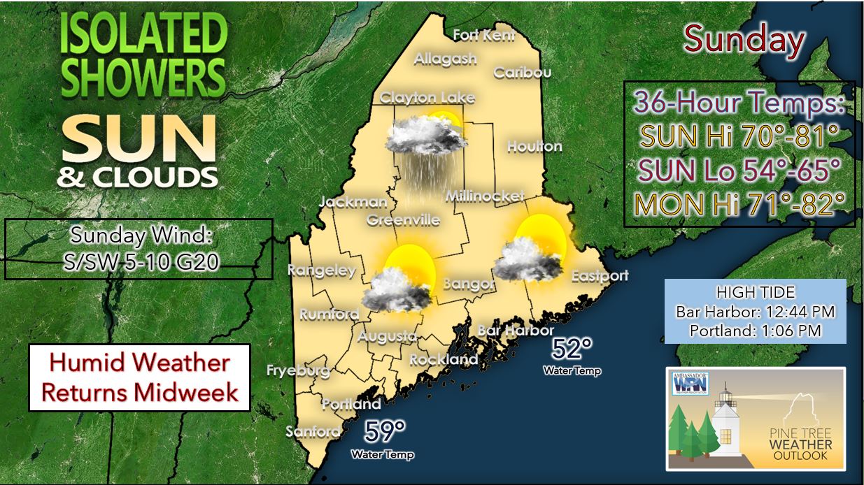
Sunday is likely to be another comfortable day with low humidity. We can expect partly to mostly sunny skies across most of the state. There will be the chance for a few isolated showers across Aroostook County associated with a cold front moving to the south into the state from the St. Lawrence River Valley. High temperatures on Sunday should be in the 70’s for the Highlands and for many of the coastal locales due to a weak sea breeze. High temperatures for parts of the interior of the state will likely climb into the lower 80’s. For Sunday night, we will watch the approach of a warm front from our southwest which could touch off some showers and storms across far southern Maine. Low temperatures Sunday night should range from the mid-50’s for Aroostook County and the Highlands to the mid-60's near the coast. Monday should be yet another pleasant day with partly to mostly sunny skies expected for much of the state. Across the far southern part of the state, we can expect overcast skies with periods of rain and thunderstorms possible. High temperatures will be in the 70’s to lower 80’s for most with mid to upper 60’s expected for the far southern areas on Monday. By Monday evening, we should see any remaining rain or showers exit the southern portions of the state. Low temperatures on Monday night will likely be in the upper 50’s to lower 60’s statewide. Tuesday will likely be the last day in a string of comfortable days with low humidity following the exit of Tropical Storm Elsa. Skies should be mostly sunny across much of the state. High temperatures on Tuesday will likely be in the 70’s to lower 80’s. For Tuesday night into Wednesday, we could see a warm front pass through the region which would usher in a more humid airmass. Into the latter half of the week, we can expect a series of disturbances to work their way through the state. This will provide the impetus for shower and thunderstorm chances as we approach next weekend. Temperatures into next weekend look to stay slightly above average. Be prepared to receive alerts and stay updated!
For more information in between posts, please follow Pine Tree Weather on Facebook and Twitter.
Thank you for supporting this community-based weather information source which operates by reader supported financial contributions. Stay updated, stay on alert, and stay safe! |
Mike Haggett
|


