
Heavy band set up could bring quick hit precipitation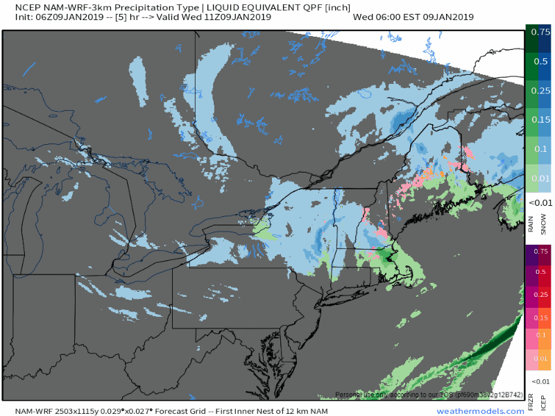 As we stand as of 5 AM Wednesday.... winter storm warnings continue for the mountains and north, winter weather advisories continue for MidCoast and southern Maine, and for southern Piscataquis, central Penobscot, and northern Washington counties. We have a pinwheel set up of intense areas of moisture that will rotate around an upper level low that will impact the region at various times of the day. The National Weather Service Gray office continued winter weather advisories for freezing rain potential as temperatures are close to 32° for much of the south and MidCoast regions. While the temperature may be above freezing, road temperatures may not be, so they opted to extend the advisory to stress the idea of an icing threat. On the subject of banding, they could be intense, and could cause areas of high impact weather in affected areas. 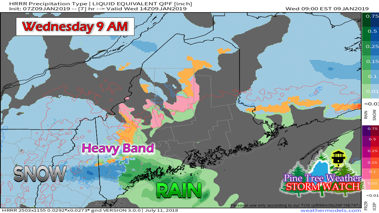 The Storm Prediction Center issued a statement at 4:25 Wednesday morning discussing a heavy snow threat which could bring 1-2" snowfall rates through this morning across New Hampshire and western Maine. Rain is also a potential feature on the eastern side of it. Where the rain/snow line gets determined precisely only time will tell. On the snow side, rapid accumulations could occur which could cause slick roads with little warning, along with reduced visibility from white out conditions. On the wet side, torrential rainfall that may bring ponding on roadways, hydroplaning, and localized urban street flooding. Along with all of that, come a chance of thunder. The band moves up the coast to the Bangor region around noon. 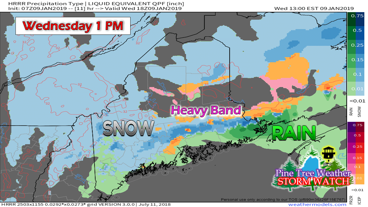 Similar situation here, but with a bit of a twist. It could be dumping rain at around noon time and then be dumping snow around 1 PM as this model idea suggests. Travel around the state is going to be another messy one. Plan accordingly to allow for plenty of extra time allow for plenty of space between you and the driver ahead of you. Expect rapidly changing travel conditions until the precipitation winds down later today into this evening. Then comes the wind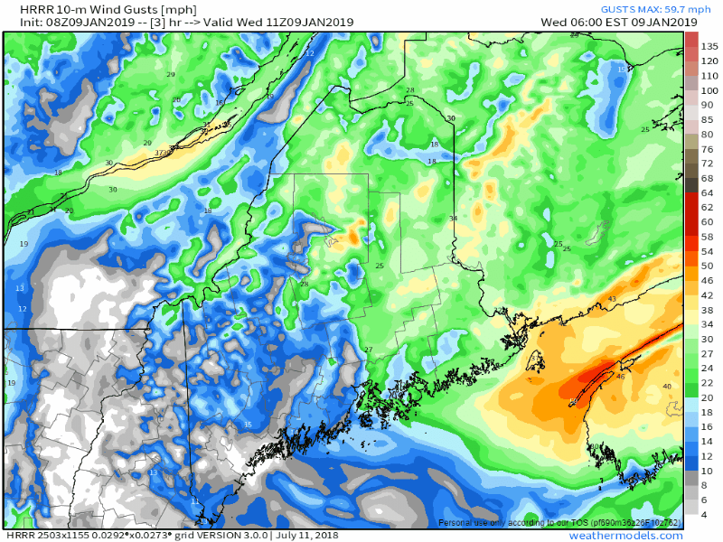 The main concern for strong wind gusts will be for southern New Hampshire, York County and the western mountains this afternoon as the storm intensifies and pulls away to the east. Wind gusts from the northwest at 30-40+ mph are possible, which may cause some spotty power outages.
With the northwest wind comes the cold. Anything liquid will likely freeze up, which poses a black ice threat into tonight. No changes to the snow forecast posted last night. Stay on alert! For the latest official forecasts, bulletins and advisories, please check in with the National Weather Service in Gray for western and southern areas, or Caribou for northern and eastern parts of Maine. For more information from me, please follow the Pine Tree Weather Facebook page and my Twitter feed. Your financial donations are much appreciated to keep this site funded and for further development. I sincerely appreciate your support. Always stay weather aware! - Mike |

Mike Haggett
|


