
Synopsis Outlook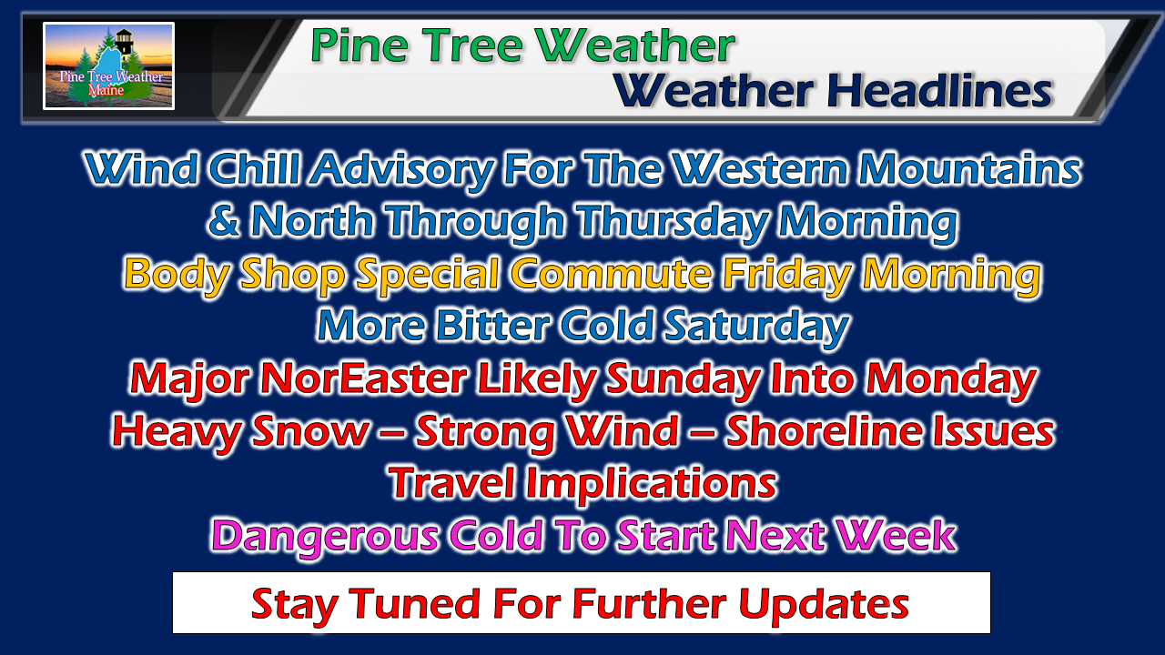 While the interior parts of the state have done well with snowfall so far this winter, the shorelines have endured rain and ice that have washed away what snow fell in November. That appears to change, and the landscape could look much different come Monday morning. Just enough snow Friday to cause some issues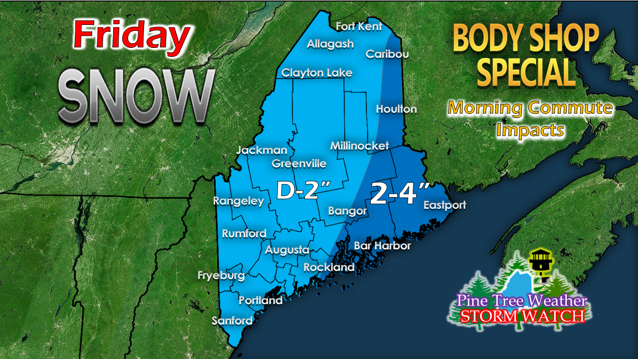 This is just a subtle shift from my idea posted here last night. Snow will likely be falling for much of the state by the morning drive time, with the only possible exception in the far north. The high end amount appear for MidCoast areas around the Penobscot eastward. Most snow will have cleared the region by evening. As long as folks take their time getting to their destinations, this shouldn't be a big deal. Sunday could be a wild day for much of the state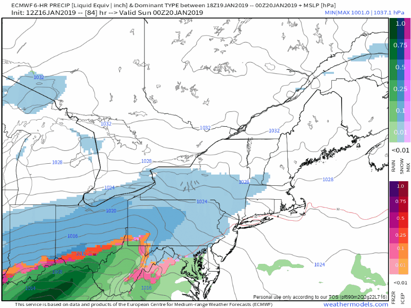 Most guidance has taken a turn eastward with the forecast track, which sets up a snowy affair for much of the region. There is plenty of moisture to work with as the moisture hose appears to extend all the way to the Bay of Campeche in the Gulf of Mexico. 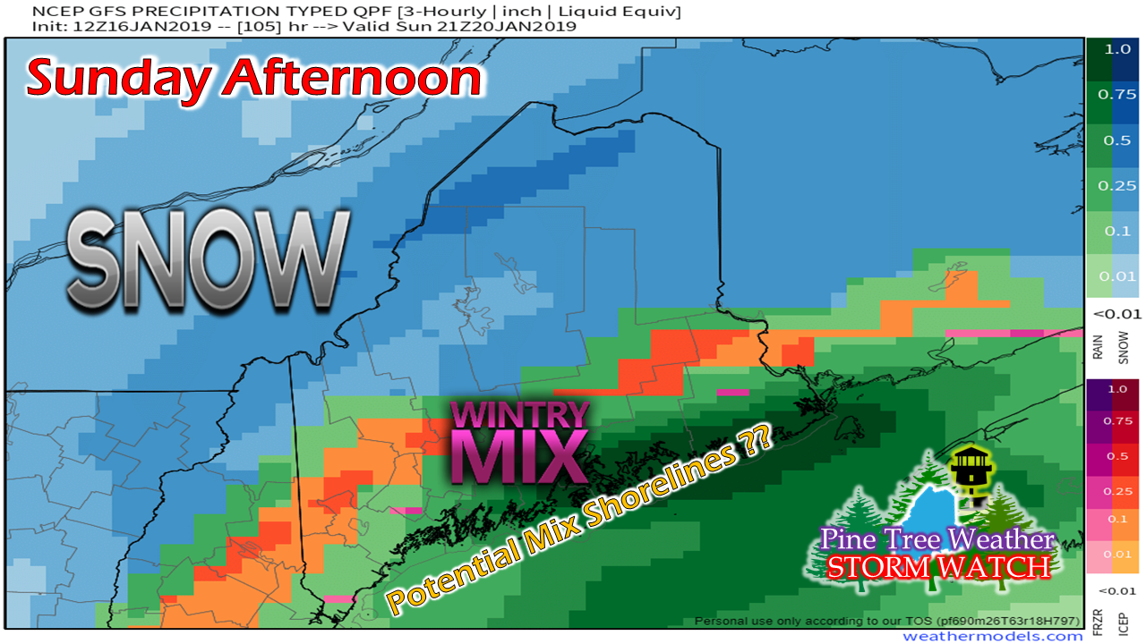 Models still have some disagreement with the track of the storm, however. I can't completely rule out a coastal front intrusion to bring a mix of sleet and perhaps freezing rain, but confidence is growing for this to be an all snow affair for the shorelines, or close to it. 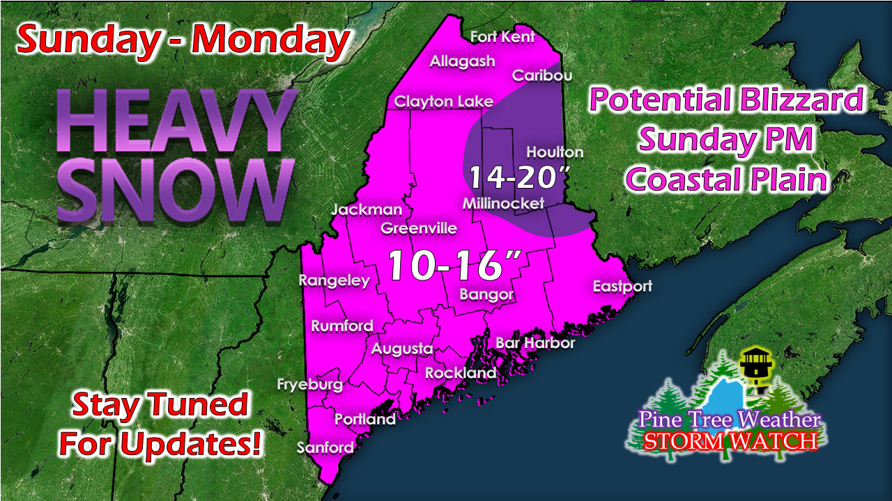 Regardless of what happens along the shorelines, this appears to be a double digit snow event. Be forewarned that these totals could increase over the interior as very cold air is likely to drive the ratios up. This could also happen for the coast, but I don't have complete confidence in that idea just yet. 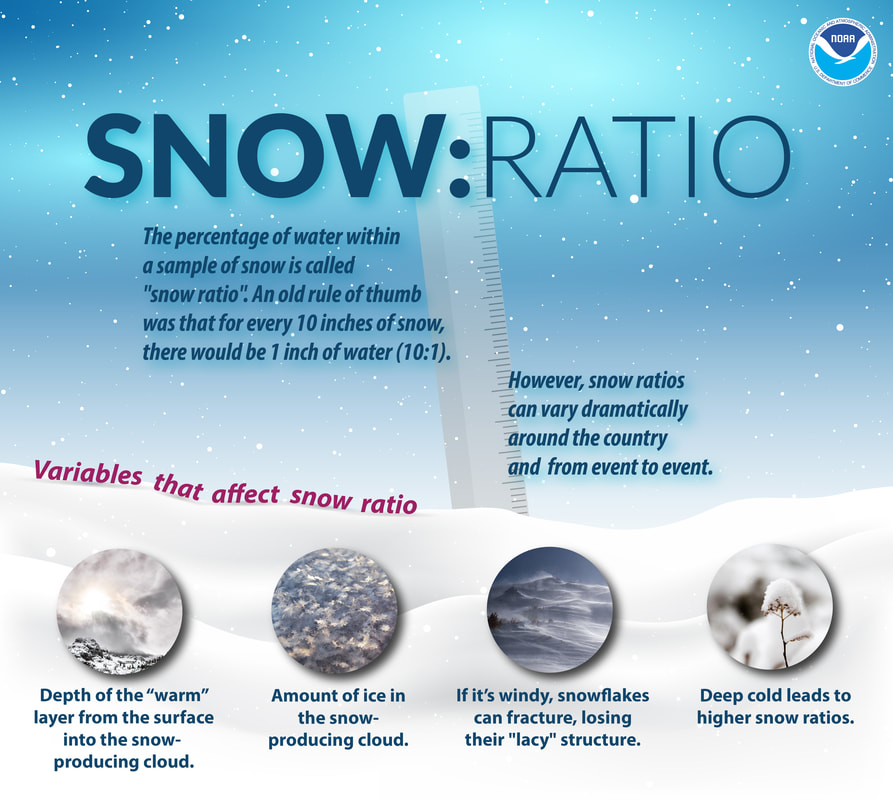 With the storm track, strong wind for the coastal plain could bring blizzard conditions. Snowfall rates at 1-3" per hour aren't out the realm of possibility here. This storm could be disruptive for travel. As I mentioned in yesterday's post, find a place to go by Saturday night and stay there until Monday. Any travel on Sunday should be discouraged, unless absolutely necessary. Shoreline concerns to watch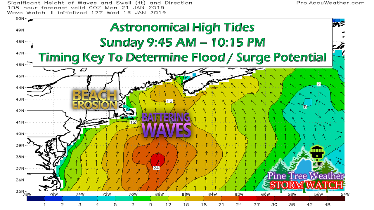 I will eat some humble pie to my shoreline followers for misreading the moon chart in yesterday's update. We are indeed headed for a full moon this weekend, which will increase tide levels. The Sunday morning high tide will be the highest of the two. The shorelines may escape the worst pending on timing as the strongest wind and potential surge occurs Sunday afternoon during the low tide end. I don't think the shorelines escape without some impacts, either way. It will be a rough one. Islanders should check with their ferry service, and boats in harbors should be well secured. Outlook through Martin Luther King Day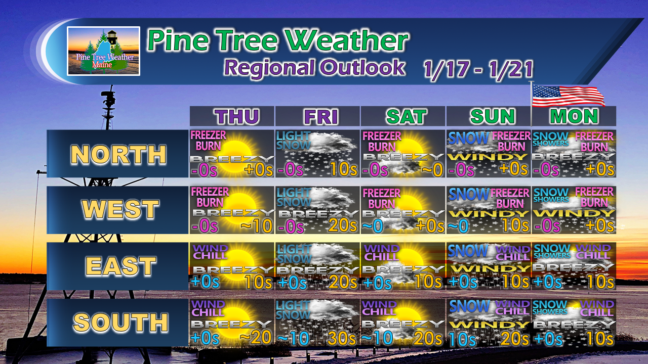 The blessing in this for weary school superintendents is that Monday is a holiday, which will allow folks to dig out. Even then, it will be bitter cold and snow will drift and blow around as gusty winds persist.
More updates coming. For the latest official forecasts, bulletins and advisories, please check in with the National Weather Service in Gray for western and southern areas, or Caribou for northern and eastern parts of Maine. For more information from me, please follow the Pine Tree Weather Facebook page and my Twitter feed. Your financial donations are much appreciated to keep this site funded and for further development. I sincerely appreciate your support not only financially, but also in sharing my efforts with others. Always stay weather aware! - Mike |

Mike Haggett
|


