Look out for patches of black ice Wednesday morning, otherwise a fair, tranquil day with slightly above average temperatures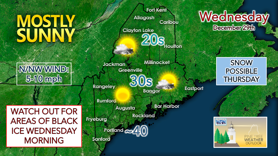 With temperatures expected to fall below freezing across the state on Tuesday night, any precipitation that has melted is likely to freeze. Use caution when driving early Wednesday morning as patches of black ice may be present. Temperatures will begin to gradually rise through the morning, with highs expected to reach the upper 20s to around 30° F in the north and mountains, mid-30s across the interior, and around 40° F near the coast. Skies appear partly to mostly sunny for the daytime with increasing clouds as the evening approaches. Chance of snow for the north and mountains on Thursday, mixed precipitation further south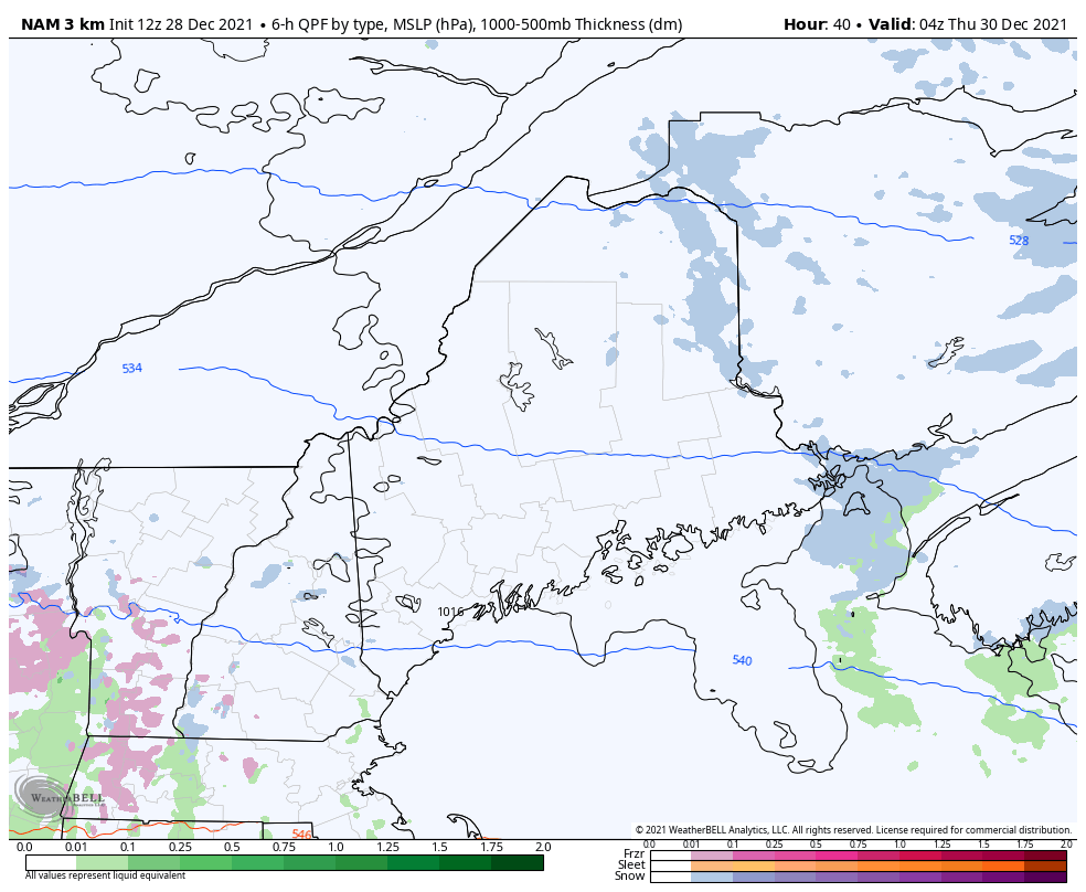 A weak warm front is expected to move through the region ahead of an approaching low on Thursday. This will likely initiate some light, wintry precipitation. North of Bangor, temperatures are expected to remain below freezing, so this looks like an all-snow event in those areas. Around Bangor and stretching south, a mix of rain and snow is more likely as temperatures hover around 32° F and above. Freezing rain may be an issue for the evening hours once temperatures begin to fall around sunset. Overall, total accumulations should be light with this system. Continue to check back for updates on Wednesday and Thursday as the forecast becomes clearer! Potential for snow to start 2022, although models are in disagreement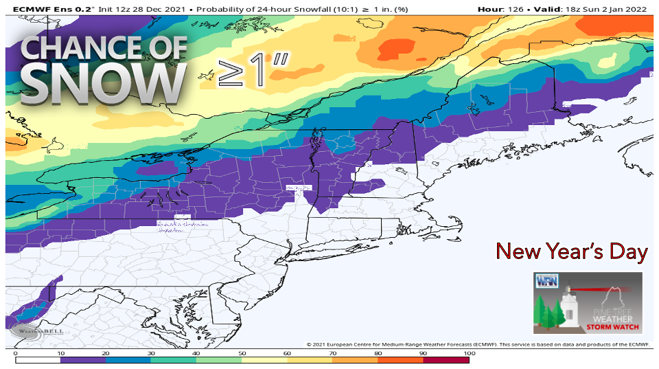 While New Year's Eve appears relatively calm, the chance for snow on New Year's Day could throw a wrench in holiday travel plans. However, it is important to note that discrepancies among forecast models bring about a lot of uncertainty. Some models are suggesting that warmer air will arrive for the weekend, meaning that any precipitation that does fall will fall as rain. Another possible scenario looks like one that we've already seen before this season - snow in the northern half of the state with a mixed bag of precipitation for the interior coastal plain. While the chance is there, if you are hoping for lots of snow I wouldn't get my hopes up just yet. Details on timing, accumulations, and precipitation type will become much clearer as the week unfolds. For now, just keep the possibility of inclement weather in mind if you are planning to travel New Year's Day.  Temperature outlook through Sunday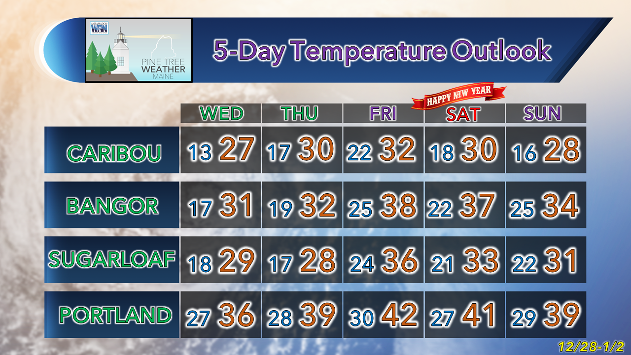 Black Ice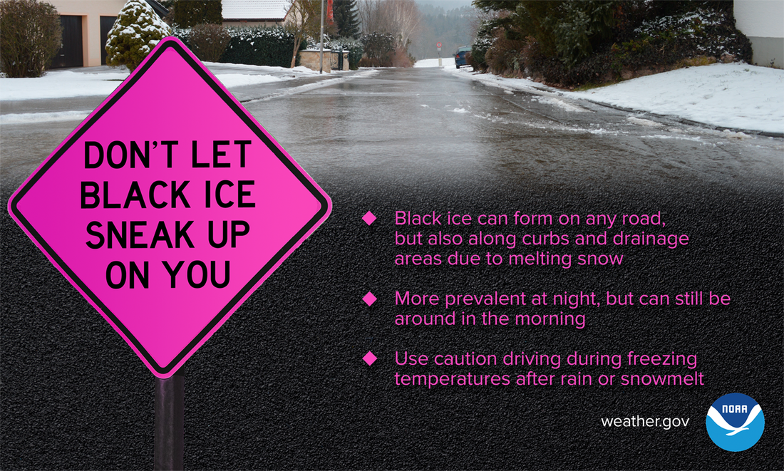 When recent rain or snowmelt comes into contact with freezing temperatures, black ice can form — and you might not even see it. And while black ice is more prevalent at night, it can often stick around for the morning commute. Use extreme caution when driving...don’t let black ice sneak up on you. weather.gov/safety/winter Be prepared to receive alerts and stay updated!
 For more information in between posts, please follow Pine Tree Weather on Facebook and Twitter. Thank you for supporting this community-based weather information source which operates by reader supported financial contributions.
|

Mike Haggett
|