
Welcome to summer For those who like their Maine summers with comfortable temperatures during the day, cool nights, and low humidity, you will enjoy the weather for the next week and beyond. The extreme heat and humidity appears to stay well south. We'll get some humidity rises here and there as frontal boundaries work through, but the "weather you can wear" does not appear to be an issue through the rest of June. The big picture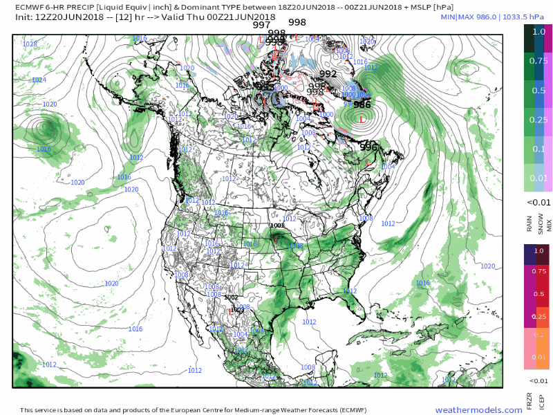 Surface map idea of the European model through early Tuesday presents a few showers working through the state Wednesday night into Thursday morning. As that clears out, the rest of the work week appears dry and pleasant. Clouds will be on the increase Friday afternoon and overspread the state Friday night into Saturday morning. A warm front approaches the state Saturday which will kick off some shower activity. A cold front approaches the region on Sunday into Monday, bringing another round of showers, and perhaps a thunderstorm for western and southern areas Sunday afternoon. The front slowly pushes through the area on Monday, with clearing skies into Tuesday. Pattern remains zonal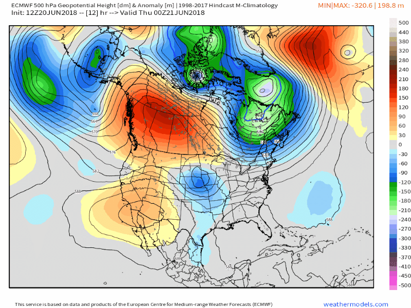 We just can't seem to shake the block that has been over Greenland that has influenced our weather pattern for much of spring. Repeated weak troughs continue to rotate through the area offering little moisture and keeping temperatures on the cool side. We may see a brief shift in the pattern as a ridge builds in for the middle part of next week. The absence of a Bermuda High will keep the heat and humidity to the south, even with the ridge taking over temporarily. Beneficial rain appears possible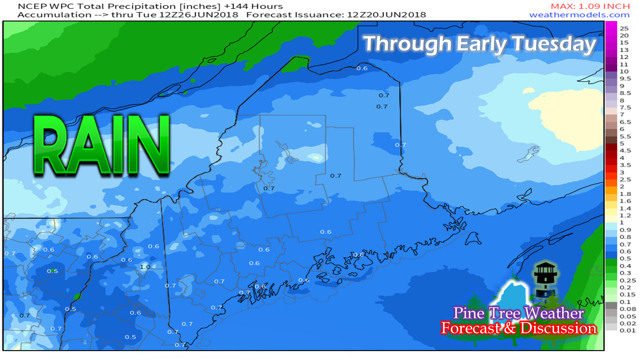 The Weather Prediction Center idea for rainfall over the next week appears encouraging for western and southern areas that are dealing with drought conditions. While this is a general idea of what to expect, results will likely vary. The Wednesday morning European operation run was a bit more bullish on heavier amounts of rain for the coastal plain. I've seen this movie before, so it's difficult for me to get too excited about it. If much of drought area can pick up a half inch or so Saturday through Monday, anything beyond that will be a bonus. Regional outlook through Monday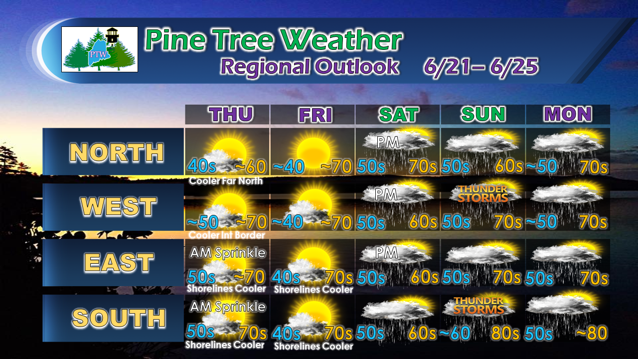 Folks in the Allagash and protected valleys of the western mountains may see a touch of frost Thursday night into Friday. While showers are in the forecast through the weekend, I do not expect it to be a total washout. Folks in the western and southern areas may see an isolated thunderstorm Sunday afternoon as humidity ticks up a bit and any sun may fuel a few pop up storms. Severe weather is unlikely at this point. The afternoons on both Saturday and Sunday are likely to have more shower activity than the mornings. Pending on how the front progresses will dictate how Monday plays out.
For official forecasts, bulletins and advisories, please stay in touch with the National Weather Service in Gray for western and southern areas, or Caribou for eastern and northern areas. Feel free to give the Pine Tree Weather Facebook page a "like" for additional information there, and follow me on Twitter for more snippets of weather related items of interest. Thanks as always for your support! - Mike |

Mike Haggett
|


