Pine Tree Weather
  • DISCUSSIONS
  • DONATE
  • MAPS
  • NWS BRIEFINGS
  • SATRAD
  • MARINE
  • SNOW / ICE OUTLOOK
  • RAIN OUTLOOK
  • CPC OUTLOOK
  • Kennebunk
  • OBSERVING WEATHER
  • Who We Are
  • My Photography
  • DISCUSSIONS
  • DONATE
  • MAPS
  • NWS BRIEFINGS
  • SATRAD
  • MARINE
  • SNOW / ICE OUTLOOK
  • RAIN OUTLOOK
  • CPC OUTLOOK
  • Kennebunk
  • OBSERVING WEATHER
  • Who We Are
  • My Photography

Cool down behind cold front, then warming trend as we head into next week

6/6/2020

Comments


Cool down Saturday night with lingering isolated showers 

Picture
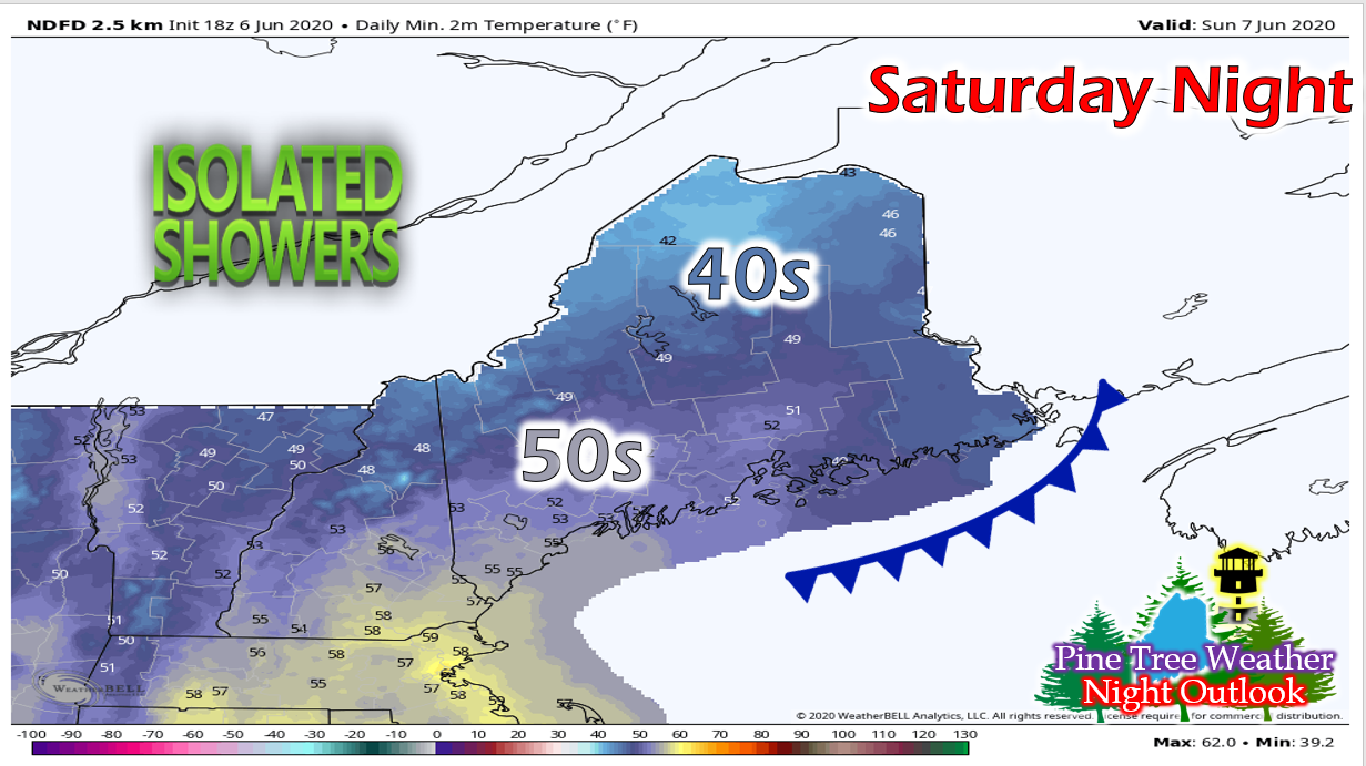
As the cold front passes this evening, cooler and drier air is expected to move into the region for tonight. An isolated rain shower leftover from today may linger into tonight and early tomorrow, but will clear out by the afternoon as the dry air from the north feeds into the state. Dew points will drop into the 40s and low 50s, so a chance of fog in the northern regions of the state is possible. 

Dry and mild Sunday

Picture
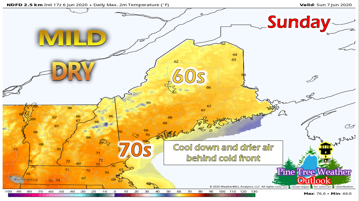
Temperatures will be in the 60s throughout most of the state tomorrow with low 70s in the southwestern regions. Clouds will also linger throughout the state, especially in the mountains, keeping temperatures down. Dry air will still be feeding in from the North, so the chance of showers decreases as the day progresses and clouds will move out by the evening hours. 
​Temperatures will fall into the 40s throughout most of the state overnight, with some isolated 50s in the southern regions.

High pressure builds in to start the week, warm trend begins

Picture
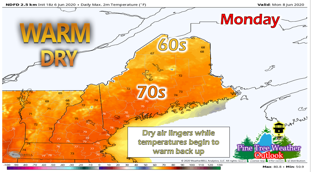
 A high pressure system moves into the region on Monday, bringing a warmer trend until the middle of the week. Temperatures Monday will be in the upper 60s in the northern regions and upper 70s in the southern regions. Drier air and winds from the N/NW will still linger throughout the state.  A seabreeze will set up, but be limited to the immediate coast. ​

Looking Ahead: continued warming trend before chance of rain to end the week

Picture
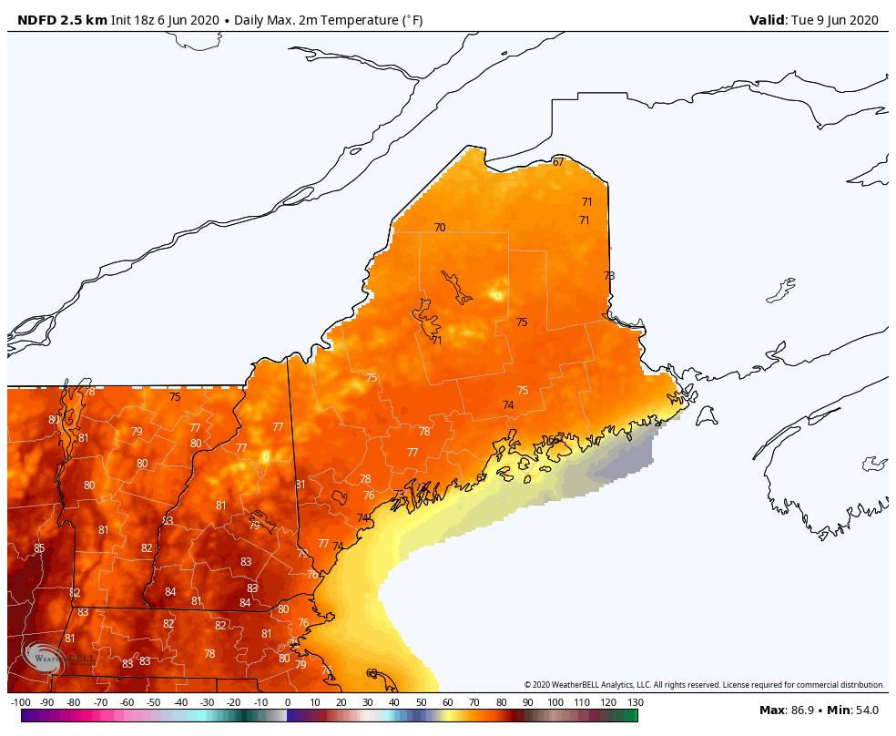
The above GIF runs from Tuesday 6/9 to Friday 6/12, showing the daily max temperatures. Temperatures will continue to warm through Wednesday, reaching the upper 80s throughout much of New England. A system will move in for Thursday and Friday, bringing rain and lowering temperatures. 
Picture
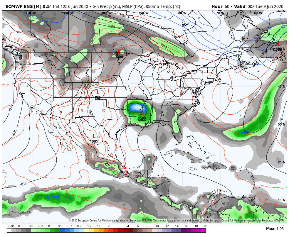
The GIF above shows the remnants of Tropical Storm Cristobal moving through the midwest U.S. and forming into a large scale system before impacting Maine. The tropical storm will move up the continental U.S. Tuesday and Wednesday, merging with another low pressure system and then begin to impact Maine on Thursday. However, this is still far out so the timing and locations impacted may change as the time grows closer. We will keep you updated with timing and impacts throughout the week as the situation becomes more clear. 

Stay informed!

Picture
Hiking, camping or boating this summer?
BE PREPARED WITH A
 
NOAA Weather Radio.

​For $20-$40, it could provide important information to you when you need it. The weather bands are standard on most public safety scanners, and newer scanner models and weather radios can be programmed for auto alert.  
Click here for more information. ​​

Picture

​► ► For the latest official forecasts, bulletins and advisories, please check in with the National Weather Service in 
Gray for western and southern areas, or Caribou for northern and eastern parts of Maine.
​For more information, please follow Pine Tree Weather on Facebook and Twitter. 

Thank you for supporting this community based weather information source that is funded by your financial contributions. 

Have a great weekend everyone!

​- Alex
Comments
    Picture

    Mike Haggett
    Kennebunk, ME

    Certified Weather
    Forecaster
    Penn State '21

    American Meteorological Society

    National Weather Association

    Weather-Ready Nation 
    Ambassador
    ​
    ​SKYWARN-CWOP

    Matthew 19:26


    Support
    Pine Tree Weather

    DONATE

    Picture

    Picture

    Picture

    Picture

    Picture

    Picture

    Picture

    Picture

    Picture

    Picture

    Archives

    January 2023
    December 2022
    November 2022
    October 2022
    September 2022
    August 2022
    July 2022
    June 2022
    May 2022
    April 2022
    March 2022
    February 2022
    January 2022
    December 2021
    November 2021
    October 2021
    September 2021
    August 2021
    July 2021
    June 2021
    May 2021
    April 2021
    March 2021
    February 2021
    January 2021
    December 2020
    November 2020
    October 2020
    September 2020
    August 2020
    July 2020
    June 2020
    May 2020
    April 2020
    March 2020
    February 2020
    January 2020
    December 2019
    November 2019
    October 2019
    September 2019
    August 2019
    July 2019
    June 2019
    May 2019
    April 2019
    March 2019
    February 2019
    January 2019
    December 2018
    November 2018
    October 2018
    September 2018
    August 2018
    July 2018
    June 2018
    May 2018
    April 2018
    March 2018
    February 2018
    January 2018
    December 2017
    November 2017
    October 2017

    RSS Feed

Proudly powered by Weebly